Marshleyharbour Wood
Wood, Forest in Kent Tunbridge Wells
England
Marshleyharbour Wood

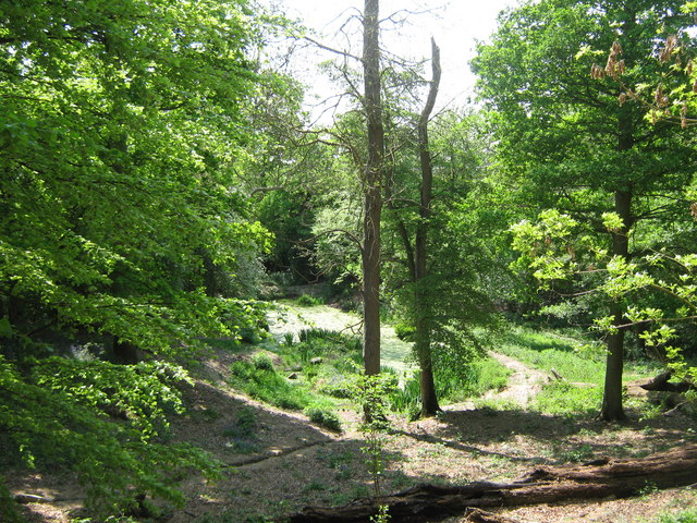
Marshleyharbour Wood is a picturesque woodland situated in the county of Kent, England. Covering an area of approximately 100 acres, this enchanting forest is known for its diverse range of flora and fauna, making it a popular destination for nature enthusiasts and hikers alike.
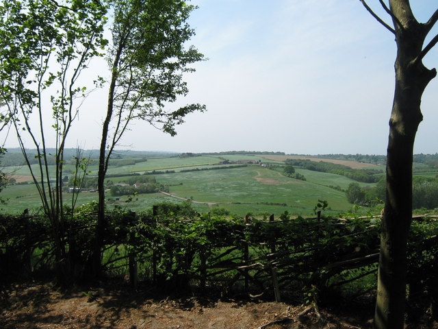
As visitors step foot into Marshleyharbour Wood, they are greeted by a captivating landscape dominated by towering oak and beech trees. The dense canopy provides a cool and tranquil atmosphere, offering respite from the hustle and bustle of everyday life. The forest floor is adorned with a vibrant carpet of bluebells during the spring, creating a stunning visual spectacle.
The wood is home to a wide array of wildlife species, including deer, rabbits, badgers, and a variety of bird species. Keen birdwatchers can spot woodpeckers, tawny owls, and various songbirds fluttering between the trees. The woodland also boasts an impressive range of plant life, with rare orchids and ferns scattered throughout.
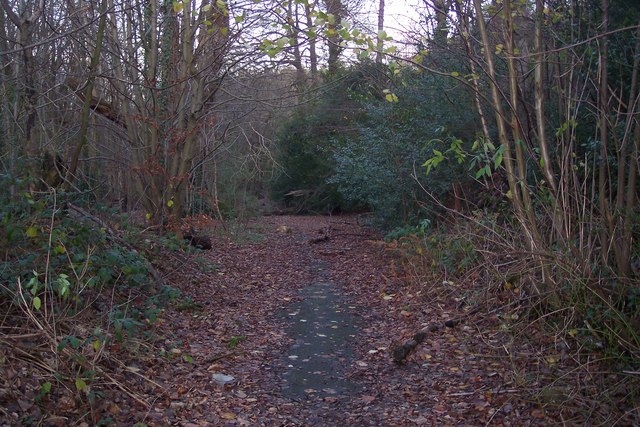
A network of well-maintained footpaths weaves through the wood, allowing visitors to explore its hidden corners and discover its natural wonders. There are also picnic areas and benches strategically placed, providing the perfect opportunity for visitors to pause, relax, and immerse themselves in the peaceful surroundings.
Marshleyharbour Wood is easily accessible, with ample parking available nearby. It is a cherished local gem, attracting visitors from across the region who come to enjoy its beauty and serenity. Whether it's a leisurely stroll, a wildlife spotting adventure, or a picnic with loved ones, Marshleyharbour Wood offers a delightful escape into nature.
If you have any feedback on the listing, please let us know in the comments section below.
Marshleyharbour Wood Images
Images are sourced within 2km of 51.149328/0.31686565 or Grid Reference TQ6241. Thanks to Geograph Open Source API. All images are credited.


Marshleyharbour Wood is located at Grid Ref: TQ6241 (Lat: 51.149328, Lng: 0.31686565)
Administrative County: Kent
District: Tunbridge Wells
Police Authority: Kent
What 3 Words
///facing.bother.speaks. Near Pembury, Kent
Nearby Locations
Related Wikis

Pembury
Pembury is a large village in Kent, in the south east of England, with a population of 6,128 at the 2011 Census. It lies just to the north-east of Royal...
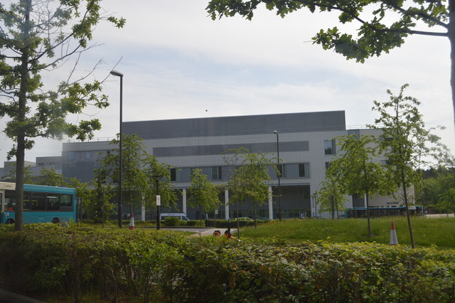
Tunbridge Wells Hospital
Tunbridge Wells Hospital is a large district general hospital in Pembury near Royal Tunbridge Wells, Kent, England, run by the Maidstone and Tunbridge...
Pembury Cutting and Pit
Pembury Cutting and Pit is a 1.6-hectare (4.0-acre) geological Site of Special Scientific Interest east of Tunbridge Wells in Kent. It is a Geological...

Kent College, Pembury
Kent College is an independent day and boarding school from 3-18. Forest Explorers Nursery is for girls and boys from rising 3 years, boys can join Reception...
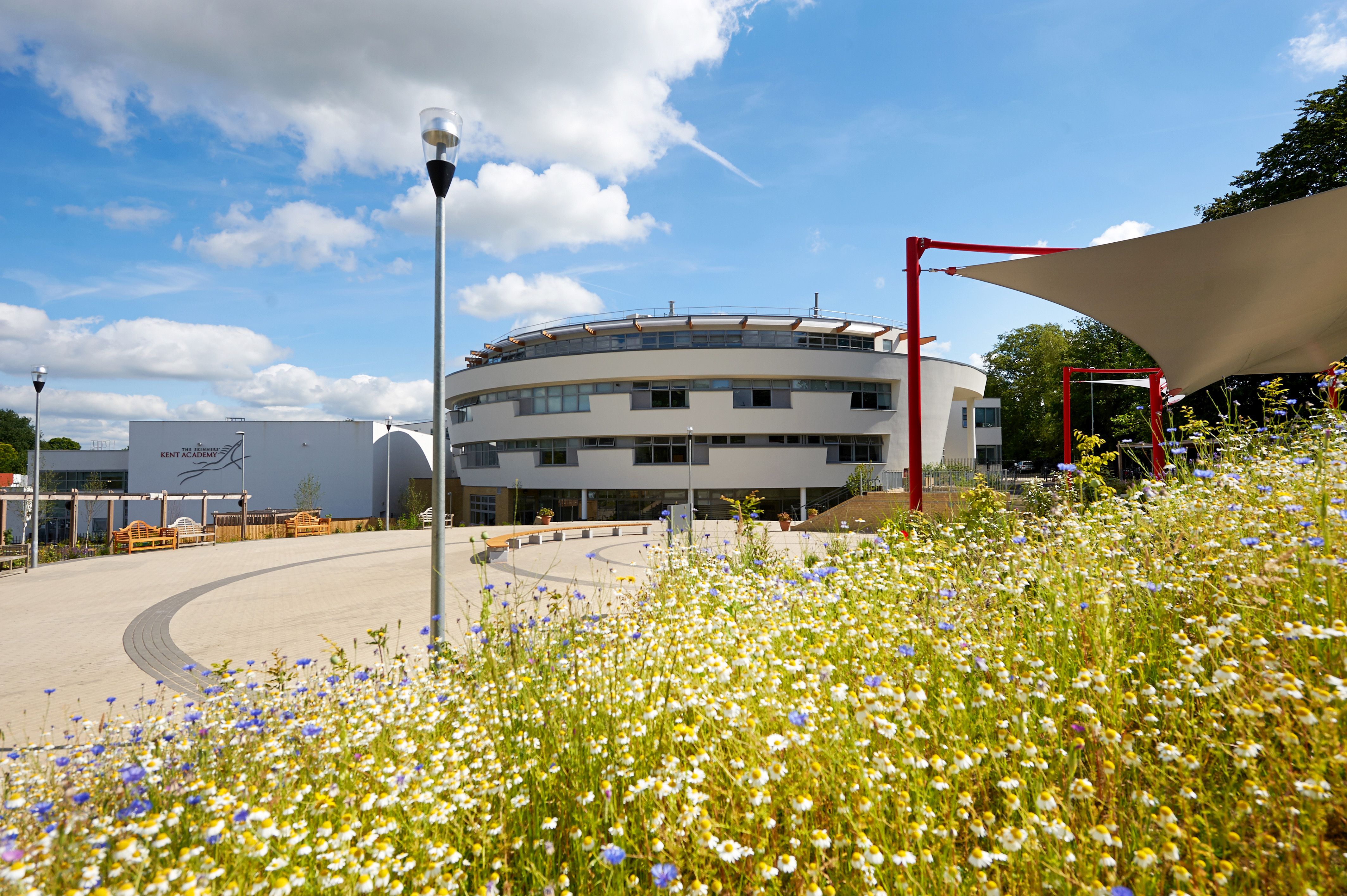
The Skinners' Kent Academy
The Skinners' Kent Academy (formerly Sandown Court then later renamed to Tunbridge Wells High School) is a secondary school with academy status in Royal...

Beechwood School, Royal Tunbridge Wells
Beechwood School is a co-educational independent day and boarding school for children aged 3–18, which comprises a Nursery, Preparatory School and Senior...

Brenchley Wood
Brenchley Wood is a 15-hectare (37-acre) nature reserve south of Paddock Wood in Kent. It is managed by the Kent Wildlife Trust, and it is part of the...
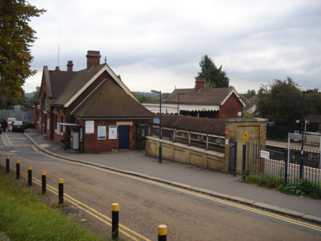
High Brooms railway station
High Brooms railway station is on the Hastings line in the south of England and serves High Brooms and Southborough in the borough of Tunbridge Wells,...
Nearby Amenities
Located within 500m of 51.149328,0.31686565Have you been to Marshleyharbour Wood?
Leave your review of Marshleyharbour Wood below (or comments, questions and feedback).