Broadcroft Grove

Wood, Forest in Essex Uttlesford

England

Broadcroft Grove

WW2 pillbox near Wimbish Green Situated on a small ridge with a good view over the surrounding countryside on two sides, this pillbox was no doubt built to guard the flank of <a href="https://www.geograph.org.uk/photo/221943">TL6134 : Great Stampford Aerodrome</a>.
WW2 pillbox near Wimbish Green Credit: David Gruar

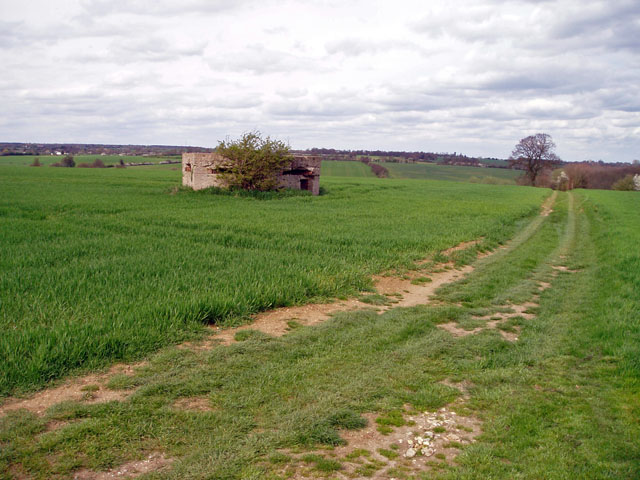
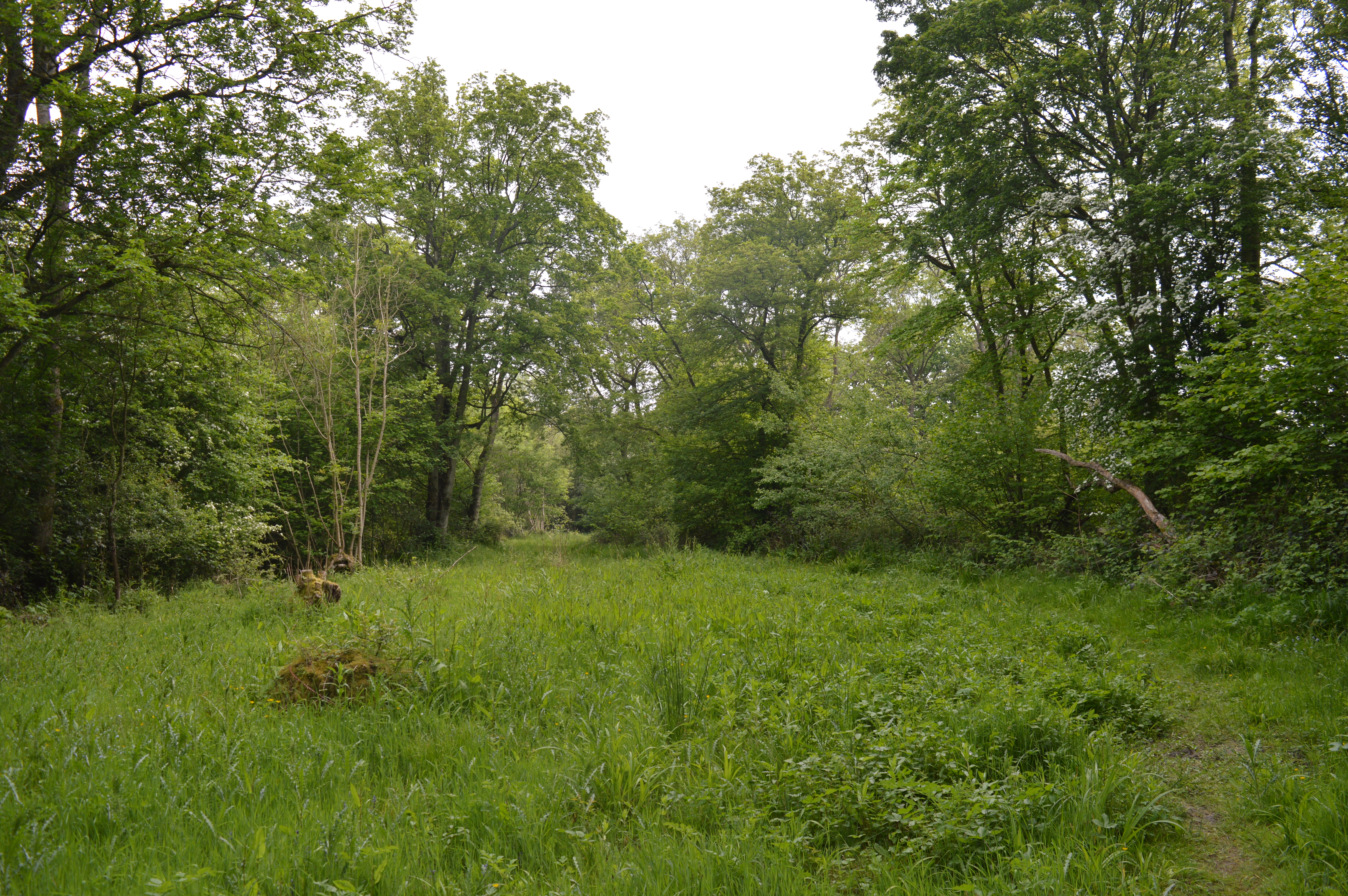
Broadcroft Grove is a picturesque woodland located in Essex, England. Situated in the heart of the county, this tranquil forest is a haven for nature enthusiasts and outdoor enthusiasts alike. Spanning approximately 50 acres, Broadcroft Grove is a diverse ecosystem that showcases the beauty of the British woodlands.

The grove is predominantly covered by a dense canopy of mature trees, including oak, beech, and ash, which provide a natural habitat for a wide range of flora and fauna. The forest floor is adorned with a rich carpet of wildflowers, ferns, and mosses, creating a vibrant and colorful landscape. The grove is also home to several species of birds, such as woodpeckers, owls, and warblers, which can be heard singing their melodic tunes throughout the day.

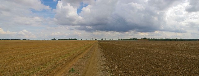
Broadcroft Grove offers a network of well-maintained trails and footpaths, allowing visitors to explore its enchanting surroundings. The paths wind through the forest, offering glimpses of hidden ponds, babbling brooks, and ancient trees. Along the way, benches and picnic areas provide the perfect spots to rest and take in the peaceful ambiance.

The grove is open to the public year-round, attracting visitors from all walks of life. Whether it's a leisurely stroll, a family picnic, or birdwatching, Broadcroft Grove offers something for everyone. It also hosts educational programs and guided tours, aiming to raise awareness about the importance of preserving and protecting the natural environment.

In conclusion, Broadcroft Grove is a remarkable woodland in Essex, offering a serene escape from the hustle and bustle of daily life. With its diverse flora and fauna, well-maintained trails, and educational opportunities, it is a must-visit destination for nature lovers and those seeking solace in the beauty of the natural world.

If you have any feedback on the listing, please let us know in the comments section below.

Broadcroft Grove Images

Images are sourced within 2km of 51.98233/0.35965568 or Grid Reference TL6234. Thanks to Geograph Open Source API. All images are credited.

WW2 pillbox near Wimbish Green Situated on a small ridge with a good view over the surrounding countryside on two sides, this pillbox was no doubt built to guard the flank of <a href="https://www.geograph.org.uk/photo/221943">TL6134 : Great Stampford Aerodrome</a>.
WW2 pillbox near Wimbish Green
Situated on a small ridge with a good view over the surrounding countryside on two sides, this pillbox was no doubt built to guard the flank of TL6134 : Great Stampford Aerodrome.
Great Stampford Aerodrome This bridle path crosses the former Great Stampford Aerodrome. You can see from the picture why this level ground was chosen for an airfield. The runways were made from prefabricated metal tracking so there is no evidence of them now, although the perimeter track is still largely extant. The field was intended as a satellite to RAF Debden but after less than a year's operations Debden was reassigned to the USAAF. The site was then used by the RAF regiment as a training base until 1944. To go to the next field in an alphabetical tour of Essex WW2 airfields click on <a href="https://www.geograph.org.uk/photo/38560">TQ5384 : Swords into Ploughshares</a>. Much information was gleaned from Graham Smith’s book “Essex Airfields In The Second World War”. <span class="nowrap"><a title="https://books.google.co.uk/books/about/Essex_Airfields_in_the_Second_World_War.html?id=u3atAAAACAAJ&redir_esc=y" rel="nofollow ugc noopener" href="https://books.google.co.uk/books/about/Essex_Airfields_in_the_Second_World_War.html?id=u3atAAAACAAJ&redir_esc=y">Link</a><img style="margin-left:2px;" alt="External link" title="External link - shift click to open in new window" src="https://s1.geograph.org.uk/img/external.png" width="10" height="10"/></span>
Great Stampford Aerodrome
This bridle path crosses the former Great Stampford Aerodrome. You can see from the picture why this level ground was chosen for an airfield. The runways were made from prefabricated metal tracking so there is no evidence of them now, although the perimeter track is still largely extant. The field was intended as a satellite to RAF Debden but after less than a year's operations Debden was reassigned to the USAAF. The site was then used by the RAF regiment as a training base until 1944. To go to the next field in an alphabetical tour of Essex WW2 airfields click on TQ5384 : Swords into Ploughshares. Much information was gleaned from Graham Smith’s book “Essex Airfields In The Second World War”. LinkExternal link
Road Farm, near Great Sampford, Essex The road is the B.1051
Road Farm, near Great Sampford, Essex
The road is the B.1051
Farmhouse at Ivytodd's Farm
Looking across a field to Goddards Farm
The farmhouse at Dove House Farm
The B.1051, heading towards Thaxted The house is known as South Shields.
The B.1051, heading towards Thaxted
The house is known as South Shields.
Howletts Farmhouse
Howletts Farmhouse
Farm buildings at Hewletts Farm
Footpath and signpost (part of Turpin's Trail).
Information board for West Wood Situated at the start of the footpath (part of the Turpin Trail) leading to West Wood which is a Site of Special Scientific Interest.
Information board for West Wood
Situated at the start of the footpath (part of the Turpin Trail) leading to West Wood which is a Site of Special Scientific Interest.
Barn conversion. This barn has been converted into semi-detached homes.
Barn conversion.
This barn has been converted into semi-detached homes.
Tile Hall Farmhouse
Tile Hall Farmhouse
Tile Hall farm buildings
Disused house and derelict barn
Road sign Boynton End consists of just a few houses
Road sign
Boynton End consists of just a few houses
Little Clark across a cereal field.
Westwood Lodge Contrary to my original titling this is not the grade II listed Friars Farm farmhouse, which is out of sight to the left of the red brick lodge.
Westwood Lodge
Contrary to my original titling this is not the grade II listed Friars Farm farmhouse, which is out of sight to the left of the red brick lodge.
Show me another place!

Broadcroft Grove is located at Grid Ref: TL6234 (Lat: 51.98233, Lng: 0.35965568)

Administrative County: Essex

District: Uttlesford

Police Authority: Essex

What 3 Words

///splinters.fall.deprives. Near Thaxted, Essex

Related Wikis

RAF Great Sampford

Royal Air Force Great Sampford or more simply RAF Great Sampford is a former Royal Air Force satellite station located 1.7 miles (2.7 km) west of Great...

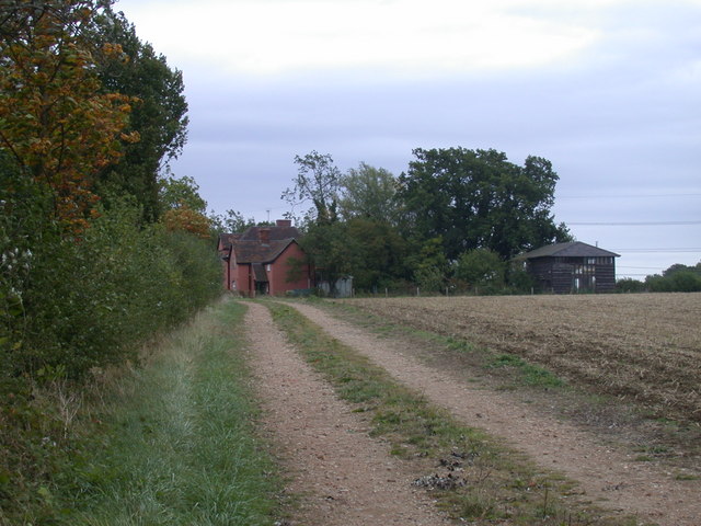
West Wood, Little Sampford

West Wood is a 23.6 hectares (58 acres) biological Site of Special Scientific Interest in Little Sampford, north of Thaxted in northwestern Essex. It is...
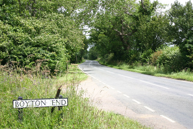
Boyton End, Essex

Boyton End is a hamlet in the Uttlesford district of Essex, England. It is located approximately one mile north-east of Thaxted on the B1051 road.

Great Sampford

Great Sampford is a village and civil parish on the junction of the B1053 and B1051 roads in the Uttlesford district, in the north-west of the English...
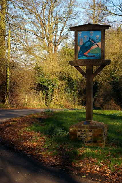
Little Sampford

Little Sampford is a village and a civil parish on the B1053 road, in the Uttlesford district, in the county of Essex, England. The population of the civil...

Thaxted

Thaxted is a town and civil parish in the Uttlesford district of north-west Essex, England. The town is in the valley of the River Chelmer, not far from...

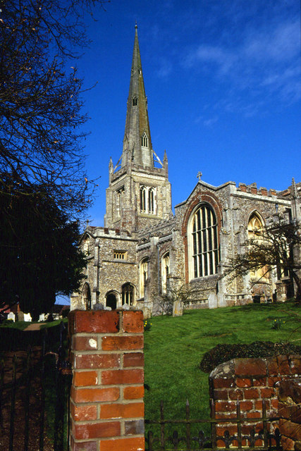
Thaxted Parish Church

The Church of Saint John the Baptist with Our Lady and Saint Laurence is the parish church of the town of Thaxted in Essex, England. The present church...
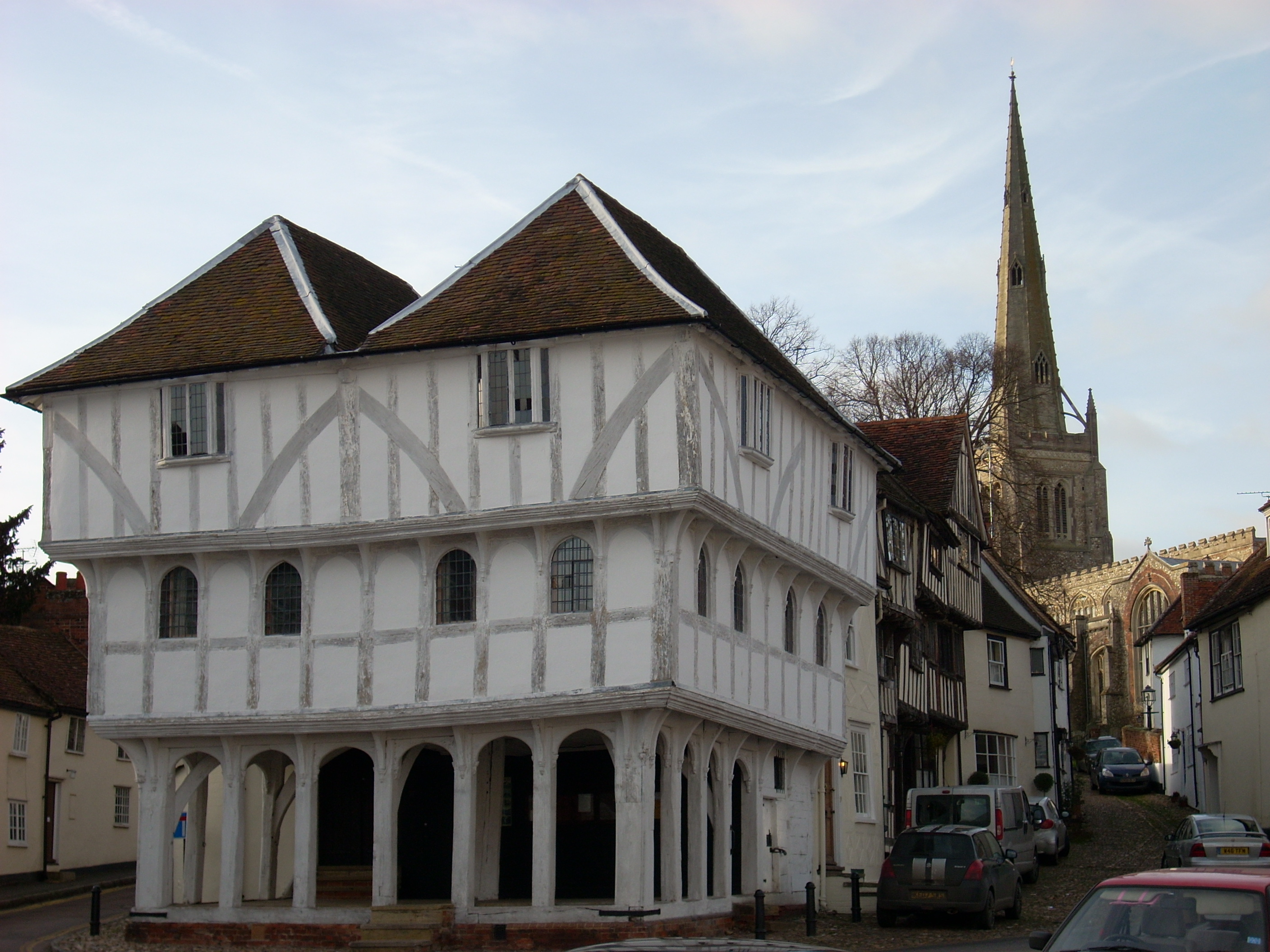
Thaxted Guildhall

Thaxted Guildhall is a municipal building in Thaxted, Essex, England. It is a Grade I listed building. == History == By the late 14th century, Thaxted...

Nearby Amenities

Located within 500m of 51.98233,0.35965568
Power: tower
Lat/Long: 51.9790951/0.3595966
Power: tower
Lat/Long: 51.9813003/0.3632766
The data included in this document is from www.openstreetmap.org. The data is made available under ODbL.

Have you been to Broadcroft Grove?

Leave your review of Broadcroft Grove below (or comments, questions and feedback).