Forest Wood
Wood, Forest in Kent Tunbridge Wells
England
Forest Wood
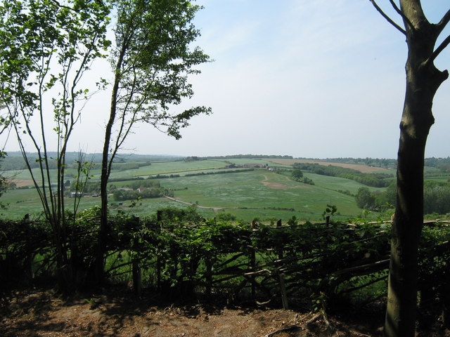
Forest Wood, Kent, also known as Wood, Forest, is a picturesque woodland located in the county of Kent, England. Spanning over several hectares, this enchanting forest is nestled in the heart of the Kent Downs Area of Outstanding Natural Beauty.
Forest Wood is a haven for nature enthusiasts, offering a diverse range of flora and fauna. The woodland is home to a variety of tree species, including oak, beech, ash, and birch. These majestic trees create a dense canopy, providing a cool and tranquil atmosphere throughout the year.
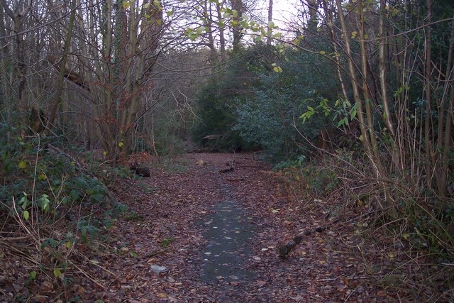
The forest floor is carpeted with a rich tapestry of wildflowers, ferns, and mosses, adding to the area's natural beauty. A network of walking trails meanders through the woodland, allowing visitors to explore the peaceful surroundings at their leisure. The trails are well-maintained and suitable for all ages and abilities, making Forest Wood an ideal destination for families and outdoor enthusiasts.
Aside from its natural beauty, Forest Wood also has historical significance. The woodland is believed to have ancient origins, and there are remnants of prehistoric settlements in the area. Archaeological finds, including flint tools and pottery fragments, have been discovered, providing evidence of human presence dating back thousands of years.
Visitors to Forest Wood can expect a tranquil and serene experience, surrounded by the sights and sounds of nature. The woodland offers a peaceful retreat from the hustle and bustle of everyday life, making it a popular destination for hikers, birdwatchers, and those seeking a connection with the natural world.
If you have any feedback on the listing, please let us know in the comments section below.
Forest Wood Images
Images are sourced within 2km of 51.150316/0.32008964 or Grid Reference TQ6241. Thanks to Geograph Open Source API. All images are credited.


Forest Wood is located at Grid Ref: TQ6241 (Lat: 51.150316, Lng: 0.32008964)
Administrative County: Kent
District: Tunbridge Wells
Police Authority: Kent
What 3 Words
///crest.complains.coast. Near Pembury, Kent
Nearby Locations
Related Wikis

Pembury
Pembury is a large village in Kent, in the south east of England, with a population of 6,128 at the 2011 Census. It lies just to the north-east of Royal...
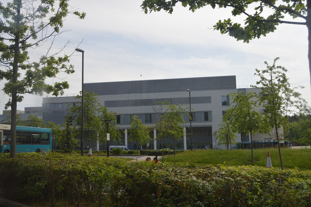
Tunbridge Wells Hospital
Tunbridge Wells Hospital is a large district general hospital in Pembury near Royal Tunbridge Wells, Kent, England, run by the Maidstone and Tunbridge...
Pembury Cutting and Pit
Pembury Cutting and Pit is a 1.6-hectare (4.0-acre) geological Site of Special Scientific Interest east of Tunbridge Wells in Kent. It is a Geological...

Kent College, Pembury
Kent College is an independent day and boarding school from 3-18. Forest Explorers Nursery is for girls and boys from rising 3 years, boys can join Reception...
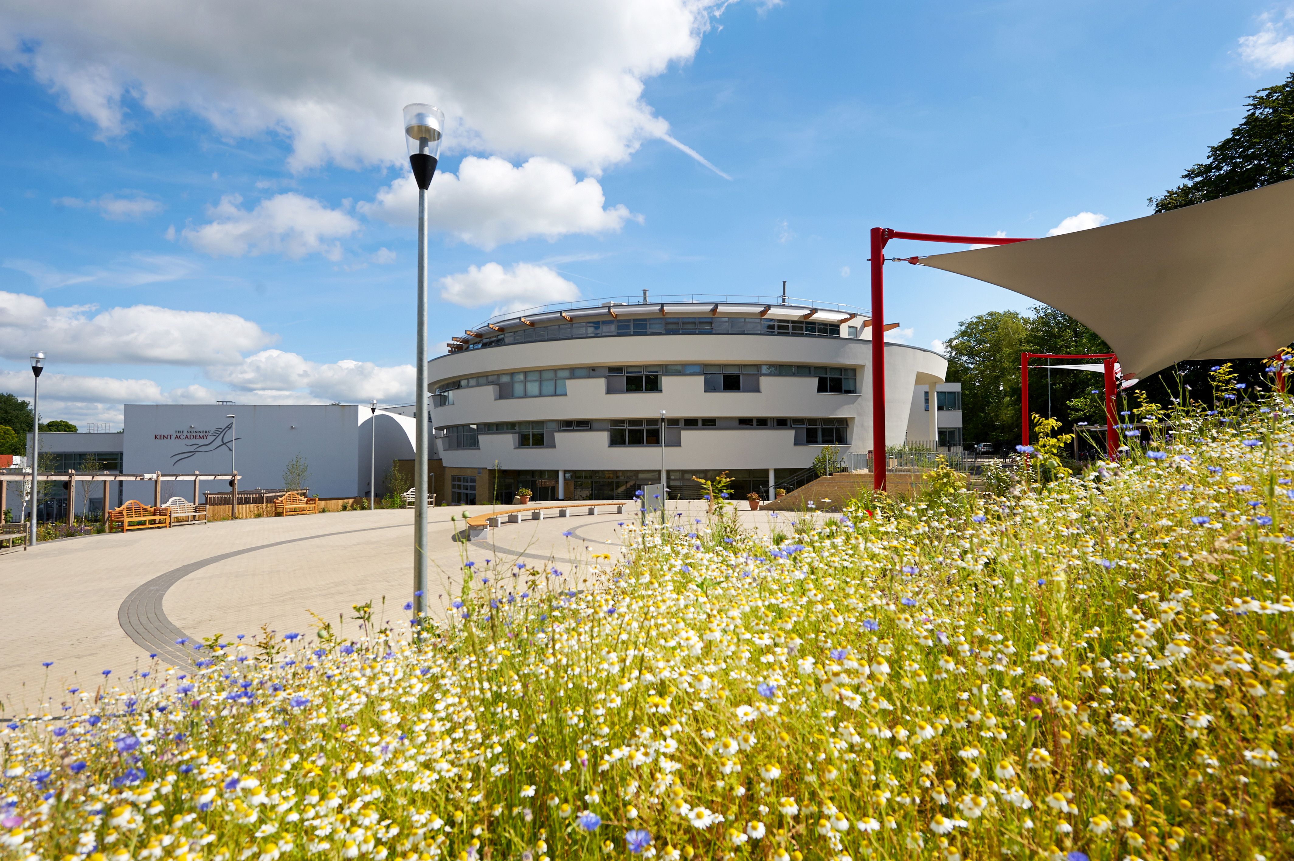
The Skinners' Kent Academy
The Skinners' Kent Academy (formerly Sandown Court then later renamed to Tunbridge Wells High School) is a secondary school with academy status in Royal...

Brenchley Wood
Brenchley Wood is a 15-hectare (37-acre) nature reserve south of Paddock Wood in Kent. It is managed by the Kent Wildlife Trust, and it is part of the...

Beechwood School, Royal Tunbridge Wells
Beechwood School is a co-educational independent day and boarding school for children aged 3–18, which comprises a Nursery, Preparatory School and Senior...
High Brooms
High Brooms is a suburb of Royal Tunbridge Wells in Kent, England. Its railway station is High Brooms railway station. It is connected by train to London...
Nearby Amenities
Located within 500m of 51.150316,0.32008964Have you been to Forest Wood?
Leave your review of Forest Wood below (or comments, questions and feedback).