Down Wood

Wood, Forest in Sussex Wealden

England

Down Wood

Bluebells in Sluice Wood As seen from a footpath passing through the wood towards Bartley Mill Road.
Bluebells in Sluice Wood Credit: David Anstiss

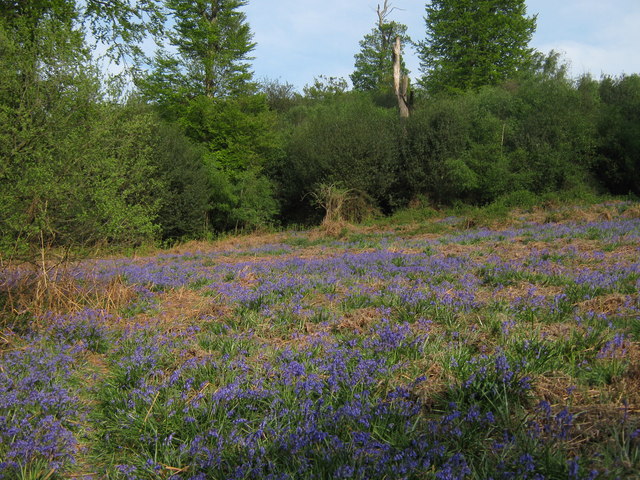
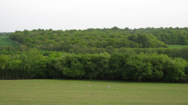
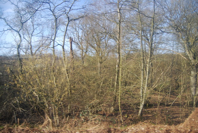
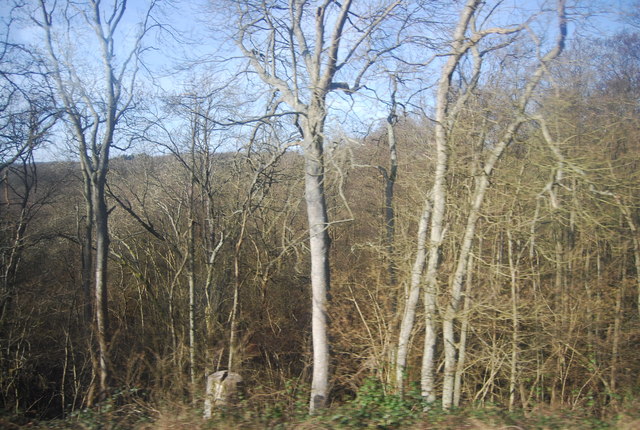
Down Wood is a picturesque forest located in Sussex, England. Situated in the heart of the South Downs National Park, it covers an area of approximately 200 hectares and is known for its rich biodiversity and natural beauty. The wood is predominantly composed of mixed broadleaf trees, including oak, ash, beech, and birch, which create a dense and lush canopy overhead.

The forest is home to a diverse range of flora and fauna, making it a haven for nature enthusiasts and wildlife lovers. Walking through the wood, visitors may spot various bird species, such as woodpeckers, owls, and warblers, as well as mammals like deer, foxes, and badgers. The forest floor is adorned with an array of wildflowers, ferns, and mosses, further enhancing its enchanting atmosphere.

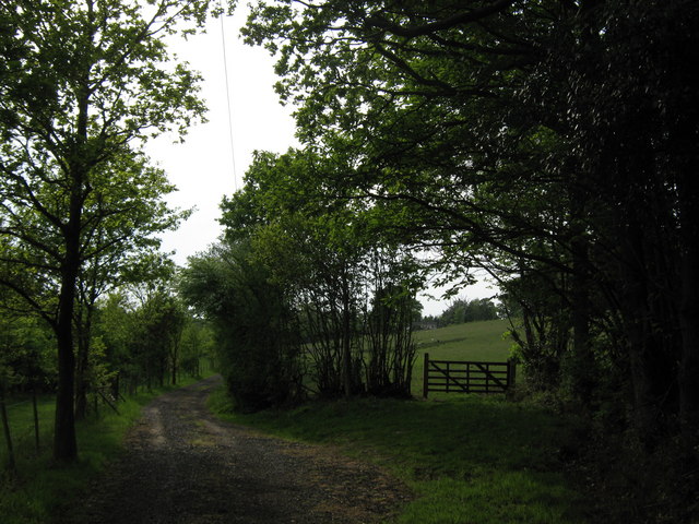
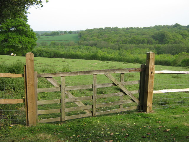
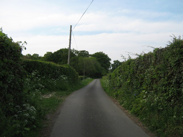
Down Wood offers a network of well-maintained footpaths and trails, allowing visitors to explore its natural wonders at their own pace. These paths wind through the forest, leading to secluded clearings, tranquil streams, and breathtaking viewpoints. The wood is a popular destination for hikers, joggers, and dog walkers, providing ample opportunities for outdoor recreation and relaxation.

Managed by the South Downs National Park Authority, Down Wood is carefully conserved to preserve its ecological value and protect its native species. Regular maintenance and conservation efforts ensure that the forest remains a thriving habitat for wildlife and a cherished natural resource for the local community and visitors alike. Whether it is to enjoy a peaceful walk, observe wildlife, or simply immerse oneself in the tranquility of nature, Down Wood offers a truly rejuvenating experience.

If you have any feedback on the listing, please let us know in the comments section below.

Down Wood Images

Images are sourced within 2km of 51.082083/0.30229524 or Grid Reference TQ6133. Thanks to Geograph Open Source API. All images are credited.

Bluebells in Sluice Wood As seen from a footpath passing through the wood towards Bartley Mill Road.
Bluebells in Sluice Wood
As seen from a footpath passing through the wood towards Bartley Mill Road.
Footpath junction in Brick Kiln Wood A footpath from Great Shoesmith Farm, leads right through the wood towards Bartley Mill Road. The permissive path leads left along a woodland stream, before rejoining the footpath.
Footpath junction in Brick Kiln Wood
A footpath from Great Shoesmith Farm, leads right through the wood towards Bartley Mill Road. The permissive path leads left along a woodland stream, before rejoining the footpath.
Footbridge near Brick Kiln Wood A footpath leads from Bartley Mill Road, through Brick Kiln wood and then over a stream towards a field near Great Shoesmith Farm.
Footbridge near Brick Kiln Wood
A footpath leads from Bartley Mill Road, through Brick Kiln wood and then over a stream towards a field near Great Shoesmith Farm.
Gates near Great Shoesmith Farm A bridleway leads from the farm, straight on towards Bartley Mill, on Bartley Mill Road.
A footpath leads right towards Brick Kiln Wood and onwards to Bartley Mill Road.
Gates near Great Shoesmith Farm
A bridleway leads from the farm, straight on towards Bartley Mill, on Bartley Mill Road. A footpath leads right towards Brick Kiln Wood and onwards to Bartley Mill Road.
Barn in Great Shoesmith Farm Part of the complex of farm buildings.
Barn in Great Shoesmith Farm
Part of the complex of farm buildings.
Track to Walnut Tree Cottage This farm track leads from Great Shoesmith Farm towards the farm cottage.
A footpath leads along the track and then towards Little Shoesmiths farm.
Track to Walnut Tree Cottage
This farm track leads from Great Shoesmith Farm towards the farm cottage. A footpath leads along the track and then towards Little Shoesmiths farm.
Gate near Little Shoesmiths This farm gate and stile, is near a field near Great Shoesmith Farm. A footpath leads over the stile towards Little Shoesmiths and onwards to Dewhurst Lane.
Gate near Little Shoesmiths
This farm gate and stile, is near a field near Great Shoesmith Farm. A footpath leads over the stile towards Little Shoesmiths and onwards to Dewhurst Lane.
Footpath to Great Shoesmith Farm A path leads from Dewhurst Lane, past Little Showsmiths and then up to Great Shoesmith Farm.
Footpath to Great Shoesmith Farm
A path leads from Dewhurst Lane, past Little Showsmiths and then up to Great Shoesmith Farm.
Farm bridge near Little Shoesmiths This bridge leads over a stream, leading from Camden Wood towards Bartley Mill.
The bridge is used by a footpath heading towards Great Shoesmith Farm.
Farm bridge near Little Shoesmiths
This bridge leads over a stream, leading from Camden Wood towards Bartley Mill. The bridge is used by a footpath heading towards Great Shoesmith Farm.
Little Shoesmiths Oast House As seen from a footpath from Great Shoesmith Farm towards Higham Lane.
Little Shoesmiths Oast House
As seen from a footpath from Great Shoesmith Farm towards Higham Lane.
Little Shoesmiths Oast House (2) As seen from a footpath from Great Shoesmith Farm towards Higham Lane.

Note- in the garden a spare Oast Cowl and garden table made from a cowl.
Little Shoesmiths Oast House (2)
As seen from a footpath from Great Shoesmith Farm towards Higham Lane. Note- in the garden a spare Oast Cowl and garden table made from a cowl.
Gate on Little Shoesmiths Access Road This track leads from Little Shoesmiths Farm towards Higham Lane. 
The gate on the right is on a footpath towards Higham Lane.
Gate on Little Shoesmiths Access Road
This track leads from Little Shoesmiths Farm towards Higham Lane. The gate on the right is on a footpath towards Higham Lane.
View of Shoesmiths Wood As seen from a footpath from Higham Farm towards Little Shoesmiths.
View of Shoesmiths Wood
As seen from a footpath from Higham Farm towards Little Shoesmiths.
Gate near Higham Farm Cottage This gate is on a footpath from Higham Lane, leading past Higham Farm Cottage towards Little Shoesmiths.
Gate near Higham Farm Cottage
This gate is on a footpath from Higham Lane, leading past Higham Farm Cottage towards Little Shoesmiths.
Higham Lane This lane leads from Dewhurst Lane, past Higham Farm towards the A2169 Bayham Road, near Bells Yew Green.
Higham Lane
This lane leads from Dewhurst Lane, past Higham Farm towards the A2169 Bayham Road, near Bells Yew Green.
Woodland by the Hastings Line
Grigg's Wood
Grigg's Wood
Grigg's Wood
Grigg's Wood
Show me another place!

Down Wood is located at Grid Ref: TQ6133 (Lat: 51.082083, Lng: 0.30229524)

Administrative County: East Sussex

District: Wealden

Police Authority: Sussex

What 3 Words

///frostbite.tweed.general. Near Wadhurst, East Sussex

Related Wikis

Wadhurst railway station

Wadhurst railway station is on the Hastings line in the south of England and serves the town of Wadhurst, East Sussex. It is 39 miles 23 chains (63.2 km...

Best Beech Hill

Best Beech Hill is a locality in the civil parish of Wadhurst in the Wealden district of East Sussex, England. Wadhurst lies approximately 1.6 miles...

Frant railway station

Frant railway station is on the Hastings line in East Sussex, England, and serves the civil parish of Frant (although the station is actually located some...

Wadhurst

Wadhurst is a market town in East Sussex, England. It is the centre of the civil parish of Wadhurst, which also includes the hamlets of Cousley Wood and...

Frant

Frant is a village and civil parish in the Wealden District of East Sussex, England, on the Kentish border about three miles (5 km) south of Royal Tunbridge...
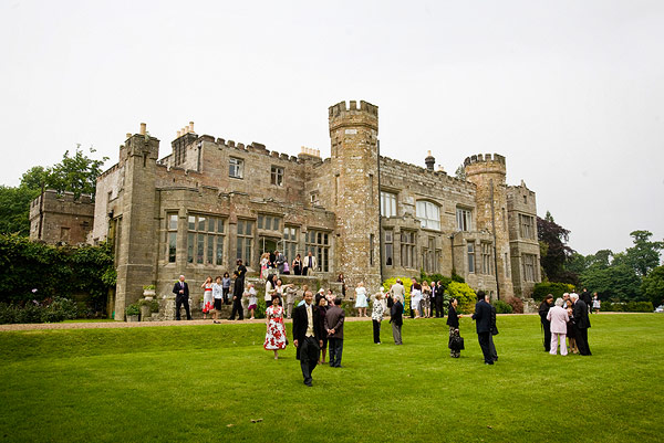
Wadhurst Castle

Wadhurst Castle is a 19th-century castellated mansion just to the west of the town of Wadhurst, East Sussex, England, in an elevated position overlooking...

St Alban's Church, Frant

St Alban's Church is a Church of England parish church in Frant, East Sussex, England. It was built in 1819–22 in a fifteenth-century gothic revival style...

Rehoboth Chapel, Pell Green

Rehoboth Chapel is a former Strict Baptist place of worship in the hamlet of Pell Green in East Sussex, England. Pell Green is in the parish of Wadhurst...

Nearby Amenities

Located within 500m of 51.082083,0.30229524
Dewhurst Farm
Place: farm
Source Name: OS OpenData StreetView
Lat/Long: 51.0799405/0.3073168
Bus Stop
Crowhurst Cottages
Bench: yes
Bin: no
Bus: yes
Lit: yes
Naptan AtcoCode: 1400WE0487
Naptan NaptanCode: esudagtp
Public Transport: platform
Shelter: yes
Tactile Paving: no
Lat/Long: 51.0782588/0.2995571
Bus Stop
Crowhurst Cottages
Bench: no
Bin: no
Bus: yes
Departures Board: timetable
Lit: yes
Naptan AtcoCode: 1400WE0486
Naptan NaptanCode: esudagtm
Public Transport: platform
Shelter: no
Tactile Paving: no
Lat/Long: 51.0783397/0.2996135
Watergate Farm
Place: farm
Lat/Long: 51.0826837/0.2991682
The data included in this document is from www.openstreetmap.org. The data is made available under ODbL.

Have you been to Down Wood?

Leave your review of Down Wood below (or comments, questions and feedback).