Blossom Wood

Wood, Forest in Sussex Wealden

England

Blossom Wood

Grigg's Wood
Grigg's Wood Credit: N Chadwick

Blossom Wood, located in Sussex, is a picturesque woodland area renowned for its natural beauty and enchanting atmosphere. Covering an expansive area, this forest is home to a diverse range of flora and fauna, making it an ideal destination for nature enthusiasts and wildlife lovers alike.

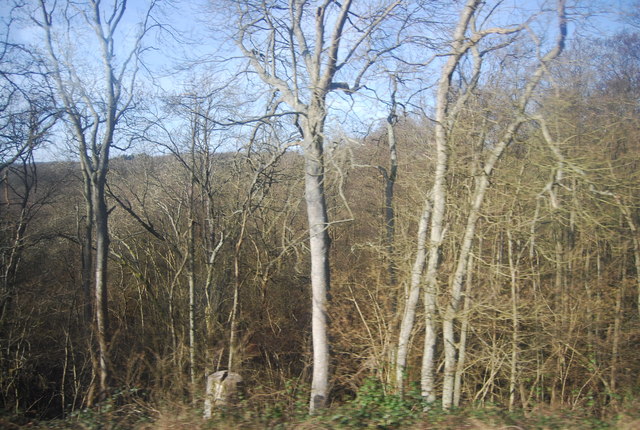
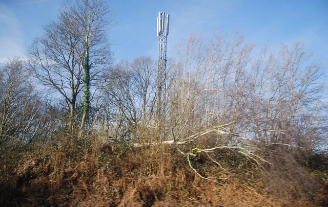
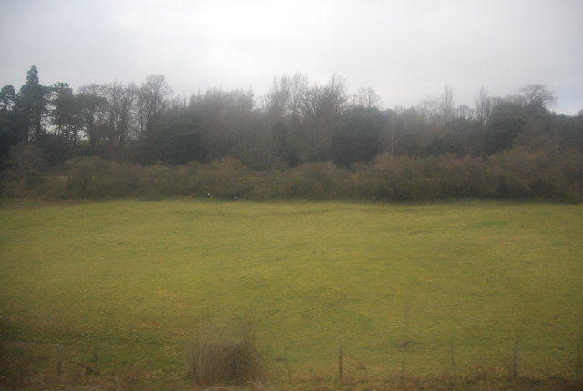
The wood is characterized by its dense tree canopy, featuring a variety of tree species such as oak, beech, and ash. These towering trees create a canopy that offers shade and protection to the woodland floor, where an array of wildflowers, ferns, and mosses thrive. During the spring season, the forest truly comes alive as a sea of colorful blossoms adorn the woodland floor, creating a stunning and vibrant spectacle.

Blossom Wood is teeming with wildlife, providing a sanctuary for numerous species. Birdwatchers can delight in observing a wide range of bird species, including woodpeckers, owls, and various songbirds. The forest is also home to a diverse range of mammals, such as deer, foxes, badgers, and rabbits. Visitors may also be lucky enough to catch a glimpse of elusive creatures like hedgehogs and bats.

The wood offers several walking trails and paths, allowing visitors to explore its beauty at their own pace. Whether it's a leisurely stroll or a more adventurous hike, Blossom Wood caters to all levels of fitness and interests. The serene and tranquil ambiance offers a perfect escape from the hustle and bustle of everyday life.

Overall, Blossom Wood in Sussex is a haven of natural beauty, providing a serene and enchanting environment for visitors to immerse themselves in the wonders of nature.

If you have any feedback on the listing, please let us know in the comments section below.

Blossom Wood Images

Images are sourced within 2km of 51.074334/0.30122527 or Grid Reference TQ6133. Thanks to Geograph Open Source API. All images are credited.

Grigg's Wood
Grigg's Wood
Telecommunications mast by the Hastings Line
Row of Houses, Wadhurst Rd
Woodland by the Hastings Line near Wadhurst Station
Station House, Wadhurst Station Wadhurst station was opened by the South Eastern Railway (SER) in 1851. It is on the Hastings line. The station is about one mile from the village at the foot of a steep hill. It is an important commuter station for the surrounding rural area.
Station House, Wadhurst Station
Wadhurst station was opened by the South Eastern Railway (SER) in 1851. It is on the Hastings line. The station is about one mile from the village at the foot of a steep hill. It is an important commuter station for the surrounding rural area.
Field between Wadhurst Rd and the railway line
Best Beech Inn
Best Beech Inn
Wadhurst Station
Wadhurst Station
Railway bridge over the B2099
Greenman Oast Single round kiln oast house.
Greenman Oast
Single round kiln oast house.
Wadhurst Station Wadhurst station was opened by the South Eastern Railway (SER) in 1851. It is on the Hastings line. The station is about one mile from the village at the foot of a steep hill. It is an important commuter station for the surrounding rural area.
Wadhurst Station
Wadhurst station was opened by the South Eastern Railway (SER) in 1851. It is on the Hastings line. The station is about one mile from the village at the foot of a steep hill. It is an important commuter station for the surrounding rural area.
Station house, Wadhurst Station Grade II listed. <span class="nowrap"><a title="http://www.britishlistedbuildings.co.uk/en-487377-wadhurst-station-and-footbridge-wadhurst" rel="nofollow ugc noopener" href="http://www.britishlistedbuildings.co.uk/en-487377-wadhurst-station-and-footbridge-wadhurst">Link</a><img style="margin-left:2px;" alt="External link" title="External link - shift click to open in new window" src="https://s1.geograph.org.uk/img/external.png" width="10" height="10"/></span>
Station house, Wadhurst Station
Grade II listed. LinkExternal link
Rockrobin House Formerly the site of the Rock Robin public house.
Rockrobin House
Formerly the site of the Rock Robin public house.
Outcrop of Sandstone Tunbridge Wells sandstone is Lower Cretaceous in age. It was lain down in large braided river channels. Today it's outcrops form upland regions across the Weald of Kent. In the Tunbridge Wells area there are several locally famous sites. Mount Edgecumbe Rocks <a href="https://www.geograph.org.uk/photo/1088017">TQ5739 : Edgecumbe Rocks</a>, Wellington Rocks <a href="https://www.geograph.org.uk/photo/1088043">TQ5739 : Wellington Rocks, Tunbridge Wells Common</a>, Toad Rock <a href="https://www.geograph.org.uk/photo/1516528">TQ5639 : Toad Rock, Rusthall</a>, Happy Valley Rocks <a href="https://www.geograph.org.uk/photo/1227365">TQ5639 : Happy Valley Rocks</a>, High Rocks <a href="https://www.geograph.org.uk/photo/1104153">TQ5638 : High Rocks</a>, Eridge Rocks <a href="https://www.geograph.org.uk/photo/1492841">TQ5535 : Eridge Rocks</a>, The Chiddingstone <a href="https://www.geograph.org.uk/photo/1680827">TQ5045 : The Chiding stone, Chiddingstone</a>, Harrison Rocks
The rock makes for good rock climbing in the SE of England.
The rock is locally rich in Iron and mining it gave the Wealden area an Iron making industry in Mediaevil times. It also accounts for a number of Chalybeate springs across Kent and Sussex.
Outcrop of Sandstone
Tunbridge Wells sandstone is Lower Cretaceous in age. It was lain down in large braided river channels. Today it's outcrops form upland regions across the Weald of Kent. In the Tunbridge Wells area there are several locally famous sites. Mount Edgecumbe Rocks TQ5739 : Edgecumbe Rocks, Wellington Rocks TQ5739 : Wellington Rocks, Tunbridge Wells Common, Toad Rock TQ5639 : Toad Rock, Rusthall, Happy Valley Rocks TQ5639 : Happy Valley Rocks, High Rocks TQ5638 : High Rocks, Eridge Rocks TQ5535 : Eridge Rocks, The Chiddingstone TQ5045 : The Chiding stone, Chiddingstone, Harrison Rocks The rock makes for good rock climbing in the SE of England. The rock is locally rich in Iron and mining it gave the Wealden area an Iron making industry in Mediaevil times. It also accounts for a number of Chalybeate springs across Kent and Sussex.
An ex pub
An ex pub
Hastings line The Hastings Line links Hastings with Tunbridge Wells and Tonbridge, then onto London Charing Cross. The line was built by the South Eastern Railway (SER) and opened fully in 1853, having been constructed in phases. Tonbridge to Tunbridge Wells opened in 1846. Tunbridge Wells to Robertsbridge opened in 1851. Robertsbridge to Battle 1852 and Battle to St Leonards (Bo Peep Junction) 1853. The line was built very quickly (and not very well) and several of the tunnels need constant maintenance even today, several of them are single track.
Wikipedia: <span class="nowrap"><a title="http://en.wikipedia.org/wiki/Hastings_Line" rel="nofollow ugc noopener" href="http://en.wikipedia.org/wiki/Hastings_Line">Link</a><img style="margin-left:2px;" alt="External link" title="External link - shift click to open in new window" src="https://s1.geograph.org.uk/img/external.png" width="10" height="10"/></span>
Hastings line
The Hastings Line links Hastings with Tunbridge Wells and Tonbridge, then onto London Charing Cross. The line was built by the South Eastern Railway (SER) and opened fully in 1853, having been constructed in phases. Tonbridge to Tunbridge Wells opened in 1846. Tunbridge Wells to Robertsbridge opened in 1851. Robertsbridge to Battle 1852 and Battle to St Leonards (Bo Peep Junction) 1853. The line was built very quickly (and not very well) and several of the tunnels need constant maintenance even today, several of them are single track. Wikipedia: LinkExternal link
Hastings line
Hastings line
Sussex Border Path The Sussex Border Path is a footpath route nearly 150 miles long around the inland boundary of the county of Sussex. The county owes its origins to the kingdom of the South Saxons and can claim to have one of the longest inland county boundaries from Emsworth to Rye. The route was devised in 1983 and is well signed along most of the route. Website <span class="nowrap"><a title="http://www.sussexborderpath.co.uk/" rel="nofollow ugc noopener" href="http://www.sussexborderpath.co.uk/">Link</a><img style="margin-left:2px;" alt="External link" title="External link - shift click to open in new window" src="https://s1.geograph.org.uk/img/external.png" width="10" height="10"/></span> 
Map: <a title="https://www.geograph.org.uk/search.php?i=40140109&page=1&displayclass=map#i=40140109&page=1&displayclass=map&zoom=2&lat=51.03263&lon=-0.05427&layers=FTTB00000000000T" href="https://www.geograph.org.uk/search.php?i=40140109&page=1&displayclass=map#i=40140109&page=1&displayclass=map&zoom=2&lat=51.03263&lon=-0.05427&layers=FTTB00000000000T">Link</a>
Sussex Border Path
The Sussex Border Path is a footpath route nearly 150 miles long around the inland boundary of the county of Sussex. The county owes its origins to the kingdom of the South Saxons and can claim to have one of the longest inland county boundaries from Emsworth to Rye. The route was devised in 1983 and is well signed along most of the route. Website LinkExternal link Map: Link
Show me another place!

Blossom Wood is located at Grid Ref: TQ6133 (Lat: 51.074334, Lng: 0.30122527)

Administrative County: East Sussex

District: Wealden

Police Authority: Sussex

What 3 Words

///barn.licks.fish. Near Wadhurst, East Sussex

Related Wikis

Wadhurst railway station

Wadhurst railway station is on the Hastings line in the south of England and serves the town of Wadhurst, East Sussex. It is 39 miles 23 chains (63.2 km...

Best Beech Hill

Best Beech Hill is a locality in the civil parish of Wadhurst in the Wealden district of East Sussex, England. Wadhurst lies approximately 1.6 miles...

Wadhurst

Wadhurst is a market town in East Sussex, England. It is the centre of the civil parish of Wadhurst, which also includes the hamlets of Cousley Wood and...

Wadhurst Castle

Wadhurst Castle is a 19th-century castellated mansion just to the west of the town of Wadhurst, East Sussex, England, in an elevated position overlooking...

Uplands Academy

Uplands Academy (formerly Uplands Community College) is a coeducational secondary school and sixth form located in Wadhurst, East Sussex, England. ��2...

Frant

Frant is a village and civil parish in the Wealden District of East Sussex, England, on the Kentish border about three miles (5 km) south of Royal Tunbridge...

Rehoboth Chapel, Pell Green

Rehoboth Chapel is a former Strict Baptist place of worship in the hamlet of Pell Green in East Sussex, England. Pell Green is in the parish of Wadhurst...

Walter's Mill, Mark Cross

Walter's Mill is a tower mill at Mark Cross, Sussex, England which has been converted to residential accommodation. == History == Walter's Mill was first...

Nearby Amenities

Located within 500m of 51.074334,0.30122527
Barrier: stile
Foot: designated
Step Count: 2
Stile: stepover
Lat/Long: 51.071071/0.2992678
Barrier: kissing_gate
Foot: designated
Lat/Long: 51.0722992/0.3024895
Bus Stop
Crowhurst Cottages
Bench: yes
Bin: no
Bus: yes
Lit: yes
Naptan AtcoCode: 1400WE0487
Naptan NaptanCode: esudagtp
Public Transport: platform
Shelter: yes
Tactile Paving: no
Lat/Long: 51.0782588/0.2995571
Bus Stop
Crowhurst Cottages
Bench: no
Bin: no
Bus: yes
Departures Board: timetable
Lit: yes
Naptan AtcoCode: 1400WE0486
Naptan NaptanCode: esudagtm
Public Transport: platform
Shelter: no
Tactile Paving: no
Lat/Long: 51.0783397/0.2996135
Barrier: kissing_gate
Foot: designated
Lat/Long: 51.0741121/0.2985173
The data included in this document is from www.openstreetmap.org. The data is made available under ODbL.

Have you been to Blossom Wood?

Leave your review of Blossom Wood below (or comments, questions and feedback).