Hoglands Wood

Wood, Forest in Essex Uttlesford

England

Hoglands Wood

TESCO Great Dunmow
TESCO Great Dunmow Credit: Andrew Tatlow

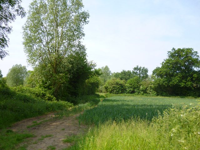
Hoglands Wood is a picturesque and ancient woodland located in Essex, England. Covering an area of approximately 100 acres, it is nestled within the rural landscape of the county, offering a tranquil and serene escape for nature enthusiasts and walkers alike.

This woodland is known for its diverse range of tree species, including oak, beech, ash, and birch, which create a dense canopy overhead. The forest floor is carpeted with an array of wildflowers, such as bluebells and primroses, adding vibrant colors to the woodland during springtime.

Hoglands Wood is also home to a rich variety of wildlife. Visitors may encounter woodland creatures such as deer, foxes, and badgers, as well as a wide range of bird species, including woodpeckers, owls, and various songbirds. The woodland provides a natural habitat for these animals, offering protection and sustenance.

The wood is intersected by a network of footpaths and trails, allowing visitors to explore its natural beauty at their own pace. These paths meander through the woodland, leading to a small pond and a stream, where visitors can enjoy the calming sounds of nature.

Hoglands Wood is a popular destination for outdoor activities, such as hiking, birdwatching, and photography. The woodland's peaceful atmosphere and scenic beauty make it an ideal spot for picnics and family outings.

Overall, Hoglands Wood in Essex offers a delightful escape from the hustle and bustle of daily life, allowing visitors to immerse themselves in the beauty of nature and experience the tranquility of a truly ancient woodland.

If you have any feedback on the listing, please let us know in the comments section below.

Hoglands Wood Images

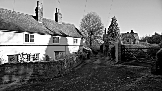
Images are sourced within 2km of 51.879393/0.34291276 or Grid Reference TL6122. Thanks to Geograph Open Source API. All images are credited.

TESCO Great Dunmow
TESCO Great Dunmow
TESCO car park Great Dunmow
Stortford Road Bridge, A120 The A120 is a trunk road that runs east-west across East Anglia from Harwich to Puckeridge, 63 miles in length. It follows the route of the Roman Road, Stane Street. <span class="nowrap"><a title="http://www.sabre-roads.org.uk/wiki/index.php?title=A120" rel="nofollow ugc noopener" href="http://www.sabre-roads.org.uk/wiki/index.php?title=A120">Link</a><img style="margin-left:2px;" alt="External link" title="External link - shift click to open in new window" src="https://s1.geograph.org.uk/img/external.png" width="10" height="10"/></span>
Stortford Road Bridge, A120
The A120 is a trunk road that runs east-west across East Anglia from Harwich to Puckeridge, 63 miles in length. It follows the route of the Roman Road, Stane Street. LinkExternal link
Footbridge, A120 The A120 is a trunk road that runs east-west across East Anglia from Harwich to Puckeridge, 63 miles in length. It follows the route of the Roman Road, Stane Street. <span class="nowrap"><a title="http://www.sabre-roads.org.uk/wiki/index.php?title=A120" rel="nofollow ugc noopener" href="http://www.sabre-roads.org.uk/wiki/index.php?title=A120">Link</a><img style="margin-left:2px;" alt="External link" title="External link - shift click to open in new window" src="https://s1.geograph.org.uk/img/external.png" width="10" height="10"/></span>
Footbridge, A120
The A120 is a trunk road that runs east-west across East Anglia from Harwich to Puckeridge, 63 miles in length. It follows the route of the Roman Road, Stane Street. LinkExternal link
New houses, Great Dunmow The recent residential enlargement of Great Dunmow to the north-west spreads further north.
New houses, Great Dunmow
The recent residential enlargement of Great Dunmow to the north-west spreads further north.
Church Row, Little Easton Grade II listed former almshouses, built 1895. The date and a 'W' are placed centrally. The 'W' perhaps stands for Warwick, as apparently Frances, the Countess of Warwick, had them built.
Church Row, Little Easton
Grade II listed former almshouses, built 1895. The date and a 'W' are placed centrally. The 'W' perhaps stands for Warwick, as apparently Frances, the Countess of Warwick, had them built.
Quarry area on site of RAF Great Dunmow 'Quarry' was what the warning notice called it, but there is little sign here apart from the wide and shallow trench between earth banks. In the distance beyond the dead tree are more quarry-like features.
Quarry area on site of RAF Great Dunmow
'Quarry' was what the warning notice called it, but there is little sign here apart from the wide and shallow trench between earth banks. In the distance beyond the dead tree are more quarry-like features.
Mawbyns, Duck Street, Little Easton A 16th century timber framed house, with several alterations over the years. Grade II listed.
Mawbyns, Duck Street, Little Easton
A 16th century timber framed house, with several alterations over the years. Grade II listed.
Field by the B184 It looks like wheat growing.
Field by the B184
It looks like wheat growing.
Frosty lane, Great Dunmow
Pump, High Street, Great Dunmow
Resting on thin ice, or taking a cold bath!
Rosemary Lane, Great Dunmow
Roundabout for the A120, Dunmow
Dunmow Fencing Supplies on Stortford Road
New Street at the junction of Great Dunmow High Street
Houses on High Street, Great Dunmow
Houses on The Downs, Great Dunmow
Show me another place!

Hoglands Wood is located at Grid Ref: TL6122 (Lat: 51.879393, Lng: 0.34291276)

Administrative County: Essex

District: Uttlesford

Police Authority: Essex

What 3 Words

///boot.trailers.shipyards. Near Great Dunmow, Essex

Nearby Locations

Hoglands Wood

Related Wikis

Helena Romanes School

Helena Romanes School (also known/abbreviated as HRS) is a coeducational all-through school and sixth form. It is situated in Great Dunmow in the English...

Stane Street (Colchester)

Stane Street is a 39 mi (63 km) Roman road that runs from Ermine Street at Braughing, Hertfordshire to Colchester in Essex. == Route == Stane Street can...

Talliston House

Talliston House & Gardens is an ex-council house in Essex, England that has been transformed by owner John Trevillian into a miniature palace. The house...

High Wood, Dunmow

High Wood, Dunmow is a 41.5-hectare (103-acre) biological Site of Special Scientific Interest in Great Dunmow in Essex. The local planning authority is...

Nearby Amenities

Located within 500m of 51.879393,0.34291276
Direction: both
Traffic Calming: table
Lat/Long: 51.8768941/0.3451704
Crossing
Crossing: unmarked
Crossing Island: no
Crossing Markings: no
Tactile Paving: yes
Lat/Long: 51.8750528/0.3429229
Crossing
Crossing: unmarked
Crossing Island: yes
Crossing Markings: no
Tactile Paving: no
Lat/Long: 51.8813351/0.3466769
Power: pole
Lat/Long: 51.8785635/0.3368819
Power: pole
Lat/Long: 51.8793537/0.3392465
Power: pole
Lat/Long: 51.8801757/0.3402069
Power: pole
Lat/Long: 51.8809598/0.3411634
Power: pole
Lat/Long: 51.8816672/0.3419497
Power: pole
Lat/Long: 51.8822919/0.3426558
Power: pole
Lat/Long: 51.8830988/0.3436353
Power: pole
Lat/Long: 51.8786535/0.3384331
Direction: both
Traffic Calming: cushion
Lat/Long: 51.8768056/0.3465414
Direction: both
Traffic Calming: hump
Lat/Long: 51.8778877/0.3493459
Barrier: kissing_gate
Lat/Long: 51.8813407/0.3464904
Bench
Lat/Long: 51.8769592/0.3465106
Barrier: wicket_gate
Lat/Long: 51.881143/0.3472268
Direction: both
Traffic Calming: table
Lat/Long: 51.8765125/0.3397249
Direction: both
Surface: paving_stones
Traffic Calming: table
Lat/Long: 51.875734/0.340191
Crossing
Crossing: unmarked
Crossing Markings: no
Lat/Long: 51.8751834/0.3405206
Crossing
Crossing: unmarked
Crossing Markings: no
Lat/Long: 51.8752887/0.3419016
Crossing
Crossing: unmarked
Crossing Island: no
Crossing Markings: no
Tactile Paving: no
Lat/Long: 51.8750571/0.3431446
Bus Stop
Bus: yes
Public Transport: platform
Lat/Long: 51.8753007/0.3411994
Bus Stop
Bus: yes
Public Transport: platform
Lat/Long: 51.8751822/0.3409284
Crossing
Crossing: unmarked
Crossing Markings: no
Lat/Long: 51.8752918/0.3409913
Crossing
Crossing: unmarked
Crossing Island: no
Crossing Markings: no
Tactile Paving: no
Lat/Long: 51.8752937/0.3415174
Crossing
Crossing: unmarked
Crossing Island: no
Crossing Markings: no
Tactile Paving: no
Lat/Long: 51.8751207/0.3406777
Crossing
Crossing: unmarked
Crossing Island: no
Crossing Markings: no
Tactile Paving: no
Lat/Long: 51.8752226/0.3411211
Playground: structure
Lat/Long: 51.8764046/0.3412202
Playground: structure
Lat/Long: 51.8761943/0.3413784
Playground: structure
Lat/Long: 51.8759459/0.341534
Playground: structure
Lat/Long: 51.8758085/0.3415259
Leisure: playground
Lat/Long: 51.8771315/0.3402892
The data included in this document is from www.openstreetmap.org. The data is made available under ODbL.

Have you been to Hoglands Wood?

Leave your review of Hoglands Wood below (or comments, questions and feedback).