Pilgrim's Wood

Wood, Forest in Kent Tunbridge Wells

England

Pilgrim's Wood

Transmitter on top of Castle Hill Pembury TV transmitter amongst the trees
Transmitter on top of Castle Hill Credit: N Chadwick

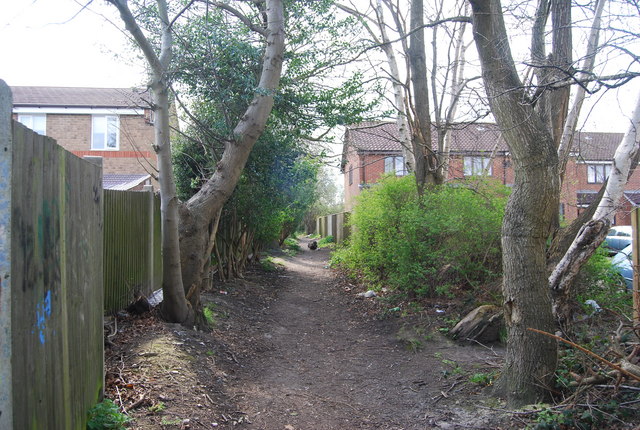
Pilgrim's Wood, located in Kent, England, is a captivating and ancient forest that spans over an area of approximately 100 acres. It is renowned for its natural beauty, rich biodiversity, and historical significance. The wood is situated near the village of Charing, making it easily accessible for visitors from nearby towns and cities.

The forest is predominantly composed of broadleaf trees, including oak, beech, and chestnut, which provide a lush and vibrant canopy, especially during the summer months. The dense foliage creates a serene and tranquil atmosphere, making it a popular destination for nature lovers, hikers, and birdwatchers.

Pilgrim's Wood holds immense historical importance as it was once a part of the medieval Pilgrims' Way, an ancient pilgrimage route that stretched from Winchester to the shrine of Thomas Becket in Canterbury. Although the original route has been altered over time, traces of the ancient path can still be found within the wood, adding to its allure and charm.

The wood is home to a diverse range of wildlife, including deer, foxes, badgers, and a variety of bird species. Nature enthusiasts can enjoy birdwatching, as the forest provides a habitat for woodpeckers, owls, and various songbirds.

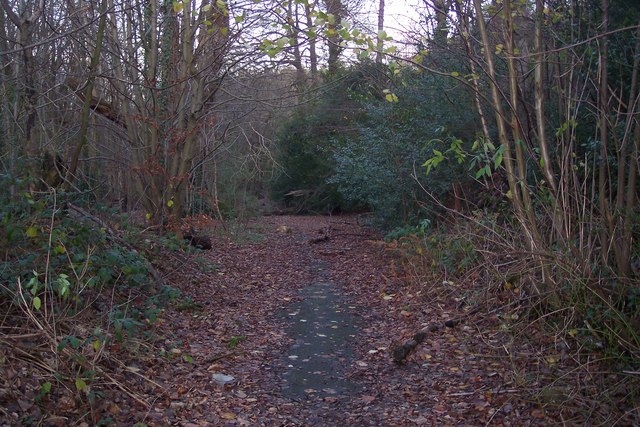
Pilgrim's Wood is accessible to the public, with well-marked trails and footpaths that guide visitors through its enchanting scenery. The forest offers a peaceful retreat from the hustle and bustle of everyday life, providing a perfect opportunity to connect with nature and explore the history and natural beauty of Kent.

If you have any feedback on the listing, please let us know in the comments section below.

Pilgrim's Wood Images

Images are sourced within 2km of 51.165557/0.29522135 or Grid Reference TQ6043. Thanks to Geograph Open Source API. All images are credited.

Transmitter on top of Castle Hill Pembury TV transmitter amongst the trees
Transmitter on top of Castle Hill
Pembury TV transmitter amongst the trees
Great Lodge Retail Park This used to be an Industrial estate (part still is) but in line with modern trends most of the area is now big national retail chains.
Great Lodge Retail Park
This used to be an Industrial estate (part still is) but in line with modern trends most of the area is now big national retail chains.
Knights Park Leisure park This area contains a health club, public house, restaurant, bowling alley & cinema
Knights Park Leisure park
This area contains a health club, public house, restaurant, bowling alley & cinema
Woods behind Knights Park Leisure Park
The old A21 Outside Pembury Hospital This was the main road until the Pembury bypass was built
The old A21 Outside Pembury Hospital
This was the main road until the Pembury bypass was built
Pembury Hospital (part of) This large complex lies on the outskirts of Pembury village. It is run by the Tunbridge Wells & Maidstone Health Trust
Pembury Hospital (part of)
This large complex lies on the outskirts of Pembury village. It is run by the Tunbridge Wells & Maidstone Health Trust
Pond & Woodland This is taken outside Pembury Hall & Kent College (a private school).
Pond & Woodland
This is taken outside Pembury Hall & Kent College (a private school).
Dislingbury Road A Kent byway in the Pembury Woods
Dislingbury Road
A Kent byway in the Pembury Woods
Church Spire at Kent College
Road through Pembury Woods Pembury Woods are a large woodland, East of Tunbridge Wells
Road through Pembury Woods
Pembury Woods are a large woodland, East of Tunbridge Wells
Busy A21 This is taken looking South towards Pembury. It is part of a 2 mile stretch that is not dual carriageway
Busy A21
This is taken looking South towards Pembury. It is part of a 2 mile stretch that is not dual carriageway
Somerhill This 17th century manor house is part of the South Frith estate, dating back to Elizabethan times, on the southern edge of Tonbridge. It is now occupied by 3 prep schools collectively known as "The Schools at Somerhill".
Grade I listed. <span class="nowrap"><a title="http://www.britishlistedbuildings.co.uk/en-436723-somerhill-capel-kent" rel="nofollow ugc noopener" href="http://www.britishlistedbuildings.co.uk/en-436723-somerhill-capel-kent">Link</a><img style="margin-left:2px;" alt="External link" title="External link - shift click to open in new window" src="https://s1.geograph.org.uk/img/external.png" width="10" height="10"/></span>
Somerhill
This 17th century manor house is part of the South Frith estate, dating back to Elizabethan times, on the southern edge of Tonbridge. It is now occupied by 3 prep schools collectively known as "The Schools at Somerhill". Grade I listed. LinkExternal link
Clocktower, Summerhill Part of the large Summerhill manor house dating back to the 17th century. Now 3 schools.
Clocktower, Summerhill
Part of the large Summerhill manor house dating back to the 17th century. Now 3 schools.
A21 climbing Castle Hill This is at the southern end of the A21 Tonbridge bypass. the dual carriageway ends and becomes a single carriageway as it climbs castle Hill. A dual carriageway is needed to avoid frequent congestion on this stretch of road.
A21 climbing Castle Hill
This is at the southern end of the A21 Tonbridge bypass. the dual carriageway ends and becomes a single carriageway as it climbs castle Hill. A dual carriageway is needed to avoid frequent congestion on this stretch of road.
Masts on top of Castle Hill, near Pembury. These are the main TV transmitters for this area.
Masts on top of Castle Hill, near Pembury.
These are the main TV transmitters for this area.
Transmitters on top of Castle Hill, near Pembury. The main transmitters for TV in this area.
Transmitters on top of Castle Hill, near Pembury.
The main transmitters for TV in this area.
Transmitters on Castle Hill.
The Oast, Half Moon Lane, Pembury, Kent Single square kilned oast house.
The Oast, Half Moon Lane, Pembury, Kent
Single square kilned oast house.
Show me another place!

Pilgrim's Wood is located at Grid Ref: TQ6043 (Lat: 51.165557, Lng: 0.29522135)

Administrative County: Kent

District: Tunbridge Wells

Police Authority: Kent

What 3 Words

///foil.quick.storms. Near Pembury, Kent

Related Wikis

Barnett's Wood

Barnett's Wood is a 12.4-hectare (31-acre) Local Nature Reserve in Southborough, on the northern outskirts of Tunbridge Wells in Kent. It is owned by...

Pembury Cutting and Pit

Pembury Cutting and Pit is a 1.6-hectare (4.0-acre) geological Site of Special Scientific Interest east of Tunbridge Wells in Kent. It is a Geological...

Southborough Pit

Southborough Pit is a 1.1-hectare (2.7-acre) geological Site of Special Scientific Interest in Tunbridge Wells in Kent. It is a Geological Conservation...

Somerhill House

Somerhill House () is a Grade I listed Jacobean mansion situated near Tonbridge, Kent, United Kingdom. It was built for The 4th Earl of Clanricarde in...

Tunbridge Wells Hospital

Tunbridge Wells Hospital is a large district general hospital in Pembury near Royal Tunbridge Wells, Kent, England, run by the Maidstone and Tunbridge...

Kent College, Pembury

Kent College is an independent day and boarding school from 3-18. Forest Explorers Nursery is for girls and boys from rising 3 years, boys can join Reception...

The Schools at Somerhill

Somerhill Independent School (formerly known as The Schools at Somerhill) is an independent prep school in Tonbridge, Kent, located at Somerhill House...

Yardley Court

Yardley Court is a private day preparatory school for boys in Tonbridge, Kent, England, founded in 1898 by Arthur Bickmore and his wife Lilian. It now...

Nearby Amenities

Located within 500m of 51.165557,0.29522135
Power: tower
Lat/Long: 51.1654041/0.2918236
Power: tower
Lat/Long: 51.1648756/0.2883973
Power: tower
Lat/Long: 51.1666737/0.3002656
Power: tower
Lat/Long: 51.1660648/0.2964362
Barrier: stile
Bicycle: no
Foot: yes
Horse: no
Material: wood
Motor Vehicle: no
Stile: stepover
Lat/Long: 51.1675057/0.2922515
The data included in this document is from www.openstreetmap.org. The data is made available under ODbL.

Have you been to Pilgrim's Wood?

Leave your review of Pilgrim's Wood below (or comments, questions and feedback).