Blackberry Belt

Wood, Forest in Cambridgeshire East Cambridgeshire

England

Blackberry Belt

A crossroads on Brinkley Road Brinkley to the left, Six Mile Bottom and Cambridge to the right, Weston Colville and (not very directly) Balsham straight ahead. The road behind the camera runs to Dullingham.
A crossroads on Brinkley Road Credit: John Sutton

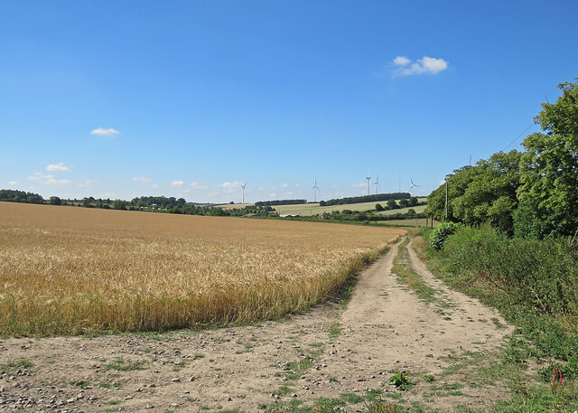
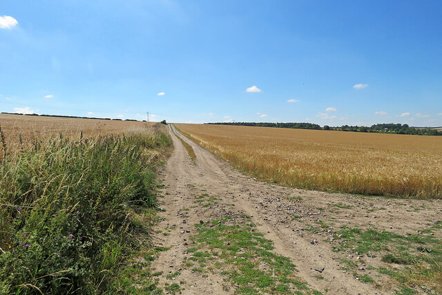
Blackberry Belt is a small woodland area located in Cambridgeshire, England. Situated in the eastern part of the county, it is known for its dense growth of blackberry bushes, hence the name. The woodland covers an area of approximately 50 acres and is characterized by its vibrant greenery and diverse wildlife.

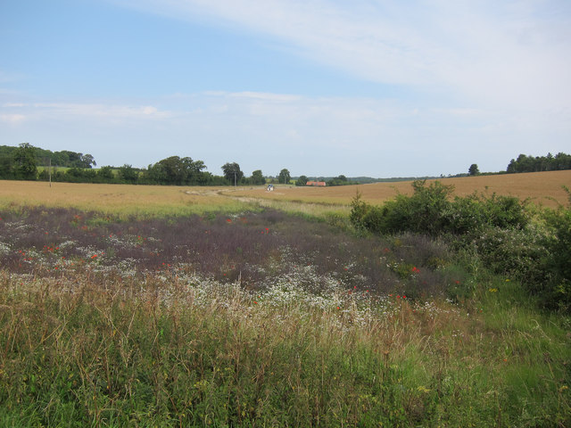
The Blackberry Belt is a haven for nature enthusiasts and hikers alike. The forest is predominantly composed of oak and beech trees, which provide a dense canopy that creates a cool and shaded environment. The woodland floor is covered with thick undergrowth, including ferns, bluebells, and a variety of wildflowers, adding to the area's natural beauty.

Home to an array of wildlife, the Blackberry Belt offers a glimpse into the local ecosystem. Visitors might spot deer, foxes, badgers, and an array of bird species, including woodpeckers and owls. The woodland serves as an important habitat for these creatures, providing them with shelter and food.

For those seeking outdoor activities, the Blackberry Belt offers numerous walking trails and paths, allowing visitors to explore the area at their own pace. These trails wind through the forest, offering stunning views and opportunities for birdwatching. The woodland is also a popular spot for foraging, with blackberry bushes abundant in late summer, providing a bountiful harvest for those looking to collect these delicious fruits.

Overall, the Blackberry Belt in Cambridgeshire is a picturesque woodland area, offering a peaceful escape from the hustle and bustle of everyday life. With its natural beauty and diverse wildlife, it is a must-visit destination for nature lovers and outdoor enthusiasts alike.

If you have any feedback on the listing, please let us know in the comments section below.

Blackberry Belt Images

Images are sourced within 2km of 52.179388/0.33672353 or Grid Reference TL5956. Thanks to Geograph Open Source API. All images are credited.

A crossroads on Brinkley Road Brinkley to the left, Six Mile Bottom and Cambridge to the right, Weston Colville and (not very directly) Balsham straight ahead. The road behind the camera runs to Dullingham.
A crossroads on Brinkley Road
Brinkley to the left, Six Mile Bottom and Cambridge to the right, Weston Colville and (not very directly) Balsham straight ahead. The road behind the camera runs to Dullingham.
North-west from Westley Waterless Straight on for Westley Bottom.
North-west from Westley Waterless
Straight on for Westley Bottom.
Westley Waterless: water shortage After the drought summer of 2022 the water level looks low in the pond on Church Lane.

For comparison: <a href="https://www.geograph.org.uk/photo/3276200">TL6156 : Westley Waterless: Church Lane and pond</a> (2012).
Westley Waterless: water shortage
After the drought summer of 2022 the water level looks low in the pond on Church Lane. For comparison: TL6156 : Westley Waterless: Church Lane and pond (2012).
Westley Waterless: St Mary - restoration Two men were working on the bellcote - one on the lead, the other painting the louvres. The spirelet replaced a round tower which collapsed in 1855.

Inside are two exquisite 14th-century brasses: <a href="https://www.geograph.org.uk/photo/3276297">TL6156 : Westley Waterless: brass of Sir John Creke (detail)</a> and <a href="https://www.geograph.org.uk/photo/3276294">TL6156 : Westley Waterless: brass of Lady Creke (detail)</a>.
Westley Waterless: St Mary - restoration
Two men were working on the bellcote - one on the lead, the other painting the louvres. The spirelet replaced a round tower which collapsed in 1855. Inside are two exquisite 14th-century brasses: TL6156 : Westley Waterless: brass of Sir John Creke (detail) and TL6156 : Westley Waterless: brass of Lady Creke (detail).
The eastern edge of Brinkley Wood At over 350ft, the hills of East Cambridgeshire are a lot higher than much of the rest of the county. Big fields and large plantations typify the area.
The eastern edge of Brinkley Wood
At over 350ft, the hills of East Cambridgeshire are a lot higher than much of the rest of the county. Big fields and large plantations typify the area.
Towards Brinkley Wood At over 350ft, the hills of East Cambridgeshire are a lot higher than much of the rest of the county. Big fields and large plantations typify the area. A little further from here, Six Mile Bottom Road, from which this picture was taken, begins to slope down to the lower-lying villages east of Cambridge, near the edge of The Fens.
Towards Brinkley Wood
At over 350ft, the hills of East Cambridgeshire are a lot higher than much of the rest of the county. Big fields and large plantations typify the area. A little further from here, Six Mile Bottom Road, from which this picture was taken, begins to slope down to the lower-lying villages east of Cambridge, near the edge of The Fens.
The road to Six Mile Bottom This is the road from West Wratting to Six Mile Bottom, near Lark Hall. The signpost on the right points along a path which cuts a corner and leads to the Weston Colville road (see <a href="https://www.geograph.org.uk/photo/7221136">TL5854 : Footpath through barley</a>).
The road to Six Mile Bottom
This is the road from West Wratting to Six Mile Bottom, near Lark Hall. The signpost on the right points along a path which cuts a corner and leads to the Weston Colville road (see TL5854 : Footpath through barley).
Barley and turbines Looking towards Lark Hall Corner and, on the skyline, some of the turbines of Wadlow Wind Farm on a fine July morning.
Barley and turbines
Looking towards Lark Hall Corner and, on the skyline, some of the turbines of Wadlow Wind Farm on a fine July morning.
Footpath through barley The start, near Lark Hall, of a path which follows a farm track, cutting a corner and leading to the Weston Colville road.
Footpath through barley
The start, near Lark Hall, of a path which follows a farm track, cutting a corner and leading to the Weston Colville road.
Oil seed rape off Westley Bottom Road With a stream running towards Partridge Hall.
Oil seed rape off Westley Bottom Road
With a stream running towards Partridge Hall.
Westley Bottom Road A good route for cycling as it becomes a byway at the level crossing <a href="https://www.geograph.org.uk/photo/358030">TL5957 : Westley Bottom level crossing</a>.
Westley Bottom Road
A good route for cycling as it becomes a byway at the level crossing TL5957 : Westley Bottom level crossing.
Barns by Balsham Lane
Icknield Way The strip on the left of the track is for game cover crops, see <a href="https://www.geograph.org.uk/photo/1637282">TL6054 : Icknield Way Path</a>.
Icknield Way
The strip on the left of the track is for game cover crops, see TL6054 : Icknield Way Path.
Oil seed rape field Looking past a lone tree towards Westley Waterless.
Oil seed rape field
Looking past a lone tree towards Westley Waterless.
Oil seed rape off Westley Bottom Road Compare with <a href="https://www.geograph.org.uk/photo/2562306">TL6056 : Oil seed rape off Westley Bottom Road</a> from three months earlier.
Oil seed rape off Westley Bottom Road
Compare with TL6056 : Oil seed rape off Westley Bottom Road from three months earlier.
Icknield Way This small part of the Icknield Way shares part of a minor country road near to Weston Colville, Cambridgeshire.
Icknield Way
This small part of the Icknield Way shares part of a minor country road near to Weston Colville, Cambridgeshire.
Signs Footpath sign and marker signs for the Icknield Way near to Weston Colville, Cambridgeshire.
Signs
Footpath sign and marker signs for the Icknield Way near to Weston Colville, Cambridgeshire.
Part Of The Icknield Way Looking west along part of the Icknield Way near to Weston Colville, Cambridgeshire.
Part Of The Icknield Way
Looking west along part of the Icknield Way near to Weston Colville, Cambridgeshire.
Show me another place!

Blackberry Belt is located at Grid Ref: TL5956 (Lat: 52.179388, Lng: 0.33672353)

Administrative County: Cambridgeshire

District: East Cambridgeshire

Police Authority: Cambridgeshire

What 3 Words

///toads.hulk.valuables. Near Balsham, Cambridgeshire

Related Wikis

Six Mile Bottom

Six Mile Bottom is a hamlet within the parish of Little Wilbraham, near Cambridge in England. == History == In the 1790s the only building at Six Mile...

Westley Waterless

Westley Waterless is a small village and civil parish in East Cambridgeshire, England, 5 miles south west of Newmarket. == History == The parish of Westley...

Six Mile Bottom railway station

Six Mile Bottom railway station is a disused railway station on the Ipswich to Cambridge line between Dullingham and Fulbourn. It served the village of...

Dullingham railway station

Dullingham is a railway station that serves the village of Dullingham in Cambridgeshire, England. It is about 1 mile (1.6 km) north-west of the centre...

Weston Colville

Weston Colville is a village in South Cambridgeshire, 10 miles southeast of Cambridge and 6 miles south of Newmarket, close to the border with Suffolk...

Brinkley, Cambridgeshire

Brinkley is a small village in Cambridgeshire, England. It is situated about 15 miles east of Cambridge and 5 miles south of Newmarket, the horse racing...

Dullingham

Dullingham is a small village and civil parish in East Cambridgeshire, England. It is situated 4 miles (6 km) south of Newmarket and 14 miles (23 km) east...

West Wratting

West Wratting is a village and civil parish 10 miles southeast of Cambridge in Cambridgeshire. At 390 feet (120 m) above sea level, it can claim to be...

Related Videos

"We've Grown Up Together, Now We'll Grow Old Together" | Swynford Manor Wedding

The beautiful cinematic wedding highlights film from Annabel & Ross' wedding day at the Swynford Manor wedding venue.

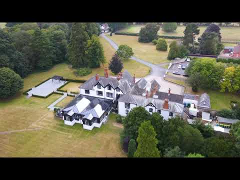
Swynford Manor #swynfordmanor #droneservices #wedding #weddings #aerialvideography #fyp #subscribe

The beautiful Swynford Manor wedding venue in Cambridge Planning for your big day? Need a drone pilot for aerial videography ...

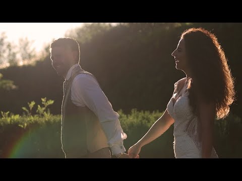
swynford manor wedding videographer

Swynford Manor wedding videographer Rosewood wedding films, Created this wedding short film for Marie & Ant.

Nearby Amenities

Located within 500m of 52.179388,0.33672353
The data included in this document is from www.openstreetmap.org. The data is made available under ODbL.

Have you been to Blackberry Belt?

Leave your review of Blackberry Belt below (or comments, questions and feedback).