Quarry Wood

Wood, Forest in Kent Tunbridge Wells

England

Quarry Wood

Transmitter on top of Castle Hill Pembury TV transmitter amongst the trees
Transmitter on top of Castle Hill Credit: N Chadwick

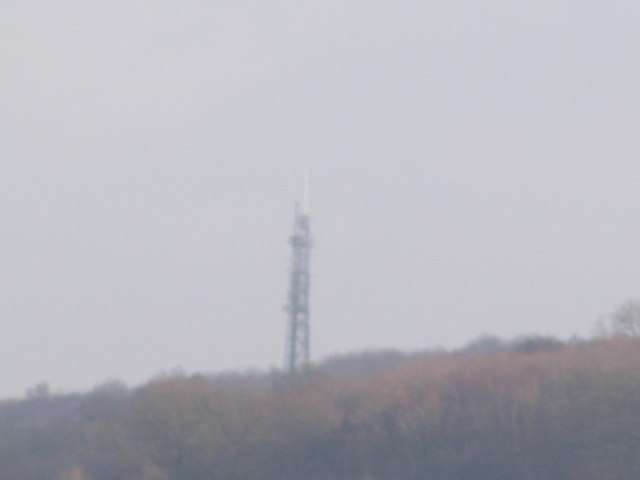
Quarry Wood, located in Kent, England, is a picturesque woodland that spans over an area of approximately 50 hectares. Situated near the village of West Thurrock, this woodland is renowned for its natural beauty and diverse ecosystem.

The wood is predominantly composed of oak and hornbeam trees, whose towering canopies provide a tranquil and shaded environment. The forest floor is covered with a carpet of bluebells during the spring, creating a stunning display of vibrant colors. In addition to bluebells, various other wildflowers and ferns can be found throughout the wood, adding to its charm.

Quarry Wood is home to a rich variety of wildlife, making it a popular destination for nature enthusiasts and wildlife photographers. The wood provides a habitat for numerous bird species, including woodpeckers, thrushes, and owls, which can be heard chirping and hooting throughout the day. Squirrels scurry among the treetops, while badgers and foxes roam the forest floor during the night.

The wood offers several walking trails and footpaths, allowing visitors to explore its beauty at their own pace. It is a haven for hikers, dog walkers, and families seeking a peaceful retreat amidst nature. The wood also features a small pond, attracting various aquatic creatures and providing a serene spot for visitors to relax and observe the surrounding wildlife.

Overall, Quarry Wood in Kent, with its ancient trees, vibrant flora, and diverse fauna, is a truly enchanting destination for those seeking a connection with nature in a peaceful and picturesque setting.

If you have any feedback on the listing, please let us know in the comments section below.

Quarry Wood Images

Images are sourced within 2km of 51.174166/0.28082706 or Grid Reference TQ5944. Thanks to Geograph Open Source API. All images are credited.

Transmitter on top of Castle Hill Pembury TV transmitter amongst the trees
Transmitter on top of Castle Hill
Pembury TV transmitter amongst the trees
Somerhill This 17th century manor house is part of the South Frith estate, dating back to Elizabethan times, on the southern edge of Tonbridge. It is now occupied by 3 prep schools collectively known as "The Schools at Somerhill".
Grade I listed. <span class="nowrap"><a title="http://www.britishlistedbuildings.co.uk/en-436723-somerhill-capel-kent" rel="nofollow ugc noopener" href="http://www.britishlistedbuildings.co.uk/en-436723-somerhill-capel-kent">Link</a><img style="margin-left:2px;" alt="External link" title="External link - shift click to open in new window" src="https://s1.geograph.org.uk/img/external.png" width="10" height="10"/></span>
Somerhill
This 17th century manor house is part of the South Frith estate, dating back to Elizabethan times, on the southern edge of Tonbridge. It is now occupied by 3 prep schools collectively known as "The Schools at Somerhill". Grade I listed. LinkExternal link
Clocktower, Summerhill Part of the large Summerhill manor house dating back to the 17th century. Now 3 schools.
Clocktower, Summerhill
Part of the large Summerhill manor house dating back to the 17th century. Now 3 schools.
A21 climbing Castle Hill This is at the southern end of the A21 Tonbridge bypass. the dual carriageway ends and becomes a single carriageway as it climbs castle Hill. A dual carriageway is needed to avoid frequent congestion on this stretch of road.
A21 climbing Castle Hill
This is at the southern end of the A21 Tonbridge bypass. the dual carriageway ends and becomes a single carriageway as it climbs castle Hill. A dual carriageway is needed to avoid frequent congestion on this stretch of road.
Masts on top of Castle Hill, near Pembury. These are the main TV transmitters for this area.
Masts on top of Castle Hill, near Pembury.
These are the main TV transmitters for this area.
Transmitters on top of Castle Hill, near Pembury. The main transmitters for TV in this area.
Transmitters on top of Castle Hill, near Pembury.
The main transmitters for TV in this area.
Transmitters on Castle Hill.
Track into Burgess Rough, near Tonbridge, Kent This track leads north-westwards from the busy A21 through Burgess Rough, which appears to be mainly alderwood, for about 1.5 km to the village of Tudeley.
Track into Burgess Rough, near Tonbridge, Kent
This track leads north-westwards from the busy A21 through Burgess Rough, which appears to be mainly alderwood, for about 1.5 km to the village of Tudeley.
New stable block, Castle Hill Fort, near Tonbridge, Kent High quality horses are extremely valuable animals, and here, they are in accommodation which reflects this, fully hygienic, spacious, warm and well-ventilated.  Not only this but there is state-of-the-art security which will discourage unwelcome visitors.
New stable block, Castle Hill Fort, near Tonbridge, Kent
High quality horses are extremely valuable animals, and here, they are in accommodation which reflects this, fully hygienic, spacious, warm and well-ventilated. Not only this but there is state-of-the-art security which will discourage unwelcome visitors.
Oast House Twin round kiln oast house.
Oast House
Twin round kiln oast house.
Toys R Us, Great Lodge Retail Park Toys "R" Us, Inc. (stylized as Toys Я Us) is a dedicated toy and juvenile-products retailer founded in 1948 and headquartered in Wayne, New Jersey. The company operates more than 872 Toys "R" Us and Babies "R" Us stores in the United States, more than 715 international stores.
The company went into receivership in early 2018.
Website: <span class="nowrap"><a title="http://www.toysrus.co.uk/index.jsf" rel="nofollow ugc noopener" href="http://www.toysrus.co.uk/index.jsf">Link</a><img style="margin-left:2px;" alt="External link" title="External link - shift click to open in new window" src="https://s1.geograph.org.uk/img/external.png" width="10" height="10"/></span>
Toys R Us, Great Lodge Retail Park
Toys "R" Us, Inc. (stylized as Toys Я Us) is a dedicated toy and juvenile-products retailer founded in 1948 and headquartered in Wayne, New Jersey. The company operates more than 872 Toys "R" Us and Babies "R" Us stores in the United States, more than 715 international stores. The company went into receivership in early 2018. Website: LinkExternal link
B & Q, Great Lodge Retail Park B&Q a retailer of DIY and home improvement and garden tools and supplies.
Founded in Southampton in 1979 by Richard Block (B) and David Quayle (Q).

In 2010 there were 373 stores around the UK.

Wikipedia <span class="nowrap"><a title="http://en.wikipedia.org/wiki/B%26Q" rel="nofollow ugc noopener" href="http://en.wikipedia.org/wiki/B%26Q">Link</a><img style="margin-left:2px;" alt="External link" title="External link - shift click to open in new window" src="https://s1.geograph.org.uk/img/external.png" width="10" height="10"/></span>
B & Q, Great Lodge Retail Park
B&Q a retailer of DIY and home improvement and garden tools and supplies. Founded in Southampton in 1979 by Richard Block (B) and David Quayle (Q). In 2010 there were 373 stores around the UK. Wikipedia LinkExternal link
Tunbridge Wells Municipal Dump Refuse collection centre & recycling point.
Tunbridge Wells Municipal Dump
Refuse collection centre & recycling point.
Oast House at Burgess Hill Farm, Pembury Road, near Tonbridge, Kent Single round kiln oast house.

Formerly part of May Day Farm.

The building was demolished in April 2015 to make way for the Tonbridge to Pembury A21 road dualling ( <a title="https://www.geograph.org.uk/snippet/12333" href="https://www.geograph.org.uk/snippet/12333">Link</a> )
Oast House at Burgess Hill Farm, Pembury Road, near Tonbridge, Kent
Single round kiln oast house. Formerly part of May Day Farm. The building was demolished in April 2015 to make way for the Tonbridge to Pembury A21 road dualling ( Link )
Derelict building, North Farm Industrial Estate
Entrance to household waste recycling centre, North Farm Estate
Tunbridge Wells North Wastewater Treatment Works
Show me another place!

Quarry Wood is located at Grid Ref: TQ5944 (Lat: 51.174166, Lng: 0.28082706)

Administrative County: Kent

District: Tunbridge Wells

Police Authority: Kent

What 3 Words

///began.linked.steps. Near Tonbridge, Kent

Related Wikis

Weald of Kent Grammar School

Weald of Kent Grammar School is a selective or grammar school with academy status in Tonbridge, Kent, England, for girls aged 11–18 and boys aged 16–18...

Tonbridge Grammar School

Tonbridge Grammar School is a state grammar school in Tonbridge, Kent, United Kingdom. The school was established in 1905 at the Technical Institute in...

Hillview School for Girls

Hillview School For Girls is a Performing Arts college with academy status in Tonbridge, Kent. It has an age range of students aged 11–18. == History... ==

Somerhill House

Somerhill House () is a Grade I listed Jacobean mansion situated near Tonbridge, Kent, United Kingdom. It was built for The 4th Earl of Clanricarde in...

The Schools at Somerhill

Somerhill Independent School (formerly known as The Schools at Somerhill) is an independent prep school in Tonbridge, Kent, located at Somerhill House...

Yardley Court

Yardley Court is a private day preparatory school for boys in Tonbridge, Kent, England, founded in 1898 by Arthur Bickmore and his wife Lilian. It now...

Barnett's Wood

Barnett's Wood is a 12.4-hectare (31-acre) Local Nature Reserve in Southborough, on the northern outskirts of Tunbridge Wells in Kent. It is owned by...

K College

K College, also known as South & West Kent College, was an English college of Further Education and Higher Education with facilities across Kent, formed...

Nearby Amenities

Located within 500m of 51.174166,0.28082706
Railway: crossing
Lat/Long: 51.1747194/0.2787607
Barrier: stile
Lat/Long: 51.1762085/0.2753637
Barrier: stile
Lat/Long: 51.1770872/0.283982
Railway: crossing
Lat/Long: 51.1747269/0.2786974
The data included in this document is from www.openstreetmap.org. The data is made available under ODbL.

Have you been to Quarry Wood?

Leave your review of Quarry Wood below (or comments, questions and feedback).