Barrettspark Wood

Wood, Forest in Sussex Wealden

England

Barrettspark Wood

The King's Church, Heathfield This building on Station Road was originally the "Recreation Hall" but is now used as an evangelical church.  Church website: <span class="nowrap"><a title="http://www.kcheathfield.org.uk/" rel="nofollow ugc noopener" href="http://www.kcheathfield.org.uk/">Link</a><img style="margin-left:2px;" alt="External link" title="External link - shift click to open in new window" src="https://s1.geograph.org.uk/img/external.png" width="10" height="10"/></span>
The King's Church, Heathfield Credit: Stephen Craven

Barrettspark Wood, located in Sussex, England, is a stunning woodland area that covers a significant area of land. Spread across several hectares, this woodland is a haven for nature enthusiasts, hikers, and wildlife lovers alike.

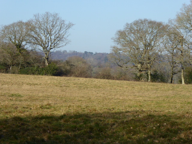
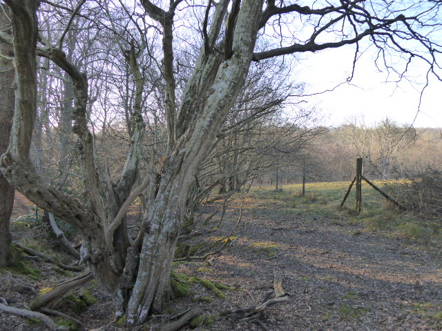
The wood is characterized by its diverse range of tree species, including oak, beech, and birch, creating a rich tapestry of colors throughout the year. The dense canopy provides ample shade and creates a cool atmosphere during the summer months. The forest floor is adorned with a carpet of wildflowers, adding to the enchanting beauty of the wood.

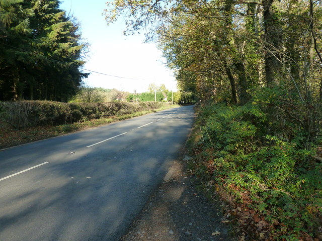
Trails wind through the wood, offering visitors the opportunity to explore its hidden corners and discover its many wonders. From babbling brooks to serene ponds, the wood boasts a variety of natural features that attract a wide range of wildlife. Birdsong echoes through the trees, and it is not uncommon to spot deer, foxes, and squirrels going about their daily routines.

Barrettspark Wood is also home to a diverse ecosystem of plants and fungi. Rare species of orchids grace the forest floor, while mushrooms and other fungi thrive in the damp conditions. This biodiversity makes the wood an important habitat for many species and contributes to its ecological significance.

Visitors to Barrettspark Wood can enjoy picnics, photography, or simply immerse themselves in the tranquility of nature. With its picturesque scenery and abundance of wildlife, this woodland truly offers a peaceful retreat away from the hustle and bustle of modern life.

If you have any feedback on the listing, please let us know in the comments section below.

Barrettspark Wood Images

Images are sourced within 2km of 50.956397/0.26265599 or Grid Reference TQ5919. Thanks to Geograph Open Source API. All images are credited.

The King's Church, Heathfield This building on Station Road was originally the "Recreation Hall" but is now used as an evangelical church.  Church website: <span class="nowrap"><a title="http://www.kcheathfield.org.uk/" rel="nofollow ugc noopener" href="http://www.kcheathfield.org.uk/">Link</a><img style="margin-left:2px;" alt="External link" title="External link - shift click to open in new window" src="https://s1.geograph.org.uk/img/external.png" width="10" height="10"/></span>
The King's Church, Heathfield
This building on Station Road was originally the "Recreation Hall" but is now used as an evangelical church. Church website: LinkExternal link
Date stone of the Recreation Hall The date stone (1909) of a public hall on Station Road, Heathfield that is now used as a church- see <a href="https://www.geograph.org.uk/photo/2382607">TQ5821 : The King's Church, Heathfield</a> for context.
Date stone of the Recreation Hall
The date stone (1909) of a public hall on Station Road, Heathfield that is now used as a church- see TQ5821 : The King's Church, Heathfield for context.
A267 near Heathfield The A267 road is a 21 mile long road from Tunbridge Wells <a href="https://www.geograph.org.uk/photo/6669020">TQ5838 : A26, A267 junction</a> to Horsebridge.
Website: <span class="nowrap"><a title="http://www.sabre-roads.org.uk/wiki/index.php?title=A267" rel="nofollow ugc noopener" href="http://www.sabre-roads.org.uk/wiki/index.php?title=A267">Link</a><img style="margin-left:2px;" alt="External link" title="External link - shift click to open in new window" src="https://s1.geograph.org.uk/img/external.png" width="10" height="10"/></span>
A267 near Heathfield
The A267 road is a 21 mile long road from Tunbridge Wells TQ5838 : A26, A267 junction to Horsebridge. Website: LinkExternal link
A267 north of Little London The A267 road is a 21 mile long road from Tunbridge Wells <a href="https://www.geograph.org.uk/photo/6669020">TQ5838 : A26, A267 junction</a> to Horsebridge.
Website: <span class="nowrap"><a title="http://www.sabre-roads.org.uk/wiki/index.php?title=A267" rel="nofollow ugc noopener" href="http://www.sabre-roads.org.uk/wiki/index.php?title=A267">Link</a><img style="margin-left:2px;" alt="External link" title="External link - shift click to open in new window" src="https://s1.geograph.org.uk/img/external.png" width="10" height="10"/></span>
A267 north of Little London
The A267 road is a 21 mile long road from Tunbridge Wells TQ5838 : A26, A267 junction to Horsebridge. Website: LinkExternal link
Pook Reed Lane off the A267 The A267 road is a 21 mile long road from Tunbridge Wells <a href="https://www.geograph.org.uk/photo/6669020">TQ5838 : A26, A267 junction</a> to Horsebridge.
Website: <span class="nowrap"><a title="http://www.sabre-roads.org.uk/wiki/index.php?title=A267" rel="nofollow ugc noopener" href="http://www.sabre-roads.org.uk/wiki/index.php?title=A267">Link</a><img style="margin-left:2px;" alt="External link" title="External link - shift click to open in new window" src="https://s1.geograph.org.uk/img/external.png" width="10" height="10"/></span>
Pook Reed Lane off the A267
The A267 road is a 21 mile long road from Tunbridge Wells TQ5838 : A26, A267 junction to Horsebridge. Website: LinkExternal link
Setyres garage, Heathfield
Station Road, Heathfield Taken from its junction with the High Street (A265) with the Union Church (for baptists and congregationalists) on the right hand side of the road.
Station Road, Heathfield
Taken from its junction with the High Street (A265) with the Union Church (for baptists and congregationalists) on the right hand side of the road.
High Street (A265), Heathfield The large building on the left is a co-operative society store. The cars are emerging from the slip road that leads to a free car park.
High Street (A265), Heathfield
The large building on the left is a co-operative society store. The cars are emerging from the slip road that leads to a free car park.
High Street (A265), Heathfield Looking southwest with the town's sign set in the pavement and visible behind the no entry road sign.
High Street (A265), Heathfield
Looking southwest with the town's sign set in the pavement and visible behind the no entry road sign.
All Saint's Church, Old Heathfield Grade II* listed.
The tower and south chapel are C13, but the rest is C14, much renewed in the C19.
Broached shingled spire.
All Saint's Church, Old Heathfield
Grade II* listed. The tower and south chapel are C13, but the rest is C14, much renewed in the C19. Broached shingled spire.
The Organ in All Saints, Old Heathfield Originally 1795 by Samuel Green. Rebuilt J W Walker in 1866. Single  manual with flat straight pedal board. 9 speaking stops.
The Organ in All Saints, Old Heathfield
Originally 1795 by Samuel Green. Rebuilt J W Walker in 1866. Single manual with flat straight pedal board. 9 speaking stops.
A267 north to Heathfield
Footpath to the Cross in Hand Stud On the A267.
Footpath to the Cross in Hand Stud
On the A267.
Pook Reed Lane off the A267 The lane leads into the centre of Heathfield.
Pook Reed Lane off the A267
The lane leads into the centre of Heathfield.
Cross in Hand Stud From the footpath to Slade Wood.
Cross in Hand Stud
From the footpath to Slade Wood.
Autumn colours on the edge of Slade Wood Possibly in the grounds of private house.
Autumn colours on the edge of Slade Wood
Possibly in the grounds of private house.
Footbridge over Waldron Gill
Waldron Gill Waldron Gill rises in Heathfield and is one of the main tributaries of the Cuckmere River.
Waldron Gill
Waldron Gill rises in Heathfield and is one of the main tributaries of the Cuckmere River.
Show me another place!

Barrettspark Wood is located at Grid Ref: TQ5919 (Lat: 50.956397, Lng: 0.26265599)

Administrative County: East Sussex

District: Wealden

Police Authority: Sussex

What 3 Words

///luckier.strutting.offerings. Near Heathfield, East Sussex

Related Wikis

Sapperton Meadows

Sapperton Meadows is a 14.7-hectare (36-acre) biological Site of Special Scientific Interest south of Heathfield in East Sussex.These poorly drained hay...

All Saints Church, Heathfield

All Saints Church is a Church of England parish church in Heathfield, East Sussex, England. It was constructed in the 14th century and is a Grade II* listed...

Heathfield Park SSSI

Heathfield Park SSSI is a 41-hectare (100-acre) biological Site of Special Scientific Interest east of Heathfield in East Sussex. It is part of Heathfield...

Maynard's Green

Maynard's Green is a village in the Wealden district of East Sussex. == External links == Maynards Green Community Primary School

Heathfield, East Sussex

Heathfield is a market town and former civil parish, now in the parish of Heathfield and Waldron, in the Wealden District of East Sussex, England. The...

Heathfield and Waldron

Heathfield and Waldron is a civil parish within the Wealden District of East Sussex, England. Heathfield is surrounded by the High Weald Area of Outstanding...

Heathfield Community College

Heathfield Community College is a secondary school near the market town of Heathfield, East Sussex, England. == School Enrollment == The college draws...

Heathfield railway station (East Sussex)

Heathfield railway station was on the Cuckoo Line between Horam and Mayfield, serving the market town of Heathfield. It was opened in 1880 by London, Brighton...

Nearby Amenities

Located within 500m of 50.956397,0.26265599
Barretts Park
Place: hamlet
Lat/Long: 50.9571731/0.2662468
Walnuts Farm
Addr City: Heathfield
Addr Hamlet: Barretts Park
Addr Postcode: TN21 8QS
Place: farm
Lat/Long: 50.9554869/0.2665794
Barretts Park Farm
Addr City: Heathfield
Addr Hamlet: Barretts Park
Addr Postcode: TN21 8QS
Place: farm
Lat/Long: 50.9565041/0.2644014
The data included in this document is from www.openstreetmap.org. The data is made available under ODbL.

Have you been to Barrettspark Wood?

Leave your review of Barrettspark Wood below (or comments, questions and feedback).