Midmore Wood

Wood, Forest in Sussex Wealden

England

Midmore Wood

The King's Church, Heathfield This building on Station Road was originally the "Recreation Hall" but is now used as an evangelical church.  Church website: <span class="nowrap"><a title="http://www.kcheathfield.org.uk/" rel="nofollow ugc noopener" href="http://www.kcheathfield.org.uk/">Link</a><img style="margin-left:2px;" alt="External link" title="External link - shift click to open in new window" src="https://s1.geograph.org.uk/img/external.png" width="10" height="10"/></span>
The King's Church, Heathfield Credit: Stephen Craven

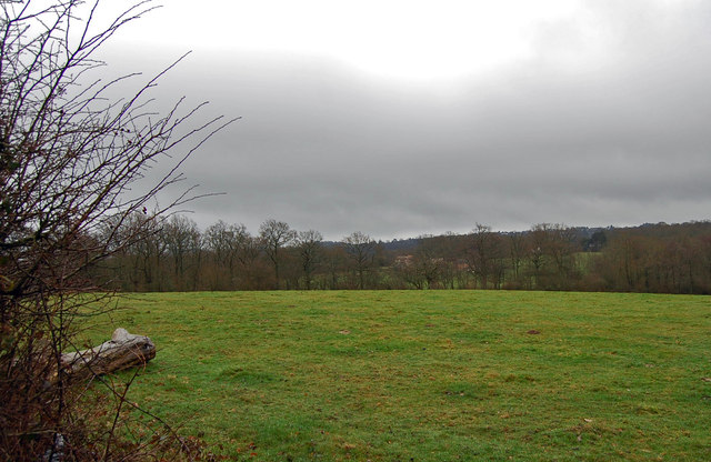
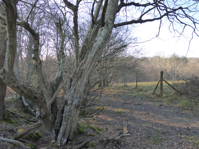
Midmore Wood is a picturesque woodland located in Sussex, England. Covering an area of approximately 100 acres, it is a prime example of a mature mixed woodland. The wood is predominantly composed of native tree species such as oak, beech, and birch, creating a diverse and rich habitat for a variety of wildlife.

The wood is characterized by its dense canopy, which filters sunlight and creates a cool and serene atmosphere. The forest floor is covered with a thick layer of leaf litter, providing a nutrient-rich environment for a plethora of plant species to thrive. Bluebells, wild garlic, and wood anemones carpet the woodland floor in the spring, creating a stunning display of color.

Midmore Wood is a haven for wildlife, with numerous bird species nesting amongst its trees. Visitors may spot great spotted woodpeckers, tawny owls, and various songbirds darting among the branches. The wood is also home to a diverse range of mammals, including foxes, badgers, and deer, which can occasionally be glimpsed by lucky visitors.

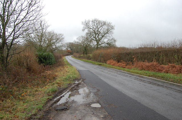
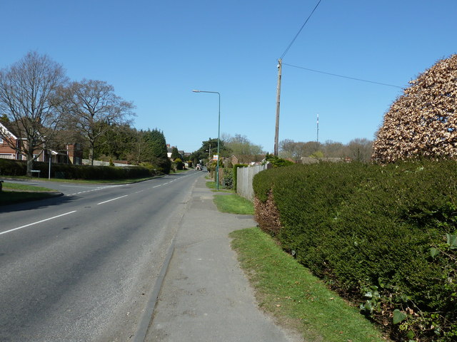
Nature enthusiasts and walkers frequent Midmore Wood, as it offers a variety of well-maintained walking trails that wind through the trees. The wood is a peaceful and tranquil setting, providing an ideal escape from the hustle and bustle of modern life.

Managed by a local conservation organization, Midmore Wood is carefully maintained to preserve its natural beauty and ecological importance. It serves as a valuable educational resource, with guided tours and events organized to raise awareness about the importance of woodland conservation.

If you have any feedback on the listing, please let us know in the comments section below.

Midmore Wood Images

Images are sourced within 2km of 50.976822/0.2612555 or Grid Reference TQ5822. Thanks to Geograph Open Source API. All images are credited.

The King's Church, Heathfield This building on Station Road was originally the "Recreation Hall" but is now used as an evangelical church.  Church website: <span class="nowrap"><a title="http://www.kcheathfield.org.uk/" rel="nofollow ugc noopener" href="http://www.kcheathfield.org.uk/">Link</a><img style="margin-left:2px;" alt="External link" title="External link - shift click to open in new window" src="https://s1.geograph.org.uk/img/external.png" width="10" height="10"/></span>
The King's Church, Heathfield
This building on Station Road was originally the "Recreation Hall" but is now used as an evangelical church. Church website: LinkExternal link
Date stone of the Recreation Hall The date stone (1909) of a public hall on Station Road, Heathfield that is now used as a church- see <a href="https://www.geograph.org.uk/photo/2382607">TQ5821 : The King's Church, Heathfield</a> for context.
Date stone of the Recreation Hall
The date stone (1909) of a public hall on Station Road, Heathfield that is now used as a church- see TQ5821 : The King's Church, Heathfield for context.
A267 on the edge of Heathfield The A267 road is a 21 mile long road from Tunbridge Wells <a href="https://www.geograph.org.uk/photo/6669020">TQ5838 : A26, A267 junction</a> to Horsebridge.
Website: <span class="nowrap"><a title="http://www.sabre-roads.org.uk/wiki/index.php?title=A267" rel="nofollow ugc noopener" href="http://www.sabre-roads.org.uk/wiki/index.php?title=A267">Link</a><img style="margin-left:2px;" alt="External link" title="External link - shift click to open in new window" src="https://s1.geograph.org.uk/img/external.png" width="10" height="10"/></span>
A267 on the edge of Heathfield
The A267 road is a 21 mile long road from Tunbridge Wells TQ5838 : A26, A267 junction to Horsebridge. Website: LinkExternal link
Setyres garage, Heathfield
Station Road, Heathfield Taken from its junction with the High Street (A265) with the Union Church (for baptists and congregationalists) on the right hand side of the road.
Station Road, Heathfield
Taken from its junction with the High Street (A265) with the Union Church (for baptists and congregationalists) on the right hand side of the road.
High Street (A265), Heathfield The large building on the left is a co-operative society store. The cars are emerging from the slip road that leads to a free car park.
High Street (A265), Heathfield
The large building on the left is a co-operative society store. The cars are emerging from the slip road that leads to a free car park.
High Street (A265), Heathfield Looking southwest with the town's sign set in the pavement and visible behind the no entry road sign.
High Street (A265), Heathfield
Looking southwest with the town's sign set in the pavement and visible behind the no entry road sign.
Pine Garage, Heathfield
Sodden field off Newick Lane
Great furnace wood and fields
Newick Lane, near Pheasantry Farm
Traffic jam on A265 east of Heathfield
A265 at Heathfield
A265 at Heathfield
Pages close, Heathfield
Junction of Pages Hill with the A265
Road Junction, B2096, towards Heathfield
A265 out of Heathfield towards Cross in Hand
A267 junction with the A265 The A267 travels south to meet the A22 at Horsebridge near Hailsham.
A267 junction with the A265
The A267 travels south to meet the A22 at Horsebridge near Hailsham.
Show me another place!

Midmore Wood is located at Grid Ref: TQ5822 (Lat: 50.976822, Lng: 0.2612555)

Administrative County: East Sussex

District: Wealden

Police Authority: Sussex

What 3 Words

///producers.copes.loans. Near Heathfield, East Sussex

Related Wikis

Heathfield, East Sussex

Heathfield is a market town and former civil parish, now in the parish of Heathfield and Waldron, in the Wealden District of East Sussex, England. The...

Heathfield and Waldron

Heathfield and Waldron is a civil parish within the Wealden District of East Sussex, England. Heathfield is surrounded by the High Weald Area of Outstanding...

Heathfield railway station (East Sussex)

Heathfield railway station was on the Cuckoo Line between Horam and Mayfield, serving the market town of Heathfield. It was opened in 1880 by London, Brighton...

Heathfield Park SSSI

Heathfield Park SSSI is a 41-hectare (100-acre) biological Site of Special Scientific Interest east of Heathfield in East Sussex. It is part of Heathfield...

Heathfield Community College

Heathfield Community College is a secondary school near the market town of Heathfield, East Sussex, England. == School Enrollment == The college draws...

Ebenezer Chapel, Heathfield

Ebenezer Chapel is a Strict Baptist place of worship in the hamlet of Broad Oak, part of the parish of Heathfield in the English county of East Sussex...

All Saints Church, Heathfield

All Saints Church is a Church of England parish church in Heathfield, East Sussex, England. It was constructed in the 14th century and is a Grade II* listed...

Heathfield transmitting station

The Heathfield transmitting station is a facility for FM and television transmission at Heathfield, East Sussex, UK (grid reference TQ566220). Opened in...

Related Videos

Secret Stones: The Hunt Is On...

The Urban Jump secret stone hunt is back on....! 🕵️‍♀️ You guys went crazy for last year's secret stone treasure hunt so we're ...

Heathfield Le Marché (Anglo/French Market) Entertainment 2023, August Bank Hol. Monday (28/08/'23).

Heathfield Le Marché (Anglo/French Market) Entertainment 2023, August Bank Holiday Monday (28/08/2023). An event by the ...

Butterfly Heaven

Was walking along a bridge down the woods and was surprised by the amount of butterflies there were. If you listen carefully you ...

Nearby Amenities

Located within 500m of 50.976822,0.2612555
Turning Circle
Lat/Long: 50.9742025/0.2591847
Post Box
Operator: Royal Mail
Operator Wikidata: Q638098
Post Box Type: wall
Ref: TN21 60D
Royal Cypher: GR
Royal Cypher Wikidata: Q33102273
Lat/Long: 50.97347/0.2607317
Crossing
Crossing: traffic_signals
Crossing Island: no
Kerb: lowered
Tactile Paving: yes
Lat/Long: 50.973163/0.258433
Public Footpath
Information: guidepost
Tourism: information
Lat/Long: 50.9730221/0.2576537
Addr Housename: Firlands
Addr Street: Mutton Hall Hill
Building: house
Lat/Long: 50.9734862/0.2605772
Generator Method: photovoltaic
Generator Output Electricity: yes
Generator Solar Modules: 8
Generator Source: solar
Generator Type: solar_photovoltaic_panel
Location: roof
Power: generator
Lat/Long: 50.9742697/0.2590102
Generator Method: photovoltaic
Generator Orientation: 170
Generator Output Electricity: yes
Generator Solar Modules: 8
Generator Source: solar
Generator Type: solar_photovoltaic_panel
Location: roof
Power: generator
Lat/Long: 50.9736169/0.2590263
Generator Method: photovoltaic
Generator Orientation: 170
Generator Output Electricity: yes
Generator Solar Modules: 8
Generator Source: solar
Generator Type: solar_photovoltaic_panel
Location: roof
Power: generator
Lat/Long: 50.973627/0.2587862
Traffic Signals
Traffic Signals: signal
Traffic Signals Direction: forward
Lat/Long: 50.9733798/0.2606759
Traffic Signals
Traffic Signals: signal
Traffic Signals Direction: forward
Lat/Long: 50.973459/0.2609258
Traffic Signals
Traffic Signals: signal
Traffic Signals Direction: backward
Lat/Long: 50.9734025/0.2612255
Traffic Signals
Traffic Signals: signal
Traffic Signals Direction: backward
Lat/Long: 50.9732536/0.2609674
Traffic Signals
Traffic Signals: pedestrian_crossing
Traffic Signals Direction: forward
Lat/Long: 50.9731528/0.258362
Traffic Signals
Traffic Signals: pedestrian_crossing
Traffic Signals Direction: backward
Lat/Long: 50.9731715/0.258492
Crossing
Lat/Long: 50.9733215/0.2609599
Give Way
Direction: forward
Lat/Long: 50.9736601/0.2657289
The data included in this document is from www.openstreetmap.org. The data is made available under ODbL.

Have you been to Midmore Wood?

Leave your review of Midmore Wood below (or comments, questions and feedback).