Broadhoath Wood

Wood, Forest in Kent Sevenoaks

England

Broadhoath Wood

Oast House at Hall Place, Seal An internal kiln oast house to North and twin square kiln oast house to South.
Oast House at Hall Place, Seal Credit: Oast House Archive

Broadhoath Wood is a picturesque woodland located in the county of Kent, in southeastern England. Covering an area of approximately 50 acres, it is a popular destination for nature lovers and outdoor enthusiasts alike. The woodland is situated near the village of Broadhoath, nestled between the towns of Maidstone and Ashford.

The wood is predominantly composed of native broadleaf trees, such as oak, ash, and beech, which create a dense canopy overhead, allowing only dappled sunlight to filter through to the forest floor. This creates a tranquil and enchanting atmosphere for visitors to explore. The woodland is also home to a diverse range of wildlife, including birds, deer, and various species of small mammals.

There are several well-maintained trails and footpaths winding through the wood, making it an ideal place for walking, jogging, or simply enjoying a peaceful stroll. These paths offer visitors the opportunity to fully immerse themselves in the natural beauty of the surroundings. Along the way, one may encounter patches of wildflowers, small streams, and occasional clearings that provide scenic viewpoints.

Broadhoath Wood is open to the public throughout the year, with no admission fee. The wood is managed by a local conservation organization, which ensures the maintenance and preservation of the natural habitat. Visitors are encouraged to respect the woodland, follow designated trails, and take their litter home with them.

Overall, Broadhoath Wood is a hidden gem in the heart of Kent, offering a peaceful retreat from the hustle and bustle of everyday life. With its stunning woodland scenery and abundant wildlife, it is a must-visit destination for nature enthusiasts and those seeking a serene outdoor experience.

If you have any feedback on the listing, please let us know in the comments section below.

Broadhoath Wood Images

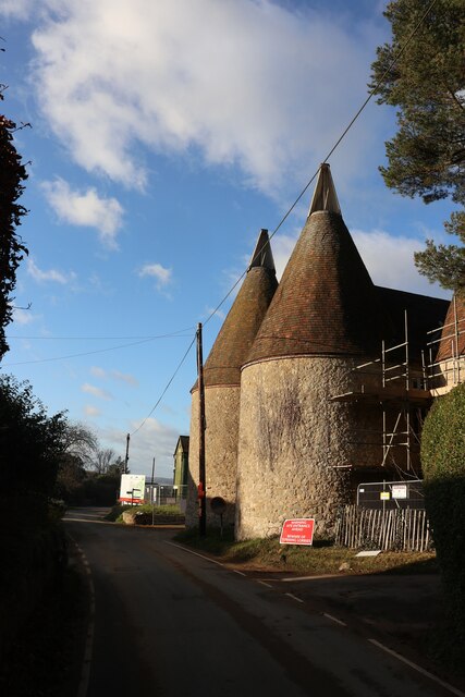
Images are sourced within 2km of 51.261763/0.24921164 or Grid Reference TQ5753. Thanks to Geograph Open Source API. All images are credited.

Oast House at Hall Place, Seal An internal kiln oast house to North and twin square kiln oast house to South.
Oast House at Hall Place, Seal
An internal kiln oast house to North and twin square kiln oast house to South.
Oast House, Stone Street Farm, Stone Street Single round kiln oast house.
Oast House, Stone Street Farm, Stone Street
Single round kiln oast house.
Oast House at Foxbury Farm, Stone Street During conversion to housing.
Oast House at Foxbury Farm, Stone Street
During conversion to housing.
Oast House at Foxbury Farm, Stone Street During conversion to housing.
Oast House at Foxbury Farm, Stone Street
During conversion to housing.
Oast House at Foxbury Farm, Stone Street During conversion to housing.
Oast House at Foxbury Farm, Stone Street
During conversion to housing.
Cowl at Foxbury Farm Oast Six round kiln oast house. Only the three kilns nearest the road retain their roofs and cowls.

Grade II listed.
Cowl at Foxbury Farm Oast
Six round kiln oast house. Only the three kilns nearest the road retain their roofs and cowls. Grade II listed.
Oast House at Foxbury Farm, Stone Street During conversion to housing.
Oast House at Foxbury Farm, Stone Street
During conversion to housing.
Telephone Box The iconic red telephone kiosk was the result of a competition in 1924 to design a telephone box suitable for London Metropolitan Boroughs. A design by Giles Gilbert Scott, a British Architect, was chosen. The box, to be known as the K2 was deployed in London in 1926. The post office suggested it be painted red.

The K6 was introduced in 1935, designed to commemorate the silver jubilee of King George V. It was a smaller version of the K2, and went on to be installed prolifically around the country. It is the most recognised and iconic telephone box, that many people around  the world are familiar with. The first K6 is still to be found outside the Royal Academy of Art in London.

Other versions of the red telephone box were designed and implemented but none were ever to survive the popularity of the K6.

Over 240,000 red telephone boxes were built between the 1920s and 1980s.
BT had replaced many red telephone boxes during the 1980s and 90s with the aluminium KX100, leading to English Heritage to designate over 2000 as listed structures. Only 9400 K6's remain. 

BT offered councils to 'adopt-a-kiosk' for £1 to keep local K6's in place. Many have found alternate uses as mini libraries/book exchanges & art galleries, and even for storage of heart defibrillators.
Telephone Box
The iconic red telephone kiosk was the result of a competition in 1924 to design a telephone box suitable for London Metropolitan Boroughs. A design by Giles Gilbert Scott, a British Architect, was chosen. The box, to be known as the K2 was deployed in London in 1926. The post office suggested it be painted red. The K6 was introduced in 1935, designed to commemorate the silver jubilee of King George V. It was a smaller version of the K2, and went on to be installed prolifically around the country. It is the most recognised and iconic telephone box, that many people around the world are familiar with. The first K6 is still to be found outside the Royal Academy of Art in London. Other versions of the red telephone box were designed and implemented but none were ever to survive the popularity of the K6. Over 240,000 red telephone boxes were built between the 1920s and 1980s. BT had replaced many red telephone boxes during the 1980s and 90s with the aluminium KX100, leading to English Heritage to designate over 2000 as listed structures. Only 9400 K6's remain. BT offered councils to 'adopt-a-kiosk' for £1 to keep local K6's in place. Many have found alternate uses as mini libraries/book exchanges & art galleries, and even for storage of heart defibrillators.
Give way to cats This is on Mote Road near Ightham Mote.
Give way to cats
This is on Mote Road near Ightham Mote.
Bridleway to Ightham Mote The bridleway passes along the southern side of Ightham Mote a little way ahead. The Greensand Ridge is on the skyline to the left.
Bridleway to Ightham Mote
The bridleway passes along the southern side of Ightham Mote a little way ahead. The Greensand Ridge is on the skyline to the left.
Bluebells along a country lane This is along a quiet country lane to the south of Bitchet Green. Burnt Wood can be seen beyond the field.
Bluebells along a country lane
This is along a quiet country lane to the south of Bitchet Green. Burnt Wood can be seen beyond the field.
Seat at Bitchet Green This arch leads through to a single seat. It is rather a  nice touch. The seat can be seen at <a title="https://www.geograph.org.uk/photo/7151894" href="https://www.geograph.org.uk/photo/7151894">Link</a>
Seat at Bitchet Green
This arch leads through to a single seat. It is rather a nice touch. The seat can be seen at Link
A lone seat at Bitchet Green This is the seat seen through the arch at <a title="https://www.geograph.org.uk/photo/7151891" href="https://www.geograph.org.uk/photo/7151891">Link</a>
A lone seat at Bitchet Green
This is the seat seen through the arch at Link
Notice at Bitchet Green I am not sure what would be the order of priority here!
Notice at Bitchet Green
I am not sure what would be the order of priority here!
Calvary at Bitchet Green This photograph was taken on Good Friday. The basket contained booklets about Easter.
Calvary at Bitchet Green
This photograph was taken on Good Friday. The basket contained booklets about Easter.
Footpath at Lower Bitchet Diantshatch Wood is at the bottom of the hill.
Footpath at Lower Bitchet
Diantshatch Wood is at the bottom of the hill.
Wilmot Cottage Wilmot Cottage. See 1980s image <a title="https://www.geograph.org.uk/photo/194176" href="https://www.geograph.org.uk/photo/194176">Link</a> when it was shown derelict; currently offered for sale, 98 year lease, for £1.25M. It is well off the beaten track.
Wilmot Cottage
Wilmot Cottage. See 1980s image Link when it was shown derelict; currently offered for sale, 98 year lease, for £1.25M. It is well off the beaten track.
Show me another place!

Broadhoath Wood is located at Grid Ref: TQ5753 (Lat: 51.261763, Lng: 0.24921164)

Administrative County: Kent

District: Sevenoaks

Police Authority: Kent

What 3 Words

///pots.monkey.record. Near Sevenoaks, Kent

Related Wikis

One Tree Hill and Bitchet Common

One Tree Hill and Bitchet Common is a 79.2-hectare (196-acre) biological Site of Special Scientific Interest east of Sevenoaks in Kent. It is in Kent Downs...
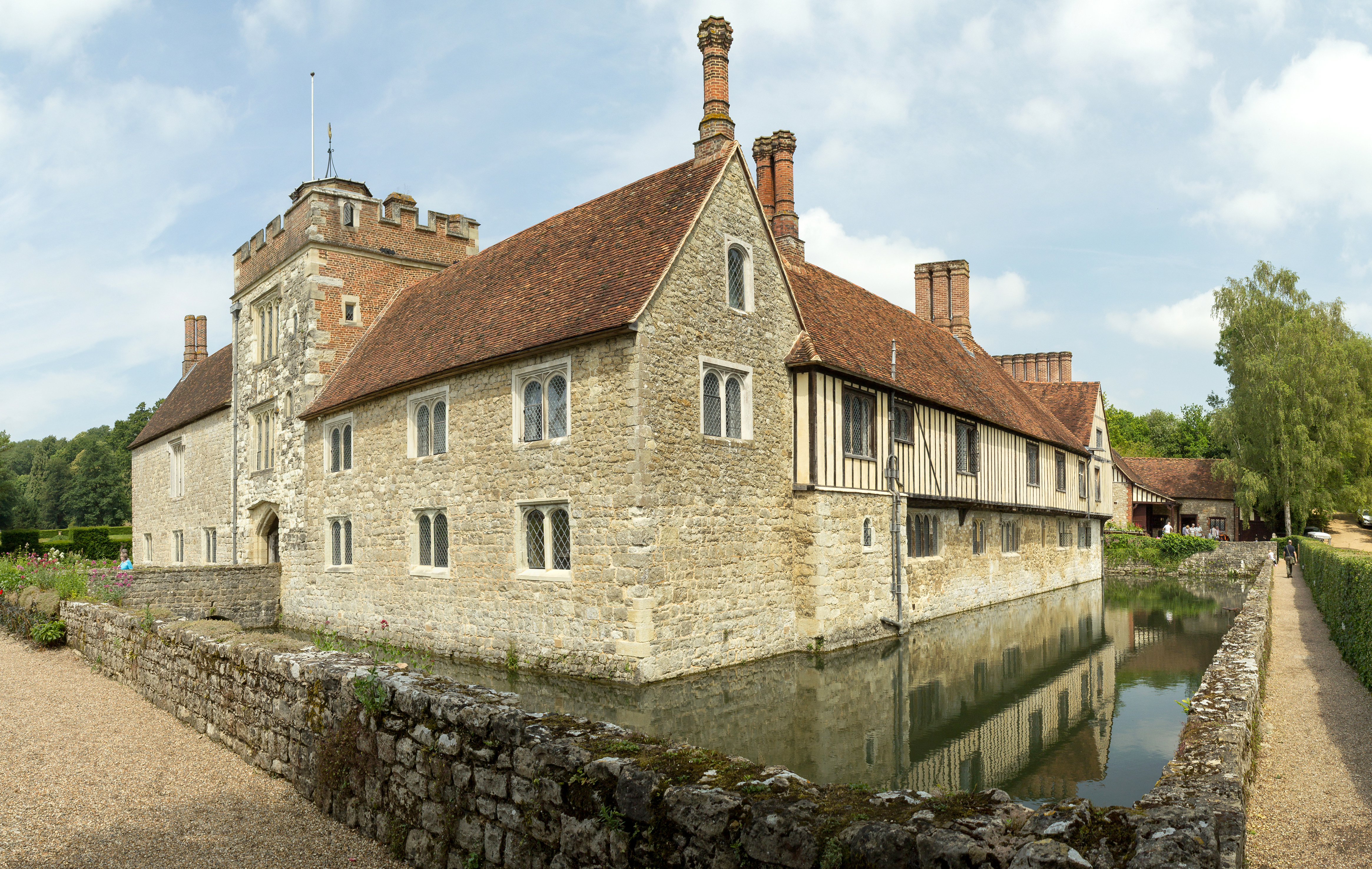
Ightham Mote

Ightham Mote (), at Ightham, is a medieval moated manor house in Kent, England. The architectural writer John Newman describes it as "the most complete...

Sevenoaks Preparatory School

Sevenoaks Prep School is a co-educational, day preparatory school for 385 pupils aged 2–13 in Sevenoaks in south-east England. The school is situated on...

Ivy Hatch Nature Reserve

Ivy Hatch Nature Reserve in Ivy Hatch, north of Tonbridge in Kent, is a 0.5-hectare (1.2-acre) reserve managed by the Kent Wildlife Trust. Several streams...

Nearby Amenities

Located within 500m of 51.261763,0.24921164
Bus Stop
The Coppice
Flag: no
Naptan AtcoCode: 2400A070440A
Naptan Bearing: SW
Naptan BusStopType: CUS
Naptan CommonName: The Coppice
Naptan Indicator: opp
Naptan Landmark: The Coppice
Naptan NaptanCode: kntgdgwd
Naptan Street: Bitchet Lane
Naptan Verified: no
Public Transport: platform
Ref: kntgdgwd
Source: naptan_import
Source Date: 2011-01-12T15:27:00
Lat/Long: 51.2651161/0.2470101
Bitchet Green
Place: hamlet
Source: OS_OpenData_StreetView
Lat/Long: 51.2647106/0.2466241
Bench
Lat/Long: 51.2574777/0.2489211
Bus Stop
The Coppice
Flag: no
Naptan AtcoCode: 2400103627
Naptan Bearing: NE
Naptan BusStopType: CUS
Naptan CommonName: The Coppice
Naptan Indicator: adj
Naptan Landmark: The Coppice
Naptan NaptanCode: kntjmdat
Naptan Street: Bitchet Lane
Naptan Verified: no
Public Transport: platform
Ref: kntjmdat
Source: NAPTAN
Source Date: 2011-01-12T15:36:00
Lat/Long: 51.2653388/0.2471213
Grit Bin
Operator: Kent Highways
Lat/Long: 51.2631368/0.2441909
Fire Hydrant
Emergency: fire_hydrant
Lat/Long: 51.2651335/0.2468013
Post Box
Collection Times: Mo-Fr 09:00; Sa 07:00; Su off
Colour: red
Ref: TN15 104
Royal Cypher: EIIR
Royal Cypher Wikidata: Q33102113
Lat/Long: 51.2651428/0.2467859
The data included in this document is from www.openstreetmap.org. The data is made available under ODbL.

Have you been to Broadhoath Wood?

Leave your review of Broadhoath Wood below (or comments, questions and feedback).