Ruffet's Wood
Wood, Forest in Sussex Wealden
England
Ruffet's Wood

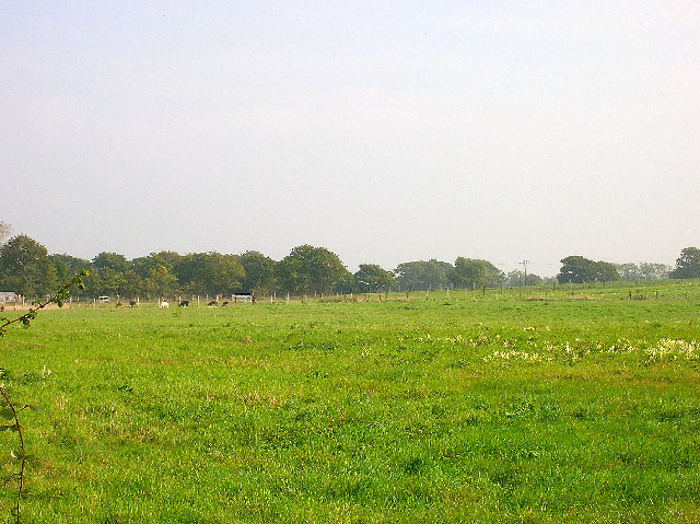
Ruffet's Wood is a picturesque forest located in Sussex, England. Covering an area of approximately 100 acres, this woodland is known for its natural charm and diverse wildlife. The wood is named after the Ruffet family, who were the original owners of the land.
The woodland is primarily made up of deciduous trees, including oak, beech, and birch, which provide a stunning display of colors during the autumn months. The leafy canopy creates a tranquil and serene atmosphere, making it a popular destination for nature lovers and photographers.
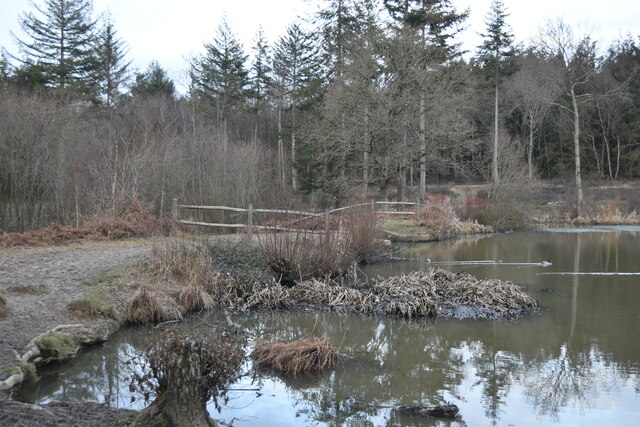
Ruffet's Wood is home to numerous species of wildlife, including deer, foxes, badgers, and a wide variety of bird species. The forest provides a natural habitat for these animals, making it an important conservation area in the region.
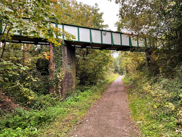
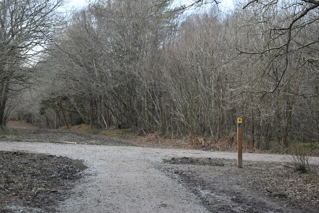
There are several walking trails that wind through the wood, allowing visitors to explore its beauty at their own pace. These paths are well-maintained and offer stunning views of the surrounding countryside. The forest also features a small stream that meanders through its heart, adding to its natural charm.
Throughout the year, Ruffet's Wood hosts various events and activities for visitors of all ages. These include guided nature walks, educational programs, and seasonal celebrations.
Overall, Ruffet's Wood is a captivating woodland that offers a peaceful escape from the hustle and bustle of everyday life. With its stunning scenery, diverse wildlife, and numerous recreational opportunities, it is a must-visit destination for anyone seeking a connection with nature in Sussex.
If you have any feedback on the listing, please let us know in the comments section below.
Ruffet's Wood Images
Images are sourced within 2km of 50.859071/0.22969155 or Grid Reference TQ5708. Thanks to Geograph Open Source API. All images are credited.


![Michelham Priory [1] At the centre of the northwest quarter is this Gateway or Barbican Tower. Built in the 15th century. This square building constructed of ashlar has a wide carriage archway on the ground floor. There are two floors above with a castellated parapet around a hipped tiled roof. On the outer side of the tower is a 16th century stone Bridge spanning the moat with one round-headed arch. Listed, grade I, with details at: <span class="nowrap"><a title="https://historicengland.org.uk/listing/the-list/list-entry/1191633" rel="nofollow ugc noopener" href="https://historicengland.org.uk/listing/the-list/list-entry/1191633">Link</a><img style="margin-left:2px;" alt="External link" title="External link - shift click to open in new window" src="https://s1.geograph.org.uk/img/external.png" width="10" height="10"/></span>
Michelham Priory is near the village of Upper Dicker in East Sussex, about 1¾ miles west of Hailsham. Founded as an Augustinian priory in 1229 and suppressed in 1537 it passed through the hands of various private owners until 1959 when it was given in trust to the Sussex Archaeological Society. There is a house and a great barn and various other buildings. The house is 13th century, with an additional 16th century wing. The barn is late 16th or early 17th century. The whole is surrounded by a moat, enclosing an area of almost 8 acres. Five of the buildings are listed and the whole site is a Scheduled Ancient Monument with details at: <span class="nowrap"><a title="https://historicengland.org.uk/listing/the-list/list-entry/1017721" rel="nofollow ugc noopener" href="https://historicengland.org.uk/listing/the-list/list-entry/1017721">Link</a><img style="margin-left:2px;" alt="External link" title="External link - shift click to open in new window" src="https://s1.geograph.org.uk/img/external.png" width="10" height="10"/></span>](https://s0.geograph.org.uk/geophotos/07/23/37/7233736_393042ff.jpg)
![Michelham Priory [2] The moat, looking southwest, seen from the bridge.
Michelham Priory is near the village of Upper Dicker in East Sussex, about 1¾ miles west of Hailsham. Founded as an Augustinian priory in 1229 and suppressed in 1537 it passed through the hands of various private owners until 1959 when it was given in trust to the Sussex Archaeological Society. There is a house and a great barn and various other buildings. The house is 13th century, with an additional 16th century wing. The barn is late 16th or early 17th century. The whole is surrounded by a moat, enclosing an area of almost 8 acres. Five of the buildings are listed and the whole site is a Scheduled Ancient Monument with details at: <span class="nowrap"><a title="https://historicengland.org.uk/listing/the-list/list-entry/1017721" rel="nofollow ugc noopener" href="https://historicengland.org.uk/listing/the-list/list-entry/1017721">Link</a><img style="margin-left:2px;" alt="External link" title="External link - shift click to open in new window" src="https://s1.geograph.org.uk/img/external.png" width="10" height="10"/></span>](https://s2.geograph.org.uk/geophotos/07/23/37/7233738_7f7298ab.jpg)
![Michelham Priory [3] The moat, looking northeast, seen from the bridge.
Michelham Priory is near the village of Upper Dicker in East Sussex, about 1¾ miles west of Hailsham. Founded as an Augustinian priory in 1229 and suppressed in 1537 it passed through the hands of various private owners until 1959 when it was given in trust to the Sussex Archaeological Society. There is a house and a great barn and various other buildings. The house is 13th century, with an additional 16th century wing. The barn is late 16th or early 17th century. The whole is surrounded by a moat, enclosing an area of almost 8 acres. Five of the buildings are listed and the whole site is a Scheduled Ancient Monument with details at: <span class="nowrap"><a title="https://historicengland.org.uk/listing/the-list/list-entry/1017721" rel="nofollow ugc noopener" href="https://historicengland.org.uk/listing/the-list/list-entry/1017721">Link</a><img style="margin-left:2px;" alt="External link" title="External link - shift click to open in new window" src="https://s1.geograph.org.uk/img/external.png" width="10" height="10"/></span>](https://s3.geograph.org.uk/geophotos/07/23/37/7233739_dad4c2fe.jpg)
![Michelham Priory [4] Now a gift shop, this was originally stables and a dovecote. A small square building, probably built in the 18th century using medieval stone. Constructed of rubble stone with an ashlar front under a hipped tile roof. Listed, grade II, with details at: <span class="nowrap"><a title="https://historicengland.org.uk/listing/the-list/list-entry/1043322" rel="nofollow ugc noopener" href="https://historicengland.org.uk/listing/the-list/list-entry/1043322">Link</a><img style="margin-left:2px;" alt="External link" title="External link - shift click to open in new window" src="https://s1.geograph.org.uk/img/external.png" width="10" height="10"/></span>
Michelham Priory is near the village of Upper Dicker in East Sussex, about 1¾ miles west of Hailsham. Founded as an Augustinian priory in 1229 and suppressed in 1537 it passed through the hands of various private owners until 1959 when it was given in trust to the Sussex Archaeological Society. There is a house and a great barn and various other buildings. The house is 13th century, with an additional 16th century wing. The barn is late 16th or early 17th century. The whole is surrounded by a moat, enclosing an area of almost 8 acres. Five of the buildings are listed and the whole site is a Scheduled Ancient Monument with details at: <span class="nowrap"><a title="https://historicengland.org.uk/listing/the-list/list-entry/1017721" rel="nofollow ugc noopener" href="https://historicengland.org.uk/listing/the-list/list-entry/1017721">Link</a><img style="margin-left:2px;" alt="External link" title="External link - shift click to open in new window" src="https://s1.geograph.org.uk/img/external.png" width="10" height="10"/></span>](https://s0.geograph.org.uk/geophotos/07/23/37/7233740_54c69142.jpg)
Ruffet's Wood is located at Grid Ref: TQ5708 (Lat: 50.859071, Lng: 0.22969155)
Administrative County: East Sussex
District: Wealden
Police Authority: Sussex
What 3 Words
///biked.steeped.unspoiled. Near Hailsham, East Sussex
Nearby Locations
Related Wikis

Arlington Stadium, Hailsham
Arlington Stadium is a sports stadium on Arlington Road West, Hailsham, East Sussex. The stadium is mainly used for Stock car racing and was formerly used...
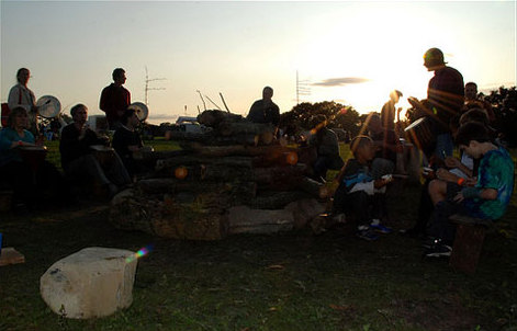
Out of the Ordinary Festival
The Out of the Ordinary Festival was an annual family- and eco-friendly music festival near Hailsham in the Sussex countryside. From 2007 to 2013 it celebrated...
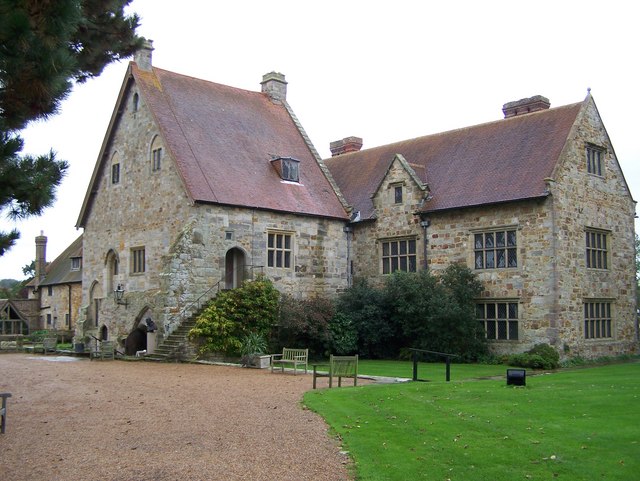
Michelham Priory
Michelham Priory is the site of a former Augustinian Priory in Upper Dicker, East Sussex, England, United Kingdom. The surviving buildings are owned and...

Hailsham Town F.C.
Hailsham Town Football Club is a football club based in Hailsham, East Sussex, England. They are currently members of the Southern Combination Division...

St Wilfrid's Church, Hailsham
St Wilfrid's Church is a Roman Catholic church serving the town of Hailsham in the Wealden district of East Sussex, England. The present building was...

Hailsham railway station
Hailsham Railway Station was on the Cuckoo Line between Polegate and Hellingly serving the town of Hailsham. Originally built in 1849 by the London, Brighton...
Hailsham Community College
Hailsham Community College is a coeducational all-through school and sixth form with academy status, located in Hailsham, East Sussex, England. There...

Hailsham
Hailsham is a town, a civil parish and the administrative centre of the Wealden district of East Sussex, England. It is mentioned in the Domesday Book...
Nearby Amenities
Located within 500m of 50.859071,0.22969155Have you been to Ruffet's Wood?
Leave your review of Ruffet's Wood below (or comments, questions and feedback).