Gutter Bridge Plantation

Wood, Forest in Cambridgeshire East Cambridgeshire

England

Gutter Bridge Plantation

Swaffham Bulbeck Lode, from Cow Bridge Although the map marks a lock at the entrance to the lode from the River Cam, it can be seen at <a href="https://www.geograph.org.uk/photo/5064694">TL5267 : Swaffham Lock</a> that the channel is now used only for drainage, not navigation, explaining the state of the channel at this end.
On the right, Cowbridge Farm.
Swaffham Bulbeck Lode, from Cow Bridge Credit: Christopher Hilton

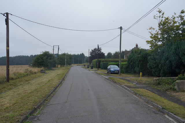
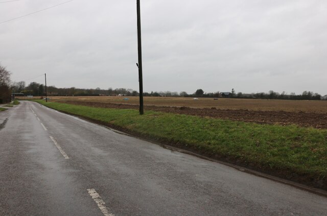
Gutter Bridge Plantation is a picturesque woodland located in Cambridgeshire, England. Covering an area of approximately 200 acres, this enchanting forest is widely recognized for its natural beauty and diverse range of flora and fauna.

The plantation is situated near the village of Gutter Bridge, which is known for its tranquility and rural charm. The woodland is easily accessible and attracts visitors from both local and distant areas who seek solace in nature's embrace.

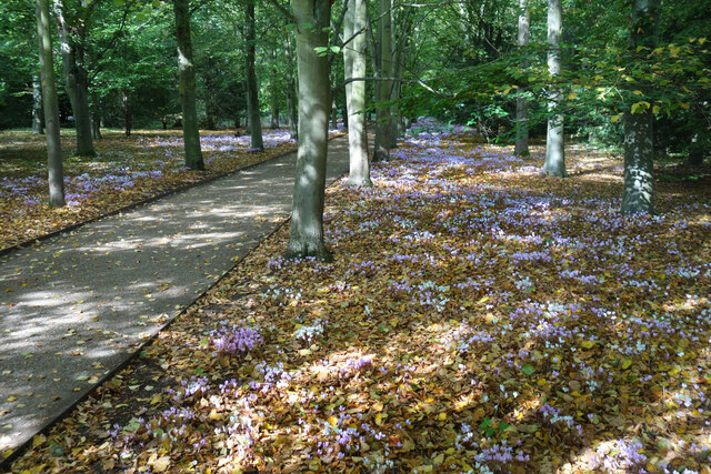
The forest boasts a variety of tree species, including oak, beech, and birch, which create a dense canopy overhead, allowing only dappled sunlight to filter through. This creates a unique ambiance, with patches of light illuminating the forest floor. The extensive network of footpaths and trails winding through the woodland provides opportunities for hiking, walking, and birdwatching.

Wildlife thrives in the plantation, with a notable presence of indigenous species such as deer, foxes, and badgers. Bird enthusiasts will not be disappointed, as Gutter Bridge Plantation is home to numerous avian species, including woodpeckers, owls, and various songbirds. The plantation is also known for its vibrant wildflower meadows, which burst into color during spring and summer months.

Gutter Bridge Plantation is managed by the local forestry commission, ensuring the conservation and preservation of this natural treasure. Whether visitors seek solitude, exercise, or an opportunity to reconnect with nature, Gutter Bridge Plantation offers a peaceful and rejuvenating experience for all who venture into its leafy embrace.

If you have any feedback on the listing, please let us know in the comments section below.

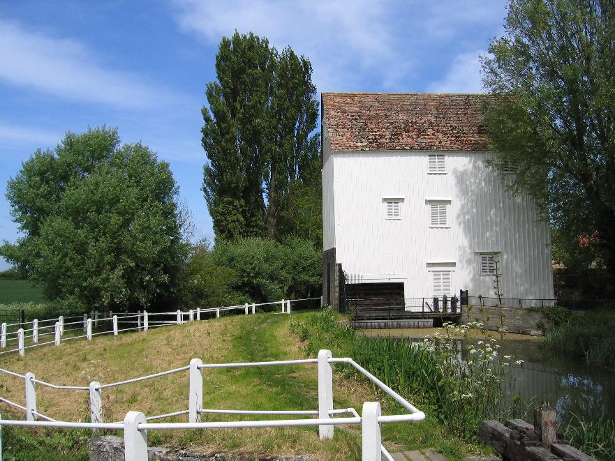
Gutter Bridge Plantation Images

Images are sourced within 2km of 52.241264/0.27127481 or Grid Reference TL5562. Thanks to Geograph Open Source API. All images are credited.

Swaffham Bulbeck Lode, from Cow Bridge Although the map marks a lock at the entrance to the lode from the River Cam, it can be seen at <a href="https://www.geograph.org.uk/photo/5064694">TL5267 : Swaffham Lock</a> that the channel is now used only for drainage, not navigation, explaining the state of the channel at this end.
On the right, Cowbridge Farm.
Swaffham Bulbeck Lode, from Cow Bridge
Although the map marks a lock at the entrance to the lode from the River Cam, it can be seen at TL5267 : Swaffham Lock that the channel is now used only for drainage, not navigation, explaining the state of the channel at this end. On the right, Cowbridge Farm.
Swaffham Bulbeck Lode, at Cow Bridge The initials NRDC on the pillow mean "Newmarket Rural District Council", the relevant local authority at the time that the current bridge was put in place; a date on the other pillar indicates this to have been in 1927.
Swaffham Bulbeck Lode, at Cow Bridge
The initials NRDC on the pillow mean "Newmarket Rural District Council", the relevant local authority at the time that the current bridge was put in place; a date on the other pillar indicates this to have been in 1927.
Church Walk, Lode
Church Walk, Lode
Recreation ground, Lode
Lode Road This is the edge of the village of Lode.
Lode Road
This is the edge of the village of Lode.
Lode Post office The village of Lode is on a dead end road and so is a fairly quiet place.
Lode Post office
The village of Lode is on a dead end road and so is a fairly quiet place.
Longmeadow houses There are just a few houses here in what I presume to be Longmeadow. The road ahead has private notices so my journey ended.
Longmeadow houses
There are just a few houses here in what I presume to be Longmeadow. The road ahead has private notices so my journey ended.
Near Swaffham Bulbeck On the edge of the village close by an old priory.
Near Swaffham Bulbeck
On the edge of the village close by an old priory.
Pelican crossing at Lode Crossing the busy B1102.
Pelican crossing at Lode
Crossing the busy B1102.
HGV on Lode Road Despite being marked on the map as a minor road. There is a very high volume of traffic.
HGV on Lode Road
Despite being marked on the map as a minor road. There is a very high volume of traffic.
Deck Chairs in the Pinetum A scene in Anglesey Abbey gardens.
Deck Chairs in the Pinetum
A scene in Anglesey Abbey gardens.
Cyclamen along the Winter Walk A scene in Anglesey Abbey gardens.
Cyclamen along the Winter Walk
A scene in Anglesey Abbey gardens.
Farmland at Commercial End
Heath Road, Swaffham Bulbeck This is typical fen scenery.
Heath Road, Swaffham Bulbeck
This is typical fen scenery.
Field by Heath Road, Swaffham Bulbeck
Swaffham Prior: a view from the churchyard The houses are some of many listed buildings in the village. The one on the left was the home of the poet Edwin Muir, who with his wife Willa was a distinguished translator of Kafka. Both are buried in Swaffham Prior churchyard: see <a href="https://www.geograph.org.uk/photo/2334831">TL5663 : Swaffham Prior: the grave of the poet Edwin Muir (1887-1959)</a>.
Swaffham Prior: a view from the churchyard
The houses are some of many listed buildings in the village. The one on the left was the home of the poet Edwin Muir, who with his wife Willa was a distinguished translator of Kafka. Both are buried in Swaffham Prior churchyard: see TL5663 : Swaffham Prior: the grave of the poet Edwin Muir (1887-1959).
Show me another place!

Gutter Bridge Plantation is located at Grid Ref: TL5562 (Lat: 52.241264, Lng: 0.27127481)

Administrative County: Cambridgeshire

District: East Cambridgeshire

Police Authority: Cambridgeshire

What 3 Words

///ourselves.influence.digress. Near Bottisham, Cambridgeshire

Related Wikis

Swaffham Bulbeck Priory

Swaffham Bulbeck Priory was a priory in Cambridgeshire, England. == References ==
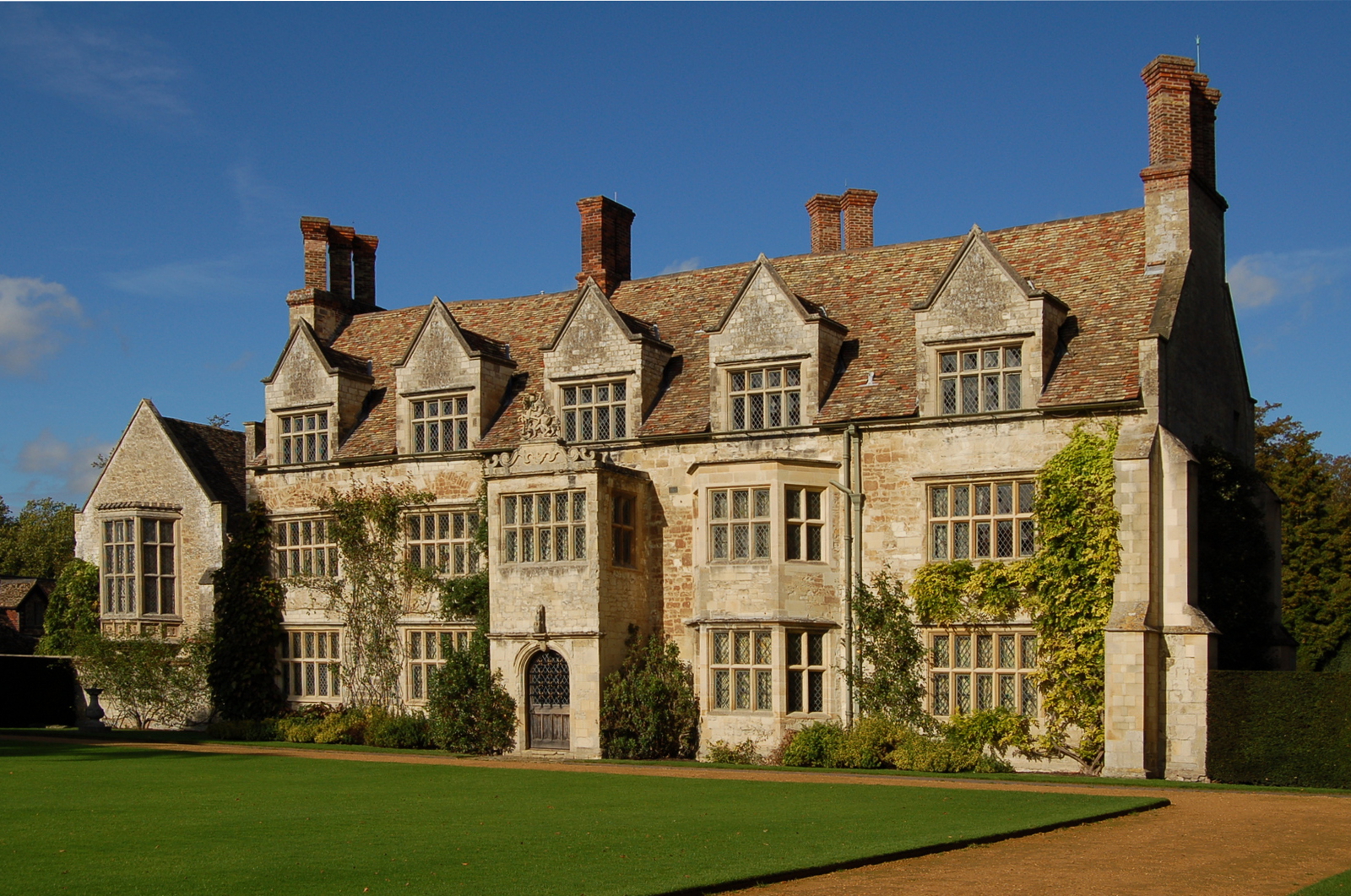
Bottisham Hall

Bottisham Hall is a country house in Bottisham, Cambridgeshire, England. Built in 1797 for the Reverend George Leonard Jenyns to replace the family's previous...

Swaffham Bulbeck

Swaffham Bulbeck is a small village in East Cambridgeshire, England. Swaffham Bulbeck is located about 8 miles (13 km) from the city of Cambridge, and...

Swaffham Prior railway station

The railway station at Swaffham Prior was on the Cambridge and Mildenhall branch of the Great Eastern Railway. The railway began operating to Swaffham...

Bottisham and Lode railway station

Bottisham and Lode Railway Station is a disused railway station on the Cambridge to Mildenhall railway in East Anglia, England. The station is located...

Church of St Cyriac and St Julitta, Swaffham Prior

The Church of St Cyriac and St Julitta is a redundant Anglican church in the village of Swaffham Prior, Cambridgeshire, England. It is recorded in the...

Lode, Cambridgeshire

Lode is a small village in East Cambridgeshire on the southern edge of The Fens. It lies just north of the B1102 between Quy and Swaffham Bulbeck, 8 miles...

Anglesey Abbey

Anglesey Abbey is a National Trust property in the village of Lode, 5+1⁄2 miles (8.9 km) northeast of Cambridge, England. The property includes a country...

Nearby Amenities

Located within 500m of 52.241264,0.27127481
Post Box
Collection Times: Mo-Fr 17:00; Sa 11:00
Operator: Royal Mail
Post Box Type: pillar
Postal Code: CB25 0
Ref: CB25 490
Royal Cypher: EIIR
Royal Cypher Wikidata: Q33102113
Lat/Long: 52.2398684/0.2782137
Bus Stop
War Memorial
Naptan AtcoCode: 0500ESWAB003
Naptan Bearing: SW
Naptan CommonName: War Memorial
Naptan Indicator: opp
Naptan Landmark: High Street
Naptan NaptanCode: cmbdjgpm
Naptan ShortCommonName: War Memorial
Naptan Street: High Street
Naptan Verified: no
Source: naptan_import
Lat/Long: 52.2394345/0.2777708
Bus Stop
Pound Way
Naptan AtcoCode: 0500ESWAB004
Naptan Bearing: SW
Naptan CommonName: Pound Way
Naptan Indicator: near
Naptan Landmark: Pound Way
Naptan NaptanCode: cmbdjgpt
Naptan ShortCommonName: Pound Way
Naptan Street: Green Bank Road
Naptan Verified: no
Public Transport: platform
Source: naptan_import
Lat/Long: 52.2398816/0.2781542
Bus Stop
Pound Way
Naptan AtcoCode: 0500ESWAB007
Naptan Bearing: NE
Naptan BusStopType: CUS
Naptan CommonName: Pound Way
Naptan Indicator: opp
Naptan Landmark: Pound Way
Naptan NaptanCode: cmbdjgta
Naptan ShortCommonName: Pound Way
Naptan Street: Green Bank Road
Naptan Verified: no
Public Transport: platform
Source: naptan_import
Lat/Long: 52.23997/0.2781007
Bus Stop
War Memorial
Naptan AtcoCode: 0500ESWAB009
Naptan Bearing: NE
Naptan BusStopType: CUS
Naptan CommonName: War Memorial
Naptan Indicator: near
Naptan Landmark: High Street
Naptan NaptanCode: cmbdjgtg
Naptan ShortCommonName: War Memorial
Naptan Street: High Street
Naptan Verified: no
Source: naptan_import
Lat/Long: 52.2394862/0.2776481
Power: pole
Lat/Long: 52.2394397/0.2712567
Power: pole
Lat/Long: 52.2399392/0.2721151
Power: pole
Lat/Long: 52.2404785/0.2730555
Power: pole
Lat/Long: 52.2396172/0.2685533
Power: pole
Lat/Long: 52.239269/0.2724047
Power: pole
Lat/Long: 52.2390751/0.2736171
Power: transformer
Lat/Long: 52.2388715/0.2748295
Power: pole
Lat/Long: 52.2397025/0.2697174
Power: pole
Lat/Long: 52.2395614/0.2668689
Power: transformer
Lat/Long: 52.2410911/0.2741016
Power: pole
Lat/Long: 52.2395021/0.2651899
Bench
Backrest: yes
Material: wood
Seats: 4
Lat/Long: 52.2398504/0.2779487
Addr Housenumber: 31
Addr Postcode: CB25 0HP
Addr Street: High Street
Shop: convenience
Lat/Long: 52.2398144/0.27822
Crossing
Crossing: uncontrolled
Crossing Ref: zebra
Lat/Long: 52.2400895/0.2768737
Historic: memorial
Memorial: war_memorial
Source: Bing
Lat/Long: 52.2395491/0.2775603
Bench
Backrest: yes
Material: wood
Seats: 4
Lat/Long: 52.2398277/0.2777446
Bench
Backrest: yes
Material: wood
Seats: 4
Lat/Long: 52.2399219/0.2774791
Bench
Backrest: yes
Inscription: SILVER JUBILEE 1952 EⅡR 1977
Material: wood
Seats: 4
Lat/Long: 52.2403468/0.2767835
Bench
Backrest: yes
Material: wood
Seats: 4
Lat/Long: 52.2408091/0.2767865
Bench: no
Leisure: picnic_table
Lit: no
Material: wood
Lat/Long: 52.2411077/0.2774138
Leisure: picnic_table
Material: wood
Lat/Long: 52.2411726/0.2777981
Leisure: picnic_table
Material: plastic
Lat/Long: 52.24113/0.2781624
Bench
Backrest: yes
Material: wood
Seats: 4
Lat/Long: 52.2410485/0.2785096
Bench
Backrest: no
Material: wood
Seats: 4
Lat/Long: 52.2405507/0.2784691
Bench
Backrest: yes
Material: wood
Seats: 4
Lat/Long: 52.2395792/0.2775171
Swaffham Bulbeck
Man Made: village_sign
Source: survey
Tourism: artwork
Wikidata: Q26677097
Lat/Long: 52.2398209/0.2776858
The data included in this document is from www.openstreetmap.org. The data is made available under ODbL.

Have you been to Gutter Bridge Plantation?

Leave your review of Gutter Bridge Plantation below (or comments, questions and feedback).