Denny Plantation

Wood, Forest in Cambridgeshire East Cambridgeshire

England

Denny Plantation

Swaffham Bulbeck Lode, from Cow Bridge Although the map marks a lock at the entrance to the lode from the River Cam, it can be seen at <a href="https://www.geograph.org.uk/photo/5064694">TL5267 : Swaffham Lock</a> that the channel is now used only for drainage, not navigation, explaining the state of the channel at this end.
On the right, Cowbridge Farm.
Swaffham Bulbeck Lode, from Cow Bridge Credit: Christopher Hilton

Denny Plantation is a picturesque woodland located in Cambridgeshire, England. Covering an expansive area of land, the plantation is known for its dense forests and thriving woodlands. The plantation is situated in a tranquil and serene environment, making it a popular destination for nature enthusiasts and hikers.

The woodland is primarily composed of deciduous trees, including oaks, maples, and birches, which create a vibrant and colorful landscape, particularly during the autumn season. The forest floor is adorned with a rich carpet of moss, ferns, and wildflowers, adding to the overall beauty of the plantation.

Denny Plantation offers a variety of trails and footpaths that wind through the woodland, providing visitors with the opportunity to explore its natural wonders. The trails range in difficulty, catering to both casual walkers and more experienced hikers. Along these paths, visitors can spot numerous species of birds, including woodpeckers and owls, as well as small mammals like foxes and squirrels.

Additionally, the plantation is home to a diverse range of wildlife, including deer and rabbits, which can often be seen grazing or hopping among the trees. The plantation also boasts a small lake, attracting various waterfowl and creating a peaceful ambiance.

Denny Plantation is not only a haven for nature lovers but also serves as an important ecological site. The woodland provides a vital habitat for numerous species, contributing to the local biodiversity of Cambridgeshire.

If you have any feedback on the listing, please let us know in the comments section below.

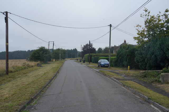
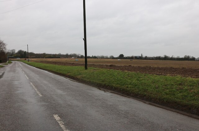
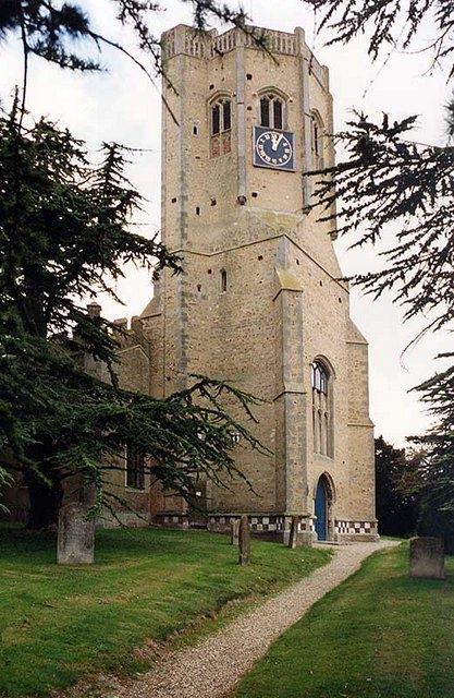
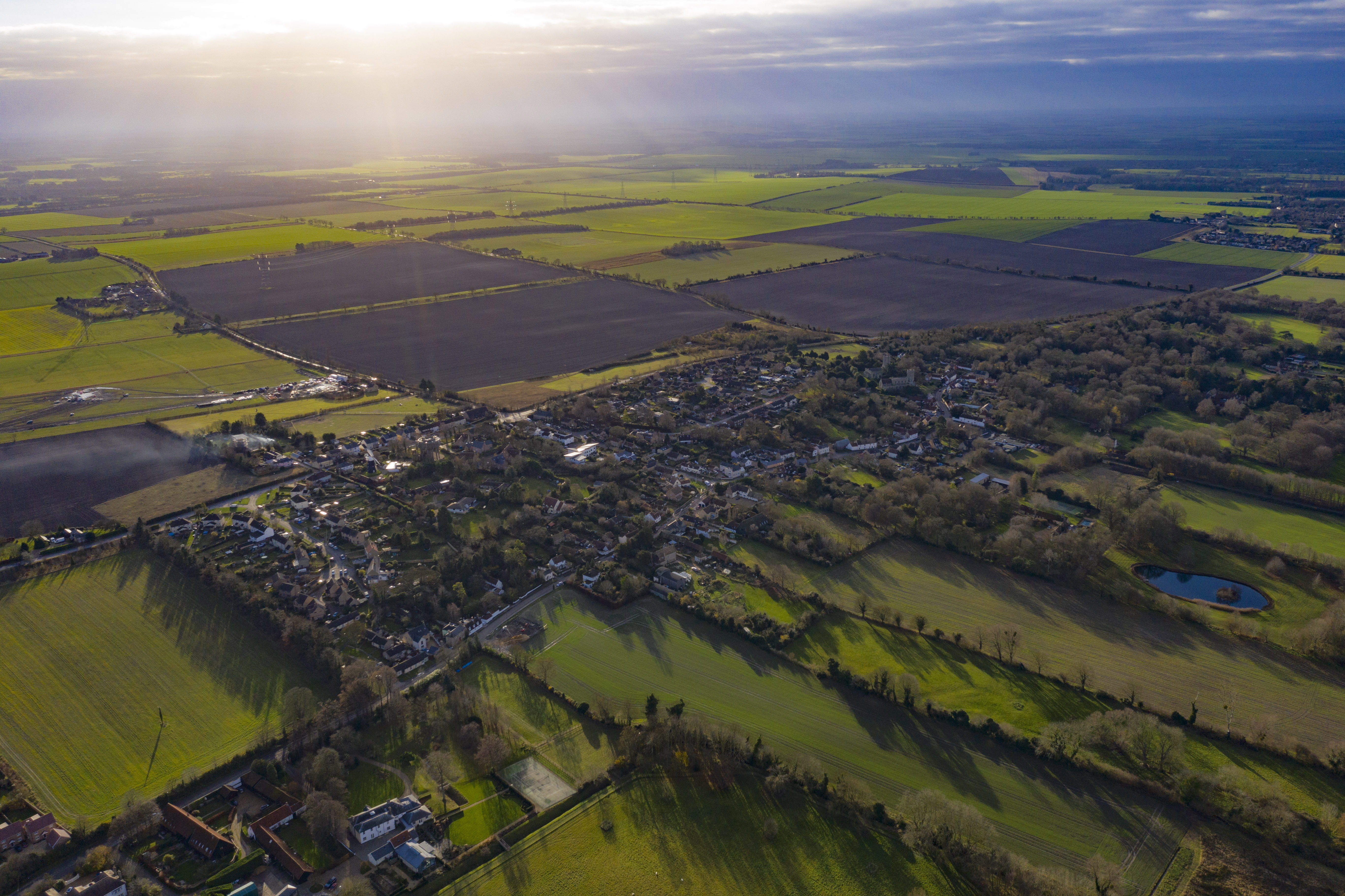
Denny Plantation Images

Images are sourced within 2km of 52.241279/0.27659271 or Grid Reference TL5562. Thanks to Geograph Open Source API. All images are credited.

Swaffham Bulbeck Lode, from Cow Bridge Although the map marks a lock at the entrance to the lode from the River Cam, it can be seen at <a href="https://www.geograph.org.uk/photo/5064694">TL5267 : Swaffham Lock</a> that the channel is now used only for drainage, not navigation, explaining the state of the channel at this end.
On the right, Cowbridge Farm.
Swaffham Bulbeck Lode, from Cow Bridge
Although the map marks a lock at the entrance to the lode from the River Cam, it can be seen at TL5267 : Swaffham Lock that the channel is now used only for drainage, not navigation, explaining the state of the channel at this end. On the right, Cowbridge Farm.
Swaffham Bulbeck Lode, at Cow Bridge The initials NRDC on the pillow mean "Newmarket Rural District Council", the relevant local authority at the time that the current bridge was put in place; a date on the other pillar indicates this to have been in 1927.
Swaffham Bulbeck Lode, at Cow Bridge
The initials NRDC on the pillow mean "Newmarket Rural District Council", the relevant local authority at the time that the current bridge was put in place; a date on the other pillar indicates this to have been in 1927.
Longmeadow houses There are just a few houses here in what I presume to be Longmeadow. The road ahead has private notices so my journey ended.
Longmeadow houses
There are just a few houses here in what I presume to be Longmeadow. The road ahead has private notices so my journey ended.
Near Swaffham Bulbeck On the edge of the village close by an old priory.
Near Swaffham Bulbeck
On the edge of the village close by an old priory.
Pelican crossing at Lode Crossing the busy B1102.
Pelican crossing at Lode
Crossing the busy B1102.
Farmland at Commercial End
Heath Road, Swaffham Bulbeck This is typical fen scenery.
Heath Road, Swaffham Bulbeck
This is typical fen scenery.
Field by Heath Road, Swaffham Bulbeck
Swaffham Prior: a view from the churchyard The houses are some of many listed buildings in the village. The one on the left was the home of the poet Edwin Muir, who with his wife Willa was a distinguished translator of Kafka. Both are buried in Swaffham Prior churchyard: see <a href="https://www.geograph.org.uk/photo/2334831">TL5663 : Swaffham Prior: the grave of the poet Edwin Muir (1887-1959)</a>.
Swaffham Prior: a view from the churchyard
The houses are some of many listed buildings in the village. The one on the left was the home of the poet Edwin Muir, who with his wife Willa was a distinguished translator of Kafka. Both are buried in Swaffham Prior churchyard: see TL5663 : Swaffham Prior: the grave of the poet Edwin Muir (1887-1959).
Swaffham Prior: St Mary Swaffham Prior is a fen-edge village and its two churches stand on a little hill on the edge of the chalklands of Newmarket Heath. (The other, St Cyriac and St Julitta, a little way to the right, in the same churchyard, is redundant and used for local events.)

St Mary's tower is rather splendid, with a square Norman base, followed by an octagonal stage, also Norman ("So there was an octagonal tower in Cambridgeshire long before the Ely octagon was designed" - Nikolaus Pevsner). For Pevsner, the thrill was the upper stage, which is sixteen-sided, though at the time of his visit in 1953 it was ruinous. This may be of interest: <a href="https://www.geograph.org.uk/photo/4302254">TL5663 : Swaffham Prior: St Mary - inside the tower</a>.

Robin Webster's <a href="https://www.geograph.org.uk/photo/5064900">TL5663 : Swaffham Prior - two churches, three saints</a> shows both churches.
Swaffham Prior: St Mary
Swaffham Prior is a fen-edge village and its two churches stand on a little hill on the edge of the chalklands of Newmarket Heath. (The other, St Cyriac and St Julitta, a little way to the right, in the same churchyard, is redundant and used for local events.) St Mary's tower is rather splendid, with a square Norman base, followed by an octagonal stage, also Norman ("So there was an octagonal tower in Cambridgeshire long before the Ely octagon was designed" - Nikolaus Pevsner). For Pevsner, the thrill was the upper stage, which is sixteen-sided, though at the time of his visit in 1953 it was ruinous. This may be of interest: TL5663 : Swaffham Prior: St Mary - inside the tower. Robin Webster's TL5663 : Swaffham Prior - two churches, three saints shows both churches.
Swaffham Bulbeck: Commercial End Commercial End was, until the arrival of the railway in 1884, a river port, connected to the River Cam by Swaffham Bulbeck Lode. The buildings to the left of the terrace, a warehouse and The Merchant's House, are some of many Grade II listed buildings in the village.

<a href="https://www.geograph.org.uk/photo/6486492">TL5563 : Swaffham Bulbeck: the north end of Commercial End</a>
<a href="https://www.geograph.org.uk/photo/6486481">TL5563 : Swaffham Bulbeck: The Merchant's House, Commercial End</a>
Swaffham Bulbeck: Commercial End
Commercial End was, until the arrival of the railway in 1884, a river port, connected to the River Cam by Swaffham Bulbeck Lode. The buildings to the left of the terrace, a warehouse and The Merchant's House, are some of many Grade II listed buildings in the village. TL5563 : Swaffham Bulbeck: the north end of Commercial End TL5563 : Swaffham Bulbeck: The Merchant's House, Commercial End
Swaffham Bulbeck: pollarded trees near Cow Bridge A bright and blustery morning in February.
Swaffham Bulbeck: pollarded trees near Cow Bridge
A bright and blustery morning in February.
Swaffham Bulbeck: Cow Bridge The bridge over Swaffham Bulbeck Lode was built by the then local authority, Newmarket Rural District Council, in 1927.

<a href="https://www.geograph.org.uk/photo/2343875">TL5563 : Cow Bridge and Swaffham Bulbeck Lode</a>
Swaffham Bulbeck: Cow Bridge
The bridge over Swaffham Bulbeck Lode was built by the then local authority, Newmarket Rural District Council, in 1927. TL5563 : Cow Bridge and Swaffham Bulbeck Lode
Straight lines in the Cambridgeshire Fens Looking north along White Droveway, near Swaffham Bulbeck, on a bright and blowy February morning.
Straight lines in the Cambridgeshire Fens
Looking north along White Droveway, near Swaffham Bulbeck, on a bright and blowy February morning.
Long Meadow: Haynes' Yard Haynes' Yard is the base for a number of businesses, including the Cambridge Tours coach-hire company.
Long Meadow: Haynes' Yard
Haynes' Yard is the base for a number of businesses, including the Cambridge Tours coach-hire company.
Swaffham Bulbeck: St Mary - chancel and chancel arch The church is "mostly C14" according to Nikolaus Pevsner. "The chancel E window of five lights [has] the flowing tracery of the second quarter of the century." Cool winter sunlight flooded the building late on a January morning.
Swaffham Bulbeck: St Mary - chancel and chancel arch
The church is "mostly C14" according to Nikolaus Pevsner. "The chancel E window of five lights [has] the flowing tracery of the second quarter of the century." Cool winter sunlight flooded the building late on a January morning.
Show me another place!

Denny Plantation is located at Grid Ref: TL5562 (Lat: 52.241279, Lng: 0.27659271)

Administrative County: Cambridgeshire

District: East Cambridgeshire

Police Authority: Cambridgeshire

What 3 Words

///gladiator.reputable.scooped. Near Bottisham, Cambridgeshire

Related Wikis

Swaffham Bulbeck Priory

Swaffham Bulbeck Priory was a priory in Cambridgeshire, England. == References ==

Swaffham Bulbeck

Swaffham Bulbeck is a small village in East Cambridgeshire, England. Swaffham Bulbeck is located about 8 miles (13 km) from the city of Cambridge, and...

Bottisham Hall

Bottisham Hall is a country house in Bottisham, Cambridgeshire, England. Built in 1797 for the Reverend George Leonard Jenyns to replace the family's previous...

Church of St Cyriac and St Julitta, Swaffham Prior

The Church of St Cyriac and St Julitta is a redundant Anglican church in the village of Swaffham Prior, Cambridgeshire, England. It is recorded in the...

Swaffham Prior railway station

The railway station at Swaffham Prior was on the Cambridge and Mildenhall branch of the Great Eastern Railway. The railway began operating to Swaffham...

Swaffham Prior

Swaffham Prior is a small village in East Cambridgeshire, England. Lying 5 miles west of Newmarket, and two miles south west of Burwell, the village is...

Bottisham and Lode railway station

Bottisham and Lode Railway Station is a disused railway station on the Cambridge to Mildenhall railway in East Anglia, England. The station is located...

Bottisham

Bottisham is a village and civil parish in the East Cambridgeshire district of Cambridgeshire, England, about 6 miles (10 km) east of Cambridge, halfway...

Nearby Amenities

Located within 500m of 52.241279,0.27659271
Post Office
Swaffham Bulbeck Post Office
Addr Country: GB
Addr Postcode: CB25 0HP
Branch: Swaffham Bulbeck
Brand: Post Office
Brand Wikidata: Q1783168
Check Date: 2020-02-20
Contact Website: https://www.postoffice.co.uk/branch-finder/138113x/swaffham-bulbeck
Ref Pol Id: 2482
Lat/Long: 52.2397813/0.2782297
Swaffham Bulbeck
Place: village
Wikidata: Q2476397
Lat/Long: 52.2387254/0.277634
Post Box
Collection Times: Mo-Fr 09:00; Sa 07:00
Operator: Royal Mail
Post Box Type: lamp
Ref: CB5 489D
Royal Cypher: EIIR
Royal Cypher Wikidata: Q33102113
Source: survey
Lat/Long: 52.245104/0.279336
Post Box
Collection Times: Mo-Fr 17:00; Sa 11:00
Operator: Royal Mail
Post Box Type: pillar
Postal Code: CB25 0
Ref: CB25 490
Royal Cypher: EIIR
Royal Cypher Wikidata: Q33102113
Lat/Long: 52.2398684/0.2782137
Post Box
Collection Times: Mo-Fr 17:00; Sa 11:15
Operator: Royal Mail
Post Box Type: lamp
Postal Code: CB25 0
Ref: CB25 491
Royal Cypher: EIIR
Royal Cypher Wikidata: Q33102113
Lat/Long: 52.2369214/0.2766135
Bus Stop
Heath Road
Naptan AtcoCode: 0500ESWAB001
Naptan Bearing: SW
Naptan CommonName: Heath Road
Naptan Indicator: near
Naptan Landmark: Heath Road
Naptan NaptanCode: cmbdjgpg
Naptan ShortCommonName: Heath Road
Naptan Street: Green Bank Road
Naptan Verified: no
Public Transport: platform
Source: naptan_import
Lat/Long: 52.2416487/0.2818458
Bus Stop
Vicarage Close
Naptan AtcoCode: 0500ESWAB002
Naptan Bearing: N
Naptan CommonName: Vicarage Close
Naptan Indicator: near
Naptan Landmark: Vicarage Close
Naptan NaptanCode: cmbdjgpj
Naptan ShortCommonName: Vicarage Close
Naptan Street: High Street
Naptan Verified: no
Source: naptan_import
Lat/Long: 52.2369234/0.2766745
Bus Stop
War Memorial
Naptan AtcoCode: 0500ESWAB003
Naptan Bearing: SW
Naptan CommonName: War Memorial
Naptan Indicator: opp
Naptan Landmark: High Street
Naptan NaptanCode: cmbdjgpm
Naptan ShortCommonName: War Memorial
Naptan Street: High Street
Naptan Verified: no
Source: naptan_import
Lat/Long: 52.2394345/0.2777708
Bus Stop
Pound Way
Naptan AtcoCode: 0500ESWAB004
Naptan Bearing: SW
Naptan CommonName: Pound Way
Naptan Indicator: near
Naptan Landmark: Pound Way
Naptan NaptanCode: cmbdjgpt
Naptan ShortCommonName: Pound Way
Naptan Street: Green Bank Road
Naptan Verified: no
Public Transport: platform
Source: naptan_import
Lat/Long: 52.2398816/0.2781542
Bus Stop
Vicarage Close
Naptan AtcoCode: 0500ESWAB005
Naptan Bearing: S
Naptan CommonName: Vicarage Close
Naptan Indicator: opp
Naptan Landmark: Vicarage Close
Naptan NaptanCode: cmbdjgpw
Naptan ShortCommonName: Vicarage Close
Naptan Street: High Street
Naptan Verified: no
Source: naptan_import
Lat/Long: 52.236901/0.2767582
Bus Stop
Pound Way
Naptan AtcoCode: 0500ESWAB007
Naptan Bearing: NE
Naptan BusStopType: CUS
Naptan CommonName: Pound Way
Naptan Indicator: opp
Naptan Landmark: Pound Way
Naptan NaptanCode: cmbdjgta
Naptan ShortCommonName: Pound Way
Naptan Street: Green Bank Road
Naptan Verified: no
Public Transport: platform
Source: naptan_import
Lat/Long: 52.23997/0.2781007
Bus Stop
Heath Road
Naptan AtcoCode: 0500ESWAB008
Naptan Bearing: NE
Naptan BusStopType: CUS
Naptan CommonName: Heath Road
Naptan Indicator: opp
Naptan Landmark: Heath Road
Naptan NaptanCode: cmbdjgtd
Naptan ShortCommonName: Heath Road
Naptan Street: Green Bank Road
Naptan Verified: no
Public Transport: platform
Source: naptan_import
Lat/Long: 52.2416626/0.2817515
Bus Stop
War Memorial
Naptan AtcoCode: 0500ESWAB009
Naptan Bearing: NE
Naptan BusStopType: CUS
Naptan CommonName: War Memorial
Naptan Indicator: near
Naptan Landmark: High Street
Naptan NaptanCode: cmbdjgtg
Naptan ShortCommonName: War Memorial
Naptan Street: High Street
Naptan Verified: no
Source: naptan_import
Lat/Long: 52.2394862/0.2776481
Power: pole
Lat/Long: 52.2394397/0.2712567
Power: pole
Lat/Long: 52.2399392/0.2721151
Power: pole
Lat/Long: 52.2404785/0.2730555
Power: pole
Lat/Long: 52.239269/0.2724047
Power: pole
Lat/Long: 52.2390751/0.2736171
Power: transformer
Lat/Long: 52.2388715/0.2748295
Power: pole
Lat/Long: 52.2397025/0.2697174
Power: transformer
Lat/Long: 52.2410911/0.2741016
Power: pole
Lat/Long: 52.2442265/0.2798841
Power: pole
Lat/Long: 52.2446296/0.2810901
Bench
Backrest: yes
Material: wood
Seats: 4
Lat/Long: 52.2398504/0.2779487
Bench
Backrest: yes
Inscription: TO COMMEMORATE THE CORONATION OF KING GEORGE VI and QUEEN ELIZABETH BY THE PEOPLE OF SWAFFHAM BULBECK MAY 12th 1937
Material: wood
Openbenches Id: 21402
Lat/Long: 52.2419245/0.2818179
Commercial End
Is In: Cambridgeshire, England, UK
Place: hamlet
Wikidata: Q1870903
Lat/Long: 52.2446171/0.2787385
Addr Housenumber: 31
Addr Postcode: CB25 0HP
Addr Street: High Street
Shop: convenience
Lat/Long: 52.2398144/0.27822
Crossing
Crossing: uncontrolled
Crossing Ref: zebra
Lat/Long: 52.2400895/0.2768737
Parking
Access: yes
Capacity: 2
Fee: no
Opening Hours: 24/7
Parking: surface
Smoothness: intermediate
Source: survey
Surface: grass_paver
Lat/Long: 52.2409346/0.2794052
Historic: memorial
Memorial: war_memorial
Source: Bing
Lat/Long: 52.2395491/0.2775603
Bench
Backrest: yes
Material: wood
Seats: 4
Lat/Long: 52.2398277/0.2777446
Bench
Backrest: yes
Material: wood
Seats: 4
Lat/Long: 52.2399219/0.2774791
Bench
Backrest: yes
Inscription: SILVER JUBILEE 1952 EⅡR 1977
Material: wood
Seats: 4
Lat/Long: 52.2403468/0.2767835
Bench
Backrest: yes
Material: wood
Seats: 4
Lat/Long: 52.2408091/0.2767865
Bench: no
Leisure: picnic_table
Lit: no
Material: wood
Lat/Long: 52.2411077/0.2774138
Leisure: picnic_table
Material: wood
Lat/Long: 52.2411726/0.2777981
Leisure: picnic_table
Material: plastic
Lat/Long: 52.24113/0.2781624
Bench
Backrest: yes
Material: wood
Seats: 4
Lat/Long: 52.2410485/0.2785096
Bench
Backrest: yes
Material: wood
Seats: 4
Lat/Long: 52.2407951/0.2788184
Bench
Backrest: yes
Material: plastic
Seats: 4
Lat/Long: 52.2402847/0.279638
Bench
Backrest: no
Material: wood
Seats: 4
Lat/Long: 52.2405507/0.2784691
Bench
Backrest: yes
Material: wood
Seats: 4
Lat/Long: 52.2399703/0.2783135
Bench
Backrest: yes
Material: wood
Seats: 4
Lat/Long: 52.2395792/0.2775171
Public Bookcase
Booth: K6
Disused Amenity: telephone
Man Made: telephone_box
Public Bookcase Type: phone_box
Lat/Long: 52.2450833/0.2793164
Advertising: board
Board Title: Swaffham Bulbeck Notices
Lat/Long: 52.2427686/0.2795422
Swaffham Bulbeck
Man Made: village_sign
Source: survey
Tourism: artwork
Wikidata: Q26677097
Lat/Long: 52.2398209/0.2776858
The data included in this document is from www.openstreetmap.org. The data is made available under ODbL.

Have you been to Denny Plantation?

Leave your review of Denny Plantation below (or comments, questions and feedback).