Ashbrook Wood

Wood, Forest in Sussex Wealden

England

Ashbrook Wood

Picnic area, Wilderness Wood, Hadlow Down Wilderness Wood is a visitor attraction focusing mainly on nature walks and especially wood and its use.
Picnic area, Wilderness Wood, Hadlow Down Credit: nick macneill

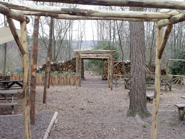
Ashbrook Wood is a picturesque woodland located in the county of Sussex, England. Covering an area of approximately 100 acres, this ancient forest is a haven for nature lovers and outdoor enthusiasts alike. The wood is situated near the village of Ashbrook, and is easily accessible by foot or car.

Ashbrook Wood is known for its diverse range of flora and fauna. The forest is home to a variety of tree species, including oak, beech, and birch, which create a dense canopy overhead. The forest floor is covered with a carpet of bluebells in the spring, creating a stunning display of color. Other wildflowers and ferns can also be found throughout the wood.

The forest provides a habitat for numerous wildlife species. Birdwatchers can spot a wide range of birds, including woodpeckers, owls, and various songbirds. Small mammals such as squirrels, rabbits, and foxes can also be seen darting through the undergrowth.

Ashbrook Wood offers several walking trails, allowing visitors to explore its natural beauty at their own pace. The trails meander through the forest, passing by tranquil streams and hidden clearings. There are also picnic areas and benches scattered throughout the wood, providing a perfect spot for a rest or a picnic lunch.

This well-preserved woodland is a popular destination for nature enthusiasts seeking a peaceful escape from the hustle and bustle of everyday life. With its rich biodiversity and serene atmosphere, Ashbrook Wood is a true gem of Sussex and a must-visit for anyone seeking a connection with nature.

If you have any feedback on the listing, please let us know in the comments section below.

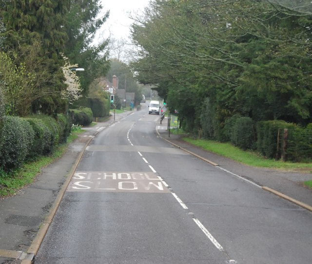
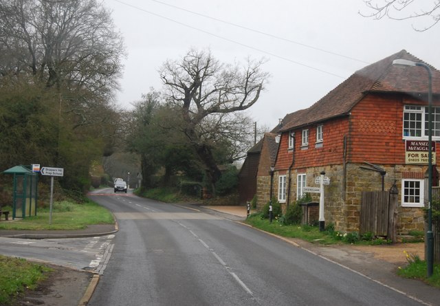
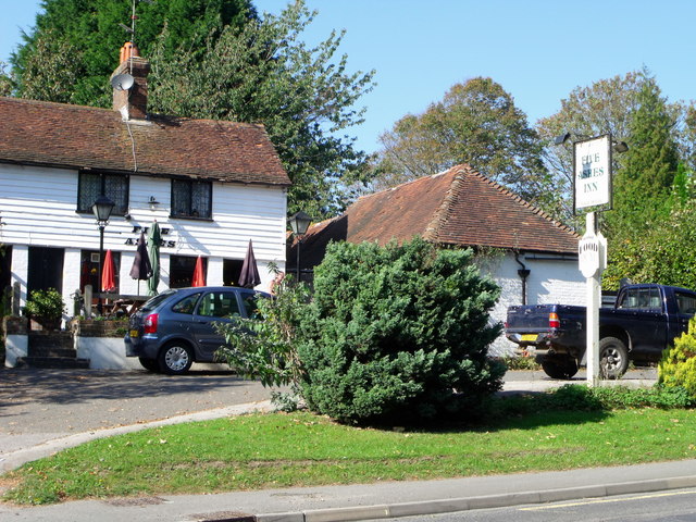
Ashbrook Wood Images

Images are sourced within 2km of 50.991229/0.20535348 or Grid Reference TQ5423. Thanks to Geograph Open Source API. All images are credited.

Picnic area, Wilderness Wood, Hadlow Down Wilderness Wood is a visitor attraction focusing mainly on nature walks and especially wood and its use.
Picnic area, Wilderness Wood, Hadlow Down
Wilderness Wood is a visitor attraction focusing mainly on nature walks and especially wood and its use.
A267, Five Ashes The A267 road is a 21 mile long road from Tunbridge Wells <a href="https://www.geograph.org.uk/photo/6669020">TQ5838 : A26, A267 junction</a> to Horsebridge.
Website: <span class="nowrap"><a title="http://www.sabre-roads.org.uk/wiki/index.php?title=A267" rel="nofollow ugc noopener" href="http://www.sabre-roads.org.uk/wiki/index.php?title=A267">Link</a><img style="margin-left:2px;" alt="External link" title="External link - shift click to open in new window" src="https://s1.geograph.org.uk/img/external.png" width="10" height="10"/></span>
A267, Five Ashes
The A267 road is a 21 mile long road from Tunbridge Wells TQ5838 : A26, A267 junction to Horsebridge. Website: LinkExternal link
Frog Hole Lane / A267 junction
A267 / A272 junction The A267 road is a 21 mile long road from Tunbridge Wells <a href="https://www.geograph.org.uk/photo/6669020">TQ5838 : A26, A267 junction</a> to Horsebridge.
Website: <span class="nowrap"><a title="http://www.sabre-roads.org.uk/wiki/index.php?title=A267" rel="nofollow ugc noopener" href="http://www.sabre-roads.org.uk/wiki/index.php?title=A267">Link</a><img style="margin-left:2px;" alt="External link" title="External link - shift click to open in new window" src="https://s1.geograph.org.uk/img/external.png" width="10" height="10"/></span>
A267 / A272 junction
The A267 road is a 21 mile long road from Tunbridge Wells TQ5838 : A26, A267 junction to Horsebridge. Website: LinkExternal link
A267 north of the junction with the B2102 The A267 road is a 21 mile long road from Tunbridge Wells <a href="https://www.geograph.org.uk/photo/6669020">TQ5838 : A26, A267 junction</a> to Horsebridge.
Website: <span class="nowrap"><a title="http://www.sabre-roads.org.uk/wiki/index.php?title=A267" rel="nofollow ugc noopener" href="http://www.sabre-roads.org.uk/wiki/index.php?title=A267">Link</a><img style="margin-left:2px;" alt="External link" title="External link - shift click to open in new window" src="https://s1.geograph.org.uk/img/external.png" width="10" height="10"/></span>
A267 north of the junction with the B2102
The A267 road is a 21 mile long road from Tunbridge Wells TQ5838 : A26, A267 junction to Horsebridge. Website: LinkExternal link
A267 looking south The A267 road is a 21 mile long road from Tunbridge Wells <a href="https://www.geograph.org.uk/photo/6669020">TQ5838 : A26, A267 junction</a> to Horsebridge.
Website: <span class="nowrap"><a title="http://www.sabre-roads.org.uk/wiki/index.php?title=A267" rel="nofollow ugc noopener" href="http://www.sabre-roads.org.uk/wiki/index.php?title=A267">Link</a><img style="margin-left:2px;" alt="External link" title="External link - shift click to open in new window" src="https://s1.geograph.org.uk/img/external.png" width="10" height="10"/></span>
A267 looking south
The A267 road is a 21 mile long road from Tunbridge Wells TQ5838 : A26, A267 junction to Horsebridge. Website: LinkExternal link
B2102, Nursery Lane junction
Dad's Hill off the A267
Junction of B2102 and A267
A267 heading north The A267 road is a 21 mile long road from Tunbridge Wells <a href="https://www.geograph.org.uk/photo/6669020">TQ5838 : A26, A267 junction</a> to Horsebridge.
Website: <span class="nowrap"><a title="http://www.sabre-roads.org.uk/wiki/index.php?title=A267" rel="nofollow ugc noopener" href="http://www.sabre-roads.org.uk/wiki/index.php?title=A267">Link</a><img style="margin-left:2px;" alt="External link" title="External link - shift click to open in new window" src="https://s1.geograph.org.uk/img/external.png" width="10" height="10"/></span>
A267 heading north
The A267 road is a 21 mile long road from Tunbridge Wells TQ5838 : A26, A267 junction to Horsebridge. Website: LinkExternal link
The A267 The A267 road is a 21 mile long road from Tunbridge Wells <a href="https://www.geograph.org.uk/photo/6669020">TQ5838 : A26, A267 junction</a> to Horsebridge.
Website: <span class="nowrap"><a title="http://www.sabre-roads.org.uk/wiki/index.php?title=A267" rel="nofollow ugc noopener" href="http://www.sabre-roads.org.uk/wiki/index.php?title=A267">Link</a><img style="margin-left:2px;" alt="External link" title="External link - shift click to open in new window" src="https://s1.geograph.org.uk/img/external.png" width="10" height="10"/></span>
The A267
The A267 road is a 21 mile long road from Tunbridge Wells TQ5838 : A26, A267 junction to Horsebridge. Website: LinkExternal link
Approaching the junction of the A267 and A272 The A267 road is a 21 mile long road from Tunbridge Wells <a href="https://www.geograph.org.uk/photo/6669020">TQ5838 : A26, A267 junction</a> to Horsebridge.
Website: <span class="nowrap"><a title="http://www.sabre-roads.org.uk/wiki/index.php?title=A267" rel="nofollow ugc noopener" href="http://www.sabre-roads.org.uk/wiki/index.php?title=A267">Link</a><img style="margin-left:2px;" alt="External link" title="External link - shift click to open in new window" src="https://s1.geograph.org.uk/img/external.png" width="10" height="10"/></span>
Approaching the junction of the A267 and A272
The A267 road is a 21 mile long road from Tunbridge Wells TQ5838 : A26, A267 junction to Horsebridge. Website: LinkExternal link
A267 south of Poundford The A267 road is a 21 mile long road from Tunbridge Wells <a href="https://www.geograph.org.uk/photo/6669020">TQ5838 : A26, A267 junction</a> to Horsebridge.
Website: <span class="nowrap"><a title="http://www.sabre-roads.org.uk/wiki/index.php?title=A267" rel="nofollow ugc noopener" href="http://www.sabre-roads.org.uk/wiki/index.php?title=A267">Link</a><img style="margin-left:2px;" alt="External link" title="External link - shift click to open in new window" src="https://s1.geograph.org.uk/img/external.png" width="10" height="10"/></span>
A267 south of Poundford
The A267 road is a 21 mile long road from Tunbridge Wells TQ5838 : A26, A267 junction to Horsebridge. Website: LinkExternal link
Entering Five Ashes on the A267 The A267 road is a 21 mile long road from Tunbridge Wells <a href="https://www.geograph.org.uk/photo/6669020">TQ5838 : A26, A267 junction</a> to Horsebridge.
Website: <span class="nowrap"><a title="http://www.sabre-roads.org.uk/wiki/index.php?title=A267" rel="nofollow ugc noopener" href="http://www.sabre-roads.org.uk/wiki/index.php?title=A267">Link</a><img style="margin-left:2px;" alt="External link" title="External link - shift click to open in new window" src="https://s1.geograph.org.uk/img/external.png" width="10" height="10"/></span>
Entering Five Ashes on the A267
The A267 road is a 21 mile long road from Tunbridge Wells TQ5838 : A26, A267 junction to Horsebridge. Website: LinkExternal link
A267 through Five Ashes The A267 road is a 21 mile long road from Tunbridge Wells <a href="https://www.geograph.org.uk/photo/6669020">TQ5838 : A26, A267 junction</a> to Horsebridge.
Website: <span class="nowrap"><a title="http://www.sabre-roads.org.uk/wiki/index.php?title=A267" rel="nofollow ugc noopener" href="http://www.sabre-roads.org.uk/wiki/index.php?title=A267">Link</a><img style="margin-left:2px;" alt="External link" title="External link - shift click to open in new window" src="https://s1.geograph.org.uk/img/external.png" width="10" height="10"/></span>
A267 through Five Ashes
The A267 road is a 21 mile long road from Tunbridge Wells TQ5838 : A26, A267 junction to Horsebridge. Website: LinkExternal link
Stone and tiled house, Criers Lane turn off
Bus stop at Five Ashes, East Sussex
Five Ashes Inn, Five Ashes, East Sussex
Show me another place!

Ashbrook Wood is located at Grid Ref: TQ5423 (Lat: 50.991229, Lng: 0.20535348)

Administrative County: East Sussex

District: Wealden

Police Authority: Sussex

What 3 Words

///applied.mush.youths. Near Heathfield, East Sussex

Related Wikis

Wealden (UK Parliament constituency)

Wealden is a constituency represented in the House of Commons of the UK Parliament since 2015 by Nus Ghani, a Conservative. Ghani is the first Muslim woman...

Wealden District

Wealden is a local government district in East Sussex, England. Its council is based in Hailsham, the district's largest town. The district also includes...

Southern Sandstone

Southern Sandstone is a local name for the Ardingly Sandstone of southeast England, a soft sandstone of Cretaceous age separating the Tunbridge Wells Sands...

Great Bush Railway

The Great Bush Railway is a private, 2 ft (610 mm) narrow gauge running round the edge of Tinkers Park, Hadlow Down, Sussex. The railway is operated by...

Five Ash Down Independent Chapel

Five Ash Down Independent Chapel is an independent Evangelical church in the Reformed (Calvinist) tradition in the hamlet of Five Ash Down, East Sussex...

Providence Chapel, Hadlow Down

Providence Chapel is a former independent Calvinistic place of worship in the village of Hadlow Down in Wealden, one of six local government districts...

St Mark's Church, Hadlow Down

St Mark's Church (dedicated to St Mark the Evangelist) is an Anglican church in the village of Hadlow Down in the district of Wealden, one of six local...

New Mill, Cross-in-Hand

New Mill is a Grade II* listed post mill at Cross in Hand near Heathfield, East Sussex, England. It was the last windmill working commercially by wind...

Nearby Amenities

Located within 500m of 50.991229,0.20535348
The data included in this document is from www.openstreetmap.org. The data is made available under ODbL.

Have you been to Ashbrook Wood?

Leave your review of Ashbrook Wood below (or comments, questions and feedback).