Ashwell's Grove

Wood, Forest in Essex Uttlesford

England

Ashwell's Grove

Stonebridge Farm, Little Walden, Essex
Stonebridge Farm, Little Walden, Essex Credit: Robert Edwards

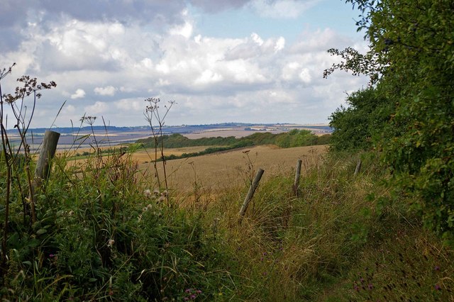
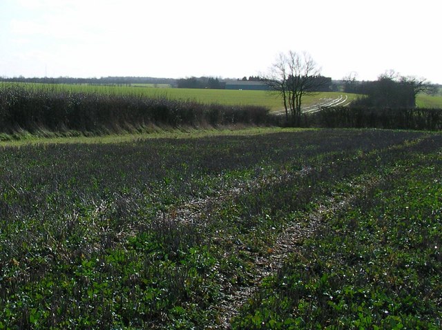
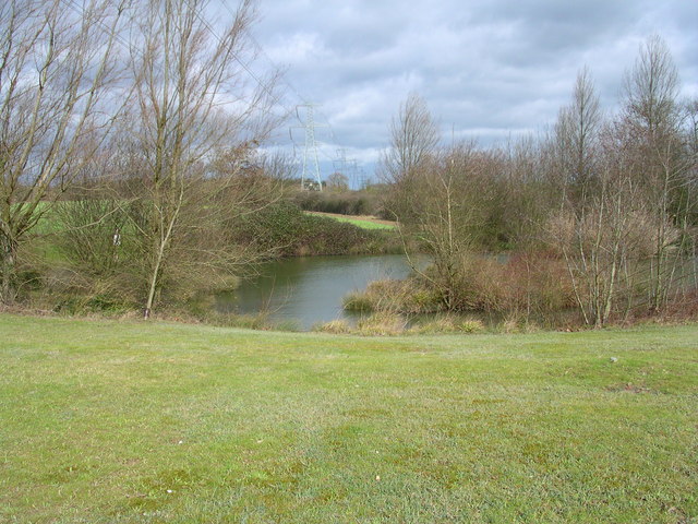
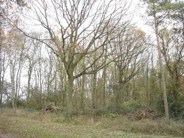
Ashwell's Grove is a picturesque woodland located in Essex, England. Situated in the heart of the county, it is part of the larger Ashwell's Forest. Covering an area of approximately 200 acres, the grove is renowned for its natural beauty and rich biodiversity.

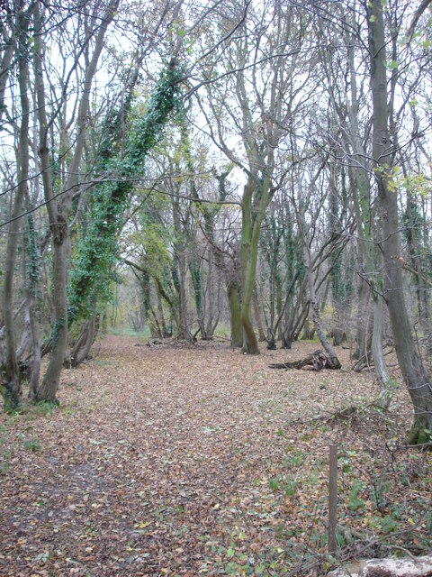
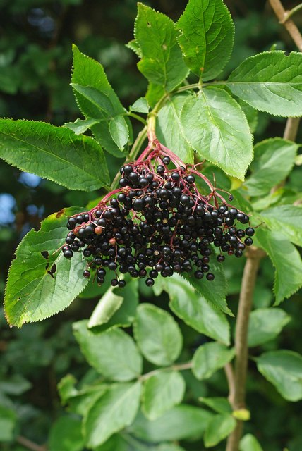
The woodland is dominated by a variety of majestic deciduous trees, including oak, beech, and ash, which create a dense and vibrant canopy that provides shade and shelter to a diverse range of flora and fauna. The forest floor is carpeted with a thick layer of leaf litter, creating a haven for a multitude of woodland plants such as bluebells, primroses, and wild garlic.

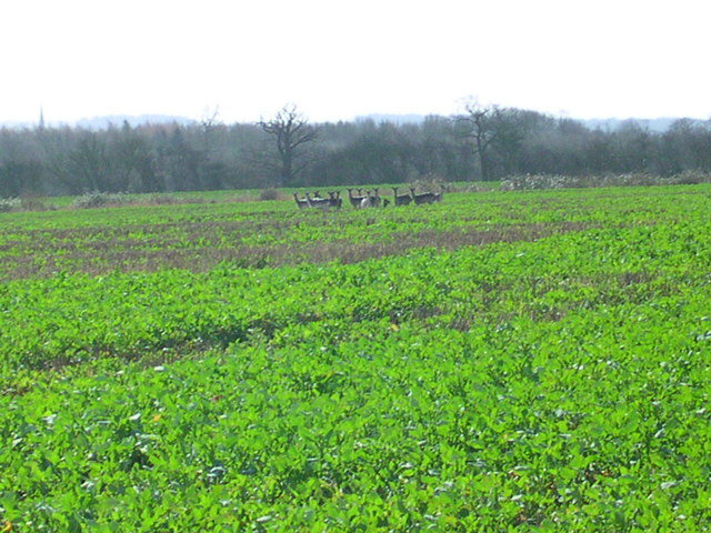
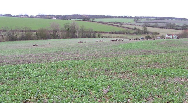
Ashwell's Grove is not only visually stunning but also serves as an important habitat for numerous animal species. It provides a sanctuary for mammals such as deer, foxes, and badgers, as well as a haven for a wide array of bird species, including woodpeckers, owls, and various songbirds.

The grove is a popular destination for nature lovers and outdoor enthusiasts, offering a range of recreational activities. There are well-maintained walking trails that meander through the woodland, allowing visitors to immerse themselves in the tranquil surroundings and observe the abundant wildlife. Additionally, the grove offers picnic areas and designated spots for birdwatching and photography.

Thanks to its preservation efforts, Ashwell's Grove remains a cherished natural treasure in Essex. Its enchanting beauty, diverse ecosystem, and recreational opportunities make it a destination that appeals to both locals and tourists seeking an escape into nature.

If you have any feedback on the listing, please let us know in the comments section below.

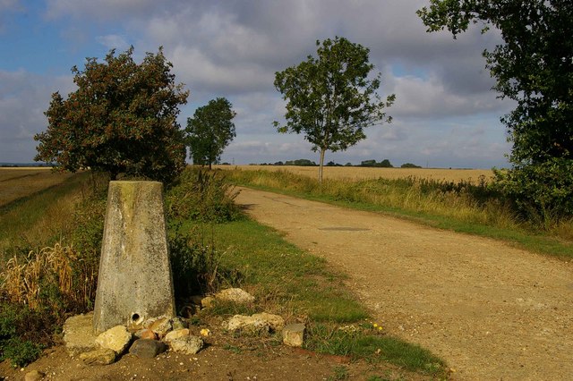
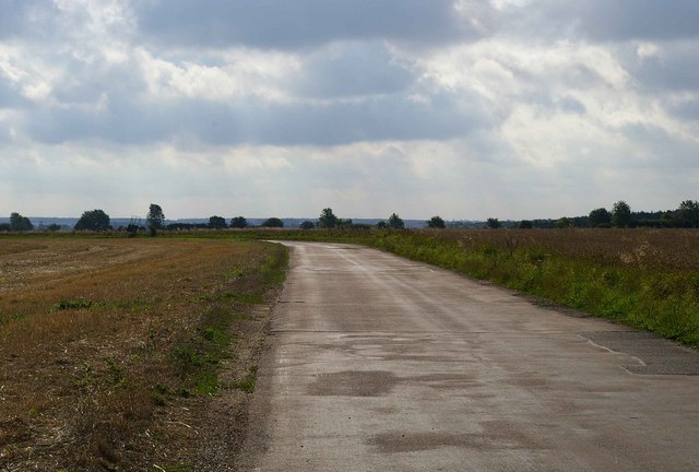
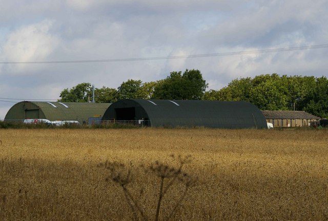
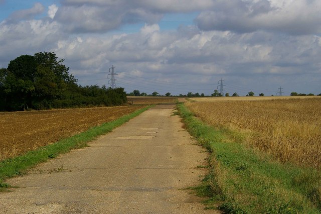
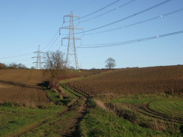
Ashwell's Grove Images

Images are sourced within 2km of 52.057857/0.25405136 or Grid Reference TL5442. Thanks to Geograph Open Source API. All images are credited.

Stonebridge Farm, Little Walden, Essex
'The Crown' inn, Little Walden, Essex This inn stands at the bend in the road through the small hamlet of Little Walden.
'The Crown' inn, Little Walden, Essex
This inn stands at the bend in the road through the small hamlet of Little Walden.
FDL, Hadstock Common, Essex These buildings belong to a company called Fuerst Day Lawson.
FDL, Hadstock Common, Essex
These buildings belong to a company called Fuerst Day Lawson.
RAF Little Walden This is the Control Tower of RAF Little Walden. It is probably the best-preserved WW2 airfield tower in Essex. It began its operational life in March 1944 with the USAAF 409th Bomb Group flying A20's, other types that operated from here included P51 Mustang, and B17's. The airfield was returned to the RAF in 1946 and finally decommissioned in 1958. To go to the next field in an alphabetical tour of Essex WW2 airfields click on <a href="https://www.geograph.org.uk/photo/260801">TL5512 : Matching Aerodrome</a>. Much information was gleaned from Graham Smith’s book “Essex Airfields In The Second World War”.
<span class="nowrap"><a title="https://books.google.co.uk/books/about/Essex_Airfields_in_the_Second_World_War.html?id=u3atAAAACAAJ&redir_esc=y" rel="nofollow ugc noopener" href="https://books.google.co.uk/books/about/Essex_Airfields_in_the_Second_World_War.html?id=u3atAAAACAAJ&redir_esc=y">Link</a><img style="margin-left:2px;" alt="External link" title="External link - shift click to open in new window" src="https://s1.geograph.org.uk/img/external.png" width="10" height="10"/></span>
RAF Little Walden
This is the Control Tower of RAF Little Walden. It is probably the best-preserved WW2 airfield tower in Essex. It began its operational life in March 1944 with the USAAF 409th Bomb Group flying A20's, other types that operated from here included P51 Mustang, and B17's. The airfield was returned to the RAF in 1946 and finally decommissioned in 1958. To go to the next field in an alphabetical tour of Essex WW2 airfields click on TL5512 : Matching Aerodrome. Much information was gleaned from Graham Smith’s book “Essex Airfields In The Second World War”. LinkExternal link
Trig on Mitchells Farm This triangulation pillar stands on the byway from Mitchells Farm to the trig point. After this point the road becomes a footpath.
Trig on Mitchells Farm
This triangulation pillar stands on the byway from Mitchells Farm to the trig point. After this point the road becomes a footpath.
Peri Track to Monks Hall This is the road to Monks Hall and Bowsers, it exactly follows the path of the perimeter track of <a href="https://www.geograph.org.uk/photo/221842">TL5543 : RAF Little Walden</a>.
Peri Track to Monks Hall
This is the road to Monks Hall and Bowsers, it exactly follows the path of the perimeter track of TL5543 : RAF Little Walden.
Monks Farm It is possible these blister style buildings on Monks farm are contemporary with <a href="https://www.geograph.org.uk/photo/221842">TL5543 : RAF Little Walden</a> however I would be willing to bet a few geograph points the rectangular building behind them is a military building of 1940’s vintage.
Monks Farm
It is possible these blister style buildings on Monks farm are contemporary with TL5543 : RAF Little Walden however I would be willing to bet a few geograph points the rectangular building behind them is a military building of 1940’s vintage.
Little Walden Path This bridle path follows the perimeter track of <a href="https://www.geograph.org.uk/photo/221842">TL5543 : RAF Little Walden</a> as far as the hedge it then takes a sharp left turn and disappears through the trees.
Little Walden Path
This bridle path follows the perimeter track of TL5543 : RAF Little Walden as far as the hedge it then takes a sharp left turn and disappears through the trees.
Bridle Path Near Burtonwood Farm This vista is further along the <a href="https://www.geograph.org.uk/photo/221860">TL5443 : Little Walden Path</a> to the southeast of Burtonwood Farm. As you can tell from the length of the grass it is not well used by horses!
Bridle Path Near Burtonwood Farm
This vista is further along the TL5443 : Little Walden Path to the southeast of Burtonwood Farm. As you can tell from the length of the grass it is not well used by horses!
Field track and pylons
Gateway to Chesterford Research Park
Turn Right at the tree for Grimsditch Wood. The aerial to the left is in TL 5735. The building on the horizon is Butlers Farm where Harcamlow Way passes to the Southwest.
Turn Right at the tree for Grimsditch Wood.
The aerial to the left is in TL 5735. The building on the horizon is Butlers Farm where Harcamlow Way passes to the Southwest.
13 deer here This herd is half the size of the one that got away.
13 deer here
This herd is half the size of the one that got away.
Electric pond
Electric pond
31 or so that got away And then we went to that pub.
31 or so that got away
And then we went to that pub.
Nunn Wood This photograph shows the northern end of the public footpath into Nunn Wood.
Nunn Wood
This photograph shows the northern end of the public footpath into Nunn Wood.
Paddock Wood This photograph shows the northern edge of Paddock Wood, viewed from the public bridleway.
Paddock Wood
This photograph shows the northern edge of Paddock Wood, viewed from the public bridleway.
Super Fruit In my opinion the worlds best fruit for making wine (especially when blended with brambles!) grapes come a poor second!!
Super Fruit
In my opinion the worlds best fruit for making wine (especially when blended with brambles!) grapes come a poor second!!
Show me another place!

Ashwell's Grove is located at Grid Ref: TL5442 (Lat: 52.057857, Lng: 0.25405136)

Administrative County: Essex

District: Uttlesford

Police Authority: Essex

What 3 Words

///relocated.definite.asking. Near Saffron Walden, Essex

Nearby Locations

Ashwell's Grove

Related Wikis

Little Walden

Little Walden is a small settlement in the Uttlesford district, in the English county of Essex. It lies about 3 miles (5 km) north of the market town of...

RAF Little Walden

Royal Air Force Little Walden or more simply RAF Little Walden is a former Royal Air Force station primarily used by the United States Army Air Forces...

Nunn Wood

Nunn Wood is a 9.7-hectare (24-acre) biological Site of Special Scientific Interest between Great Chesterford and Ashdon in Essex, England.The site is...

Hadstock

Hadstock is a village in Essex, England, about 6 miles (10 km) from Saffron Walden. It is on the county boundary with Cambridgeshire and about 9 miles...

Ashdon Halt railway station

Ashdon Halt was a railway station on the Saffron Walden Railway. It opened 14 August 1911 and closed 7 September 1964. The halt was approximately 46 miles...

Little Chesterford

Little Chesterford is a small village and civil parish in Uttlesford, Essex, in the East of England. Close to the Cambridgeshire border, it is built principally...

Hales and Shadwell Woods

Hales and Shadwell Woods is a 15.4-hectare (38-acre) biological Site of Special Scientific Interest north-east of Saffron Walden in Essex. Shadwell Wood...

Hildersham Wood

Hildersham Wood is a 7.7-hectare (19-acre) biological Site of Special Scientific Interest south of Hildersham in Cambridgeshire.The principal trees in...

Nearby Amenities

Located within 500m of 52.057857,0.25405136
Ashwell House
Caravans: yes
Cash Withdrawal Fee: yes
Motorhomes: yes
Operator: Camping and Caravanning Club
Shower: no
Tents: yes
Toilets: yes
Tourism: camp_site
Website: https://www.campingandcaravanningclub.co.uk/campsites/uk/essex/saffron-walden/ashwellhouse/
Lat/Long: 52.0581354/0.2476445
The data included in this document is from www.openstreetmap.org. The data is made available under ODbL.

Have you been to Ashwell's Grove?

Leave your review of Ashwell's Grove below (or comments, questions and feedback).