Burgoyne's Plantation

Wood, Forest in Cambridgeshire South Cambridgeshire

England

Burgoyne's Plantation

Great Abington, St Mary <span class="nowrap"><a title="http://www.druidic.org/camchurch/churches/gtabington.htm" rel="nofollow ugc noopener" href="http://www.druidic.org/camchurch/churches/gtabington.htm">Link</a><img style="margin-left:2px;" alt="External link" title="External link - shift click to open in new window" src="https://s1.geograph.org.uk/img/external.png" width="10" height="10"/></span>
Great Abington, St Mary Credit: mym

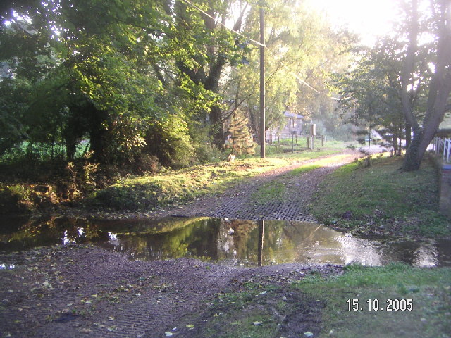
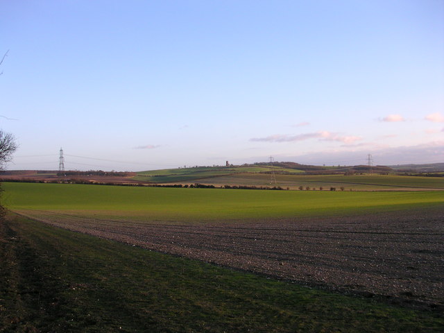
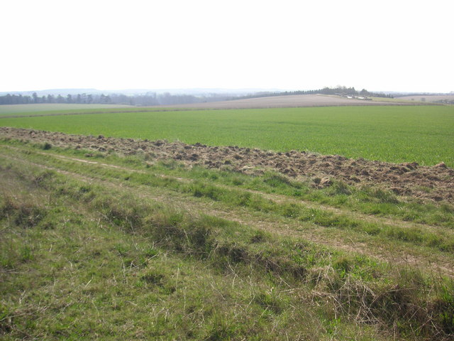
Burgoyne's Plantation is a picturesque woodland located in Cambridgeshire, England. Spanning over several acres, this enchanting forest is a beloved natural retreat for locals and visitors alike. Situated in the heart of the countryside, Burgoyne's Plantation offers a serene and tranquil escape from the hustle and bustle of everyday life.

The woodland is characterized by its dense and diverse array of trees, including oak, beech, and birch, which create a captivating canopy overhead. The forest floor is adorned with a rich tapestry of wildflowers, ferns, and mosses, adding to the area's enchanting ambiance.

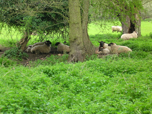
Burgoyne's Plantation is a haven for wildlife, providing a sanctuary for various species of birds, mammals, and insects. Birdsong can be heard throughout the day, as numerous feathered creatures make their homes within the branches. Wildlife enthusiasts can spot deer, foxes, and rabbits frolicking amidst the trees, adding a touch of whimsy to the woodland experience.

For outdoor enthusiasts, Burgoyne's Plantation offers a variety of walking trails and paths, allowing visitors to explore the forest's hidden nooks and crannies. The trails are well-maintained, making them accessible to individuals of all ages and abilities. Along the way, benches and picnic areas are scattered throughout, providing the perfect opportunity to rest and admire the natural beauty.

Overall, Burgoyne's Plantation is a captivating woodland in Cambridgeshire, offering a peaceful retreat for nature lovers. With its diverse flora and fauna, well-maintained trails, and serene atmosphere, it is an idyllic destination for those seeking solace in the beauty of the natural world.

If you have any feedback on the listing, please let us know in the comments section below.

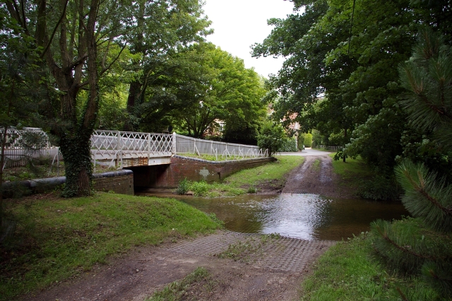
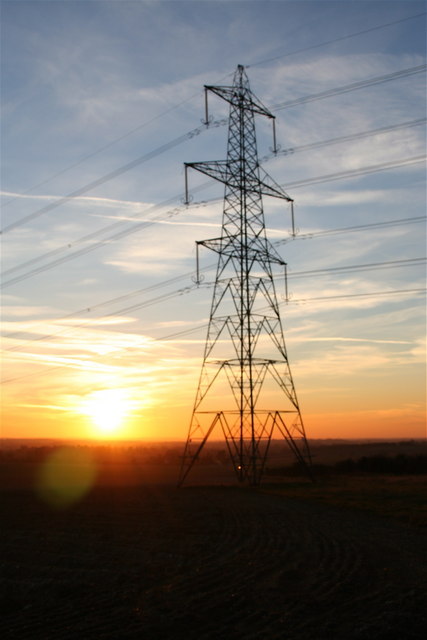
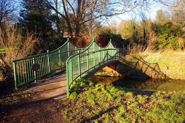
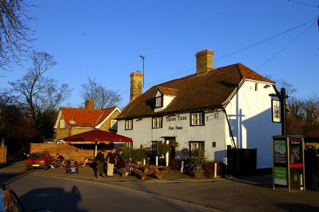
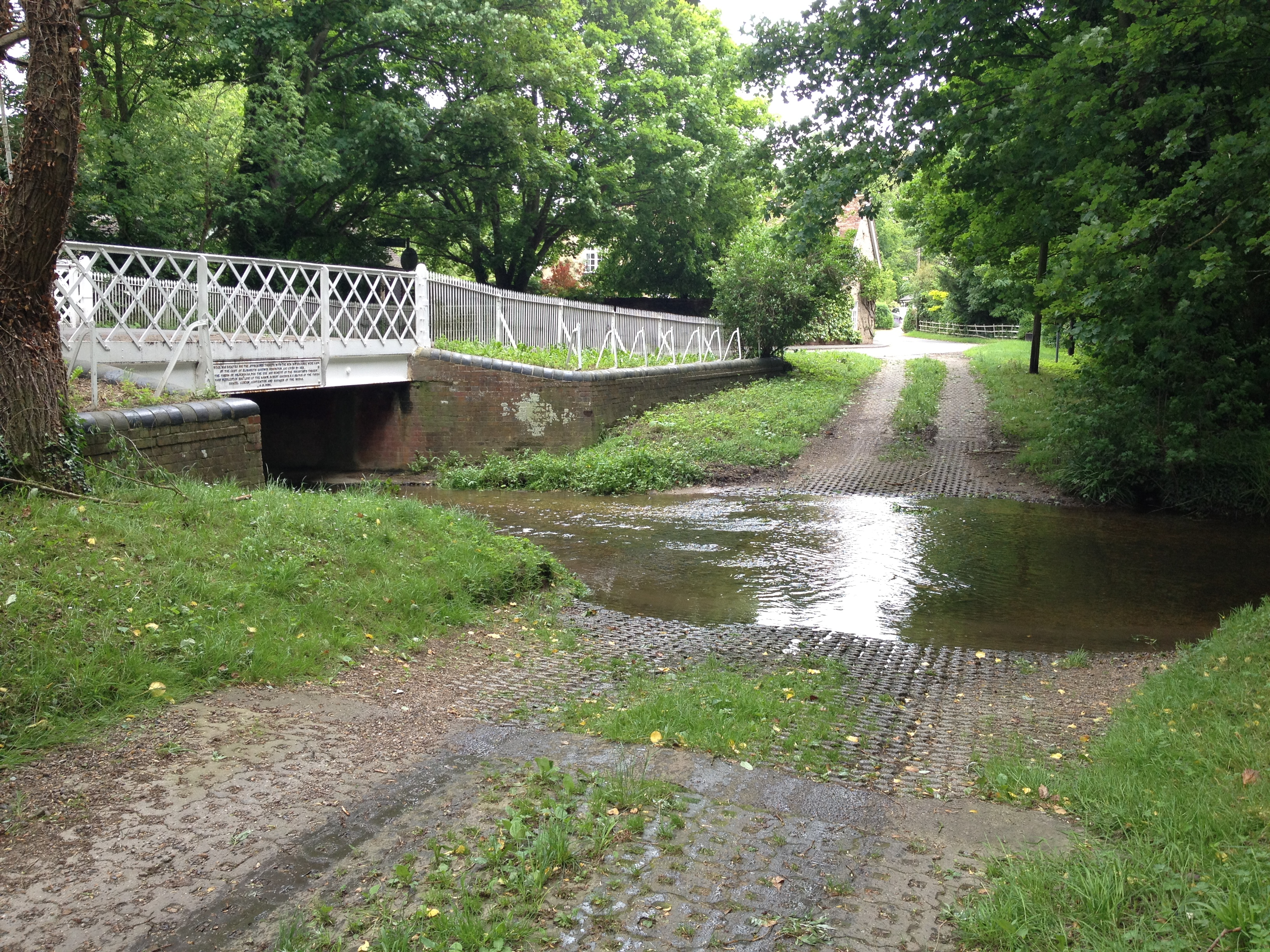
Burgoyne's Plantation Images

Images are sourced within 2km of 52.127376/0.25736883 or Grid Reference TL5450. Thanks to Geograph Open Source API. All images are credited.

Great Abington, St Mary <span class="nowrap"><a title="http://www.druidic.org/camchurch/churches/gtabington.htm" rel="nofollow ugc noopener" href="http://www.druidic.org/camchurch/churches/gtabington.htm">Link</a><img style="margin-left:2px;" alt="External link" title="External link - shift click to open in new window" src="https://s1.geograph.org.uk/img/external.png" width="10" height="10"/></span>
Great Abington, St Mary
Great Abington High Street A view of the three tuns pub from outside Abington school.
Great Abington High Street
A view of the three tuns pub from outside Abington school.
Hildersham Ford
Hildersham Ford
Furze Hill Look but no touch!
The site holds fragments of grassland characteristic of the Breckland of East Anglia holding both acidic
and calcareous components. This is a rare example of sandy habitat in the county and represents a south-
western outlier of the Suffolk Breckland.
<span class="nowrap"><a title="http://www.english-nature.org.uk/citation/citation_photo/1001115.pdf" rel="nofollow ugc noopener" href="http://www.english-nature.org.uk/citation/citation_photo/1001115.pdf">Link</a><img style="margin-left:2px;" alt="External link" title="External link - shift click to open in new window" src="https://s1.geograph.org.uk/img/external.png" width="10" height="10"/></span>
Furze Hill
Look but no touch! The site holds fragments of grassland characteristic of the Breckland of East Anglia holding both acidic and calcareous components. This is a rare example of sandy habitat in the county and represents a south- western outlier of the Suffolk Breckland. LinkExternal link
Pretty plain . The Roman Road to Wandlebury is on the horizon. The tree to the right is on a path  shown on the historic map but unfortunately not on the 2001 map.  The path is perpendicular to the Roman Road.
Pretty plain .
The Roman Road to Wandlebury is on the horizon. The tree to the right is on a path shown on the historic map but unfortunately not on the 2001 map. The path is perpendicular to the Roman Road.
Where the road with no name crosses the Roman Rd. Behind me is the road between Hildersham and Balsham.  The Linton Water tower is on the Horizon.
Where the road with no name crosses the Roman Rd.
Behind me is the road between Hildersham and Balsham. The Linton Water tower is on the Horizon.
Pretty plain from the north. Linton water tower on the horizon. Half lit.
Pretty plain from the north.
Linton water tower on the horizon. Half lit.
Little Abington The building bordering the image to the left is the Little Abington Pottery.
Little Abington
The building bordering the image to the left is the Little Abington Pottery.
Bridleway between Roman Road and Hildersham Bridleway leading from Roman Road to Hildersham. On the small hill in the right half of the image you can see farm equipment supposedly belonging to the rectory farm.
Bridleway between Roman Road and Hildersham
Bridleway leading from Roman Road to Hildersham. On the small hill in the right half of the image you can see farm equipment supposedly belonging to the rectory farm.
Sheep dip path Go to ford and dip again
Sheep dip path
Go to ford and dip again
Hildersham Ford and Bridge, River Granta The village ford is now by-passed by a road bridge.
Hildersham Ford and Bridge, River Granta
The village ford is now by-passed by a road bridge.
Village Sign
Village Sign
Farmland near Hildersham Looking south-eastwards from the minor road between Hildersham and Balsham.
Farmland near Hildersham
Looking south-eastwards from the minor road between Hildersham and Balsham.
Farmland near Hildersham Looking north west from the minor road between Hildersham and Balsham.
Farmland near Hildersham
Looking north west from the minor road between Hildersham and Balsham.
Pylon at sunset This electricity pylon stands at the junction of the Balsham to Hildersham road and the Roman Road.
Pylon at sunset
This electricity pylon stands at the junction of the Balsham to Hildersham road and the Roman Road.
Millennium bridge over the Granta This footbridge linking the parishes of Great and Little Abington was constructed and presented in 2000 by Granta Park and TWI. <span class="nowrap"><a title="http://www.twi.co.uk" rel="nofollow ugc noopener" href="http://www.twi.co.uk">Link</a><img style="margin-left:2px;" alt="External link" title="External link - shift click to open in new window" src="https://s1.geograph.org.uk/img/external.png" width="10" height="10"/></span>
Millennium bridge over the Granta
This footbridge linking the parishes of Great and Little Abington was constructed and presented in 2000 by Granta Park and TWI. LinkExternal link
Three Tuns The free house in Abington.
Three Tuns
The free house in Abington.
Abington cottage A brick and flint cottage with pretty Gothic windows and a weatherboarded extension in Church Lane.
Abington cottage
A brick and flint cottage with pretty Gothic windows and a weatherboarded extension in Church Lane.
Show me another place!

Burgoyne's Plantation is located at Grid Ref: TL5450 (Lat: 52.127376, Lng: 0.25736883)

Administrative County: Cambridgeshire

District: South Cambridgeshire

Police Authority: Cambridgeshire

What 3 Words

///defensive.like.fleet. Near Linton, Cambridgeshire

Nearby Locations

Burgoyne's Plantation

Related Wikis

Alder Carr, Hildersham

Alder Carr is a 6.7-hectare biological Site of Special Scientific Interest in Hildersham in Cambridgeshire.The site is a wet valley which has alder on...

Furze Hill SSSI

Furze Hill is a 5.8-hectare (14-acre) biological Site of Special Scientific Interest in three nearby areas east of Hildersham in Cambridgeshire.The site...
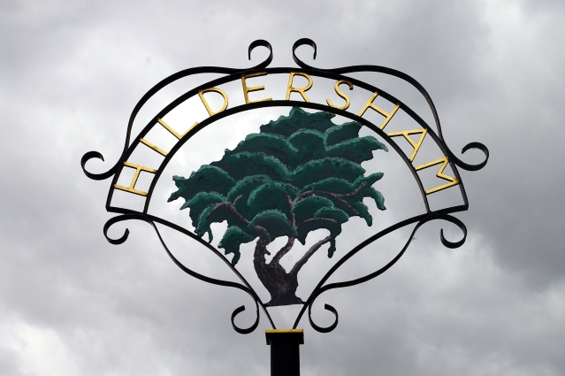
Hildersham

Hildersham is a small village 8 miles to the south-east of Cambridge, England. It is situated just off the A1307 between Linton and Great Abington on a...

The Abingtons, Cambridgeshire

The Abingtons are a community in South Cambridgeshire consisting of two small villages: Little Abington and Great Abington, about 7 miles (11 km) south...

Abington railway station (England)

Abington railway station served Little Abington, Great Abington and Babraham in Cambridgeshire. It closed in 1851, along with its line which was one of...

Granta Park

Granta Park is a science, technology and biopharmaceutical park based on the bank of the River Granta in Great Abington near Cambridge, England. The idea...

Roman Road, Cambridgeshire

The Roman Road in Cambridgeshire, also known as Worsted Street Roman Road, is a 12.4-hectare (31-acre) linear biological Site of Special Scientific Interest...

Rivey Hill

Rivey Hill is a hill overlooking Linton in Cambridgeshire, England (grid reference TL567480). At 367 feet (112 m) it is the highest point for several miles...

Have you been to Burgoyne's Plantation?

Leave your review of Burgoyne's Plantation below (or comments, questions and feedback).