Coalpit Wood

Wood, Forest in Sussex Wealden

England

Coalpit Wood

View from the edge of Card's Wood The footpath from Brickyard Lane through Card's Wood emerges here, just before Blackdown Lane is reached.
View from the edge of Card's Wood Credit: Marathon

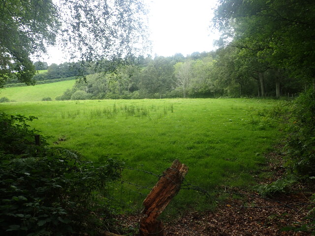
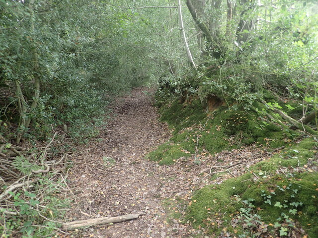
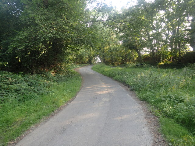
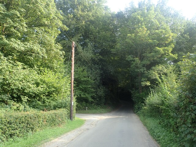
Coalpit Wood is a charming woodland area located in Sussex, England. It is nestled within the South Downs National Park, making it a popular destination for nature enthusiasts and hikers. Covering an area of approximately 50 acres, this ancient woodland is characterized by its diverse range of flora and fauna.

The wood is predominantly composed of broadleaf trees such as oak, beech, and ash, which create a lush and vibrant canopy overhead. The forest floor is adorned with an array of wildflowers, including bluebells, primroses, and wood anemones, which create a stunning display of color during the spring months.

Coalpit Wood is home to a variety of wildlife species, offering a haven for nature lovers. Visitors may encounter roe deer, badgers, foxes, and a plethora of bird species, including woodpeckers, owls, and warblers. The wood is also a habitat for several rare butterflies, such as the silver-washed fritillary and the purple emperor.

In addition to its natural beauty, Coalpit Wood also has historical significance. It is believed to have been used as a source of coal during the medieval period, hence its name. The remnants of old mining pits can still be seen throughout the wood, adding an intriguing element to the overall ambiance.

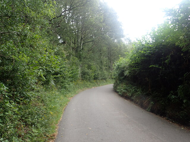
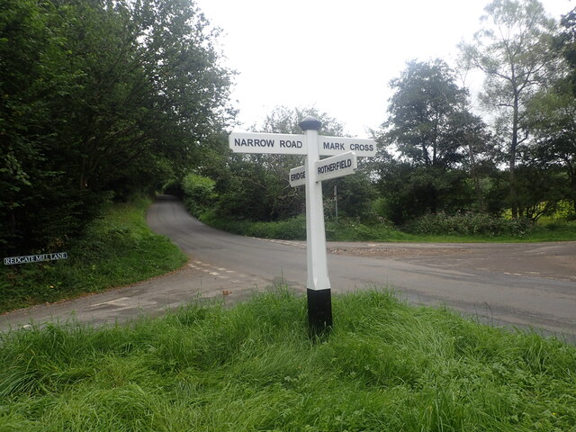
Visitors to Coalpit Wood can enjoy a serene and peaceful environment, with several walking trails and picnic spots available. The wood offers a true escape from the hustle and bustle of daily life, allowing visitors to immerse themselves in the beauty of nature.

If you have any feedback on the listing, please let us know in the comments section below.

Coalpit Wood Images

Images are sourced within 2km of 51.068261/0.20525943 or Grid Reference TQ5432. Thanks to Geograph Open Source API. All images are credited.

View from the edge of Card's Wood The footpath from Brickyard Lane through Card's Wood emerges here, just before Blackdown Lane is reached.
View from the edge of Card's Wood
The footpath from Brickyard Lane through Card's Wood emerges here, just before Blackdown Lane is reached.
View from Redgate Mill Lane to an old railway line This was the Cuckoo Line. It became known as the Cuckoo Line because traditionally, the first cuckoo of spring was released from a cage at Heathfield Fair. The line was opened in two stages - between Polegate and Hailsham opened on 14th May 1849 and northwards from Hailsham to Eridge in 1880, the section here being opened on 1st September 1880. The Cuckoo Line was closed to passengers north of Hailsham on 14th June 1965 and the final stretch of line on 9th September 1968.

See <span class="nowrap"><a title="http://disused-stations.org.uk/r/rotherfield_and_mark_cross/index.shtml" rel="nofollow ugc noopener" href="http://disused-stations.org.uk/r/rotherfield_and_mark_cross/index.shtml">Link</a><img style="margin-left:2px;" alt="External link" title="External link - shift click to open in new window" src="https://s1.geograph.org.uk/img/external.png" width="10" height="10"/></span>  and <span class="nowrap"><a title="https://www.eastsussex.gov.uk/leisureandtourism/discover-east-sussex/countryside-sites/cuckootrail/" rel="nofollow ugc noopener" href="https://www.eastsussex.gov.uk/leisureandtourism/discover-east-sussex/countryside-sites/cuckootrail/">Link</a><img style="margin-left:2px;" alt="External link" title="External link - shift click to open in new window" src="https://s1.geograph.org.uk/img/external.png" width="10" height="10"/></span>  for more information.  This part of the old line is not accessible but can be seen here, just on this side of the woodland.
View from Redgate Mill Lane to an old railway line
This was the Cuckoo Line. It became known as the Cuckoo Line because traditionally, the first cuckoo of spring was released from a cage at Heathfield Fair. The line was opened in two stages - between Polegate and Hailsham opened on 14th May 1849 and northwards from Hailsham to Eridge in 1880, the section here being opened on 1st September 1880. The Cuckoo Line was closed to passengers north of Hailsham on 14th June 1965 and the final stretch of line on 9th September 1968. See LinkExternal link and LinkExternal link for more information. This part of the old line is not accessible but can be seen here, just on this side of the woodland.
The Sussex Border Path near Stitches Farm The Sussex Border Path drops down ahead to the valley of the Eridge Brook which also carries the Uckfield Line between Eridge and Crowborough. See <span class="nowrap"><a title="https://www.walkingenglishman.com/ldp/sussexborderpath.html" rel="nofollow ugc noopener" href="https://www.walkingenglishman.com/ldp/sussexborderpath.html">Link</a><img style="margin-left:2px;" alt="External link" title="External link - shift click to open in new window" src="https://s1.geograph.org.uk/img/external.png" width="10" height="10"/></span>
The Sussex Border Path near Stitches Farm
The Sussex Border Path drops down ahead to the valley of the Eridge Brook which also carries the Uckfield Line between Eridge and Crowborough. See LinkExternal link
Looking down to the former Cuckoo Line This was the Cuckoo Line. It became known as the Cuckoo Line because traditionally, the first cuckoo of spring was released from a cage at Heathfield Fair. The line was opened in two stages - between Polegate and Hailsham opened on 14th May 1849 and northwards from Hailsham to Eridge in 1880, the section here being opened on 1st September 1880. The Cuckoo Line was closed to passengers north of Hailsham on 14th June 1965 and the final stretch of line on 9th September 1968.

See <span class="nowrap"><a title="http://disused-stations.org.uk/r/rotherfield_and_mark_cross/index.shtml" rel="nofollow ugc noopener" href="http://disused-stations.org.uk/r/rotherfield_and_mark_cross/index.shtml">Link</a><img style="margin-left:2px;" alt="External link" title="External link - shift click to open in new window" src="https://s1.geograph.org.uk/img/external.png" width="10" height="10"/></span>  and <span class="nowrap"><a title="https://www.eastsussex.gov.uk/leisureandtourism/discover-east-sussex/countryside-sites/cuckootrail/" rel="nofollow ugc noopener" href="https://www.eastsussex.gov.uk/leisureandtourism/discover-east-sussex/countryside-sites/cuckootrail/">Link</a><img style="margin-left:2px;" alt="External link" title="External link - shift click to open in new window" src="https://s1.geograph.org.uk/img/external.png" width="10" height="10"/></span>  for more information.  This part of the old line is not accessible but can be seen here, just on this side of the woodland.
Looking down to the former Cuckoo Line
This was the Cuckoo Line. It became known as the Cuckoo Line because traditionally, the first cuckoo of spring was released from a cage at Heathfield Fair. The line was opened in two stages - between Polegate and Hailsham opened on 14th May 1849 and northwards from Hailsham to Eridge in 1880, the section here being opened on 1st September 1880. The Cuckoo Line was closed to passengers north of Hailsham on 14th June 1965 and the final stretch of line on 9th September 1968. See LinkExternal link and LinkExternal link for more information. This part of the old line is not accessible but can be seen here, just on this side of the woodland.
Looking towards the former Cuckoo Line This was the Cuckoo Line. It became known as the Cuckoo Line because traditionally, the first cuckoo of spring was released from a cage at Heathfield Fair. The line was opened in two stages - between Polegate and Hailsham opened on 14th May 1849 and northwards from Hailsham to Eridge in 1880, the section here being opened on 1st September 1880. The Cuckoo Line was closed to passengers north of Hailsham on 14th June 1965 and the final stretch of line on 9th September 1968.

See <span class="nowrap"><a title="http://disused-stations.org.uk/r/rotherfield_and_mark_cross/index.shtml" rel="nofollow ugc noopener" href="http://disused-stations.org.uk/r/rotherfield_and_mark_cross/index.shtml">Link</a><img style="margin-left:2px;" alt="External link" title="External link - shift click to open in new window" src="https://s1.geograph.org.uk/img/external.png" width="10" height="10"/></span>  and <span class="nowrap"><a title="https://www.eastsussex.gov.uk/leisureandtourism/discover-east-sussex/countryside-sites/cuckootrail/" rel="nofollow ugc noopener" href="https://www.eastsussex.gov.uk/leisureandtourism/discover-east-sussex/countryside-sites/cuckootrail/">Link</a><img style="margin-left:2px;" alt="External link" title="External link - shift click to open in new window" src="https://s1.geograph.org.uk/img/external.png" width="10" height="10"/></span>  for more information.  This part of the old line is not accessible but can be seen here, between the further hedge and the woodland.
Looking towards the former Cuckoo Line
This was the Cuckoo Line. It became known as the Cuckoo Line because traditionally, the first cuckoo of spring was released from a cage at Heathfield Fair. The line was opened in two stages - between Polegate and Hailsham opened on 14th May 1849 and northwards from Hailsham to Eridge in 1880, the section here being opened on 1st September 1880. The Cuckoo Line was closed to passengers north of Hailsham on 14th June 1965 and the final stretch of line on 9th September 1968. See LinkExternal link and LinkExternal link for more information. This part of the old line is not accessible but can be seen here, between the further hedge and the woodland.
Footpath into Card's Wood This is just after the footpath leaves Cowford Bridge Lane near the crossroads with Eridge Lane and Hackdon Hill.
Footpath into Card's Wood
This is just after the footpath leaves Cowford Bridge Lane near the crossroads with Eridge Lane and Hackdon Hill.
Cowford Bridge Lane near Card's Wood This is just east of the crossroads with Eridge Lane and Hackdon Hill. A footpath leaves on the left just ahead and heads into Card's Wood - see <a title="https://www.geograph.org.uk/photo/6951285" href="https://www.geograph.org.uk/photo/6951285">Link</a>
Cowford Bridge Lane near Card's Wood
This is just east of the crossroads with Eridge Lane and Hackdon Hill. A footpath leaves on the left just ahead and heads into Card's Wood - see Link
Crossroads near Card's Wood This is just west of Card's Wood. Eridge Lane is behind on the right and Hackdon Hill is straight ahead. As can be seen, Redgate Mill Lane is on the left and the lane on the right leading to Card's Wood is Cowford Bridge Lane.
Crossroads near Card's Wood
This is just west of Card's Wood. Eridge Lane is behind on the right and Hackdon Hill is straight ahead. As can be seen, Redgate Mill Lane is on the left and the lane on the right leading to Card's Wood is Cowford Bridge Lane.
Stitches Farm from the Sussex Border Path Beyond the farm, the Sussex Border Path drops down to the valley of the Eridge Brook which also carries the Uckfield Line between Eridge and Crowborough. See <span class="nowrap"><a title="https://www.walkingenglishman.com/ldp/sussexborderpath.html" rel="nofollow ugc noopener" href="https://www.walkingenglishman.com/ldp/sussexborderpath.html">Link</a><img style="margin-left:2px;" alt="External link" title="External link - shift click to open in new window" src="https://s1.geograph.org.uk/img/external.png" width="10" height="10"/></span>
Stitches Farm from the Sussex Border Path
Beyond the farm, the Sussex Border Path drops down to the valley of the Eridge Brook which also carries the Uckfield Line between Eridge and Crowborough. See LinkExternal link
The Sussex Border Path heading towards Stitches Farm Beyond the farm, the Sussex Border Path drops down to the valley of the Eridge Brook which also carries the Uckfield Line between Eridge and Crowborough. See <span class="nowrap"><a title="https://www.walkingenglishman.com/ldp/sussexborderpath.html" rel="nofollow ugc noopener" href="https://www.walkingenglishman.com/ldp/sussexborderpath.html">Link</a><img style="margin-left:2px;" alt="External link" title="External link - shift click to open in new window" src="https://s1.geograph.org.uk/img/external.png" width="10" height="10"/></span>
The Sussex Border Path heading towards Stitches Farm
Beyond the farm, the Sussex Border Path drops down to the valley of the Eridge Brook which also carries the Uckfield Line between Eridge and Crowborough. See LinkExternal link
The Sussex Border Path on the way to Stitches Farm Beyond the farm, the Sussex Border Path drops down to the valley of the Eridge Brook which also carries the Uckfield Line between Eridge and Crowborough. See <span class="nowrap"><a title="https://www.walkingenglishman.com/ldp/sussexborderpath.html" rel="nofollow ugc noopener" href="https://www.walkingenglishman.com/ldp/sussexborderpath.html">Link</a><img style="margin-left:2px;" alt="External link" title="External link - shift click to open in new window" src="https://s1.geograph.org.uk/img/external.png" width="10" height="10"/></span>
The Sussex Border Path on the way to Stitches Farm
Beyond the farm, the Sussex Border Path drops down to the valley of the Eridge Brook which also carries the Uckfield Line between Eridge and Crowborough. See LinkExternal link
View from Sandhill Lane This is close to and within the sound of the A26.
View from Sandhill Lane
This is close to and within the sound of the A26.
View from Sandhill Lane This is close to Sandhill Cottages and looks across the valley through which the Uckfield line runs.
View from Sandhill Lane
This is close to Sandhill Cottages and looks across the valley through which the Uckfield line runs.
Sandhill Lane Sandhill Lane here passes through Roughets Wood but keeps along the south side of the wood.
Sandhill Lane
Sandhill Lane here passes through Roughets Wood but keeps along the south side of the wood.
Triangular junction at Danegate There is a triangular junction where Danegate meets Sham Farm Road and Blackdon Hill. This view looks up from Danegate to Blackdon Hill. The triangle is on the right.
Triangular junction at Danegate
There is a triangular junction where Danegate meets Sham Farm Road and Blackdon Hill. This view looks up from Danegate to Blackdon Hill. The triangle is on the right.
Looking along Danegate from a triangular junction There is a triangular junction where Danegate meets Sham Farm Road and Blackdon Hill. This view looks along Danegate. See also <a title="https://www.geograph.org.uk/photo/6953726" href="https://www.geograph.org.uk/photo/6953726">Link</a>
Looking along Danegate from a triangular junction
There is a triangular junction where Danegate meets Sham Farm Road and Blackdon Hill. This view looks along Danegate. See also Link
View from Sandhill Lane This view is close to Sandhill Cottages, which are on the right, and looks across the valley through which the Uckfield line runs.
View from Sandhill Lane
This view is close to Sandhill Cottages, which are on the right, and looks across the valley through which the Uckfield line runs.
Sandhill Lane Sandhill Lane enters Slab Wood just ahead. This is close to and within the sound of the A26.
Sandhill Lane
Sandhill Lane enters Slab Wood just ahead. This is close to and within the sound of the A26.
Show me another place!

Coalpit Wood is located at Grid Ref: TQ5432 (Lat: 51.068261, Lng: 0.20525943)

Administrative County: East Sussex

District: Wealden

Police Authority: Sussex

What 3 Words

///factually.voters.rice. Near Town Row, East Sussex

Related Wikis

Bowles Rocks

Bowles Rocks is a sandstone crag in the county of East Sussex, on the border with Kent, approximately 8 kilometres (5 mi) south of the town of Royal Tunbridge...

Bowles Outdoor Centre

Bowles Outdoor Centre is an outdoor education/outdoor learning centre in southeast England, located between Royal Tunbridge Wells and Crowborough at Bowles...

Eridge railway station

Eridge railway station is on the Uckfield branch of the Oxted line in southern England and serves a rural district around Eridge in East Sussex. It is...

Bream Wood

Bream Wood is a 7.8-hectare (19-acre) biological Site of Special Scientific Interest north of Crowborough in East Sussex.This steep sided valley wood has...

Jarvis Brook

Jarvis Brook is a village between Crowborough and Rotherfield in the Borough of Wealden East Sussex. Crowborough Railway Station, on the Uckfield branch...

Rotherfield

Rotherfield is a village and civil parish in the Wealden District of East Sussex, England. It is one of the largest parishes in East Sussex. There are...

Beacon Academy

Beacon Academy (formerly Beacon Community College) is a coeducational secondary school and sixth form located in Crowborough in the English county of East...

Rotherfield and Mark Cross railway station

Rotherfield and Mark Cross (also Rotherfield) is the name of a closed station on the Eridge - Heathfield - Polegate railway (the Cuckoo Line) in East Sussex...

Nearby Amenities

Located within 500m of 51.068261,0.20525943
Source: Landsat photo
Lat/Long: 51.0665154/0.2116579
The data included in this document is from www.openstreetmap.org. The data is made available under ODbL.

Have you been to Coalpit Wood?

Leave your review of Coalpit Wood below (or comments, questions and feedback).