Aston End

Settlement in Hertfordshire East Hertfordshire

England

Aston End

Hydean Way Shops Typical of local shops in Stevenage new town.  Above a parade of shops including a small supermarket, take away food outlet and Post Office there are maisonettes accessed from the rear.  To the right there are 2/3 bedroomed homes.
Hydean Way Shops Credit: Robin Hall

Aston End is a small village located in Hertfordshire, England. Situated approximately 30 miles north of London, it falls within the district of East Hertfordshire. The village is surrounded by picturesque countryside, with rolling hills and farmland providing a tranquil atmosphere.

Aston End has a rich history, dating back to medieval times. The name itself is derived from the Old English words "east tun," meaning eastern farm or settlement. The village is known for its charming thatched cottages and traditional architecture, which adds to its rustic charm.

Despite its small size, Aston End offers a range of amenities for residents and visitors alike. The village boasts a local pub, The Three Horseshoes, which is a popular spot for socializing and enjoying traditional British cuisine. Additionally, there is a community center that hosts various activities and events throughout the year.

For those seeking outdoor activities, Aston End is well-served by beautiful walking trails and scenic spots. The nearby Aston Bury Manor House and Gardens is a popular destination for nature enthusiasts, with its stunning gardens and historic buildings.

Transport links in Aston End are convenient, with easy access to major roads and public transportation. The village is located near the A602 road, providing connections to nearby towns and cities. The nearest railway station is in the neighboring village of Watton-at-Stone, offering regular services to London and other destinations.

Overall, Aston End is a charming and idyllic village that offers a peaceful retreat from the hustle and bustle of city life, while still providing convenient amenities and access to nearby attractions.

If you have any feedback on the listing, please let us know in the comments section below.
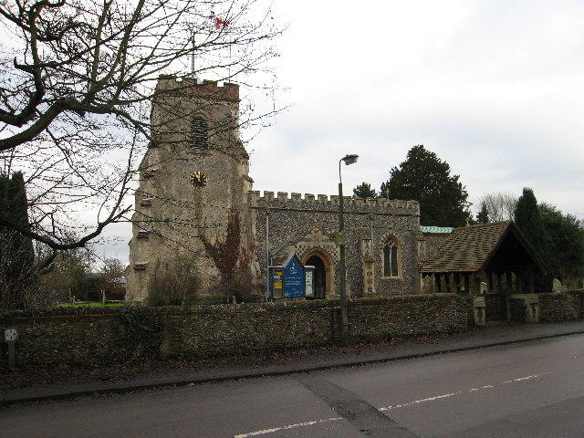
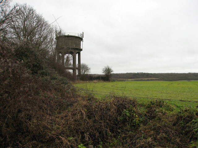
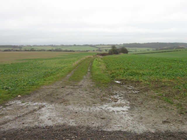
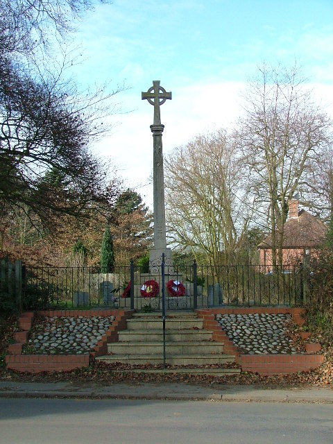
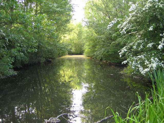
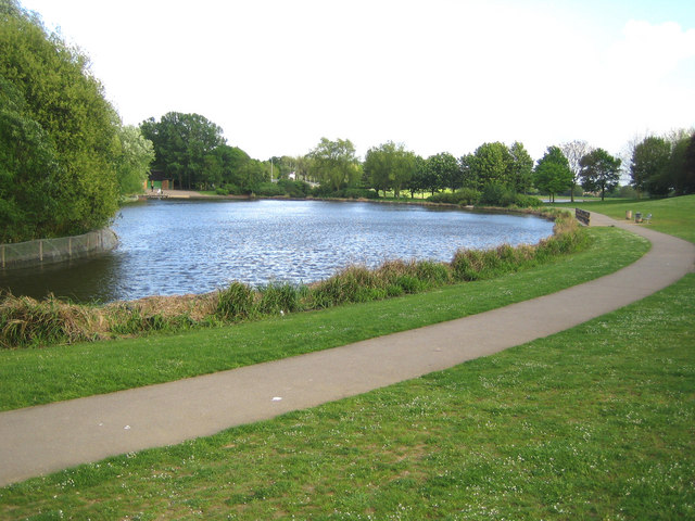
Aston End Images

Images are sourced within 2km of 51.901691/-0.152256 or Grid Reference TL2724. Thanks to Geograph Open Source API. All images are credited.

Hydean Way Shops Typical of local shops in Stevenage new town.  Above a parade of shops including a small supermarket, take away food outlet and Post Office there are maisonettes accessed from the rear.  To the right there are 2/3 bedroomed homes.
Hydean Way Shops
Typical of local shops in Stevenage new town. Above a parade of shops including a small supermarket, take away food outlet and Post Office there are maisonettes accessed from the rear. To the right there are 2/3 bedroomed homes.
Fairlands Valley Park This large lake is used by sailors and fishermen.  This photo is taken facing south.  To the rear there are two smaller lakes.  The park is very popular in the summer.
Fairlands Valley Park
This large lake is used by sailors and fishermen. This photo is taken facing south. To the rear there are two smaller lakes. The park is very popular in the summer.
Parishes Mead. Parishes mead is a newer development on the east side of Stevenage.  There is a mixture of private and social housing here.
Parishes Mead.
Parishes mead is a newer development on the east side of Stevenage. There is a mixture of private and social housing here.
Fortuna Close One of the more modern parts of Stevenage and with some more imaginative building - three storeys!
Fortuna Close
One of the more modern parts of Stevenage and with some more imaginative building - three storeys!
Ferrier Rd This could be any road in this area.  Plans seem to have been bought as a job lot.
Ferrier Rd
This could be any road in this area. Plans seem to have been bought as a job lot.
Telford Avenue. On the edge of TL2525..  I wasn't going any further into this estate.  I always get lost even though it's not that big by local standards.  This estate, in common with others in the area suffers from the increase in car ownership.  Parking is awkward, the roads not wide and the layout is twisting.
Telford Avenue.
On the edge of TL2525.. I wasn't going any further into this estate. I always get lost even though it's not that big by local standards. This estate, in common with others in the area suffers from the increase in car ownership. Parking is awkward, the roads not wide and the layout is twisting.
Ridlins Athletics Track This photo of the Ridlins Athletics track shows the west corner and the Bert Hill stand.  The back of the stand has space for community groups such as playgroups.
Ridlins Athletics Track
This photo of the Ridlins Athletics track shows the west corner and the Bert Hill stand. The back of the stand has space for community groups such as playgroups.
Football pitches These are to the north west of the running track.
Football pitches
These are to the north west of the running track.
War memorial - Walkern. Stuck out in rather an odd place.  It sits in the grass triangle at a junction just outside of Walkern.  There are no houses or other buildings in the immediate vicinity.
War memorial - Walkern.
Stuck out in rather an odd place. It sits in the grass triangle at a junction just outside of Walkern. There are no houses or other buildings in the immediate vicinity.
St Mary's Church, Aston The church is built of flint with stone dressings on the nave and chancel and the roofs are covered with copper.
St Mary's Church, Aston
The church is built of flint with stone dressings on the nave and chancel and the roofs are covered with copper.
Aston Water Tower The Water Tower and surrounding countryside from the lane to Aston End
Aston Water Tower
The Water Tower and surrounding countryside from the lane to Aston End
The Crown, Aston End
Just Outside Stevenage On the Stevenage boundary, looking across TL2725 from Stevenage Road and you are in open country.
Just Outside Stevenage
On the Stevenage boundary, looking across TL2725 from Stevenage Road and you are in open country.
Aston war memorial. Next door to the church.
Aston war memorial.
Next door to the church.
River Beane near Aston (1) Viewed looking downstream from the footbridge over the ford on Ford Lane, the river bed is totally dry here.

Please compare with <a href="https://www.geograph.org.uk/photo/5916512">TL2823 : River Beane near Aston (2)</a> taken nearly 10 years later!
River Beane near Aston (1)
Viewed looking downstream from the footbridge over the ford on Ford Lane, the river bed is totally dry here. Please compare with TL2823 : River Beane near Aston (2) taken nearly 10 years later!
Stevenage: Fairlands Valley Park The second lake, going downstream, of the four in the park, this is the reverse view from <a href="https://www.geograph.org.uk/photo/175166">TL2524 : Stevenage: Fairlands Valley Park</a>
Stevenage: Fairlands Valley Park
The second lake, going downstream, of the four in the park, this is the reverse view from TL2524 : Stevenage: Fairlands Valley Park
Stevenage: Fairlands Valley Park The second lake going downstream viewed from the weir to the third lake.
Stevenage: Fairlands Valley Park
The second lake going downstream viewed from the weir to the third lake.
Stevenage: Fairlands Valley Park The third of the four lakes going downstream. Fairlands was the name of the hamlet in the area before the post-war urban sprawl of Stevenage swallowed it up.
Stevenage: Fairlands Valley Park
The third of the four lakes going downstream. Fairlands was the name of the hamlet in the area before the post-war urban sprawl of Stevenage swallowed it up.
Show me another place!

Aston End is located at Grid Ref: TL2724 (Lat: 51.901691, Lng: -0.152256)

Administrative County: Hertfordshire

District: East Hertfordshire

Police Authority: Hertfordshire

What 3 Words

///treetop.revival.inquest. Near Walkern, Hertfordshire

Nearby Locations

New Wood Aston End

Related Wikis

Aston End

Aston End is a hamlet in Hertfordshire, England. It is in the civil parish of Aston. It features a pub and a butchers, as well as a few houses. == References... ==

Benington High Wood

Benington High Wood is a 20.7-hectare (51-acre) biological Site of Special Scientific Interest in Benington, Hertfordshire. The planning authority is East...

Aston, Hertfordshire

Aston is a village and civil parish in the East Hertfordshire district of Hertfordshire, England. According to the 2001 census it had a population of...

The Nobel School

The Nobel School is a co-educational secondary school and sixth form located in Stevenage in the English county of Hertfordshire. == History == The Nobel...

Marriotts School

Marriotts School is a secondary school in Stevenage, Hertfordshire, England. The school was rebuilt along with Lonsdale School (for special needs children...

Barnwell School

Barnwell School is a coeducational secondary school and sixth form that was established in 1959 and is situated in the south of Stevenage, Hertfordshire...

Shephall

Shephall (SHEP-all) is a neighbourhood of the new town of Stevenage in Hertfordshire. It was formerly a separate village and parish, being absorbed into...

Ridlins Mire

Ridlins Mire is a 1.6-hectare (4.0-acre) nature reserve managed by the Herts and Middlesex Wildlife Trust in Stevenage, Hertfordshire, England.This wetland...

Nearby Amenities

Located within 500m of 51.901691,-0.152256
Aston End
Place: village
Wikidata: Q427078
Lat/Long: 51.9000613/-0.1503467
Note: Signpost here points north as bridleway and nothing to the south (this disagrees with the hertfordshire_county_council_prow_gis_data.
Lat/Long: 51.9041402/-0.1505282
Pub
The Crown
Addr City: Stevenage
Addr Housenumber: 56
Addr Postcode: SG2 7HD
Addr Street: Long Lane
Smoking: outside
Lat/Long: 51.9020089/-0.1509465
Barrier: kissing_gate
Lat/Long: 51.899348/-0.1491169
Barrier: kissing_gate
Foot: yes
Lat/Long: 51.8998815/-0.1478183
Barrier: kissing_gate
Foot: yes
Lat/Long: 51.9012894/-0.1479645
Barrier: entrance
Foot: yes
Wheelchair: no
Lat/Long: 51.9033709/-0.14859
Landuse: farm
Note Retag: CS #48756035
Lat/Long: 51.901446/-0.1499385
Barrier: kissing_gate
Lat/Long: 51.8973964/-0.1528631
Barrier: kissing_gate
Lat/Long: 51.8975044/-0.1529816
Bench
Backrest: yes
Colour: green
Material: metal
Seats: 3
Lat/Long: 51.8978047/-0.148647
Note: Marker post for "Circular Walk Town to Country No 3"
Lat/Long: 51.9027784/-0.1506432
Barrier: kissing_gate
Lat/Long: 51.9027846/-0.150626
Post Box
Check Date: 2021-03-28
Collection Times: Mo-Fr 09:00, Sa 07:00
Post Box Type: wall
Ref: SG2 97
Royal Cypher: VR
Royal Cypher Wikidata: Q33102356
Lat/Long: 51.901279/-0.157977
Post Box
Check Date: 2021-05-09
Collection Times: Mo-Fr 17:45, Sa 11:30
Post Box Type: pillar
Ref: SG2 414
Royal Cypher: EIIR
Royal Cypher Wikidata: Q33102113
Lat/Long: 51.898769/-0.157759
Post Box
Collection Times: Mo-Fr 17:00; Sa 09:00
Ref: SG2 197
Lat/Long: 51.901917/-0.15121
Barrier: kissing_gate
Foot: yes
Lat/Long: 51.8980307/-0.1532835
Barrier: kissing_gate
Foot: yes
Lat/Long: 51.8981334/-0.1533322
Material: wood
Power: pole
Lat/Long: 51.9060552/-0.1509412
Power: pole
Lat/Long: 51.905112/-0.1516317
Material: wood
Power: pole
Lat/Long: 51.9007751/-0.1567551
Material: wood
Power: pole
Lat/Long: 51.9014123/-0.1558673
Power: pole
Lat/Long: 51.9029489/-0.1538208
Power: pole
Lat/Long: 51.9049149/-0.1528579
Power: pole
Lat/Long: 51.9035264/-0.1536076
Material: wood
Power: pole
Lat/Long: 51.902037/-0.155072
Power: pole
Lat/Long: 51.9024457/-0.1543934
Barrier: kissing_gate
Lat/Long: 51.9041547/-0.1462074
Barrier: kissing_gate
Foot: yes
Source: GPS, observation
Lat/Long: 51.900938/-0.150032
Waste Basket
Lat/Long: 51.8987281/-0.1566692
Grit Bin
Lat/Long: 51.898877/-0.1573568
The data included in this document is from www.openstreetmap.org. The data is made available under ODbL.

Have you been to Aston End?

Leave your review of Aston End below (or comments, questions and feedback).