Aston Cross

Settlement in Gloucestershire Tewkesbury

England

Aston Cross

Cut silage field and hedgerow  Looking east towards the A435.
Cut silage field and hedgerow Credit: JThomas

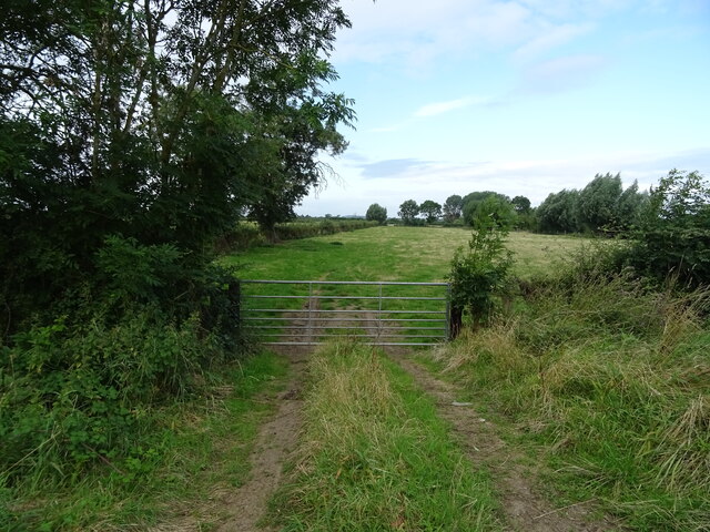
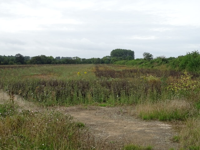
Aston Cross is a small village located in the county of Gloucestershire, England. Situated approximately 7 miles southwest of the city of Gloucester, it falls within the administrative district of Tewkesbury. The village is nestled in the picturesque countryside, surrounded by rolling hills and lush green fields, offering residents and visitors a peaceful and idyllic setting.

Historically, Aston Cross was predominantly an agricultural community, with farming playing a vital role in the local economy. However, in recent years, the village has seen some diversification, with a few small businesses and services emerging.

The village itself is characterized by a charming mix of traditional stone cottages and modern houses, giving it a unique blend of old-world charm and contemporary living. The community in Aston Cross is tight-knit, with a friendly and welcoming atmosphere.

For those seeking outdoor activities, Aston Cross offers ample opportunities. There are several walking trails and footpaths that meander through the surrounding countryside, allowing residents and visitors to explore the natural beauty of the area. Additionally, the nearby River Severn provides opportunities for boating and fishing enthusiasts.

Although Aston Cross is a small village, it benefits from its proximity to larger towns and cities. The city of Gloucester is easily accessible, offering a wider range of amenities, including shopping centers, restaurants, and cultural attractions.

In summary, Aston Cross is a charming village in Gloucestershire, known for its tranquil setting and natural beauty. It offers a peaceful lifestyle while still providing easy access to nearby urban centers.

If you have any feedback on the listing, please let us know in the comments section below.

Aston Cross Images

Images are sourced within 2km of 52.0005/-2.087367 or Grid Reference SO9433. Thanks to Geograph Open Source API. All images are credited.

Cut silage field and hedgerow  Looking east towards the A435.
Cut silage field and hedgerow
Looking east towards the A435.
Field of beans near Oxenton
Footpath towards the B4079 Little used path - looking south.
Footpath towards the B4079
Little used path - looking south.
Field margin near Pamington Off the B4079.
Field margin near Pamington
Off the B4079.
Crop field off the B4079 near Pamington
Sharp bend in the B4079 towards Pamington
Grazing, Pamington Off the B4079.
Grazing, Pamington
Off the B4079.
Concrete farm track off the B4079, Pamington
B4079, Pamington Towards Aston Cross.
B4079, Pamington
Towards Aston Cross.
Ashchurch MOD Depot
Ashchurch MOD Depot
A46 towards Ashchurch
KX100 telephone box on the A46, Aston Cross Unloved but still working.
KX100 telephone box on the A46, Aston Cross
Unloved but still working.
Course of disused railway near Aston on Carrant The former Ashchurch to Evesham Railway - looking east from the bridge on the B4079.
Course of disused railway near Aston on Carrant
The former Ashchurch to Evesham Railway - looking east from the bridge on the B4079.
B4079 heading north Towards Kinsham.
B4079 heading north
Towards Kinsham.
Field entrance off the B4079 near Aston on Carrant
Grazing towards the Carrant Brook
Sharp bend in the B4079 near Aston on Carrant Towards Kinsham.
Sharp bend in the B4079 near Aston on Carrant
Towards Kinsham.
Crop field and hedgerow near Barn Farm Cottage Off the B4079.
Crop field and hedgerow near Barn Farm Cottage
Off the B4079.
Show me another place!

Aston Cross is located at Grid Ref: SO9433 (Lat: 52.0005, Lng: -2.087367)

Administrative County: Gloucestershire

District: Tewkesbury

Police Authority: Gloucestershire

What 3 Words

///crossings.slung.slept. Near Bredon, Worcestershire

Nearby Locations

Pamington Aston Cross

Related Wikis

Ashchurch

Ashchurch is a village and former civil parish, now in the parish of Ashchurch Rural, in the Tewkesbury district, in the county of Gloucestershire, England...

Ashchurch for Tewkesbury railway station

Ashchurch for Tewkesbury is a railway station serving the medieval market town of Tewkesbury and the village of Ashchurch in Gloucestershire, England....

Northway, Gloucestershire

Northway is a village and civil parish in Gloucestershire, England, 2 miles north-east of Tewkesbury, and is in effect a suburb of that town. The parish...

Teddington, Gloucestershire

Teddington is a village and parish in Gloucestershire, England. == Population == The village had a population of less than 300, of which the majority were...

Oxenton

Oxenton is a village and civil parish 11 miles (18 km) north east of Gloucester, in the Tewkesbury district, in the county of Gloucestershire, England...

Alderman Knight School

Alderman Knight School is a mixed special school located in Tewkesbury in the English county of Gloucestershire.The school is named after Cameron Knight...

Tewkesbury Rural District

Tewkesbury Rural District was from 1894 to 1935 a rural district in the southwestern part of the Midlands in England. It had the unusual feature of including...

Tewkesbury School

Tewkesbury Academy (previously Tewkesbury School) is a secondary school in the English town of Tewkesbury in Gloucestershire. It has been an academy since...

Nearby Amenities

Located within 500m of 52.0005,-2.087367
Traffic Signals
Lat/Long: 52.0021396/-2.0859809
Pamington
Created By: Potlatch 0.10b
Place: hamlet
Source: npe
Lat/Long: 51.9964523/-2.0880834
Ellendene Drive
Lat/Long: 51.9971629/-2.0853399
Aston Cross
Place: hamlet
Lat/Long: 52.0010443/-2.0871849
Bus Stop
Tewkesbury Rd
Bus: yes
Naptan AtcoCode: 1600GL177
Naptan Bearing: NE
Naptan CommonName: Tewkesbury Rd
Naptan NaptanCode: glodpwtg
Naptan Street: A46
Naptan Verified: no
Public Transport: platform
Source: naptan_import
Lat/Long: 52.001353/-2.0887273
Bus Stop
Tewkesbury Rd
Bus: yes
Naptan AtcoCode: 1600GL178
Naptan Bearing: SW
Naptan CommonName: Tewkesbury Rd
Naptan NaptanCode: glodpwma
Naptan Street: A46
Public Transport: platform
Source: naptan_import
Lat/Long: 52.0008609/-2.0897199
Bus Stop
Queen's Head Inn
Bus: yes
Naptan AtcoCode: 1600GL179
Naptan Bearing: NW
Naptan CommonName: Queen's Head Inn
Naptan Indicator: Opp
Naptan NaptanCode: glodtadp
Naptan Street: B4079
Naptan Verified: no
Public Transport: platform
Source: naptan_import
Lat/Long: 52.0016878/-2.0859165
Bus Stop
Queen's Head Inn
Bus: yes
Naptan AtcoCode: 1600GL180
Naptan Bearing: SE
Naptan CommonName: Queen's Head Inn
Naptan NaptanCode: glodtagm
Naptan Street: B4079
Naptan Verified: no
Public Transport: platform
Source: naptan_import
Lat/Long: 52.0012924/-2.0855224
Bus Stop
Bredon Rd
Bus: yes
Naptan AtcoCode: 1600GLA57069
Naptan Bearing: NW
Naptan CommonName: Bredon Rd
Naptan NaptanCode: glogmwpj
Naptan Street: Bredon Rd
Naptan Verified: no
Public Transport: platform
Source: naptan_import
Lat/Long: 52.0024069/-2.0861364
Telephone
Booth: KX100
Covered: booth
Operator: BT
Source: drive-by survey
Lat/Long: 52.0011152/-2.0889581
Post Box
Operator: Royal Mail
Post Box Type: lamp
Source: drive-by survey
Lat/Long: 52.0013481/-2.0881883
J. D. Auto Service
Addr City: Tewkesbury
Addr Place: Aston Cross
Addr Postcode: GL20 8HX
Shop: car_repair
Lat/Long: 52.0023919/-2.0858336
Addr Hamlet: Aston Cross
Addr Housename: Manor Cottages
Addr Street: Bredon Road
Addr Unit: 1
Lat/Long: 52.0029312/-2.0864406
Give Way
Direction: backward
Lat/Long: 51.9988348/-2.0937484
Addr Hamlet: Aston Cross
Addr Housename: Hill View
Addr Street: Bredon Road
Lat/Long: 52.0026064/-2.0863107
Fixme: check name change point
Lat/Long: 51.999748/-2.0907256
Aston Cross South
Location Transition: yes
Power: pole
Transformer: distribution
Voltage Primary: 11000
Lat/Long: 52.0006034/-2.0863925
Power: pole
Lat/Long: 52.0003218/-2.0862906
Power: pole
Lat/Long: 51.9996126/-2.0860733
Power: pole
Lat/Long: 51.9989116/-2.0858493
Pamington Estate
Power: pole
Transformer: distribution
Voltage Primary: 11000
Lat/Long: 51.9975351/-2.0854041
Power: pole
Lat/Long: 51.998218/-2.0856401
Power: pole
Lat/Long: 51.9978778/-2.0865668
Location Transition: yes
Power: pole
Lat/Long: 51.9976334/-2.0872454
Location Transition: yes
Power: pole
Lat/Long: 51.9968556/-2.0882566
Power: pole
Lat/Long: 51.9961364/-2.0882332
Power: pole
Lat/Long: 51.9967342/-2.0888025
Pamington
Power: pole
Transformer: distribution
Voltage Primary: 11000
Lat/Long: 51.9966153/-2.0893469
Aston Cross Chapel
Power: pole
Transformer: distribution
Voltage Primary: 11000
Lat/Long: 52.0040504/-2.0861987
Location Transition: yes
Power: pole
Lat/Long: 52.0039183/-2.0863523
Power: pole
Lat/Long: 52.003962/-2.0854001
Power: pole
Lat/Long: 52.0041081/-2.0843661
Barrier: yes
Lat/Long: 51.997424/-2.087548
The data included in this document is from www.openstreetmap.org. The data is made available under ODbL.

Have you been to Aston Cross?

Leave your review of Aston Cross below (or comments, questions and feedback).