New Wood

Wood, Forest in Hertfordshire East Hertfordshire

England

New Wood

Fairlands Valley Park This large lake is used by sailors and fishermen.  This photo is taken facing south.  To the rear there are two smaller lakes.  The park is very popular in the summer.
Fairlands Valley Park Credit: Robin Hall

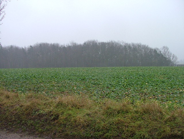
New Wood, located in Hertfordshire, England, is a picturesque forested area that attracts nature enthusiasts and outdoor adventurers alike. Covering an expansive area, this woodland is renowned for its diverse flora and fauna, making it an important ecological site within the region.

The forest's dense canopy is primarily composed of deciduous trees, including oak, beech, and birch, which provide shelter and food for a wide variety of wildlife. The forest floor is adorned with a rich carpet of wildflowers, creating a vibrant and colorful landscape during the spring and summer months.

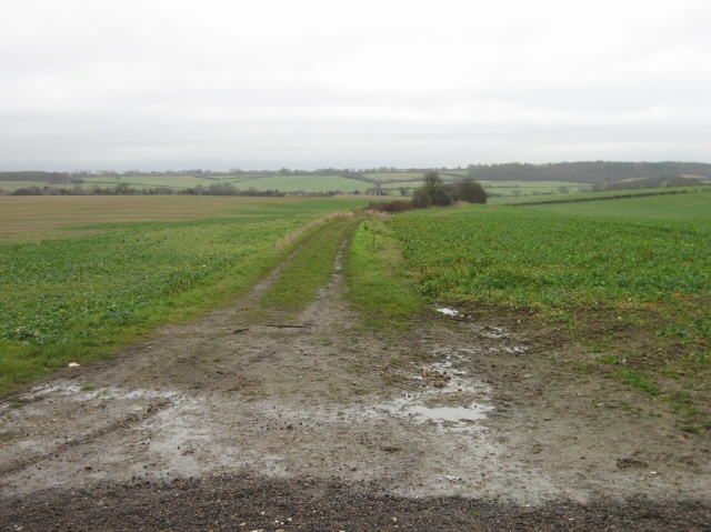
Numerous walking trails wind through the forest, allowing visitors to explore its natural beauty at their own pace. These paths provide an opportunity to spot various woodland creatures, such as deer, foxes, and a variety of bird species. Additionally, the forest is home to several designated picnic areas, offering visitors a chance to relax and enjoy their surroundings.

New Wood is also a popular destination for outdoor activities such as cycling and horse riding. The well-maintained trails and bridleways provide ample opportunities for enthusiasts to explore the forest on wheels or horseback.

Managed by the local forestry commission, New Wood is dedicated to preserving its natural heritage. Conservation efforts are in place to protect and enhance the forest's biodiversity, ensuring that future generations can enjoy its beauty and ecological significance.

Overall, New Wood in Hertfordshire is a stunning forested area, offering a tranquil retreat from urban life. Whether it's for a leisurely walk, a picnic with loved ones, or a chance to immerse oneself in nature, this woodland provides a captivating experience for all who visit.

If you have any feedback on the listing, please let us know in the comments section below.

New Wood Images

Images are sourced within 2km of 51.903689/-0.14835966 or Grid Reference TL2724. Thanks to Geograph Open Source API. All images are credited.

Fairlands Valley Park This large lake is used by sailors and fishermen.  This photo is taken facing south.  To the rear there are two smaller lakes.  The park is very popular in the summer.
Fairlands Valley Park
This large lake is used by sailors and fishermen. This photo is taken facing south. To the rear there are two smaller lakes. The park is very popular in the summer.
Parishes Mead. Parishes mead is a newer development on the east side of Stevenage.  There is a mixture of private and social housing here.
Parishes Mead.
Parishes mead is a newer development on the east side of Stevenage. There is a mixture of private and social housing here.
Fortuna Close One of the more modern parts of Stevenage and with some more imaginative building - three storeys!
Fortuna Close
One of the more modern parts of Stevenage and with some more imaginative building - three storeys!
Ferrier Rd This could be any road in this area.  Plans seem to have been bought as a job lot.
Ferrier Rd
This could be any road in this area. Plans seem to have been bought as a job lot.
War memorial - Walkern. Stuck out in rather an odd place.  It sits in the grass triangle at a junction just outside of Walkern.  There are no houses or other buildings in the immediate vicinity.
War memorial - Walkern.
Stuck out in rather an odd place. It sits in the grass triangle at a junction just outside of Walkern. There are no houses or other buildings in the immediate vicinity.
Baron's Grove. This photo taken from the bridleway.  The trees look as though they are shrouded in mist because they are.
Baron's Grove.
This photo taken from the bridleway. The trees look as though they are shrouded in mist because they are.
St Mary's Church, Aston The church is built of flint with stone dressings on the nave and chancel and the roofs are covered with copper.
St Mary's Church, Aston
The church is built of flint with stone dressings on the nave and chancel and the roofs are covered with copper.
Aston Water Tower The Water Tower and surrounding countryside from the lane to Aston End
Aston Water Tower
The Water Tower and surrounding countryside from the lane to Aston End
The Crown, Aston End
Just Outside Stevenage On the Stevenage boundary, looking across TL2725 from Stevenage Road and you are in open country.
Just Outside Stevenage
On the Stevenage boundary, looking across TL2725 from Stevenage Road and you are in open country.
Aston war memorial. Next door to the church.
Aston war memorial.
Next door to the church.
River Beane near Aston (1) Viewed looking downstream from the footbridge over the ford on Ford Lane, the river bed is totally dry here.

Please compare with <a href="https://www.geograph.org.uk/photo/5916512">TL2823 : River Beane near Aston (2)</a> taken nearly 10 years later!
River Beane near Aston (1)
Viewed looking downstream from the footbridge over the ford on Ford Lane, the river bed is totally dry here. Please compare with TL2823 : River Beane near Aston (2) taken nearly 10 years later!
Fairlands Valley Park
Fairlands Valley Park lake looking north from the top edge of the large lake
Fairlands Valley Park lake
looking north from the top edge of the large lake
St Mary, Aston, Herts
St Mary, Aston, Herts - East end
St Mary, Aston, Herts - Window
Show me another place!

New Wood is located at Grid Ref: TL2724 (Lat: 51.903689, Lng: -0.14835966)

Administrative County: Hertfordshire

District: East Hertfordshire

Police Authority: Hertfordshire

What 3 Words

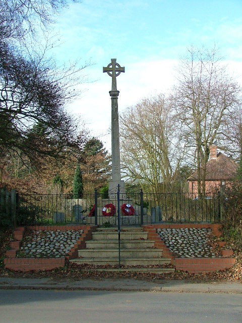
///bossy.presuming.uniforms. Near Walkern, Hertfordshire

Nearby Locations

Aston End New Wood

Related Wikis

Aston End

Aston End is a hamlet in Hertfordshire, England. It is in the civil parish of Aston. It features a pub and a butchers, as well as a few houses. == References... ==

Benington High Wood

Benington High Wood is a 20.7-hectare (51-acre) biological Site of Special Scientific Interest in Benington, Hertfordshire. The planning authority is East...

The Nobel School

The Nobel School is a co-educational secondary school and sixth form located in Stevenage in the English county of Hertfordshire. == History == The Nobel...

Aston, Hertfordshire

Aston is a village and civil parish in the East Hertfordshire district of Hertfordshire, England. According to the 2001 census it had a population of...

Marriotts School

Marriotts School is a secondary school in Stevenage, Hertfordshire, England. The school was rebuilt along with Lonsdale School (for special needs children...

Walkern

Walkern is a village and civil parish in East Hertfordshire, England. It is about two miles (3 km) from Stevenage. The village has several shops, including...

Benington Castle

Benington Castle is a ruined castle in the village of Benington, near Stevenage in Hertfordshire, England at grid reference TL296236. It has been protected...

Pryor's Wood

Pryor's Wood is an 8.7-hectare (21-acre) nature reserve in Great Ashby, near Stevenage in Hertfordshire. It was formerly managed by the Herts and Middlesex...

Nearby Amenities

Located within 500m of 51.903689,-0.14835966
Aston End
Place: village
Wikidata: Q427078
Lat/Long: 51.9000613/-0.1503467
Note: Signpost here points north as bridleway and nothing to the south (this disagrees with the hertfordshire_county_council_prow_gis_data.
Lat/Long: 51.9041402/-0.1505282
Pub
The Crown
Addr City: Stevenage
Addr Housenumber: 56
Addr Postcode: SG2 7HD
Addr Street: Long Lane
Smoking: outside
Lat/Long: 51.9020089/-0.1509465
Barrier: kissing_gate
Lat/Long: 51.899348/-0.1491169
Barrier: kissing_gate
Foot: yes
Lat/Long: 51.8998815/-0.1478183
Barrier: kissing_gate
Foot: yes
Lat/Long: 51.9012894/-0.1479645
Barrier: entrance
Foot: yes
Wheelchair: no
Lat/Long: 51.9033709/-0.14859
Landuse: farm
Note Retag: CS #48756035
Lat/Long: 51.901446/-0.1499385
Landuse: farm
Note Retag: CS #48756035
Lat/Long: 51.9063213/-0.1493485
Note: Marker post for "Circular Walk Town to Country No 3"
Lat/Long: 51.9027784/-0.1506432
Barrier: kissing_gate
Lat/Long: 51.9027846/-0.150626
Post Box
Collection Times: Mo-Fr 17:00; Sa 09:00
Ref: SG2 197
Lat/Long: 51.901917/-0.15121
Material: wood
Power: pole
Lat/Long: 51.9005974/-0.1433774
Material: wood
Power: pole
Lat/Long: 51.9028912/-0.1429536
Material: wood
Power: pole
Lat/Long: 51.9020538/-0.143085
Material: wood
Power: pole
Lat/Long: 51.9014762/-0.143203
Material: wood
Power: pole
Lat/Long: 51.9062076/-0.1440546
Material: wood
Power: pole
Lat/Long: 51.9069952/-0.1443537
Material: wood
Power: pole
Lat/Long: 51.905026/-0.1436992
Material: wood
Power: pole
Lat/Long: 51.9074092/-0.1460822
Material: wood
Power: pole
Lat/Long: 51.9038378/-0.1432647
Material: wood
Power: pole
Lat/Long: 51.9078014/-0.1476299
Material: wood
Power: pole
Lat/Long: 51.9060552/-0.1509412
Power: pole
Lat/Long: 51.905112/-0.1516317
Material: wood
Power: pole
Lat/Long: 51.9071011/-0.1501846
Power: pole
Lat/Long: 51.9029489/-0.1538208
Power: pole
Lat/Long: 51.9049149/-0.1528579
Power: pole
Lat/Long: 51.9035264/-0.1536076
Material: wood
Power: pole
Lat/Long: 51.902037/-0.155072
Power: pole
Lat/Long: 51.9024457/-0.1543934
Barrier: kissing_gate
Lat/Long: 51.9041547/-0.1462074
Barrier: kissing_gate
Foot: yes
Source: GPS, observation
Lat/Long: 51.900938/-0.150032
Barrier: kissing_gate
Lat/Long: 51.9042853/-0.1461956
The data included in this document is from www.openstreetmap.org. The data is made available under ODbL.

Have you been to New Wood?

Leave your review of New Wood below (or comments, questions and feedback).