Two Acre Plantation

Wood, Forest in Cambridgeshire South Cambridgeshire

England

Two Acre Plantation

Great Abington, St Mary <span class="nowrap"><a title="http://www.druidic.org/camchurch/churches/gtabington.htm" rel="nofollow ugc noopener" href="http://www.druidic.org/camchurch/churches/gtabington.htm">Link</a><img style="margin-left:2px;" alt="External link" title="External link - shift click to open in new window" src="https://s1.geograph.org.uk/img/external.png" width="10" height="10"/></span>
Great Abington, St Mary Credit: mym

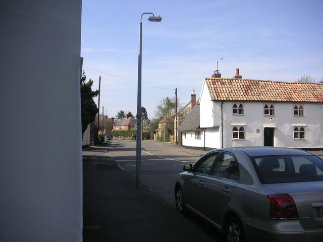
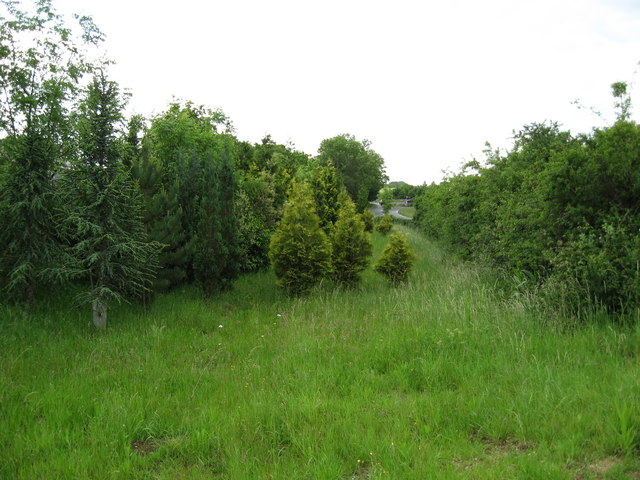
Two Acre Plantation is a charming woodland area located in Cambridgeshire, England. Covering an expanse of approximately two acres, this plantation is a haven for nature enthusiasts and outdoor lovers alike. The woodland is primarily composed of various types of trees, creating a lush and vibrant forest setting.

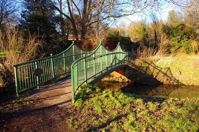
Situated in the heart of Cambridgeshire, Two Acre Plantation offers visitors a tranquil escape from the hustle and bustle of everyday life. The plantation is easily accessible, with well-maintained footpaths meandering through the woodland, allowing visitors to explore the area at their own pace. These paths lead to secluded clearings and quiet glades, where one can sit and soak in the serene atmosphere.

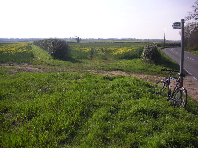
The woodland is home to a diverse range of flora and fauna, making it an ideal spot for nature lovers and wildlife enthusiasts. Visitors may spot a variety of bird species, including woodpeckers and thrushes, as well as small mammals such as squirrels and rabbits. The trees themselves provide a habitat for numerous insects and fungi, adding to the ecological richness of the area.

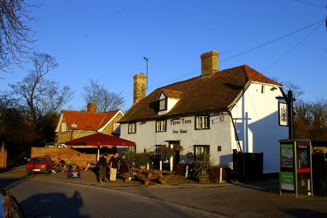
Two Acre Plantation is also popular among walkers and hikers, who can enjoy the peaceful ambiance while traversing the well-marked trails. The plantation's proximity to nearby villages and towns makes it a popular destination for day trips and picnics.

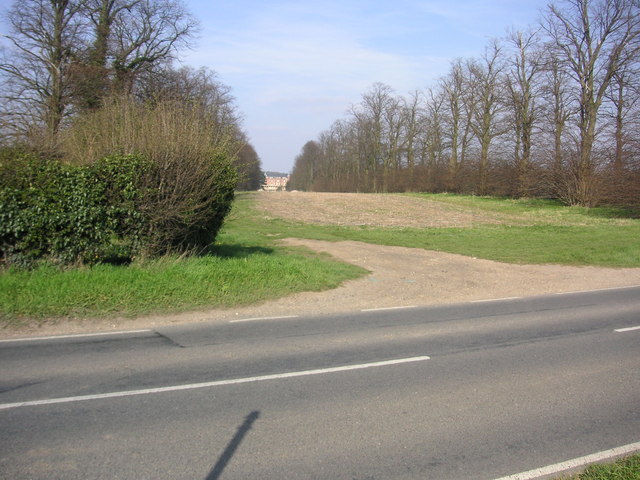
Overall, Two Acre Plantation offers a delightful woodland experience, showcasing the natural beauty of Cambridgeshire's landscape. Whether one seeks solitude, wildlife encounters, or simply a refreshing stroll amidst nature, this plantation is a must-visit destination for all nature lovers.

If you have any feedback on the listing, please let us know in the comments section below.

Two Acre Plantation Images

Images are sourced within 2km of 52.12659/0.21678617 or Grid Reference TL5149. Thanks to Geograph Open Source API. All images are credited.

Great Abington, St Mary <span class="nowrap"><a title="http://www.druidic.org/camchurch/churches/gtabington.htm" rel="nofollow ugc noopener" href="http://www.druidic.org/camchurch/churches/gtabington.htm">Link</a><img style="margin-left:2px;" alt="External link" title="External link - shift click to open in new window" src="https://s1.geograph.org.uk/img/external.png" width="10" height="10"/></span>
Great Abington, St Mary
Little Abington, St Mary <span class="nowrap"><a title="http://www.druidic.org/camchurch/churches/ltabington.htm" rel="nofollow ugc noopener" href="http://www.druidic.org/camchurch/churches/ltabington.htm">Link</a><img style="margin-left:2px;" alt="External link" title="External link - shift click to open in new window" src="https://s1.geograph.org.uk/img/external.png" width="10" height="10"/></span>
Little Abington, St Mary
Great Abington High Street A view of the three tuns pub from outside Abington school.
Great Abington High Street
A view of the three tuns pub from outside Abington school.
Abington Social Club, Great Abington, Cambs.
Two Acre Plantation Two Acre Plantation viewed from footbridge over A11
Two Acre Plantation
Two Acre Plantation viewed from footbridge over A11
Little Abington The building bordering the image to the left is the Little Abington Pottery.
Little Abington
The building bordering the image to the left is the Little Abington Pottery.
Footpath diverging from Sawston Road Footpath diverging from Sawston Road near Church Farm. At the horizon there are the buildings of Sawston visible.
Footpath diverging from Sawston Road
Footpath diverging from Sawston Road near Church Farm. At the horizon there are the buildings of Sawston visible.
Babraham Hall viewed from Sawston Road Babraham Hall viewed from Sawston Road near Church Farm
Babraham Hall viewed from Sawston Road
Babraham Hall viewed from Sawston Road near Church Farm
Course of old railway Course of the old Cambridge to Haverhill railway line (part of the 'Stour Valley Line') near Pampisford. The site of Pampisford station is now lost under the widened A11 trunk road.
Course of old railway
Course of the old Cambridge to Haverhill railway line (part of the 'Stour Valley Line') near Pampisford. The site of Pampisford station is now lost under the widened A11 trunk road.
Millennium bridge over the Granta This footbridge linking the parishes of Great and Little Abington was constructed and presented in 2000 by Granta Park and TWI. <span class="nowrap"><a title="http://www.twi.co.uk" rel="nofollow ugc noopener" href="http://www.twi.co.uk">Link</a><img style="margin-left:2px;" alt="External link" title="External link - shift click to open in new window" src="https://s1.geograph.org.uk/img/external.png" width="10" height="10"/></span>
Millennium bridge over the Granta
This footbridge linking the parishes of Great and Little Abington was constructed and presented in 2000 by Granta Park and TWI. LinkExternal link
Three Tuns The free house in Abington.
Three Tuns
The free house in Abington.
Thatched cottage A traditional building in the High Street.
Thatched cottage
A traditional building in the High Street.
Abington cottage A brick and flint cottage with pretty Gothic windows and a weatherboarded extension in Church Lane.
Abington cottage
A brick and flint cottage with pretty Gothic windows and a weatherboarded extension in Church Lane.
Abingtons village sign East Anglian village signs are usually freestanding; exceptionally, this shared sign for Great and Little Abington is a mosaic on the parapet of the bridge over the Granta, which forms the boundary between the two parishes.
Abingtons village sign
East Anglian village signs are usually freestanding; exceptionally, this shared sign for Great and Little Abington is a mosaic on the parapet of the bridge over the Granta, which forms the boundary between the two parishes.
St Mary's Church, Great Abington The church stands in parkland, away from the houses of the village street.
St Mary's Church, Great Abington
The church stands in parkland, away from the houses of the village street.
Snowdrops (Galanthus nivalis) Early harbingers of spring on the edge of St Mary's churchyard.
Snowdrops (Galanthus nivalis)
Early harbingers of spring on the edge of St Mary's churchyard.
St Mary's churchyard The churchyard and north side of the parish church.
St Mary's churchyard
The churchyard and north side of the parish church.
Show me another place!

Two Acre Plantation is located at Grid Ref: TL5149 (Lat: 52.12659, Lng: 0.21678617)

Administrative County: Cambridgeshire

District: South Cambridgeshire

Police Authority: Cambridgeshire

What 3 Words

///profile.major.booklets. Near Sawston, Cambridgeshire

Related Wikis

Abington railway station (England)

Abington railway station served Little Abington, Great Abington and Babraham in Cambridgeshire. It closed in 1851, along with its line which was one of...

Bourne Bridge railway station

Bourne Bridge railway station served Little Abington, Great Abington, Pampisford and Babraham in Cambridgeshire. It was closed in 1851, along with its...

Granta Park

Granta Park is a science, technology and biopharmaceutical park based on the bank of the River Granta in Great Abington near Cambridge, England. The idea...

Babraham Institute

The Babraham Institute is a life sciences research institution and a partner organisation of the University of Cambridge. The Babraham Institute is based...

Pampisford railway station

Pampisford railway station is a former British railway station in Pampisford, Cambridgeshire. It was on the Stour Valley Railway from 1865 to its closure...

Babraham

Babraham is a village and civil parish in the South Cambridgeshire district of Cambridgeshire, England, about 6 miles (9.7 km) south-east of Cambridge...

The Abingtons, Cambridgeshire

The Abingtons are a community in South Cambridgeshire consisting of two small villages: Little Abington and Great Abington, about 7 miles (11 km) south...

Pampisford Hall

Pampisford Hall is a country house designed by George Goldie in the civil parish of Pampisford in the English county of Cambridgeshire. It became a Grade...

Nearby Amenities

Located within 500m of 52.12659,0.21678617
Motorway Junction
Lat/Long: 52.1229131/0.2175133
Motorway Junction
Fourwentways
Lat/Long: 52.1266327/0.220147
Fuel
Shell
Addr City: Cambridge
Addr Postcode: CB21 6AR
Addr Street: Fourwentways Services
Addr Village: Little Abington
Brand: Shell
Brand Wikidata: Q110716465
Compressed Air: yes
Fhrs Id: 596767
Opening Hours: 24/7
Phone: +44 1223 837949
Ref Navads: NVDS353_10019190
Website: https://find.shell.com/gb/fuel/10019190-shell-four-went-ways
Wheelchair: yes
Lat/Long: 52.1270493/0.2227728
Fourwentways
Alt Name: Four Wents
Is In: Cambridgeshire, England, UK
Place: hamlet
Source Name: local knowledge
Lat/Long: 52.1283875/0.2227686
Fountain
Lat/Long: 52.1241142/0.2212003
Abington
Historic Railway: station
Railway: site
Source: wikipedia
Wikidata: Q4667876
Wikipedia: en:Abington railway station (England)
Lat/Long: 52.1281983/0.2204437
Fast Food
Greggs
Addr Country: GB
Addr Housename: A11 Four Went Ways
Addr Postcode: CB21 6AP
Addr Street: Newmarket Road
Brand: Greggs
Brand Wikidata: Q3403981
Brand Wikipedia: en:Greggs
Contact Website: https://www.greggs.co.uk/shop-finder?shop-code=5193
Cuisine: sandwich;bakery
Fhrs Id: 1215954
Takeaway: yes
Lat/Long: 52.1268262/0.2224722
Colour: red and white
Inscription: GAS NTS HP GAS PIPELINE
Marker: aerial
Material: plastic
Utility: gas
Lat/Long: 52.1263029/0.2148153
Colour: red
Marker: post
Material: concrete
Utility: gas
Lat/Long: 52.1263042/0.2148088
Colour: red and white
Marker: aerial
Material: plastic
Utility: gas
Lat/Long: 52.1308354/0.2185526
Fast Food
Burger King
Brand: Burger King
Brand Wikidata: Q177054
Cuisine: burger
Takeaway: yes
Lat/Long: 52.1267504/0.2224185
The data included in this document is from www.openstreetmap.org. The data is made available under ODbL.

Have you been to Two Acre Plantation?

Leave your review of Two Acre Plantation below (or comments, questions and feedback).