Mary Ann's Plantation

Wood, Forest in Essex Uttlesford

England

Mary Ann's Plantation

A short country lane leading to Church End Farm
A short country lane leading to Church End Farm Credit: Robert Edwards

Mary Ann's Plantation is a historic estate located in Essex, England, nestled within a serene woodland area known as Essex Wood or Essex Forest. The plantation dates back several centuries, with its origins tracing back to the 17th century. It is renowned for its stunning natural beauty and rich historical significance.

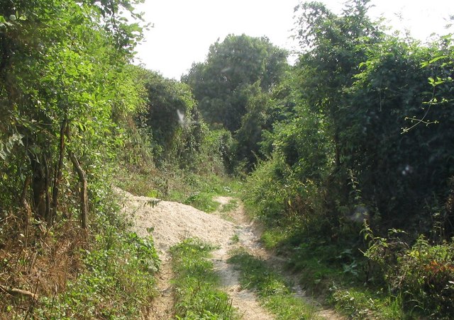
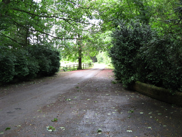
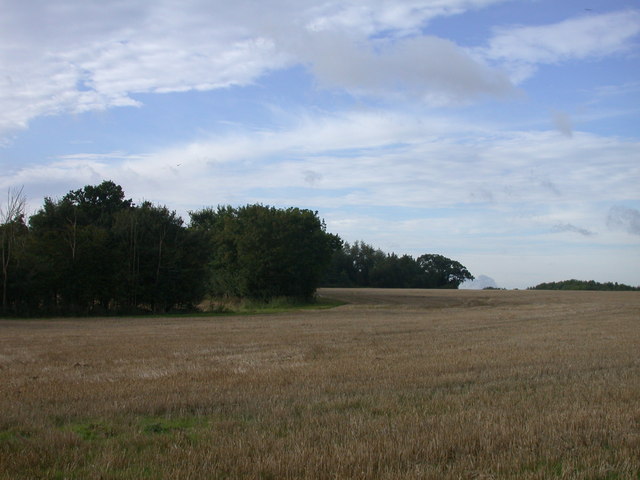
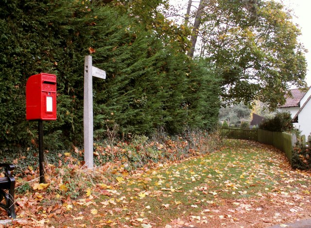
Covering an expansive area of land, Mary Ann's Plantation is characterized by its lush greenery, towering trees, and vibrant flora. The estate is a haven for nature enthusiasts, offering picturesque walking trails that meander through the enchanting woodland, providing visitors with the opportunity to immerse themselves in the tranquility of the surroundings.

The plantation itself boasts a fascinating history. Originally established as a farm, it evolved into a prosperous plantation during the colonial period, where crops such as tobacco and cotton were cultivated. The estate was named after Mary Ann, a prominent figure in the local community who played a pivotal role in the plantation's development.

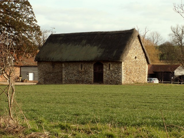
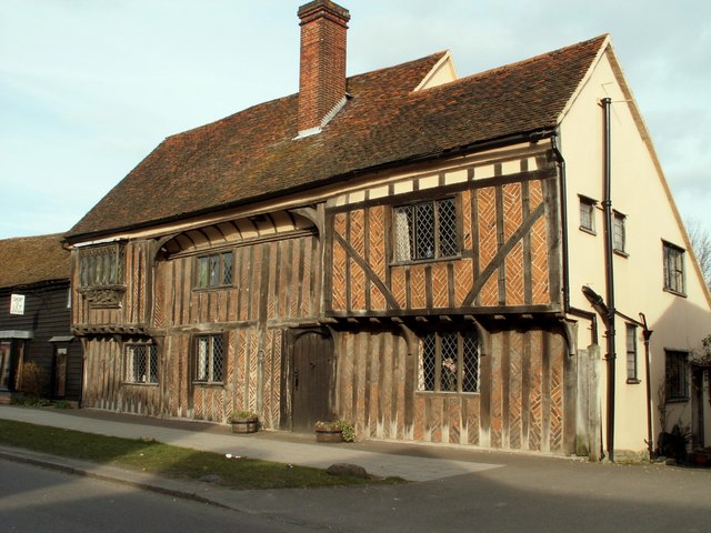
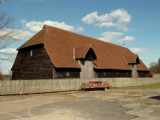
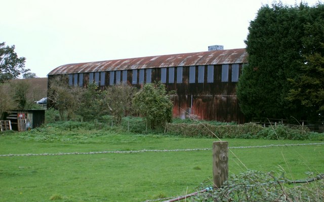
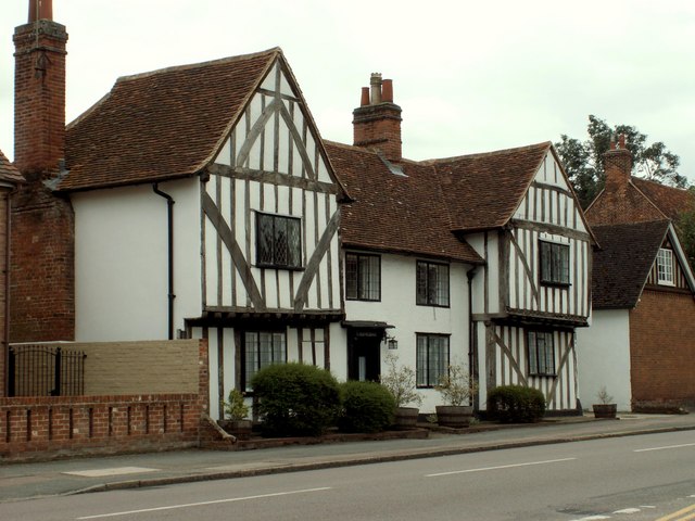
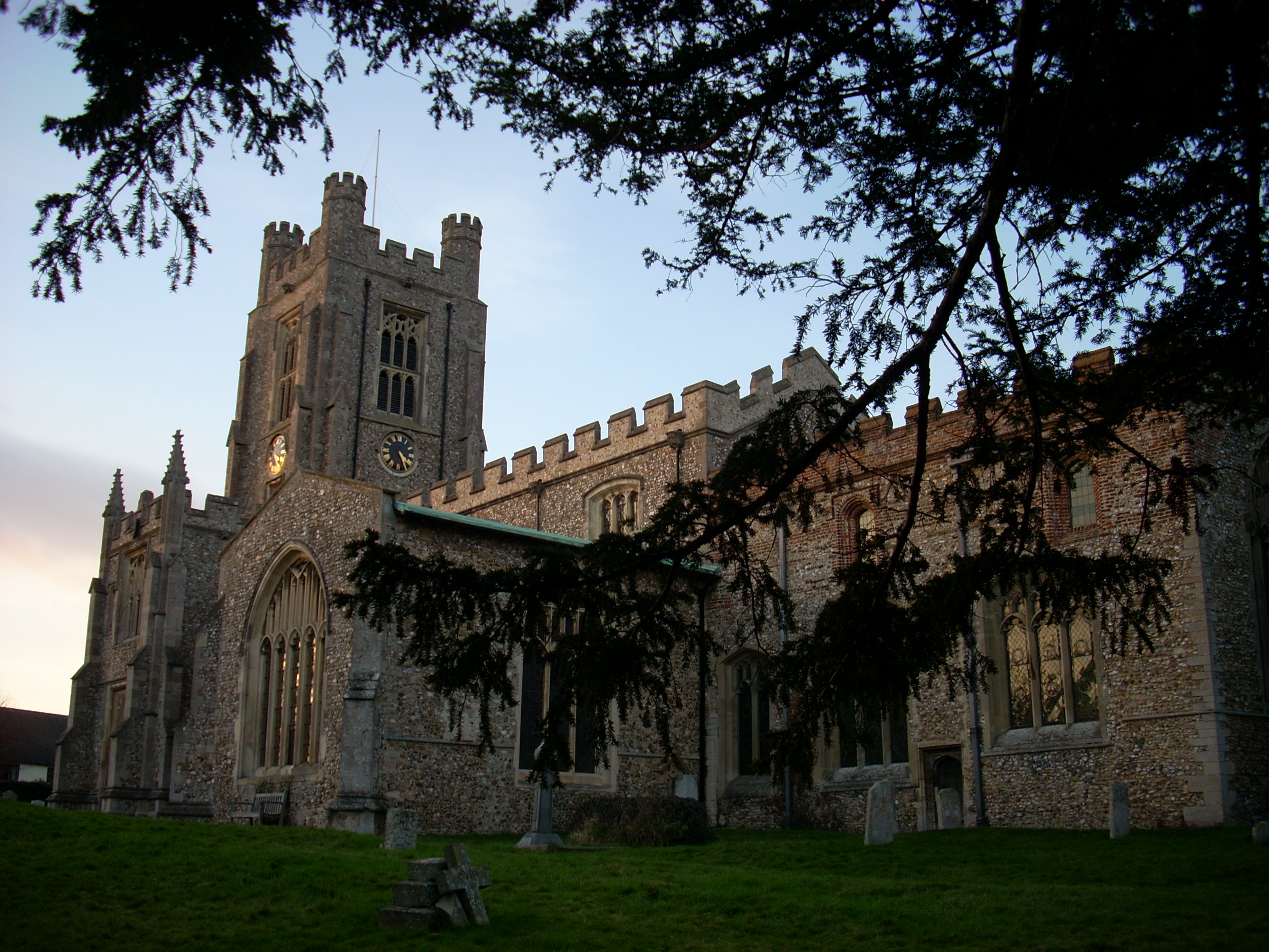
Today, Mary Ann's Plantation stands as a testament to the region's past, with several well-preserved historic buildings still standing on the estate. These include the main plantation house, barns, and outbuildings, which provide visitors with a glimpse into the lives of the plantation's inhabitants.

Visitors to Mary Ann's Plantation can explore the estate's grounds, admire the breathtaking scenery, and learn about the area's history through guided tours and interactive exhibits. The plantation also hosts various events throughout the year, including cultural festivals and educational programs, allowing visitors to engage with the rich heritage of the estate.

Mary Ann's Plantation is a cherished destination for those seeking a peaceful retreat, a connection to history, and a chance to revel in the natural beauty of Essex Wood.

If you have any feedback on the listing, please let us know in the comments section below.

Mary Ann's Plantation Images

Images are sourced within 2km of 51.966453/0.20884494 or Grid Reference TL5132. Thanks to Geograph Open Source API. All images are credited.

A short country lane leading to Church End Farm
Chapel of St. Helen, Bonhunt Farm, Essex Standing in the grounds of Bonhunt farm, near Newport, is the small Chapel of St. Helen. It's a complete Norman structure with a thatched roof.
Chapel of St. Helen, Bonhunt Farm, Essex
Standing in the grounds of Bonhunt farm, near Newport, is the small Chapel of St. Helen. It's a complete Norman structure with a thatched roof.
Monk's Barn, Newport, Essex This wonderful 15th century house stands on the high street of Newport. It has fine exposed timbers and brick-nogging. Below the oriel window, on the left, is a fine carving of the crowned Madonna rising from the clouds.
Monk's Barn, Newport, Essex
This wonderful 15th century house stands on the high street of Newport. It has fine exposed timbers and brick-nogging. Below the oriel window, on the left, is a fine carving of the crowned Madonna rising from the clouds.
Church approach, Newport, Essex St. Mary the Virgin church at Newport, was once a collegiate church which explains its size. It is mostly 13th century but the tower was only built in 1858 by G. E. Pritchett.
Church approach, Newport, Essex
St. Mary the Virgin church at Newport, was once a collegiate church which explains its size. It is mostly 13th century but the tower was only built in 1858 by G. E. Pritchett.
Quendon parish church, Essex This church dates back to the 13th century but this view from the south, shows much of the restoration of 1881.
Quendon parish church, Essex
This church dates back to the 13th century but this view from the south, shows much of the restoration of 1881.
Railway bridge near Widdington, Essex View looking East on a small country lane, which leads into the village of Widdington.
Railway bridge near Widdington, Essex
View looking East on a small country lane, which leads into the village of Widdington.
Prior's Hall Barn, Widdington, Essex One of the finest surviving medieval barns in eastern England, tree-ring dated to the mid-15th century, with a breathtaking aisled interior and crown post roof, the product of some 400 oaks. The property is in the care of English Heritage.
Prior's Hall Barn, Widdington, Essex
One of the finest surviving medieval barns in eastern England, tree-ring dated to the mid-15th century, with a breathtaking aisled interior and crown post roof, the product of some 400 oaks. The property is in the care of English Heritage.
Fountain and Drinking Trough, Quendon The inscription on the inside of the roof reads: This fountain and drinking trough were donated to the people of Quendon in 1887 by Henry Tufnell Esq. in memory of Col. Cranmer-Byng of Quendon Hall. They were later restored in memory of G.B. Beeman who lived at Manor Farm 1922-54.
Fountain and Drinking Trough, Quendon
The inscription on the inside of the roof reads: This fountain and drinking trough were donated to the people of Quendon in 1887 by Henry Tufnell Esq. in memory of Col. Cranmer-Byng of Quendon Hall. They were later restored in memory of G.B. Beeman who lived at Manor Farm 1922-54.
Shiptons Farm, just west of Widdington, Essex
Byway from St Helen's Chapel to Rickling Church This section of byway is surrounded by farmland and woodland. Its route is lined by thick hedge and passes through the chalk land in ancient deep cuttings. In this photograph badgers have covered the byway with chalk making passage quite tricky.
Byway from St Helen's Chapel to Rickling Church
This section of byway is surrounded by farmland and woodland. Its route is lined by thick hedge and passes through the chalk land in ancient deep cuttings. In this photograph badgers have covered the byway with chalk making passage quite tricky.
The Railway Station at Newport, Essex
Driveway to Quendon Hall Driveway leading through the woods to Quendon Hall
Driveway to Quendon Hall
Driveway leading through the woods to Quendon Hall
The Old Vicarage, High Street, Newport Dating back to the 14th century, this was originally a hall house.
The Old Vicarage, High Street, Newport
Dating back to the 14th century, this was originally a hall house.
Spring Close
Spring Close
Newport fire station Newport fire station, Debden Road, Newport, Eseex
Newport fire station
Newport fire station, Debden Road, Newport, Eseex
Public Bridleway at Quendon This is a view from the B.1383 road, which was once the busy A.11
Public Bridleway at Quendon
This is a view from the B.1383 road, which was once the busy A.11
The Maltings Newport
Newport station Note the covered car.I have not seen a car cover for years.
Newport station
Note the covered car.I have not seen a car cover for years.
Show me another place!

Mary Ann's Plantation is located at Grid Ref: TL5132 (Lat: 51.966453, Lng: 0.20884494)

Administrative County: Essex

District: Uttlesford

Police Authority: Essex

What 3 Words

///shams.equivocal.minus. Near Elsenham, Essex

Related Wikis

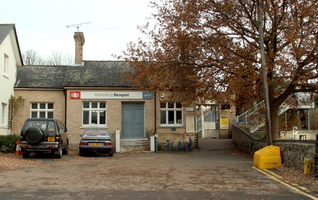
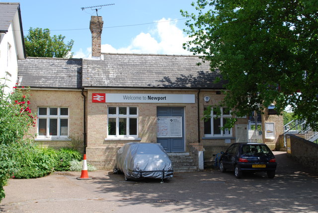
Newport railway station (Essex)

Newport railway station is on the West Anglia Main Line serving the village of Newport in Essex, England. It is 39 miles 72 chains (64.2 km) down the line...

Chapel of St Helen

Chapel of St Helen (also St Helen's Chapel) is an ancient religious building in Wicken Bonhunt, north-west Essex. It dates from around the 11th century...

Quendon

Quendon is a linear village and former civil parish, now in the parish of Quendon and Rickling, in the Uttlesford district, in the county of Essex, England...

Newport, Essex

Newport is a large village and civil parish in the Uttlesford district in Essex, near Saffron Walden. The village has a population of over 2,000, measured...

Nearby Amenities

Located within 500m of 51.966453,0.20884494
Phone
Check Date: 2021-08-31
Emergency: phone
Lat/Long: 51.9654211/0.2142175
Phone
Check Date: 2021-08-31
Emergency: phone
Lat/Long: 51.9653913/0.2146333
Man Made: mast
Tower Type: telecommunication
Lat/Long: 51.9666174/0.2153478
Colour: red and white
Marker: aerial
Utility: gas
Lat/Long: 51.9697828/0.2133792
Northcroft Spring
Place: locality
Lat/Long: 51.9670371/0.2076347
Longcroft Spring
Place: locality
Lat/Long: 51.9655035/0.2124627
The data included in this document is from www.openstreetmap.org. The data is made available under ODbL.

Have you been to Mary Ann's Plantation?

Leave your review of Mary Ann's Plantation below (or comments, questions and feedback).