Cypress Wood

Wood, Forest in Sussex Wealden

England

Cypress Wood

St. Mark's, Hadlow Down, East Sussex
St. Mark's, Hadlow Down, East Sussex Credit: nick macneill

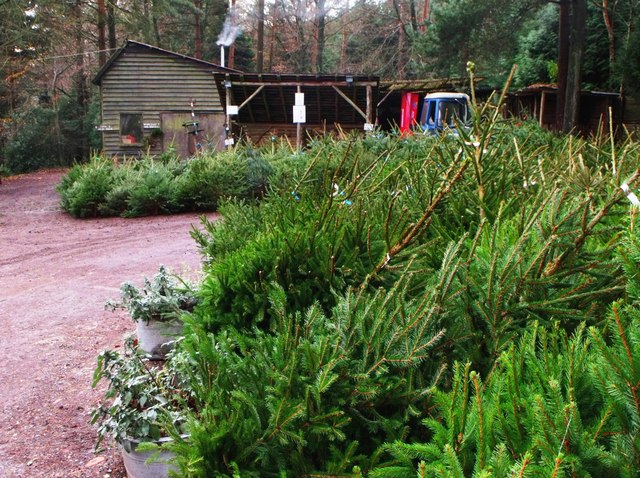
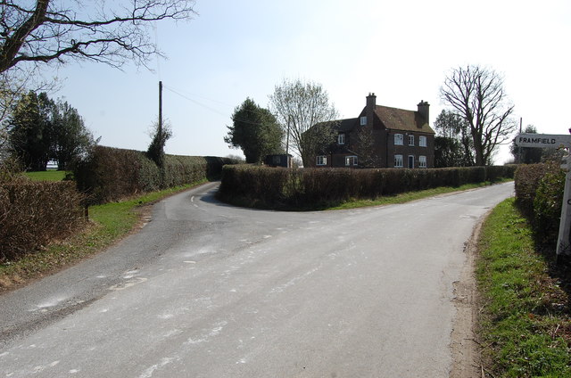
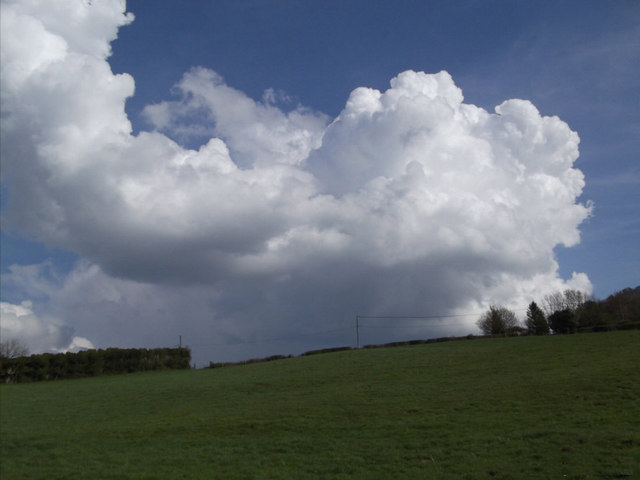
Cypress Wood is a picturesque forest located in Sussex, England. Covering an area of approximately 500 acres, this wood is known for its stunning landscape, diverse flora and fauna, and rich historical significance.

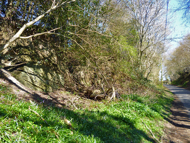
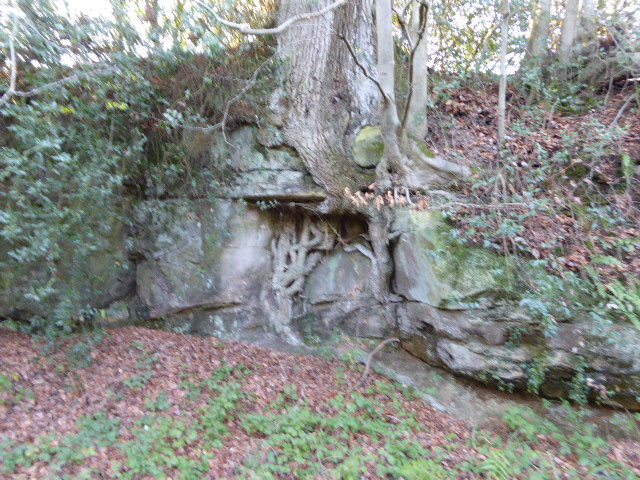
One of the striking features of Cypress Wood is its abundance of ancient cypress trees, which give the wood its name. These majestic trees can reach heights of up to 30 meters and are known for their distinctive shape and aromatic wood. The wood is also home to a variety of other tree species including oak, beech, and birch, creating a diverse and vibrant ecosystem.

The forest is a haven for nature lovers, bird enthusiasts, and wildlife photographers. It is home to a wide range of animal species, including deer, foxes, badgers, and numerous bird species such as woodpeckers, owls, and nightingales. The wood provides a peaceful and tranquil environment, making it a popular destination for long walks, picnics, and nature trails.

Cypress Wood has a rich history dating back centuries. It was once used as a hunting ground for the wealthy and has remnants of ancient structures, including a medieval deer park. The wood also played a significant role during World War II as a secret location for military training exercises.

Today, Cypress Wood is managed and maintained by the local council, ensuring the preservation of its natural beauty and historical significance. It continues to be a beloved spot for locals and visitors alike, offering a unique and enchanting experience in the heart of Sussex.

If you have any feedback on the listing, please let us know in the comments section below.

Cypress Wood Images

Images are sourced within 2km of 51.003194/0.16087863 or Grid Reference TQ5124. Thanks to Geograph Open Source API. All images are credited.

St. Mark's, Hadlow Down, East Sussex
St. Mark's, Hadlow Down, East Sussex (2)
Christmas trees, Wilderness Wood, Hadlow Down
Sharp bend on Brick Kiln Lane A small stream is crossed just before the bend - the white wooden railing on the right marks the spot.
Sharp bend on Brick Kiln Lane
A small stream is crossed just before the bend - the white wooden railing on the right marks the spot.
A pull-in on the A272 A useful thing to remember on this sort of road, the trouble is, they are often hogged by a lorry. This is by the entrance to Five Chimneys Cottage, according to the sign. The road here is called The Toll, a clue to its turnpike origins.
A pull-in on the A272
A useful thing to remember on this sort of road, the trouble is, they are often hogged by a lorry. This is by the entrance to Five Chimneys Cottage, according to the sign. The road here is called The Toll, a clue to its turnpike origins.
Entering Buxted A 40 limit on the outskirts, then a 30 limit. On the right is the turning for Howbourne Lane, a no through road.
Entering Buxted
A 40 limit on the outskirts, then a 30 limit. On the right is the turning for Howbourne Lane, a no through road.
30 - slow down in Buxted Whoops! A bit too fast. It is easy to exceed the limit in this direction which is continuously downhill.
30 - slow down in Buxted
Whoops! A bit too fast. It is easy to exceed the limit in this direction which is continuously downhill.
Stonehurst Lane through unnamed wood This small wood has no name, or if it has, the cartographers were not told of it.
Stonehurst Lane through unnamed wood
This small wood has no name, or if it has, the cartographers were not told of it.
Footpath towards Tibbs Mill Lane Path Hadlow Down 7 starts here on Hastingford Lane.
Footpath towards Tibbs Mill Lane
Path Hadlow Down 7 starts here on Hastingford Lane.
St Mark the Evangelist, Hadlow Down In 1835 the Earl and Countess de la Warr gave land for a church in Hadlow Down, and the Prime Minister, Lord Liverpool, contributed £100. The church was consecrated in 1836, however, it was demolished in the early 20th Century  retaining the tower and walls of the nave, and a new structure erected incorporating a fine new chancel and chapel. It was dedicated to St Mark in 1913. The rebuilding was at the expense of Charles Lang Huggins of Hadlow Grange. The attractive Lady Chapel was designed for private prayer and meditation.
An electronic organ was installed in 1993.
St Mark the Evangelist, Hadlow Down
In 1835 the Earl and Countess de la Warr gave land for a church in Hadlow Down, and the Prime Minister, Lord Liverpool, contributed £100. The church was consecrated in 1836, however, it was demolished in the early 20th Century retaining the tower and walls of the nave, and a new structure erected incorporating a fine new chancel and chapel. It was dedicated to St Mark in 1913. The rebuilding was at the expense of Charles Lang Huggins of Hadlow Grange. The attractive Lady Chapel was designed for private prayer and meditation. An electronic organ was installed in 1993.
Interior St Mark's church, Hadlow Down Looking west
Interior St Mark's church, Hadlow Down
Looking west
Road junction near Popeswood Farm Rosers Common off to the left
Road junction near Popeswood Farm
Rosers Common off to the left
Land near Hastingford Farm The river Uck runs behind the trees on the right of the photo.
Land near Hastingford Farm
The river Uck runs behind the trees on the right of the photo.
Drive to Huggetts Furnace Farm
Rocky bank on Fowly Lane An Ardingly Sandstone exposure by the lane which passes though a sunken section on the hill up from a stream valley.
Rocky bank on Fowly Lane
An Ardingly Sandstone exposure by the lane which passes though a sunken section on the hill up from a stream valley.
Hastingford Lane at River Uck bridge There is a curious skew crossing here. The posts on the left protect the west parapet of the bridge, which is opposite the drive on the right. The east parapet is out of shot this side of the drive.
Hastingford Lane at River Uck bridge
There is a curious skew crossing here. The posts on the left protect the west parapet of the bridge, which is opposite the drive on the right. The east parapet is out of shot this side of the drive.
Green field,Big cloud Looking uphill to the base of a growing cumulus cloud behind the horizon
Green field,Big cloud
Looking uphill to the base of a growing cumulus cloud behind the horizon
London Bound Looking from a pedestrian and agricultural bridge over the London-Uckfield line at the London bound train on its way.
London Bound
Looking from a pedestrian and agricultural bridge over the London-Uckfield line at the London bound train on its way.
Show me another place!

Cypress Wood is located at Grid Ref: TQ5124 (Lat: 51.003194, Lng: 0.16087863)

Administrative County: East Sussex

District: Wealden

Police Authority: Sussex

What 3 Words

///revives.parsnips.outermost. Near Buxted, East Sussex

Related Wikis

Stockland Farm Meadows

Stockland Farm Meadows is a 5.8-hectare (14-acre) biological Site of Special Scientific Interest south of Crowborough in East Sussex.These two species...

Hastingford Cutting

Hastingford Cutting is a 0.04-hectare (0.099-acre) geological Site of Special Scientific Interest south of Crowborough in East Sussex. It is a Geological...

Hadlow Down

Hadlow Down is a village and civil parish in the Wealden District of East Sussex, England. It is located on the A272 road three miles (4.8 km) north-west...

St Mark's Church, Hadlow Down

St Mark's Church (dedicated to St Mark the Evangelist) is an Anglican church in the village of Hadlow Down in the district of Wealden, one of six local...

Five Ash Down Independent Chapel

Five Ash Down Independent Chapel is an independent Evangelical church in the Reformed (Calvinist) tradition in the hamlet of Five Ash Down, East Sussex...

Providence Chapel, Hadlow Down

Providence Chapel is a former independent Calvinistic place of worship in the village of Hadlow Down in Wealden, one of six local government districts...

Great Bush Railway

The Great Bush Railway is a private, 2 ft (610 mm) narrow gauge running round the edge of Tinkers Park, Hadlow Down, Sussex. The railway is operated by...

Vanguard Way

The Vanguard Way is a long-distance walk of 66.2 mi (106.5 km) from East Croydon station in outer London (OS grid reference TQ328658), travelling from...

Nearby Amenities

Located within 500m of 51.003194,0.16087863
Barrier: cattle_grid
Lat/Long: 51.0055287/0.1598116
Barrier: stile
Lat/Long: 51.0055279/0.1597457
Barrier: stile
Lat/Long: 51.0041958/0.1629143
Barrier: stile
Lat/Long: 51.0007211/0.1559922
Barrier: stile
Lat/Long: 51.0053233/0.1597631
Barrier: stile
Lat/Long: 51.001421/0.1581612
The data included in this document is from www.openstreetmap.org. The data is made available under ODbL.

Have you been to Cypress Wood?

Leave your review of Cypress Wood below (or comments, questions and feedback).