Tinney Spinney

Wood, Forest in Essex Uttlesford

England

Tinney Spinney

Rickling Church
Rickling Church Credit: Terry Butcher

Tinney Spinney is a small woodland located in Essex, England. Situated in the rural village of Wood, this forest offers a peaceful retreat for nature enthusiasts and locals alike. Covering an area of approximately 10 acres, Tinney Spinney is a haven for wildlife and provides an important habitat for a variety of flora and fauna.

The woodland is predominantly made up of native tree species such as oak, beech, and ash, creating a diverse and picturesque landscape. The dense canopy allows for limited sunlight to reach the forest floor, resulting in a rich understory of ferns, mosses, and wildflowers. This provides a perfect environment for woodland creatures such as badgers, foxes, and deer.

Tinney Spinney is also home to a network of walking trails, allowing visitors to explore the woodland and experience its beauty up close. The paths wind through the trees, offering glimpses of hidden ponds and streams along the way. These water features attract a variety of bird species, making it an ideal spot for birdwatching.

The woodland is managed by a local conservation group, which ensures the preservation of its natural beauty and biodiversity. They actively work to maintain the health of the trees, control invasive species, and protect the wildlife that calls Tinney Spinney home.

Overall, Tinney Spinney in Essex is a tranquil and enchanting woodland that provides a peaceful escape from the hustle and bustle of everyday life. Its diverse ecosystem and well-maintained trails make it a popular destination for nature lovers who seek to immerse themselves in the beauty of the forest.

If you have any feedback on the listing, please let us know in the comments section below.

Tinney Spinney Images

Images are sourced within 2km of 51.964146/0.19513524 or Grid Reference TL5031. Thanks to Geograph Open Source API. All images are credited.

Rickling Church
Rickling Church
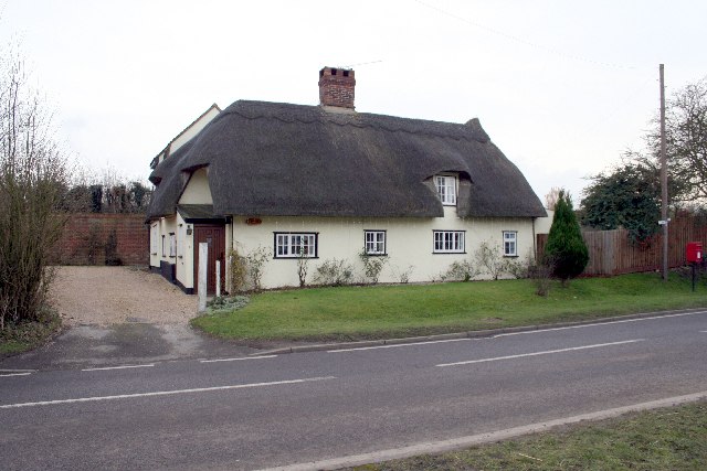
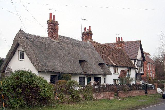
Thatched cottage in Wicken Bonhunt
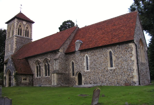
St. Margaret's church, Wicken Bonhunt, Essex Apart from the 13th century chancel, this church was a complete rebuild in 1858-9 and designed by John Hanson Sperling.
St. Margaret's church, Wicken Bonhunt, Essex
Apart from the 13th century chancel, this church was a complete rebuild in 1858-9 and designed by John Hanson Sperling.
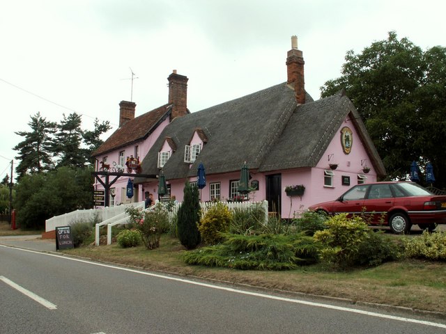
'Coach & Horses' inn, Wicken Bonhunt, Essex The carved wooden sign that stands out from the inn, as seen in the photo, used to be right across the width of the road some years ago.
'Coach & Horses' inn, Wicken Bonhunt, Essex
The carved wooden sign that stands out from the inn, as seen in the photo, used to be right across the width of the road some years ago.
Rickling Road This is the view as you leave Wicken Bonhunt.
Rickling Road
This is the view as you leave Wicken Bonhunt.
Rickling: Pond Lay Plantation An isolated clump of woodland in an otherwise arable landscape.
Rickling: Pond Lay Plantation
An isolated clump of woodland in an otherwise arable landscape.
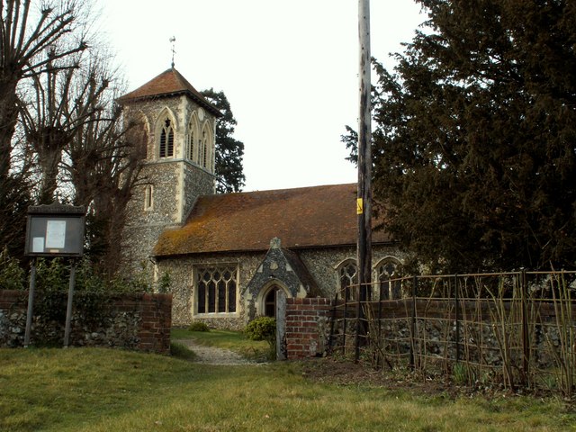
Rickling: All Saints Church There are few houses near this isolated thirteenth century church, but it is a popular venue for weddings including that of local celebrity chef Jamie Oliver and his bride, Juliette Norton, in June 2000. The BBC news article for the event is here <span class="nowrap"><a title="http://news.bbc.co.uk/1/hi/entertainment/803555.stm" rel="nofollow ugc noopener" href="http://news.bbc.co.uk/1/hi/entertainment/803555.stm">Link</a><img style="margin-left:2px;" alt="External link" title="External link - shift click to open in new window" src="https://s1.geograph.org.uk/img/external.png" width="10" height="10"/></span>
Rickling: All Saints Church
There are few houses near this isolated thirteenth century church, but it is a popular venue for weddings including that of local celebrity chef Jamie Oliver and his bride, Juliette Norton, in June 2000. The BBC news article for the event is here LinkExternal link
Rickling: Coldhams This view was taken from the very south-western corner of the grid square looking towards Coldhams. The current OS mapping shows two farms here, Moat Farm and Coldhams Farm, but the 1881 OS mapping shows just the farm at what is today's Moat Farm, but called Coldhams. Today's Coldhams Farm did not exist then.
Rickling: Coldhams
This view was taken from the very south-western corner of the grid square looking towards Coldhams. The current OS mapping shows two farms here, Moat Farm and Coldhams Farm, but the 1881 OS mapping shows just the farm at what is today's Moat Farm, but called Coldhams. Today's Coldhams Farm did not exist then.
A short country lane leading to Church End Farm
All Saints Church, Rickling, Essex
St Margaret's Church, Wicken Bonhunt, Essex
Houses on Rickling Green The tree stump has been cut since a nice tree was there in 2009
Houses on Rickling Green
The tree stump has been cut since a nice tree was there in 2009
Brick Kiln Lane, Rickling Green
Thatched cottage in Wicken Bonhunt
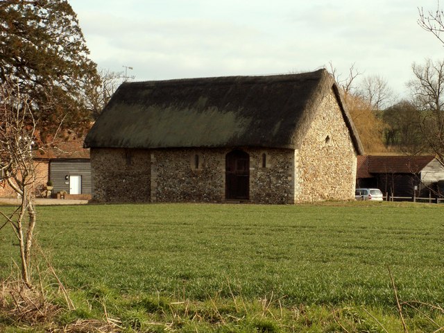
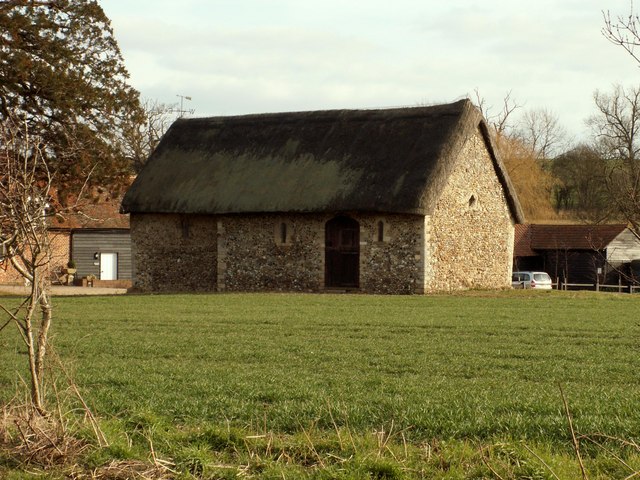
Chapel of St. Helen, Bonhunt Farm, Essex Standing in the grounds of Bonhunt farm, near Newport, is the small Chapel of St. Helen. It's a complete Norman structure with a thatched roof.
Chapel of St. Helen, Bonhunt Farm, Essex
Standing in the grounds of Bonhunt farm, near Newport, is the small Chapel of St. Helen. It's a complete Norman structure with a thatched roof.
Quendon parish church, Essex This church dates back to the 13th century but this view from the south, shows much of the restoration of 1881.
Quendon parish church, Essex
This church dates back to the 13th century but this view from the south, shows much of the restoration of 1881.
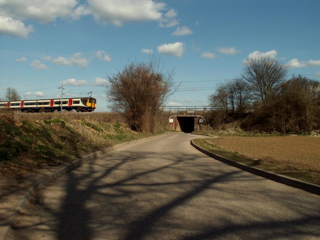
Railway bridge near Widdington, Essex View looking East on a small country lane, which leads into the village of Widdington.
Railway bridge near Widdington, Essex
View looking East on a small country lane, which leads into the village of Widdington.
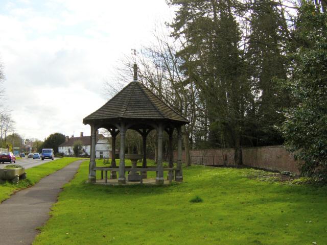
Fountain and Drinking Trough, Quendon The inscription on the inside of the roof reads: This fountain and drinking trough were donated to the people of Quendon in 1887 by Henry Tufnell Esq. in memory of Col. Cranmer-Byng of Quendon Hall. They were later restored in memory of G.B. Beeman who lived at Manor Farm 1922-54.
Fountain and Drinking Trough, Quendon
The inscription on the inside of the roof reads: This fountain and drinking trough were donated to the people of Quendon in 1887 by Henry Tufnell Esq. in memory of Col. Cranmer-Byng of Quendon Hall. They were later restored in memory of G.B. Beeman who lived at Manor Farm 1922-54.
Show me another place!

Tinney Spinney is located at Grid Ref: TL5031 (Lat: 51.964146, Lng: 0.19513524)

Administrative County: Essex

District: Uttlesford

Police Authority: Essex

What 3 Words

///regretted.invented.blazing. Near Elsenham, Essex

Nearby Locations

Tinney Spinney

Related Wikis

Quendon

Quendon is a linear village and former civil parish, now in the parish of Quendon and Rickling, in the Uttlesford district, in the county of Essex, England...

Rickling, Essex

Rickling is a village and former civil parish, now in the parish of Quendon and Rickling, in the Uttlesford district of Essex, England. The village is...

Quendon and Rickling

Quendon and Rickling is a civil parish in the Uttlesford district of Essex, England with an area of 2,048 acres. The population of the civil parish at...

Chapel of St Helen

Chapel of St Helen (also St Helen's Chapel) is an ancient religious building in Wicken Bonhunt, north-west Essex. It dates from around the 11th century...

Nearby Amenities

Located within 500m of 51.964146,0.19513524
The data included in this document is from www.openstreetmap.org. The data is made available under ODbL.

Have you been to Tinney Spinney?

Leave your review of Tinney Spinney below (or comments, questions and feedback).