Joyden's Wood

Wood, Forest in Kent Dartford

England

Joyden's Wood

Birchwood Road towards Dartford
Birchwood Road towards Dartford Credit: JThomas

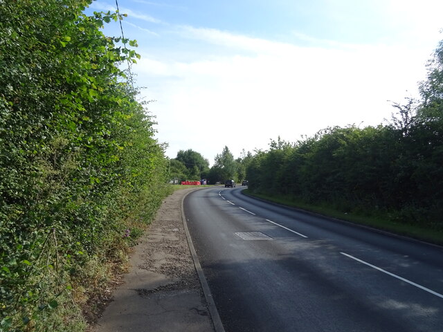
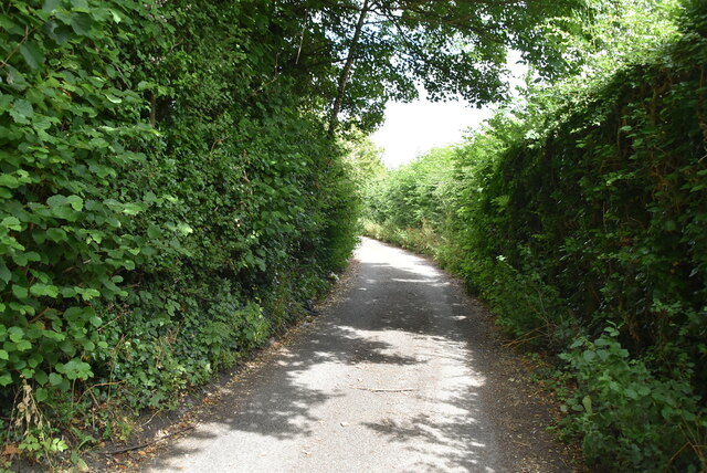
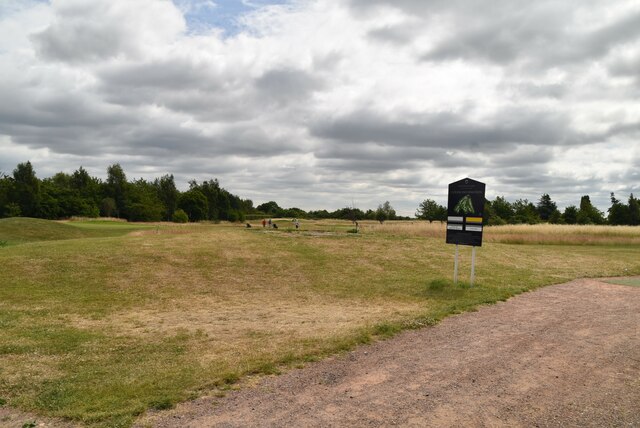
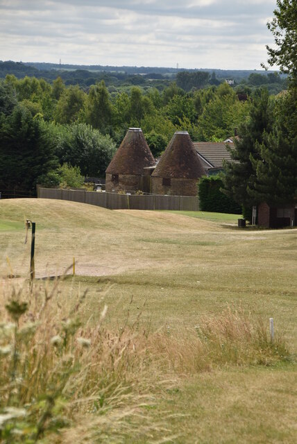
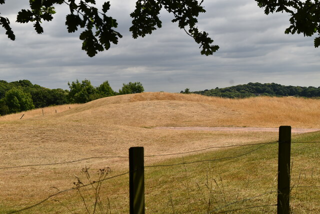
Joyden's Wood is a beautiful woodland area located in Kent, England. Covering an area of approximately 336 acres, it is a popular destination for nature enthusiasts and outdoor lovers. The wood is situated near the town of Dartford, providing easy access for both locals and visitors.

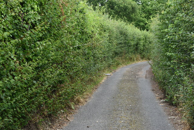
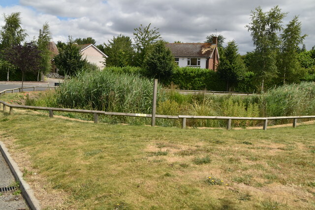
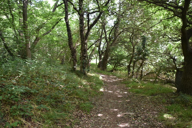
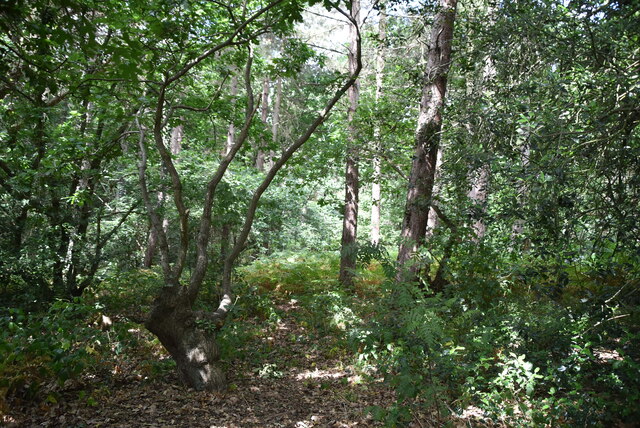
As one of the largest woodlands in the region, Joyden's Wood boasts a diverse range of flora and fauna. The wood is predominantly made up of oak and birch trees, creating a dense and picturesque forest. Walking through the wood, visitors can enjoy the peaceful surroundings and the tranquil sounds of nature.

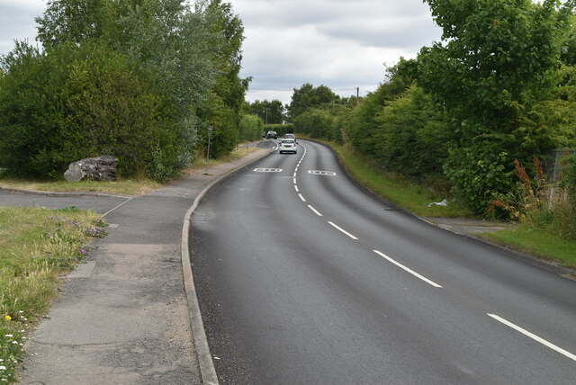
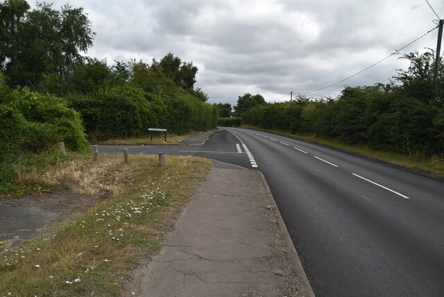
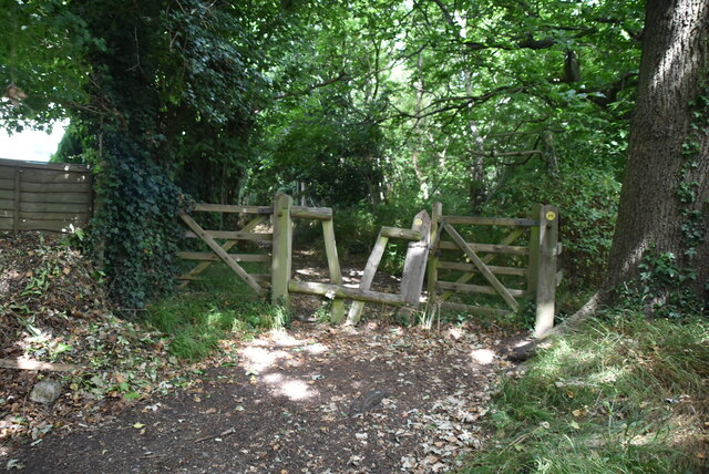
In addition to its natural beauty, Joyden's Wood offers a variety of recreational activities. There are numerous walking trails and paths that crisscross through the wood, allowing visitors to explore its different areas. These trails cater to different levels of fitness, making it suitable for both casual strolls and more challenging hikes.

Wildlife enthusiasts will also be delighted by the abundance of animal species that call Joyden's Wood home. The wood is home to a variety of birds, including woodpeckers, owls, and various songbirds. Additionally, visitors may spot small mammals such as squirrels and rabbits, as well as reptiles and amphibians.

Joyden's Wood is not only a place of natural beauty but also holds historical significance. It is believed to have been used as a hunting ground by the Romans and was later owned by the Joyden's family, from whom it derived its name.

Overall, Joyden's Wood offers a serene and idyllic escape from the hustle and bustle of everyday life, providing visitors with the opportunity to immerse themselves in the beauty of nature.

If you have any feedback on the listing, please let us know in the comments section below.

Joyden's Wood Images

Images are sourced within 2km of 51.424115/0.15751852 or Grid Reference TQ5071. Thanks to Geograph Open Source API. All images are credited.

Birchwood Road towards Dartford
Birchwood Rd
Birchwood Rd
Birchwood Rd
Birchwood Rd
Stonehill Green
Stonehill Green
Stonehill Green
Stonehill Green
Stonehill Farm
Stonehill Farm
Barn, Stonehill Farm
The Forge
The Forge
Birchwood Park Golf Course Website: <span class="nowrap"><a title="www.birchwoodparkgc.co.uk/" rel="nofollow ugc noopener" href="http://www.birchwoodparkgc.co.uk/">Link</a><img style="margin-left:2px;" alt="External link" title="External link - shift click to open in new window" src="https://s1.geograph.org.uk/img/external.png" width="10" height="10"/></span>
Birchwood Park Golf Course
Website: LinkExternal link
Pond, Stonehill Green
Stonehill Green
Stonehill Green
Stonehill Green
Stonehill Green
Oast, Birchwood Park Golf Centre Buildings made to look like oast houses.
Oast, Birchwood Park Golf Centre
Buildings made to look like oast houses.
Oast, Birchwood Park Golf Centre Buildings made to look like oast houses.
Oast, Birchwood Park Golf Centre
Buildings made to look like oast houses.
Entering Joyden Wood A Woodland Trust site in Dartford borough, opened to the public in 1988.  Close to the A2 and A20 trunk roads,this remains a natural ancient woodland and contains visible remains of the ancient "Faesten Dic" (strong dyke), an Anglo-Saxon (or possibly older) defensive ditch.  It is approximately 130 hectares in area and contains many tracks and paths; the main tracks are open to horses and cyclists.
Entering Joyden Wood
A Woodland Trust site in Dartford borough, opened to the public in 1988. Close to the A2 and A20 trunk roads,this remains a natural ancient woodland and contains visible remains of the ancient "Faesten Dic" (strong dyke), an Anglo-Saxon (or possibly older) defensive ditch. It is approximately 130 hectares in area and contains many tracks and paths; the main tracks are open to horses and cyclists.
Joyden Wood A Woodland Trust site in Dartford borough, opened to the public in 1988.  Close to the A2 and A20 trunk roads,this remains a natural ancient woodland and contains visible remains of the ancient "Faesten Dic" (strong dyke), an Anglo-Saxon (or possibly older) defensive ditch.  It is approximately 130 hectares in area and contains many tracks and paths; the main tracks are open to horses and cyclists.
Joyden Wood
A Woodland Trust site in Dartford borough, opened to the public in 1988. Close to the A2 and A20 trunk roads,this remains a natural ancient woodland and contains visible remains of the ancient "Faesten Dic" (strong dyke), an Anglo-Saxon (or possibly older) defensive ditch. It is approximately 130 hectares in area and contains many tracks and paths; the main tracks are open to horses and cyclists.
Joyden Wood
Joyden Wood
Birchwood Park Golf Course Website: <span class="nowrap"><a title="www.birchwoodparkgc.co.uk/" rel="nofollow ugc noopener" href="http://www.birchwoodparkgc.co.uk/">Link</a><img style="margin-left:2px;" alt="External link" title="External link - shift click to open in new window" src="https://s1.geograph.org.uk/img/external.png" width="10" height="10"/></span>
Birchwood Park Golf Course
Website: LinkExternal link
Show me another place!

Joyden's Wood is located at Grid Ref: TQ5071 (Lat: 51.424115, Lng: 0.15751852)

Administrative County: Kent

District: Dartford

Police Authority: Kent

What 3 Words

///meant.tonic.alert. Near Bexley, London

Nearby Locations

Faesten Dic Joyden's Wood

Related Wikis

Joyden's Wood

Joyden's Wood is an area of ancient woodland that straddles the border between the London Borough of Bexley in South East London and the Borough of Dartford...

Loring Hall

Loring Hall is a private mental health care facility in North Cray, London Borough of Bexley. Formerly known as Wollet Hall or Woollet Hall, it is a Grade...

Coldblow

Coldblow is a village in South East London within the London Borough of Bexley. It is located south east of Bexleyheath and south west of Dartford, adjacent...

North Cray

North Cray is an area in South East London, England, within the London Borough of Bexley. It is located east of Sidcup and south of Bexleyheath and is...

Maypole, Dartford

Maypole is a village in the Borough of Dartford in Kent, England. It is located north of Joyden's Wood and south-west of the town of Dartford. In the 2021...

Bexley Hospital

Bexley Hospital was a psychiatric hospital at Old Bexley Lane, Dartford Heath, Bexley, in the County of Kent. It operated between 19 September 1898 and...

Bowmans, Kent

Bowmans is a part of the town of Dartford in Kent, England. It is located to the south-west of the town centre.

Ruxley

Ruxley is a rural settlement of South East London, England that straddles the boundary of the London Boroughs of Bromley and Bexley. It is located 13 miles...

Nearby Amenities

Located within 500m of 51.424115,0.15751852
Turning Circle
Lat/Long: 51.4224279/0.1624112
Turning Circle
Lat/Long: 51.4233475/0.1627815
Barrier: stile
Lat/Long: 51.4202816/0.1610022
Fixme: Fpath_incomplete
Lat/Long: 51.4270272/0.1520831
Barrier: bollard
Bicycle: no
Foot: yes
Lat/Long: 51.4266327/0.1531699
Faesten Dic
Historic: ruins
Lat/Long: 51.4276108/0.1597702
Barrier: stile
Foot: yes
Lat/Long: 51.4239613/0.1534715
Fixme: Fpath_incomplete
Lat/Long: 51.4239368/0.1535
Bench
Lat/Long: 51.4251425/0.1599679
Bench
Backrest: yes
Colour: brown
Material: wood
Seats: 3
Lat/Long: 51.4213816/0.1577382
Bench
Backrest: yes
Mapillary: 2995064827486379
Survey Date: 2018-02-11
Lat/Long: 51.4211879/0.1613065
Bench
Lat/Long: 51.4212356/0.1614771
Hurricane
Artwork Type: sculpture
Tourism: artwork
Lat/Long: 51.4218101/0.1576512
Bench
Colour: brown
Material: wood
Seats: 2
Lat/Long: 51.4222428/0.1579382
Bench
Backrest: no
Material: wood
Lat/Long: 51.424757/0.1561904
Barrier: kissing_gate
Material: metal
Lat/Long: 51.4214206/0.1549231
Bench
Material: wood
Seats: 3
Lat/Long: 51.4218561/0.1575064
Bench
Material: wood
Seats: 3
Lat/Long: 51.4219299/0.15773
Bench
Material: wood
Seats: 3
Lat/Long: 51.4219932/0.1573287
Roman Soldier
Artist Name: Peter Leadbeater
Artwork Type: statue
Material: wood
Tourism: artwork
Lat/Long: 51.4270903/0.1622797
Saxon Soldier
Artist Name: Peter Leadbeater
Artwork Type: statue
Material: wood
Tourism: artwork
Lat/Long: 51.4270467/0.1622555
Marker: post
Operator: Dartford Orienteers
Orienteering: marker
Ref: M
Sport: orienteering
Website: https://www.dfok.co.uk/
Lat/Long: 51.4256012/0.1585691
Marker: post
Operator: Dartford Orienteers
Orienteering: marker
Ref: F
Sport: orienteering
Website: https://www.dfok.co.uk/
Lat/Long: 51.4220579/0.1584555
The data included in this document is from www.openstreetmap.org. The data is made available under ODbL.

Have you been to Joyden's Wood?

Leave your review of Joyden's Wood below (or comments, questions and feedback).