Nursery Wood

Wood, Forest in Sussex Wealden

England

Nursery Wood

Footpath from East Hoathly to Old Whyly This photo was taken on the Thomas Turner walk, which is a series of footpaths around East Hoathly. The roof of Old Whyly can be seen in the distance.
Footpath from East Hoathly to Old Whyly Credit: Barry Hall

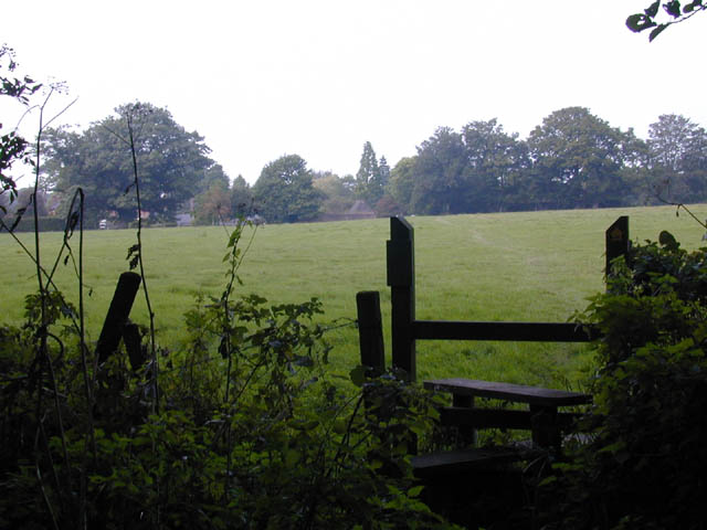
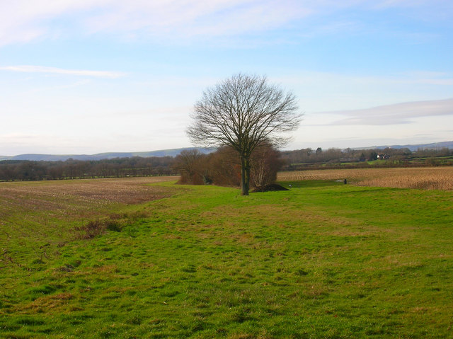
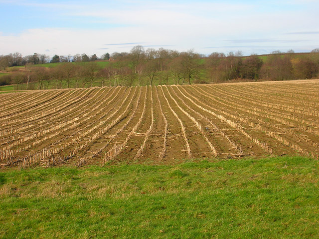
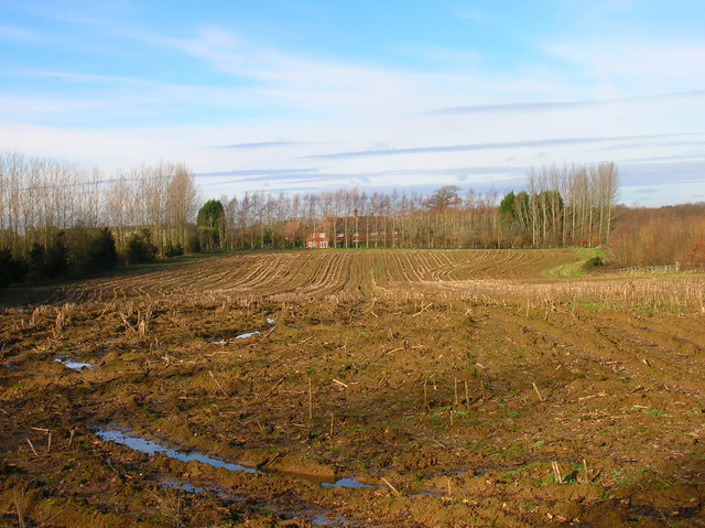
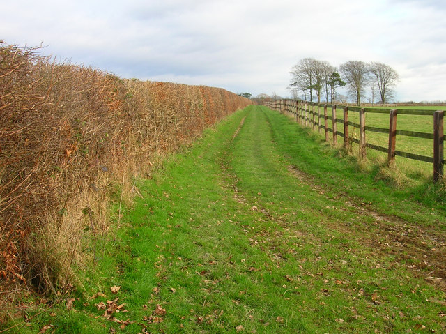
Nursery Wood is a picturesque forest located in Sussex, England. Covering an area of approximately 500 acres, this enchanting woodland is known for its diverse flora and fauna, making it a popular destination for nature lovers and outdoor enthusiasts.

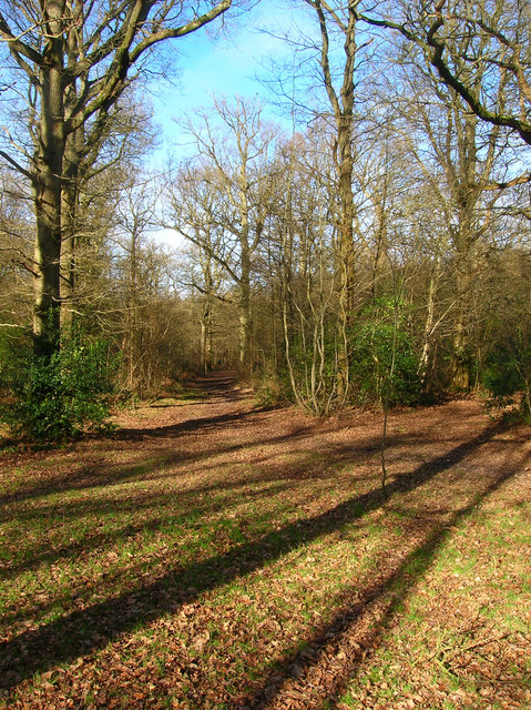
The wood is characterized by its towering trees, which primarily consist of oak, beech, and birch. These majestic specimens create a dense canopy that provides shade and shelter for the numerous animal species that call Nursery Wood their home. Visitors can expect to encounter a myriad of wildlife, including squirrels, rabbits, deer, and a variety of bird species.

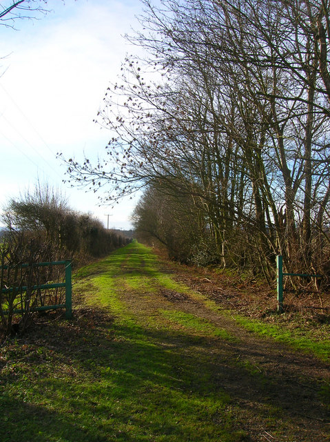
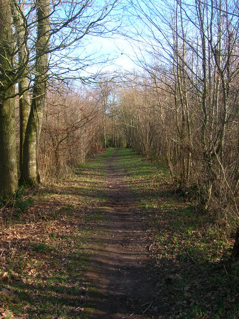
Tranquil walking trails wind their way through the wood, offering visitors the opportunity to explore the forest at their own pace. These well-maintained paths provide easy access to the different areas of the wood, ensuring that visitors can fully appreciate the natural beauty that surrounds them.

Nursery Wood is also home to a diverse range of plant species, with patches of bluebells, wild garlic, and primroses adding vibrant splashes of color to the forest floor during the spring months. This makes it an especially popular destination for nature photography and wildflower enthusiasts.

Visitors to Nursery Wood can also take advantage of the various amenities available on-site. There are picnic areas dotted throughout the wood, allowing visitors to relax and enjoy a meal surrounded by nature. Additionally, there are designated camping spots for those who wish to spend more time exploring the wood and its surroundings.

Overall, Nursery Wood in Sussex offers a serene and captivating woodland experience, providing a welcome escape from the hustle and bustle of everyday life.

If you have any feedback on the listing, please let us know in the comments section below.

Nursery Wood Images

Images are sourced within 2km of 50.930279/0.13173827 or Grid Reference TQ4916. Thanks to Geograph Open Source API. All images are credited.

Footpath from East Hoathly to Old Whyly This photo was taken on the Thomas Turner walk, which is a series of footpaths around East Hoathly. The roof of Old Whyly can be seen in the distance.
Footpath from East Hoathly to Old Whyly
This photo was taken on the Thomas Turner walk, which is a series of footpaths around East Hoathly. The roof of Old Whyly can be seen in the distance.
Old Whyly Old Whyly is a 17th Century manor house. It is mentioned numerous times in The Diary of Thomas Turner 1754-1765, in East Hoathly. Thomas Turner frequently visited Jeremiah French, the tenant farmer, at Whyly mostly for evenings playing cards and heavy drinking. He invariably returned home inebriated and on several occasions his wife had to be carried home on a gate!
Old Whyly
Old Whyly is a 17th Century manor house. It is mentioned numerous times in The Diary of Thomas Turner 1754-1765, in East Hoathly. Thomas Turner frequently visited Jeremiah French, the tenant farmer, at Whyly mostly for evenings playing cards and heavy drinking. He invariably returned home inebriated and on several occasions his wife had to be carried home on a gate!
Black Lion Inn Old coaching inn on the A22/B2192 crossroads. The road to Uckfield is straight ahead that to Lewes is to the left.
Black Lion Inn
Old coaching inn on the A22/B2192 crossroads. The road to Uckfield is straight ahead that to Lewes is to the left.
Looking Towards Bog Shaw Taken from the footpath that links Halland with Rowlands Wood. The South Downs can be seen in the background.
Looking Towards Bog Shaw
Taken from the footpath that links Halland with Rowlands Wood. The South Downs can be seen in the background.
Footpath to Shortgate Taken from its junction with the Halland-Rowlands Wood footpath.
Footpath to Shortgate
Taken from its junction with the Halland-Rowlands Wood footpath.
Footpath to Laughton Park Farm The footpath follows an old lane between two field boundaries on its way to Halland Park Farm.
Footpath to Laughton Park Farm
The footpath follows an old lane between two field boundaries on its way to Halland Park Farm.
Field of Stalks near Halland Park Farm Looking back towards Halland, the trees to the right hide the pond in the next grid square. The building on the hill is Hartfield Farm.
Field of Stalks near Halland Park Farm
Looking back towards Halland, the trees to the right hide the pond in the next grid square. The building on the hill is Hartfield Farm.
Moat, Moat Wood The remnants of an medieval settlement possibly a farmstead or a hunting lodge. The island is to the right of the water. Moat Wood is joint owned by East Hoathly parish council and the Woodland Trust.
Moat, Moat Wood
The remnants of an medieval settlement possibly a farmstead or a hunting lodge. The island is to the right of the water. Moat Wood is joint owned by East Hoathly parish council and the Woodland Trust.
Footpath, Moat Wood Taken from the entrance near the A22. Moat Wood is owned jointly by East Hoathly parish council and the Woodland Trust. Its wildlife includes Black Adders and Nightingales.
Footpath, Moat Wood
Taken from the entrance near the A22. Moat Wood is owned jointly by East Hoathly parish council and the Woodland Trust. Its wildlife includes Black Adders and Nightingales.
Ploughed Field near Godfrey's Cottage The A22 is behind the bushes to the right of the picture.
Ploughed Field near Godfrey's Cottage
The A22 is behind the bushes to the right of the picture.
Moat Wood Jointly owned by East Hoathly parish council and the Woodland Trust and home to such wildlife as Black Adders and Nightingales. This part of the open access wood heads north westwards away from the moat.
Moat Wood
Jointly owned by East Hoathly parish council and the Woodland Trust and home to such wildlife as Black Adders and Nightingales. This part of the open access wood heads north westwards away from the moat.
Footpath to Slays Wood? According to the map it should be but no sign or entrance to the field could be found. The field layouts do not agree with the map either. Most of the land around here is owned by Hesmond Stud a horse breeders who have fenced out the fields and diverted other footpaths though they are not too well signposted coming from the direction of Old Whyley. This looks up towards the peak of a hill marked 73 on the OS Map.

Edit: Five years on the footpath is now marked out, see <a href="https://www.geograph.org.uk/photo/2882890">TQ5117 : Footpath to Annandale Farm</a>.
Footpath to Slays Wood?
According to the map it should be but no sign or entrance to the field could be found. The field layouts do not agree with the map either. Most of the land around here is owned by Hesmond Stud a horse breeders who have fenced out the fields and diverted other footpaths though they are not too well signposted coming from the direction of Old Whyley. This looks up towards the peak of a hill marked 73 on the OS Map. Edit: Five years on the footpath is now marked out, see TQ5117 : Footpath to Annandale Farm.
Sweetwillow Shaw The fenced field belongs to Hesmond Stud.
Sweetwillow Shaw
The fenced field belongs to Hesmond Stud.
Two Types of Field Boundaries The older hedges to the left and the newer fences to the right for the horses of Hesmond Stud. Taken at the point where the footpath heads towards Annan Court.
Two Types of Field Boundaries
The older hedges to the left and the newer fences to the right for the horses of Hesmond Stud. Taken at the point where the footpath heads towards Annan Court.
Annan Court Conference and holiday centre for the London City Church.
Annan Court
Conference and holiday centre for the London City Church.
Stile next to Crossroads, Palehouse Common Much negotiation required to avoid wet feet if trying to escape this field. The point where the footpath from Honey's Green meets a crossroads of minor lanes. The buildings behind belong to Palehouse Common Farm.
Stile next to Crossroads, Palehouse Common
Much negotiation required to avoid wet feet if trying to escape this field. The point where the footpath from Honey's Green meets a crossroads of minor lanes. The buildings behind belong to Palehouse Common Farm.
Electricity Pylon near The Lews Taken from the footpath from Honey's Green
Electricity Pylon near The Lews
Taken from the footpath from Honey's Green
Electricity Pylons near The Lews Straight on view of <a href="https://www.geograph.org.uk/photo/323458">TQ5018 : Electricity Pylon near The Lews</a> as the iron giant and his dark black cloud bear down on a lonely geographer. Actually the picture is taken in a small dip next to a stream looking up the slope towards the pylon.
Electricity Pylons near The Lews
Straight on view of TQ5018 : Electricity Pylon near The Lews as the iron giant and his dark black cloud bear down on a lonely geographer. Actually the picture is taken in a small dip next to a stream looking up the slope towards the pylon.
Show me another place!

Nursery Wood is located at Grid Ref: TQ4916 (Lat: 50.930279, Lng: 0.13173827)

Administrative County: East Sussex

District: Wealden

Police Authority: Sussex

What 3 Words

///falters.suitably.womb. Near Uckfield, East Sussex

Nearby Locations

Warren Wood Nursery Wood

Related Wikis

Bentley Wood, East Sussex

Bentley Wood, also known as the House at Halland, is a Modernist house designed by the Russian émigré architect Serge Chermayeff and built in a rural location...

Bentley Wildfowl and Motor Museum

The Bentley Wildfowl and Motor Museum was a visitor attraction near Halland, East Sussex, England. As of October 2018, it is closed to the public. ��2...

Park Corner Heath

Park Corner Heath is a 2.9-hectare (7.2-acre) biological Site of Special Scientific Interest about 1.2 miles (2 km) south of East Hoathly, adjacent to...

East Hoathly with Halland

East Hoathly with Halland is a civil parish in the Wealden District of East Sussex, England. The parish contains the two villages of East Hoathly and...

Related Videos

The Vacationist Eco Cabin - forests and firepits

We are creating a magical woodland at The Vacationist Eco Cabin - clearing the overgrowth and making a space to sit and enjoy ...

Visiting the East Sussex National Hotel (using Groupon)

Jasmine and I took a fabulous groupon deal to this hotel.

CAMPERS & COFFEE - 6th June 2021 - Video Highlights

CAMPERS & COFFEE - 6th June 2021 - Video Highlights Campers & Coffee is a BRAND NEW monthly show for camper van and ...

Nearby Amenities

Located within 500m of 50.930279,0.13173827
Halland
Place: village
Source: local_knowledge
Wikidata: Q22340633
Lat/Long: 50.9299313/0.1342783
Material: wood
Power: pole
Source: bing
Lat/Long: 50.926436/0.1280817
Material: wood
Power: pole
Source: bing
Lat/Long: 50.9272239/0.1289333
Material: wood
Power: pole
Source: bing
Lat/Long: 50.9273871/0.1291101
Material: wood
Power: pole
Source: bing
Lat/Long: 50.929167/0.1291848
Post Box
Brand: Royal Mail
Brand Wikidata: Q638098
Brand Wikipedia: en:Royal Mail
Collection Times: Mo-Fr 16:00; Sa 09:30
Operator: Royal Mail
Operator Wikidata: Q638098
Post Box Type: lamp
Ref: BN8 533
Royal Cypher: EIIR
Royal Cypher Wikidata: Q33102113
Lat/Long: 50.9288779/0.1351952
Speed Camera
Maxspeed: 30 mph
Lat/Long: 50.9307169/0.1339502
Bus Stop
Bus: yes
Public Transport: platform
Lat/Long: 50.9290928/0.1372749
Hartfield Farm
Place: farm
Lat/Long: 50.9269443/0.1332304
Footpath
Information: guidepost
Operator: East Sussex County Council
Tourism: information
Lat/Long: 50.9291636/0.1251074
Footpath
Information: guidepost
Operator: East Sussex County Council
Tourism: information
Lat/Long: 50.9260925/0.1315383
Addr Housename: The Sheiling
Building: house
Lat/Long: 50.9337419/0.1284635
Bus Stop
Blacksmith's Arms
Bus: yes
Naptan AtcoCode: 1400WE0394
Naptan NaptanCode: esudadaj
Public Transport: platform
Lat/Long: 50.9291457/0.1354882
Footpath
Information: guidepost
Operator: East Sussex County Council
Tourism: information
Lat/Long: 50.9267654/0.1298594
Bus Stop
Blacksmith's Arms
Bus: yes
Naptan AtcoCode: 1400WE0396
Naptan NaptanCode: esudadam
Public Transport: platform
Lat/Long: 50.9299459/0.1352418
Addr Housename: Hazel Bank
Building: house
Lat/Long: 50.9337075/0.1283216
Bus Stop
Blacksmith's Arms
Bus: yes
Public Transport: platform
Lat/Long: 50.9289892/0.1355348
Addr Housename: Belvoir Lodge
Building: house
Lat/Long: 50.9310728/0.1341218
Footpath
Information: guidepost
Tourism: information
Lat/Long: 50.9299343/0.1369887
Restaurant
Buffalo Bills Tex Mex Restaurant
Lat/Long: 50.9296184/0.1369991
Barrier: yes
Lat/Long: 50.9327005/0.127656
Barrier: yes
Lat/Long: 50.9326104/0.1269633
Bus Stop
Chapel
Bus: yes
Public Transport: platform
Lat/Long: 50.9272366/0.1329578
Bus Stop
Chapel
Bus: yes
Public Transport: platform
Lat/Long: 50.9273014/0.1328165
The data included in this document is from www.openstreetmap.org. The data is made available under ODbL.

Have you been to Nursery Wood?

Leave your review of Nursery Wood below (or comments, questions and feedback).