Warren Wood

Wood, Forest in Sussex Wealden

England

Warren Wood

Communications Mast near Laughton The building is Walls Farm. Taken from the track that links Laughton Common with Whitesmith.
Communications Mast near Laughton Credit: Simon Carey

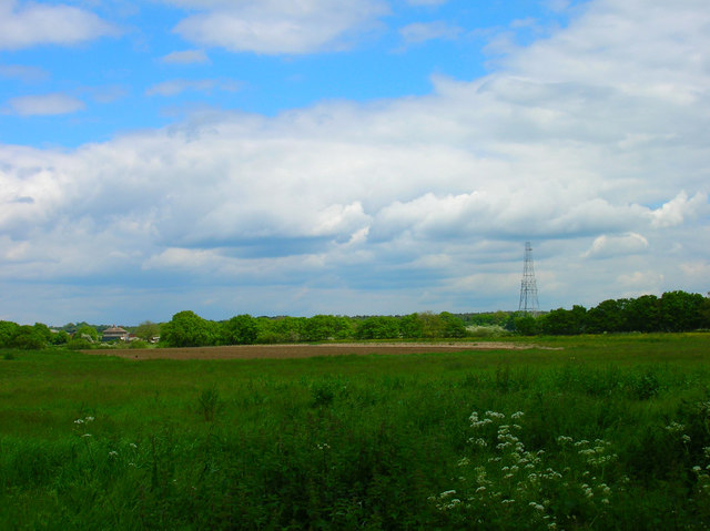
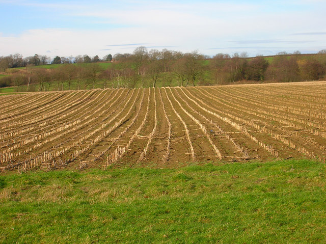
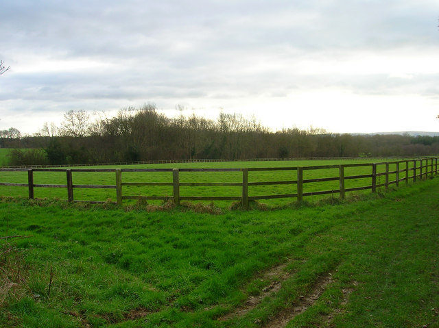
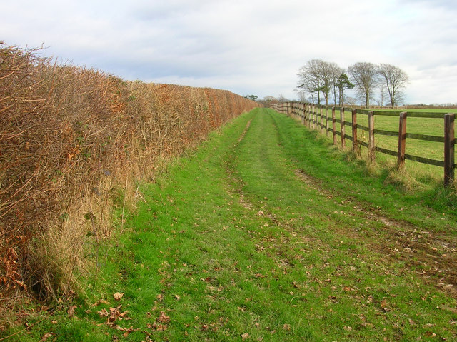
Warren Wood is a picturesque forest located in the county of Sussex, England. Covering an area of approximately 200 acres, it is a haven of natural beauty and tranquility. The wood is part of the wider Warren Forest, which stretches across several parishes in the region.

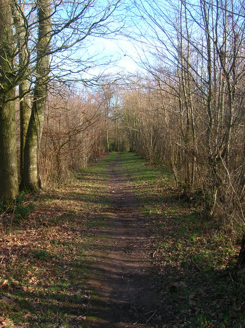
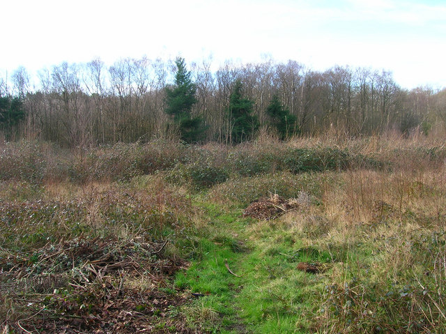
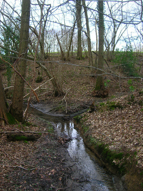
The woodland is characterized by its dense canopy of oak, beech, and birch trees, creating a stunning display of colors throughout the seasons. The forest floor is covered in a thick carpet of moss, ferns, and wildflowers, adding to the enchanting atmosphere. It is a perfect habitat for a diverse range of wildlife, including deer, foxes, badgers, and a variety of bird species.

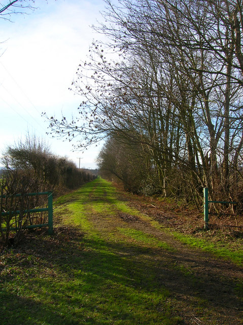
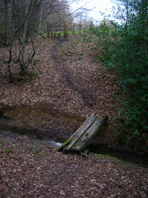
Several well-maintained footpaths wind their way through the wood, allowing visitors to explore and appreciate its natural wonders. The paths are lined with informative signs, providing educational insights into the local flora and fauna. In spring, the forest comes alive with a vibrant display of bluebells, attracting photographers and nature enthusiasts from far and wide.

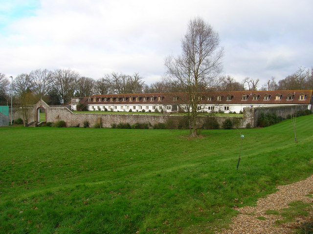
Warren Wood is not only a popular destination for leisurely walks and nature appreciation but also a site of historical interest. The wood has a rich past, with evidence of ancient settlements and archaeological finds dating back to the Bronze Age. These historical remnants add an extra layer of fascination for those interested in the area's cultural heritage.

Overall, Warren Wood offers a delightful escape from the hustle and bustle of everyday life, providing visitors with a chance to immerse themselves in nature and connect with the rich history of Sussex.

If you have any feedback on the listing, please let us know in the comments section below.
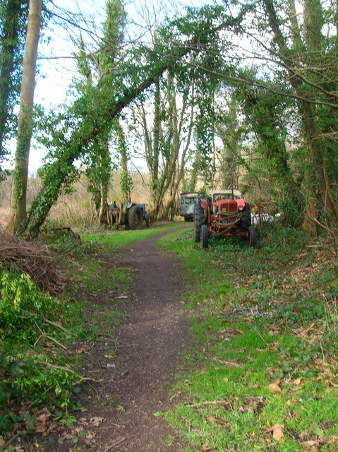
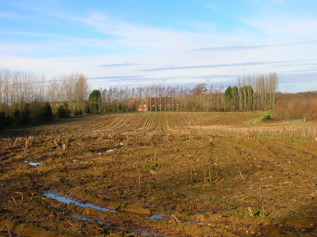
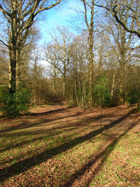
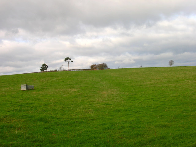
Warren Wood Images

Images are sourced within 2km of 50.924979/0.13092676 or Grid Reference TQ4916. Thanks to Geograph Open Source API. All images are credited.

Communications Mast near Laughton The building is Walls Farm. Taken from the track that links Laughton Common with Whitesmith.
Communications Mast near Laughton
The building is Walls Farm. Taken from the track that links Laughton Common with Whitesmith.
Black Lion Inn Old coaching inn on the A22/B2192 crossroads. The road to Uckfield is straight ahead that to Lewes is to the left.
Black Lion Inn
Old coaching inn on the A22/B2192 crossroads. The road to Uckfield is straight ahead that to Lewes is to the left.
Looking Towards Bog Shaw Taken from the footpath that links Halland with Rowlands Wood. The South Downs can be seen in the background.
Looking Towards Bog Shaw
Taken from the footpath that links Halland with Rowlands Wood. The South Downs can be seen in the background.
Footpath to Shortgate Taken from its junction with the Halland-Rowlands Wood footpath.
Footpath to Shortgate
Taken from its junction with the Halland-Rowlands Wood footpath.
Footpath to Laughton Park Farm The footpath follows an old lane between two field boundaries on its way to Halland Park Farm.
Footpath to Laughton Park Farm
The footpath follows an old lane between two field boundaries on its way to Halland Park Farm.
Field of Stalks near Halland Park Farm Looking back towards Halland, the trees to the right hide the pond in the next grid square. The building on the hill is Hartfield Farm.
Field of Stalks near Halland Park Farm
Looking back towards Halland, the trees to the right hide the pond in the next grid square. The building on the hill is Hartfield Farm.
Moat, Moat Wood The remnants of an medieval settlement possibly a farmstead or a hunting lodge. The island is to the right of the water. Moat Wood is joint owned by East Hoathly parish council and the Woodland Trust.
Moat, Moat Wood
The remnants of an medieval settlement possibly a farmstead or a hunting lodge. The island is to the right of the water. Moat Wood is joint owned by East Hoathly parish council and the Woodland Trust.
Footpath, Moat Wood Taken from the entrance near the A22. Moat Wood is owned jointly by East Hoathly parish council and the Woodland Trust. Its wildlife includes Black Adders and Nightingales.
Footpath, Moat Wood
Taken from the entrance near the A22. Moat Wood is owned jointly by East Hoathly parish council and the Woodland Trust. Its wildlife includes Black Adders and Nightingales.
Moat Wood This view is from the footpath near to the East Hoathly entrance.
Moat Wood
This view is from the footpath near to the East Hoathly entrance.
Tractor's Graveyard There are a couple more vehicles out of shot lining the footpath from East Hoathly into Moat Wood.
Tractor's Graveyard
There are a couple more vehicles out of shot lining the footpath from East Hoathly into Moat Wood.
Ploughed Field near Godfrey's Cottage The A22 is behind the bushes to the right of the picture.
Ploughed Field near Godfrey's Cottage
The A22 is behind the bushes to the right of the picture.
Moat Wood Jointly owned by East Hoathly parish council and the Woodland Trust and home to such wildlife as Black Adders and Nightingales. This part of the open access wood heads north westwards away from the moat.
Moat Wood
Jointly owned by East Hoathly parish council and the Woodland Trust and home to such wildlife as Black Adders and Nightingales. This part of the open access wood heads north westwards away from the moat.
Footpath to Slays Wood? According to the map it should be but no sign or entrance to the field could be found. The field layouts do not agree with the map either. Most of the land around here is owned by Hesmond Stud a horse breeders who have fenced out the fields and diverted other footpaths though they are not too well signposted coming from the direction of Old Whyley. This looks up towards the peak of a hill marked 73 on the OS Map.

Edit: Five years on the footpath is now marked out, see <a href="https://www.geograph.org.uk/photo/2882890">TQ5117 : Footpath to Annandale Farm</a>.
Footpath to Slays Wood?
According to the map it should be but no sign or entrance to the field could be found. The field layouts do not agree with the map either. Most of the land around here is owned by Hesmond Stud a horse breeders who have fenced out the fields and diverted other footpaths though they are not too well signposted coming from the direction of Old Whyley. This looks up towards the peak of a hill marked 73 on the OS Map. Edit: Five years on the footpath is now marked out, see TQ5117 : Footpath to Annandale Farm.
Sweetwillow Shaw The fenced field belongs to Hesmond Stud.
Sweetwillow Shaw
The fenced field belongs to Hesmond Stud.
Two Types of Field Boundaries The older hedges to the left and the newer fences to the right for the horses of Hesmond Stud. Taken at the point where the footpath heads towards Annan Court.
Two Types of Field Boundaries
The older hedges to the left and the newer fences to the right for the horses of Hesmond Stud. Taken at the point where the footpath heads towards Annan Court.
Annan Court Conference and holiday centre for the London City Church.
Annan Court
Conference and holiday centre for the London City Church.
Footbridge over Unnamed Stream, The Lews The stream actually carves out a small gorge here, the drop from either side of the footpath towards the footbridge is quite steep. This view looks northwards.
Footbridge over Unnamed Stream, The Lews
The stream actually carves out a small gorge here, the drop from either side of the footpath towards the footbridge is quite steep. This view looks northwards.
Two Streams Converging, The Lews Taken from the footbridge <a href="https://www.geograph.org.uk/photo/323477">TQ5017 : Footbridge over Unnamed Stream, The Lews</a> looking westwards.
Two Streams Converging, The Lews
Taken from the footbridge TQ5017 : Footbridge over Unnamed Stream, The Lews looking westwards.
Show me another place!

Warren Wood is located at Grid Ref: TQ4916 (Lat: 50.924979, Lng: 0.13092676)

Administrative County: East Sussex

District: Wealden

Police Authority: Sussex

What 3 Words

///bounding.biggest.defers. Near Uckfield, East Sussex

Nearby Locations

Warren Wood Nursery Wood

Related Wikis

Bentley Wildfowl and Motor Museum

The Bentley Wildfowl and Motor Museum was a visitor attraction near Halland, East Sussex, England. As of October 2018, it is closed to the public. ��2...

Park Corner Heath

Park Corner Heath is a 2.9-hectare (7.2-acre) biological Site of Special Scientific Interest about 1.2 miles (2 km) south of East Hoathly, adjacent to...

East Hoathly with Halland

East Hoathly with Halland is a civil parish in the Wealden District of East Sussex, England. The parish contains the two villages of East Hoathly and...

Laughton, East Sussex

Laughton is a village and civil parish in the Wealden district of East Sussex, England. The village is located five miles (8 km) east of Lewes, at a junction...

Nearby Amenities

Located within 500m of 50.924979,0.13092676
Material: wood
Power: pole
Source: bing
Lat/Long: 50.9241585/0.1245158
Material: wood
Power: pole
Source: bing
Lat/Long: 50.9244536/0.1259103
Material: wood
Power: pole
Source: bing
Lat/Long: 50.9250485/0.1265702
Material: wood
Power: pole
Source: bing
Lat/Long: 50.9256983/0.1272724
Material: wood
Power: pole
Source: bing
Lat/Long: 50.926436/0.1280817
Material: wood
Power: pole
Source: bing
Lat/Long: 50.9272239/0.1289333
Material: wood
Power: pole
Source: bing
Lat/Long: 50.9273871/0.1291101
Material: wood
Power: pole
Source: bing
Lat/Long: 50.929167/0.1291848
Vine Farm
Place: farm
Source Name: OS_OpenData_StreetView
Lat/Long: 50.9254228/0.1257205
Hartfield Farm
Place: farm
Lat/Long: 50.9269443/0.1332304
Footpath
Information: guidepost
Operator: East Sussex County Council
Tourism: information
Lat/Long: 50.9260925/0.1315383
Footpath
Information: guidepost
Operator: East Sussex County Council
Tourism: information
Lat/Long: 50.9267654/0.1298594
Barrier: yes
Lat/Long: 50.9247009/0.1249917
Barrier: yes
Lat/Long: 50.9246781/0.1250583
Barrier: yes
Lat/Long: 50.9250399/0.1259813
Bus Stop
White Lion Farm
Bus: yes
Naptan AtcoCode: 1400WE10044
Naptan NaptanCode: esudgpjm
Public Transport: platform
Lat/Long: 50.9220878/0.1267545
Bus Stop
White Lion Farm
Bus: yes
Public Transport: platform
Lat/Long: 50.921996/0.1265661
Bus Stop
Terrible Down Barn
Bus: yes
Public Transport: platform
Lat/Long: 50.9239687/0.1280559
Bus Stop
Terrible Down Barn
Bus: yes
Naptan AtcoCode: 1400WE10045
Naptan NaptanCode: esudgpjp
Public Transport: platform
Lat/Long: 50.9240335/0.1283385
Bus Stop
Chapel
Bus: yes
Public Transport: platform
Lat/Long: 50.9272366/0.1329578
Bus Stop
Chapel
Bus: yes
Public Transport: platform
Lat/Long: 50.9273014/0.1328165
The data included in this document is from www.openstreetmap.org. The data is made available under ODbL.

Have you been to Warren Wood?

Leave your review of Warren Wood below (or comments, questions and feedback).