Watercrofts Wood

Wood, Forest in Kent Sevenoaks

England

Watercrofts Wood

View from Meenfield Wood Emerging from Meenfield Wood towards Timberden Bottom, the pasture studded with white daisies.
View from Meenfield Wood Credit: Trevor Harris

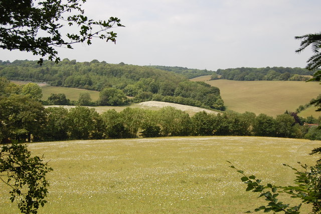
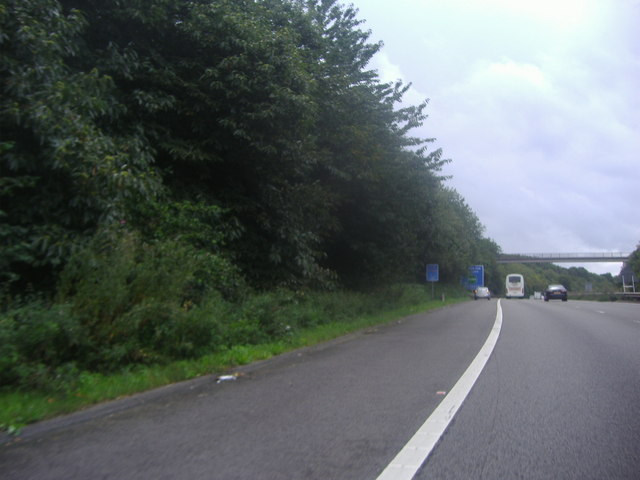
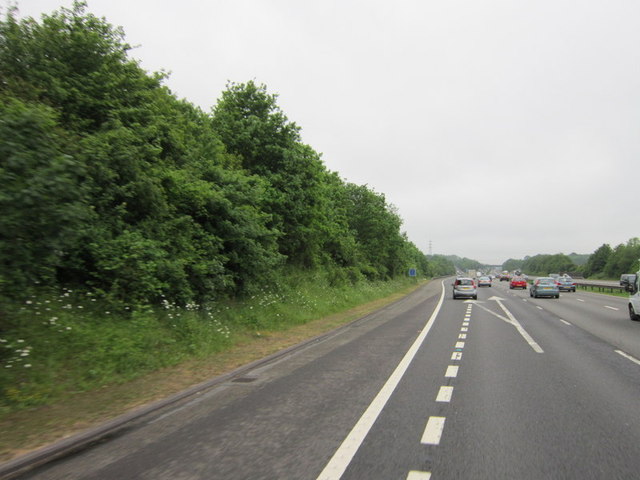
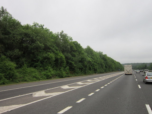
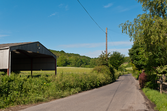
Watercrofts Wood is a charming forest located in the county of Kent, England. Covering an area of approximately 50 acres, this wood is a captivating natural haven with a diverse range of flora and fauna.

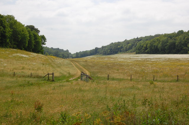
The wood is predominantly composed of deciduous trees, including oak, beech, and ash, which create a beautiful canopy during the summer months. The forest floor is adorned with a rich carpet of bluebells, primroses, and wild garlic in the spring, creating a picturesque scene.

Watercrofts Wood is home to a variety of wildlife, making it a popular destination for nature enthusiasts and birdwatchers. Visitors may spot native species such as badgers, foxes, and rabbits, as well as a variety of bird species including woodpeckers, owls, and thrushes. The wood is also home to a thriving population of butterflies and insects, providing an important habitat for these creatures.

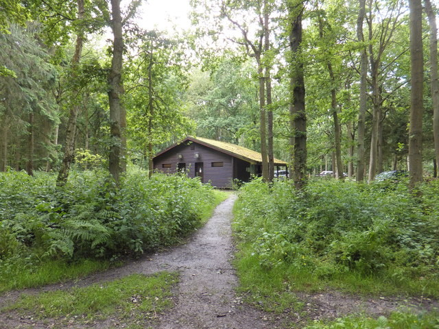
There are several walking trails within the wood, allowing visitors to explore its natural beauty at their own pace. These paths wind through the trees, offering glimpses of serene ponds and small streams. The wood is well-maintained, with clear signposts and a designated parking area for visitors.

Watercrofts Wood offers a peaceful retreat from the hustle and bustle of everyday life, providing a tranquil setting for picnics, photography, or simply enjoying the natural surroundings. With its abundant wildlife and picturesque scenery, it is no wonder that Watercrofts Wood is a cherished gem in the beautiful county of Kent.

If you have any feedback on the listing, please let us know in the comments section below.

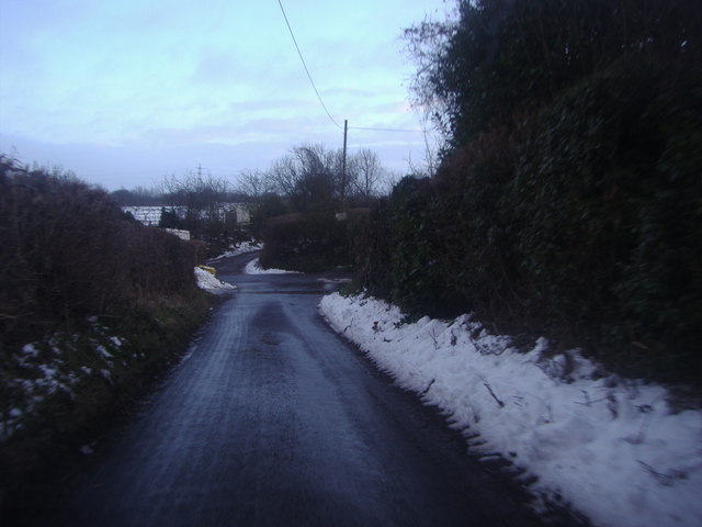
Watercrofts Wood Images

Images are sourced within 2km of 51.340218/0.13888777 or Grid Reference TQ4962. Thanks to Geograph Open Source API. All images are credited.

View from Meenfield Wood Emerging from Meenfield Wood towards Timberden Bottom, the pasture studded with white daisies.
View from Meenfield Wood
Emerging from Meenfield Wood towards Timberden Bottom, the pasture studded with white daisies.
Valley View Taken from the point where the footpath meets Shacklands Road at Timberden Bottom.
Hard to believe how close is the M25.
Valley View
Taken from the point where the footpath meets Shacklands Road at Timberden Bottom. Hard to believe how close is the M25.
Junction 4, M25 The M25 is a 117 mile orbital motorway that encircles London. It was constructed between 1975 and 1986.
The motorway is not a continuous loop as a section to the East of London at The Dartford Crossing is an A-Road.
Wikipedia; <span class="nowrap"><a title="http://en.wikipedia.org/wiki/M25_motorway" rel="nofollow ugc noopener" href="http://en.wikipedia.org/wiki/M25_motorway">Link</a><img style="margin-left:2px;" alt="External link" title="External link - shift click to open in new window" src="https://s1.geograph.org.uk/img/external.png" width="10" height="10"/></span>
Junction 4, M25
The M25 is a 117 mile orbital motorway that encircles London. It was constructed between 1975 and 1986. The motorway is not a continuous loop as a section to the East of London at The Dartford Crossing is an A-Road. Wikipedia; LinkExternal link
Exit 4 roundabout on the M25 Leading to Badgers Mount on the left turnoff
Exit 4 roundabout on the M25
Leading to Badgers Mount on the left turnoff
The M25 sliproad to Badgers Mount
Footbridge over the M25, Badgers Mount
Sign for the junction 4 exit on the M25
Junction 4, M25 The M25 is a 117 mile orbital motorway that encircles London. It was constructed between 1975 and 1986.
The motorway is not a continuous loop as a section to the East of London at The Dartford Crossing is an A-Road.
Wikipedia; <span class="nowrap"><a title="http://en.wikipedia.org/wiki/M25_motorway" rel="nofollow ugc noopener" href="http://en.wikipedia.org/wiki/M25_motorway">Link</a><img style="margin-left:2px;" alt="External link" title="External link - shift click to open in new window" src="https://s1.geograph.org.uk/img/external.png" width="10" height="10"/></span>
Junction 4, M25
The M25 is a 117 mile orbital motorway that encircles London. It was constructed between 1975 and 1986. The motorway is not a continuous loop as a section to the East of London at The Dartford Crossing is an A-Road. Wikipedia; LinkExternal link
Footbridge over the M25 The M25 is a 117 mile orbital motorway that encircles London. It was constructed between 1975 and 1986.
The motorway is not a continuous loop as a section to the East of London at The Dartford Crossing is an A-Road.
Wikipedia; <span class="nowrap"><a title="http://en.wikipedia.org/wiki/M25_motorway" rel="nofollow ugc noopener" href="http://en.wikipedia.org/wiki/M25_motorway">Link</a><img style="margin-left:2px;" alt="External link" title="External link - shift click to open in new window" src="https://s1.geograph.org.uk/img/external.png" width="10" height="10"/></span>
Footbridge over the M25
The M25 is a 117 mile orbital motorway that encircles London. It was constructed between 1975 and 1986. The motorway is not a continuous loop as a section to the East of London at The Dartford Crossing is an A-Road. Wikipedia; LinkExternal link
M25 heading south The M25 is a 117 mile orbital motorway that encircles London. It was constructed between 1975 and 1986.
The motorway is not a continuous loop as a section to the East of London at The Dartford Crossing is an A-Road.
Wikipedia; <span class="nowrap"><a title="http://en.wikipedia.org/wiki/M25_motorway" rel="nofollow ugc noopener" href="http://en.wikipedia.org/wiki/M25_motorway">Link</a><img style="margin-left:2px;" alt="External link" title="External link - shift click to open in new window" src="https://s1.geograph.org.uk/img/external.png" width="10" height="10"/></span>
M25 heading south
The M25 is a 117 mile orbital motorway that encircles London. It was constructed between 1975 and 1986. The motorway is not a continuous loop as a section to the East of London at The Dartford Crossing is an A-Road. Wikipedia; LinkExternal link
Firmingers Road at the junction of Rock Hill
Junction 4, M25 westbound
The on slip, junction 4, M25
A public path over the M25
Andrew's Wood, Badgers Mount
M25 - 300 yds from junction 4
Timberden Farm Outbuildings of this farm on Shacklands Road.
Timberden Farm
Outbuildings of this farm on Shacklands Road.
Show me another place!

Watercrofts Wood is located at Grid Ref: TQ4962 (Lat: 51.340218, Lng: 0.13888777)

Administrative County: Kent

District: Sevenoaks

Police Authority: Kent

What 3 Words

///bunny.nets.opens. Near Otford, Kent

Related Wikis

Badgers Mount

Badgers Mount is a village and civil parish in the Sevenoaks District of Kent, England It is located 3.6 miles south east of Orpington and 5.6 miles north...

Knockholt railway station

Knockholt railway station is on the South Eastern Main Line, located in the London Borough of Bromley, Greater London. It is 16 miles 44 chains (26.6 km...

Halstead, Kent

Halstead is a village and civil parish in the Sevenoaks District of Kent, England. It is located 4.7 miles south east of Orpington & 6.1 miles north west...

St Margaret's Church, Halstead

St Margaret's Church is an Anglican parish church in the village of Halstead and the Sevenoaks deanery, although the church also serves the village of...

Hewitt's Chalk Bank

Hewitt's Chalk Bank is a 4-hectare (10-acre) nature reserve north-east of Pratt's Bottom in the London Borough of Bromley. It is managed by the Kent Wildlife...

Well Hill

Well Hill is a small rural hamlet within the civil parish of Shoreham in the Sevenoaks District of Kent, England. It lies 3 miles south east of Orpington...

Pratt's Bottom

Pratt's Bottom is a village in Greater London, England, within the London Borough of Bromley and, prior to 1965, within the historic county of Kent. It...

Chelsfield

Chelsfield is an area in south-east London, England, within the London Borough of Bromley and, prior to 1965, in the historic county of Kent. It lies south...

Nearby Amenities

Located within 500m of 51.340218,0.13888777
Bus Stop
Foxes Garage
Bus: yes
Fixme: Can somebody confirm is there is a bus stop here? If yes, can they set naptan:verified to yes.
Flag: no
Naptan AtcoCode: 240098601
Naptan Bearing: N
Naptan BusStopType: CUS
Naptan CommonName: Foxes Garage
Naptan Indicator: adj
Naptan Landmark: Badgers Road
Naptan NaptanCode: kntgpatg
Naptan Street: Orpington By-Pass Road
Naptan Verified: no
Public Transport: platform
Ref: kntgpatg
Source: naptan_import
Source Date: 2018-04-11T09:49:00
Lat/Long: 51.3397952/0.1449128
Bus Stop
Watercroft Road
Bus: yes
Naptan AtcoCode: 2400A034600A
Naptan Bearing: NW
Naptan CommonName: Watercroft Road
Naptan Indicator: adj
Naptan Landmark: Watercroft Road
Naptan NaptanCode: kntdmdpw
Naptan Street: London Road
Naptan Verified: no
Public Transport: platform
Ref: kntdmdpw
Source: naptan_import
Source Date: 2018-04-11T09:59:00
Lat/Long: 51.3430182/0.1383289
Bus Stop
Watercroft Road
Bus: yes
Naptan AtcoCode: 2400A034670A
Naptan Bearing: SE
Naptan CommonName: Watercroft Road
Naptan Indicator: opp
Naptan Landmark: Watercroft Road
Naptan NaptanCode: kntdmdtg
Naptan Street: London Road
Naptan Verified: no
Public Transport: platform
Ref: kntdmdtg
Source: naptan_import
Source Date: 2018-04-11T10:00:00
Lat/Long: 51.3428362/0.1389379
Bus Stop
Badgers Rise
Bus: yes
Naptan AtcoCode: 2400A034680A
Naptan Bearing: S
Naptan CommonName: Badgers Rise
Naptan Indicator: adj
Naptan Landmark: Badgers Rise
Naptan NaptanCode: kntdmdtj
Naptan Street: Old London Road
Naptan Verified: no
Public Transport: platform
Ref: kntdmdtj
Source: naptan_import
Source Date: 2018-04-11T09:46:00
Lat/Long: 51.339434/0.1435176
Post Box
Collection Times: Mo-Fr 09:00; Sa 07:00; Su off
Colour: red
Ref: TN14 65
Royal Cypher: EIIR
Royal Cypher Wikidata: Q33102113
Lat/Long: 51.3393737/0.1435573
Bus Stop
Badgers Rise
Bus: yes
Naptan AtcoCode: 2400A034590A
Naptan Bearing: N
Naptan CommonName: Badgers Rise
Naptan Indicator: opp
Naptan Landmark: Badgers Rise
Naptan NaptanCode: kntdmdpt
Naptan Street: Old London Road
Naptan Verified: no
Public Transport: platform
Ref: kntdmdpt
Source: naptan_import
Source Date: 2018-04-11T09:47:00
Lat/Long: 51.3394744/0.1432754
Power: pole
Lat/Long: 51.3359139/0.1406577
Power: pole
Lat/Long: 51.336849/0.1406684
Power: pole
Lat/Long: 51.3359072/0.1408401
Power: pole
Lat/Long: 51.3368573/0.1408347
Power: pole
Lat/Long: 51.3399497/0.1407824
Power: pole
Lat/Long: 51.3388078/0.1407999
Power: pole
Lat/Long: 51.3378091/0.140816
Power: pole
Lat/Long: 51.3378208/0.1406658
Power: pole
Lat/Long: 51.3399514/0.1406591
Termination
Power: pole
Lat/Long: 51.3424127/0.1412292
Termination
Power: pole
Lat/Long: 51.3423407/0.1413269
Post Box
Collection Times: Mo-Fr 16:15; Sa 09:30; Su off
Colour: red
Post Box Mounting: wooden_post
Post Box Type: lamp
Ref: TN14 66
Royal Cypher: EIIR
Royal Cypher Wikidata: Q33102113
Lat/Long: 51.3423685/0.1394424
Barrier: kissing_gate
Bicycle: no
Foot: yes
Horse: no
Motor Vehicle: no
Lat/Long: 51.3426798/0.1359878
Barrier: kissing_gate
Bicycle: no
Foot: yes
Horse: no
Motor Vehicle: no
Lat/Long: 51.3365148/0.1354081
Barrier: kissing_gate
Bicycle: no
Foot: yes
Horse: no
Motor Vehicle: no
Lat/Long: 51.3403976/0.1355364
The data included in this document is from www.openstreetmap.org. The data is made available under ODbL.

Have you been to Watercrofts Wood?

Leave your review of Watercrofts Wood below (or comments, questions and feedback).