Weddrell's Plain

Wood, Forest in Essex Epping Forest

England

Weddrell's Plain

Pasture near Lambourne End, Essex Viewed looking north westwards from the Three Forests Way.
Pasture near Lambourne End, Essex Credit: Nigel Cox

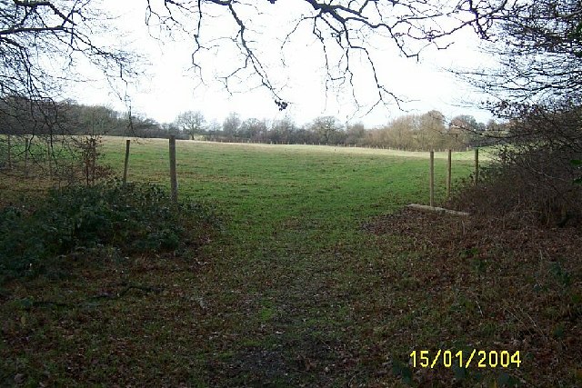
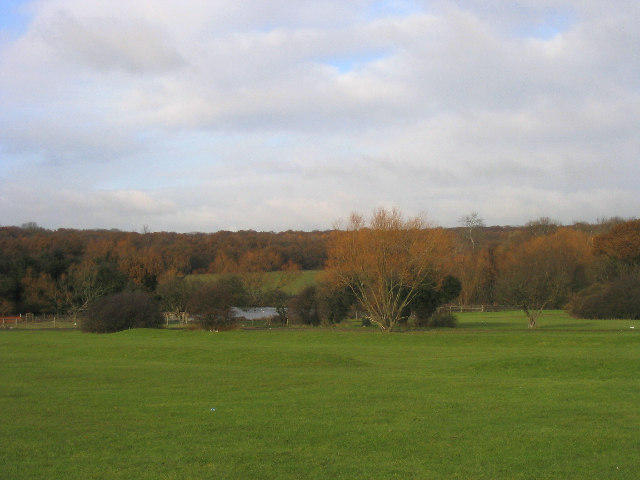
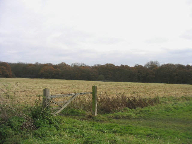
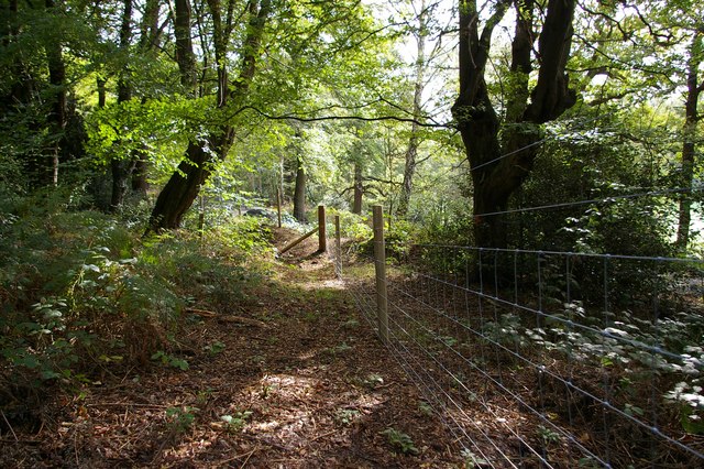
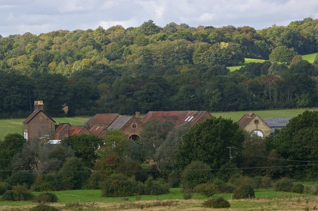
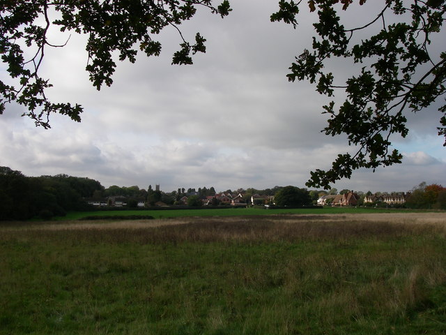
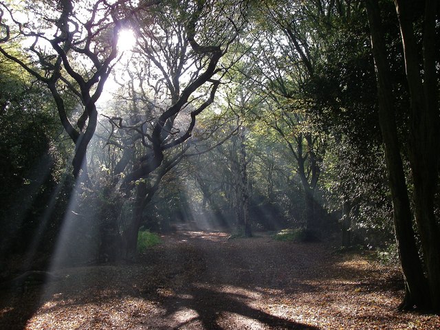
Weddrell's Plain, located in Essex, England, is a picturesque woodland area known for its natural beauty and serene atmosphere. Covering a vast expanse of land, it is part of the larger Epping Forest and is a popular destination for nature lovers and outdoor enthusiasts.

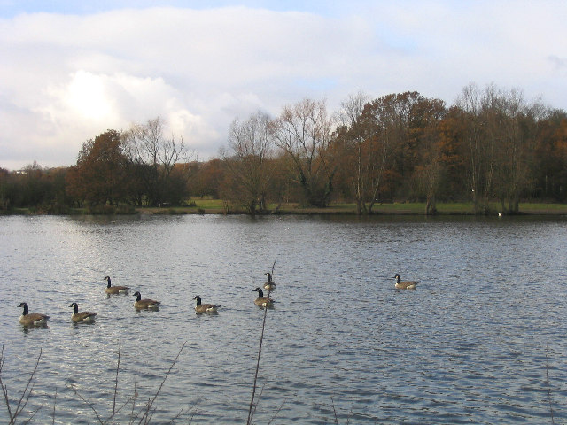
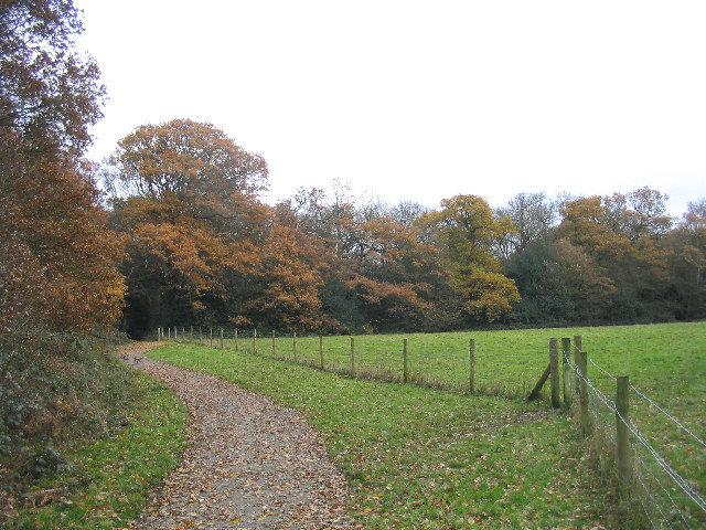
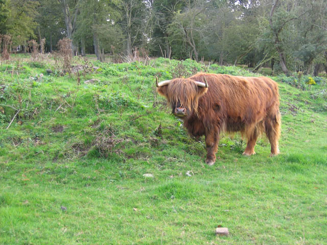
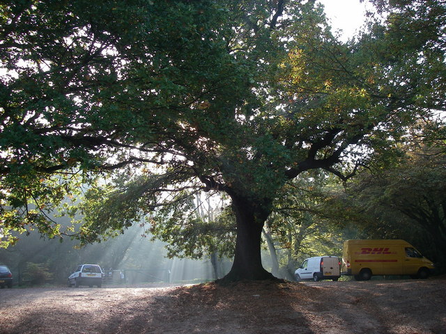
The plain is characterized by its dense, lush vegetation, consisting primarily of oak and beech trees that create a dense canopy overhead. The forest floor is carpeted with a variety of wildflowers, adding splashes of color to the landscape. Weddrell's Plain is also home to a diverse range of wildlife, including deer, rabbits, squirrels, and a variety of bird species.

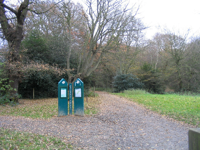
Traversing through the woods, visitors can explore a network of well-maintained walking trails, offering an opportunity to immerse oneself in nature and enjoy the peaceful surroundings. The plain is also intersected by a small stream, which adds to the tranquility of the area.

Weddrell's Plain attracts visitors throughout the year, with each season offering its own unique charm. In the spring, the forest comes alive with vibrant blooms and blossoms, while autumn brings a stunning display of colorful foliage. In winter, the plain transforms into a winter wonderland, with snow-covered trees and a peaceful hush.

Visitors to Weddrell's Plain can enjoy a range of outdoor activities, including hiking, birdwatching, and photography. The area is also home to several picnic spots, perfect for a leisurely lunch amidst nature.

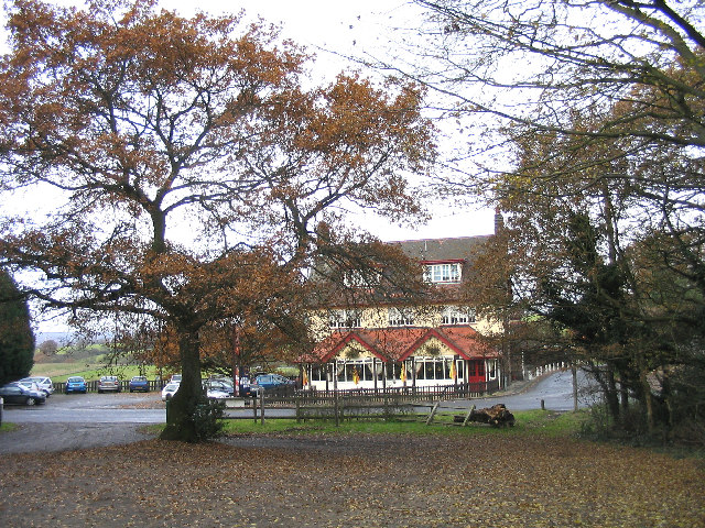
Overall, Weddrell's Plain in Essex is a haven of natural beauty, offering visitors a chance to escape the hustle and bustle of city life and immerse themselves in the tranquility of the forest.

If you have any feedback on the listing, please let us know in the comments section below.

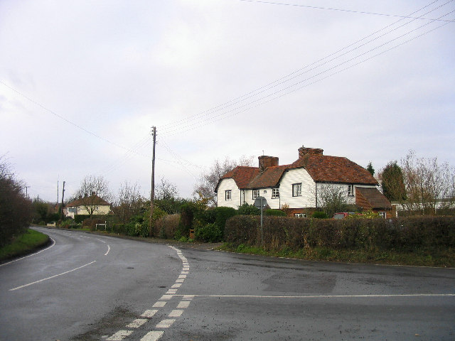
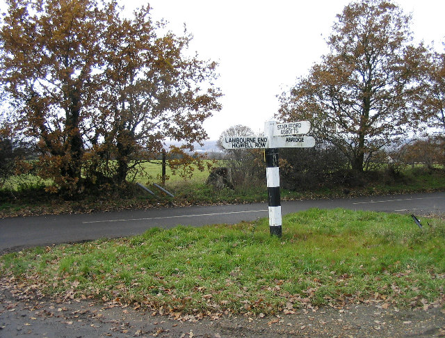
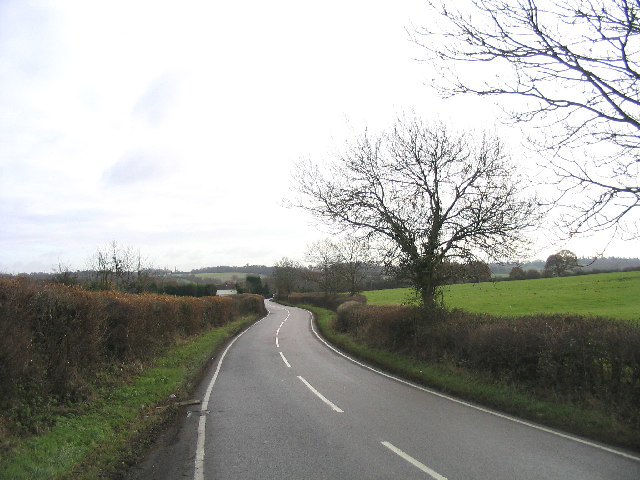
Weddrell's Plain Images

Images are sourced within 2km of 51.624007/0.13299343 or Grid Reference TQ4793. Thanks to Geograph Open Source API. All images are credited.

Pasture near Lambourne End, Essex Viewed looking north westwards from the Three Forests Way.
Pasture near Lambourne End, Essex
Viewed looking north westwards from the Three Forests Way.
Hainault Forest Country Park Looking north towards the lake from the main car park.
Hainault Forest Country Park
Looking north towards the lake from the main car park.
The Lake, Hainault Forest Country Park
Cottages, Chigwell Row, Essex A row of traditional Essex-style white weatherboard cottages
Cottages, Chigwell Row, Essex
A row of traditional Essex-style white weatherboard cottages
Footpath, Hainault Forest Country Park Part of the Forest Walk situated on north side of the forest
Footpath, Hainault Forest Country Park
Part of the Forest Walk situated on north side of the forest
Hainault Forest Country Park The start of the Forest Walk on Lambourne End side of the forest.
Hainault Forest Country Park
The start of the Forest Walk on Lambourne End side of the forest.
Camelot Public House, Lambourne End
Wild Wood Trail, Hainault Forest Part of a 2.5km circular walk around the north-east part of the forest.
Wild Wood Trail, Hainault Forest
Part of a 2.5km circular walk around the north-east part of the forest.
Lambourne End, Essex
Fingerpost, between Abridge and Lambourne End Situated at junction of Hoe Lane and New Road
Fingerpost, between Abridge and Lambourne End
Situated at junction of Hoe Lane and New Road
Bournebridge Lane, Stapleford Abbotts Looking east towards the village
Bournebridge Lane, Stapleford Abbotts
Looking east towards the village
Highland cow at Foxburrows Farm This rare breeds centre forms part of Hainault Forest Country Park, a mixture of grassland and deciduous woodland close to the suburbs of NE London.
Highland cow at Foxburrows Farm
This rare breeds centre forms part of Hainault Forest Country Park, a mixture of grassland and deciduous woodland close to the suburbs of NE London.
Edge of the Forest This fence divides Hainault Forest Country Park from a Golf Course
Edge of the Forest
This fence divides Hainault Forest Country Park from a Golf Course
Park Farm This is Park Farm near Havering atte Bower the picture was taken from the Bridleway that runs along the edge of Havering Country Park.
Park Farm
This is Park Farm near Havering atte Bower the picture was taken from the Bridleway that runs along the edge of Havering Country Park.
Footpath From Marchings Farm This is the footpath from Marchings Farm to Gravel Lane as it reaches Gravel Lane.
Footpath From Marchings Farm
This is the footpath from Marchings Farm to Gravel Lane as it reaches Gravel Lane.
Hainault Forest and Chigwell Row Common View from 'Edgar Moon's seat' overlooking the common towards the church and school.  Hainault Forest and the common are managed by the Woodland Trust.
Hainault Forest and Chigwell Row Common
View from 'Edgar Moon's seat' overlooking the common towards the church and school. Hainault Forest and the common are managed by the Woodland Trust.
Camelot Car Park, Hainault Forest Hainault Forest is leased to the Woodland Trust and is open to the public.  It is possibly the largest area of old pollarded hornbeam trees in Europe.
Camelot Car Park, Hainault Forest
Hainault Forest is leased to the Woodland Trust and is open to the public. It is possibly the largest area of old pollarded hornbeam trees in Europe.
Forest path, November morning The Camelot path into Hainault Forest on a Monday morning.  Believe it or not this is only about 13 miles from St. Paul's Cathedral.
Forest path, November morning
The Camelot path into Hainault Forest on a Monday morning. Believe it or not this is only about 13 miles from St. Paul's Cathedral.
Show me another place!

Weddrell's Plain is located at Grid Ref: TQ4793 (Lat: 51.624007, Lng: 0.13299343)

Administrative County: Essex

District: Epping Forest

Police Authority: Essex

What 3 Words

///truth.tries.trees. Near Hainault, London

Related Wikis

Hainault Forest

Hainault Forest was a large wooded area in the English counties of Essex and Greater London which was mostly destroyed after 1851. Popular outrage at the...

Lambourne

Lambourne is a civil parish in the Epping Forest district of Essex, England. It is located approximately 4.5 miles (7 km) south of Epping and 5 miles...

Offset Festival

Offset Festival was a musical festival held at Hainault Forest Country Park, just outside London, from 2008 to 2010. == 2008 == The first event aimed to...

Chigwell Row

Chigwell Row is a small village falling within the Epping Forest district of Essex. It is located 12.9 miles (20.8 km) north east of Charing Cross. It...

Chigwell Row Wood

Chigwell Row Wood is a 14.1 hectare Local Nature Reserve in Chigwell in Epping Forest district, Essex. It is owned by The Chigwell Row Recreation Ground...

Hainault Lodge

Hainault Lodge in Fairlop is the only Local Nature Reserve in the London Borough of Redbridge. It is owned and managed by Redbrige Council. == History... ==

Redbridge Cycling Centre

Redbridge Cycling Centre is a road cycle circuit and mountain bike course at Hog Hill – near Hainault Forest Country Park and directly opposite the Forest...

The Forest Academy

The Forest Academy (formerly Hainault Forest High School) is a coeducational secondary school situated near to Hainault Forest Country Park in Hainault...

Nearby Amenities

Located within 500m of 51.624007,0.13299343
Barrier: kissing_gate
Lat/Long: 51.6227844/0.1370589
Bench
Lat/Long: 51.6195818/0.1330675
Cabin Hill
Natural: peak
Lat/Long: 51.6221127/0.1348301
Cabin's Plain
Place: locality
Lat/Long: 51.6228398/0.1323069
Taylor's Plain
Place: locality
Lat/Long: 51.6257871/0.1349258
Weddrell's Plain
Place: locality
Lat/Long: 51.6242086/0.1326588
Three Cornered Plain
Place: locality
Lat/Long: 51.6270885/0.1380876
Coal tax post
Historic: boundary_stone
Inscription: 24 & 25 VICT CAP 42
Material: iron
Note: Coal tax boundary marker 8
Lat/Long: 51.6238861/0.1259675
Description: SLOW
Direction: backward
Traffic Sign: GB:1024
Lat/Long: 51.6271528/0.1317895
The data included in this document is from www.openstreetmap.org. The data is made available under ODbL.

Have you been to Weddrell's Plain?

Leave your review of Weddrell's Plain below (or comments, questions and feedback).