Sheep Water

Lake, Pool, Pond, Freshwater Marsh in Essex Epping Forest

England

Sheep Water

Pasture near Lambourne End, Essex Viewed looking north westwards from the Three Forests Way.
Pasture near Lambourne End, Essex Credit: Nigel Cox

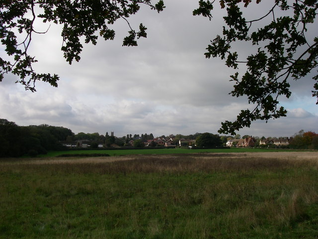
Sheep Water is a picturesque freshwater marsh located in the village of Essex, England. Covering an area of approximately 5 acres, it is a popular destination for both locals and tourists seeking tranquility and natural beauty.

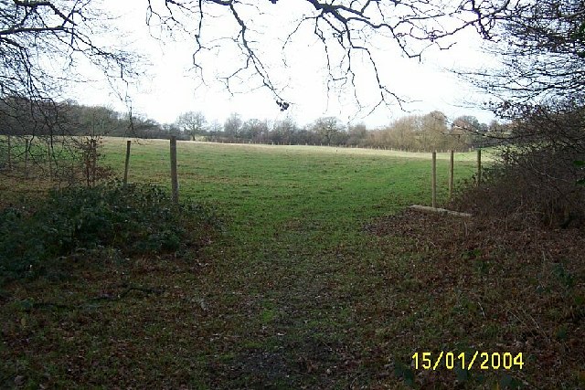
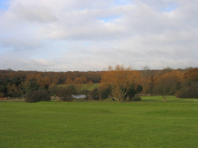
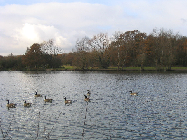
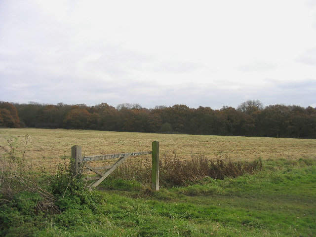
Nestled amidst rolling hills and lush greenery, Sheep Water is primarily known for its pristine lake, pool, pond, and freshwater marsh. The lake itself spans a significant portion of the site, offering a serene spot for fishing and boating enthusiasts. Its crystal-clear water is home to a variety of fish species, including perch, pike, and roach, making it a haven for anglers of all levels.

The pool and pond within Sheep Water provide additional opportunities for leisurely activities such as swimming and picnicking. The pool, in particular, is a favorite spot for families, with its shallow waters and sandy beach, making it a safe and enjoyable environment for children.

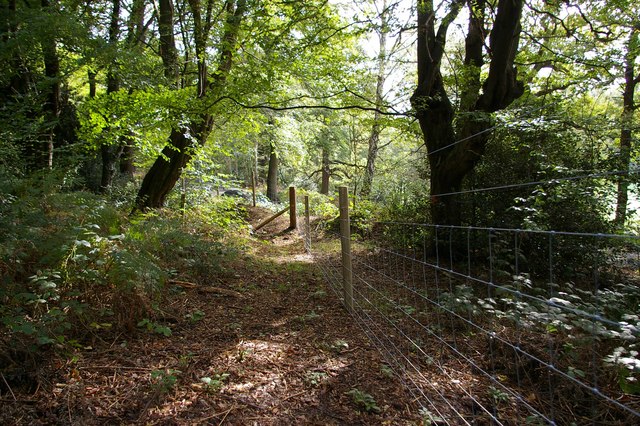
Surrounding the water bodies, the freshwater marsh adds to the beauty of the landscape. Rich in biodiversity, it serves as a habitat for numerous species of birds, amphibians, and insects. Birdwatching enthusiasts can spot a range of avian species, including ducks, herons, and swans.

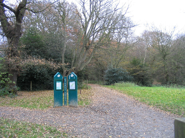
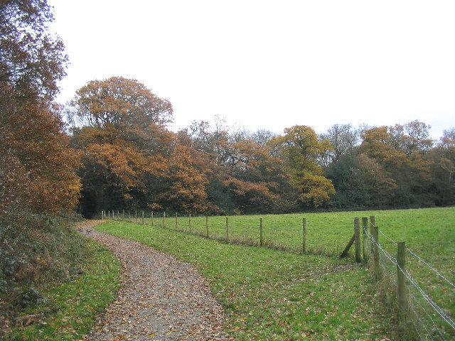
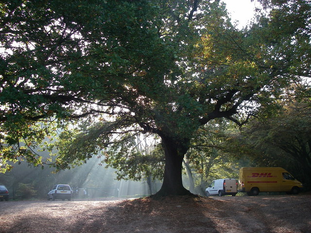
Sheep Water also offers amenities to enhance visitors' experiences, such as walking trails, picnic areas, and a visitor center providing information about the local flora and fauna. Additionally, the site hosts educational programs and guided tours, allowing visitors to learn about the unique ecosystem and conservation efforts.

Overall, Sheep Water, Essex, presents a captivating blend of natural features, making it a must-visit destination for nature lovers and those seeking a peaceful retreat amidst the scenic beauty of the English countryside.

If you have any feedback on the listing, please let us know in the comments section below.

Sheep Water Images

Images are sourced within 2km of 51.621011/0.12411268 or Grid Reference TQ4793. Thanks to Geograph Open Source API. All images are credited.

Pasture near Lambourne End, Essex Viewed looking north westwards from the Three Forests Way.
Pasture near Lambourne End, Essex
Viewed looking north westwards from the Three Forests Way.
Hainault Forest Country Park Looking north towards the lake from the main car park.
Hainault Forest Country Park
Looking north towards the lake from the main car park.
The Lake, Hainault Forest Country Park
Cottages, Chigwell Row, Essex A row of traditional Essex-style white weatherboard cottages
Cottages, Chigwell Row, Essex
A row of traditional Essex-style white weatherboard cottages
Footpath, Hainault Forest Country Park Part of the Forest Walk situated on north side of the forest
Footpath, Hainault Forest Country Park
Part of the Forest Walk situated on north side of the forest
Hainault Forest Country Park The start of the Forest Walk on Lambourne End side of the forest.
Hainault Forest Country Park
The start of the Forest Walk on Lambourne End side of the forest.
Camelot Public House, Lambourne End
Wild Wood Trail, Hainault Forest Part of a 2.5km circular walk around the north-east part of the forest.
Wild Wood Trail, Hainault Forest
Part of a 2.5km circular walk around the north-east part of the forest.
Fingerpost, between Abridge and Lambourne End Situated at junction of Hoe Lane and New Road
Fingerpost, between Abridge and Lambourne End
Situated at junction of Hoe Lane and New Road
The largest Muslim cemetery in Europe The Gardens of Peace, Elmbridge Road, Hainault, is the largest dedicated Muslim cemetery in Europe.   The absence of headstones is notable, the graves consisting of earth mounds marked with small stone name plates.
The largest Muslim cemetery in Europe
The Gardens of Peace, Elmbridge Road, Hainault, is the largest dedicated Muslim cemetery in Europe. The absence of headstones is notable, the graves consisting of earth mounds marked with small stone name plates.
Hainault Housing Shops and flats in Manford Way, part of the huge Hainault overspill development of the 1950s
Hainault Housing
Shops and flats in Manford Way, part of the huge Hainault overspill development of the 1950s
Circular reservoir near Chigwell Row This reservoir forms part of Essex and Suffolk Water's treatment works.
Circular reservoir near Chigwell Row
This reservoir forms part of Essex and Suffolk Water's treatment works.
Highland cow at Foxburrows Farm This rare breeds centre forms part of Hainault Forest Country Park, a mixture of grassland and deciduous woodland close to the suburbs of NE London.
Highland cow at Foxburrows Farm
This rare breeds centre forms part of Hainault Forest Country Park, a mixture of grassland and deciduous woodland close to the suburbs of NE London.
Forest Road This is the Junction of Forest Road and Roebuck Road which leads on to the Hainault Industrial Estate
Forest Road
This is the Junction of Forest Road and Roebuck Road which leads on to the Hainault Industrial Estate
Edge of the Forest This fence divides Hainault Forest Country Park from a Golf Course
Edge of the Forest
This fence divides Hainault Forest Country Park from a Golf Course
Footpath From Marchings Farm This is the footpath from Marchings Farm to Gravel Lane as it reaches Gravel Lane.
Footpath From Marchings Farm
This is the footpath from Marchings Farm to Gravel Lane as it reaches Gravel Lane.
Hainault Forest and Chigwell Row Common View from 'Edgar Moon's seat' overlooking the common towards the church and school.  Hainault Forest and the common are managed by the Woodland Trust.
Hainault Forest and Chigwell Row Common
View from 'Edgar Moon's seat' overlooking the common towards the church and school. Hainault Forest and the common are managed by the Woodland Trust.
Camelot Car Park, Hainault Forest Hainault Forest is leased to the Woodland Trust and is open to the public.  It is possibly the largest area of old pollarded hornbeam trees in Europe.
Camelot Car Park, Hainault Forest
Hainault Forest is leased to the Woodland Trust and is open to the public. It is possibly the largest area of old pollarded hornbeam trees in Europe.
Show me another place!

Sheep Water is located at Grid Ref: TQ4793 (Lat: 51.621011, Lng: 0.12411268)

Administrative County: Essex

District: Epping Forest

Police Authority: Essex

What 3 Words

///hands.newly.affair. Near Hainault, London

Related Wikis

Hainault Forest

Hainault Forest was a large wooded area in the English counties of Essex and Greater London which was mostly destroyed after 1851. Popular outrage at the...

Chigwell Row Wood

Chigwell Row Wood is a 14.1 hectare Local Nature Reserve in Chigwell in Epping Forest district, Essex. It is owned by The Chigwell Row Recreation Ground...

Chigwell Row

Chigwell Row is a small village falling within the Epping Forest district of Essex. It is located 12.9 miles (20.8 km) north east of Charing Cross. It...

Offset Festival

Offset Festival was a musical festival held at Hainault Forest Country Park, just outside London, from 2008 to 2010. == 2008 == The first event aimed to...

The Forest Academy

The Forest Academy (formerly Hainault Forest High School) is a coeducational secondary school situated near to Hainault Forest Country Park in Hainault...

Hainault Lodge

Hainault Lodge in Fairlop is the only Local Nature Reserve in the London Borough of Redbridge. It is owned and managed by Redbrige Council. == History... ==

Redbridge Cycling Centre

Redbridge Cycling Centre is a road cycle circuit and mountain bike course at Hog Hill – near Hainault Forest Country Park and directly opposite the Forest...
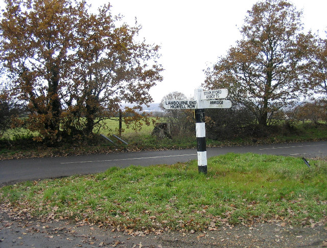
Lambourne

Lambourne is a civil parish in the Epping Forest district of Essex, England. It is located approximately 4.5 miles (7 km) south of Epping and 5 miles...

Nearby Amenities

Located within 500m of 51.621011,0.12411268
Noexit: yes
Lat/Long: 51.6195622/0.1186517
Noexit: yes
Lat/Long: 51.6202793/0.119234
Noexit: yes
Lat/Long: 51.6202674/0.1186076
Noexit: yes
Lat/Long: 51.6207427/0.1192637
Noexit: yes
Lat/Long: 51.6205548/0.1183409
Noexit: yes
Lat/Long: 51.6212225/0.1222981
Noexit: yes
Lat/Long: 51.620473/0.1198443
Turning Circle
Lat/Long: 51.6213979/0.1211034
Turning Circle
Lat/Long: 51.6222675/0.1195626
Noexit: yes
Lat/Long: 51.6234967/0.1217351
Noexit: yes
Lat/Long: 51.62304/0.1216961
Noexit: yes
Lat/Long: 51.6198849/0.1181335
Noexit: yes
Lat/Long: 51.6204551/0.1180054
Post Office
Chigwell Row Post Office
Addr City: Chigwell
Addr Housenumber: 78
Addr Postcode: IG7 6EN
Addr Street: Lambourne Road
Addr Village: Chigwell Row
Branch: Chigwell Row
Brand: Post Office
Brand Wikidata: Q1783168
Check Date: 2022‑05‑27
Check Date Opening Hours: 2022‑05‑27
Contact Website: https://www.postoffice.co.uk/branch-finder/2030268/chigwell-row
Opening Hours: Mo,Tu,Th,Fr 09:00-17:30; We 09:00-13:00
Ref Pol Id: 91397
Source: knowledge
Lat/Long: 51.620835/0.117644
Crossing
Crossing: uncontrolled
Crossing Island: no
Crossing Ref: zebra
Tactile Paving: yes
Lat/Long: 51.6223538/0.1219372
Bench
Lat/Long: 51.6186349/0.1302032
Coal tax post
Historic: boundary_stone
Inscription: 24 & 25 VICT CAP 42
Material: iron
Note: Coal tax boundary marker 8
Lat/Long: 51.6238861/0.1259675
Post Box
Lat/Long: 51.6208984/0.1176265
Give Way
Direction: backward
Lat/Long: 51.618626/0.1180924
Give Way
Direction: forward
Lat/Long: 51.6227446/0.1205045
Noexit: yes
Lat/Long: 51.6225129/0.1212198
Give Way
Direction: backward
Lat/Long: 51.6221347/0.1211404
Give Way
Direction: forward
Lat/Long: 51.6222688/0.121774
Tactile Paving: yes
Lat/Long: 51.6223348/0.1219565
Give Way
Direction: forward
Lat/Long: 51.6227237/0.1229274
Give Way
Direction: backward
Lat/Long: 51.6209965/0.1177089
Give Way
Direction: backward
Lat/Long: 51.621185/0.1183333
Give Way
Direction: backward
Lat/Long: 51.6215727/0.1196388
Noexit: yes
Lat/Long: 51.6222939/0.1200136
Noexit: yes
Lat/Long: 51.6204398/0.1193741
Crossing
Crossing: unmarked
Crossing Island: no
Crossing Markings: no
Lat/Long: 51.6201541/0.1180784
Noexit: yes
Lat/Long: 51.6199344/0.1184896
Pub
Two Brewers
Indoor Seating: yes
Outdoor Seating: yes
Lat/Long: 51.6219773/0.1201361
The data included in this document is from www.openstreetmap.org. The data is made available under ODbL.

Have you been to Sheep Water?

Leave your review of Sheep Water below (or comments, questions and feedback).