Avenue Holt

Wood, Forest in Lincolnshire East Lindsey

England

Avenue Holt

Direction Sign – Signpost on Gravel Pits Lane, Burgh le Marsh Located on the southwest side of the junction of North Road, Gravel Pits Lane and Bratoft Lane in Burgh le Marsh parish. 3 arms and no finial.

Milestone Society National ID: LI_TF4865
Direction Sign – Signpost on Gravel Pits Lane, Burgh le Marsh Credit: A Riley

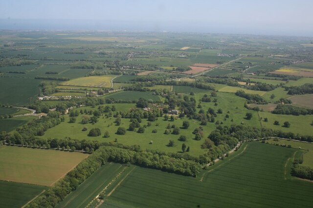
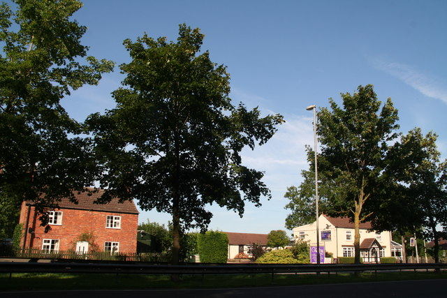
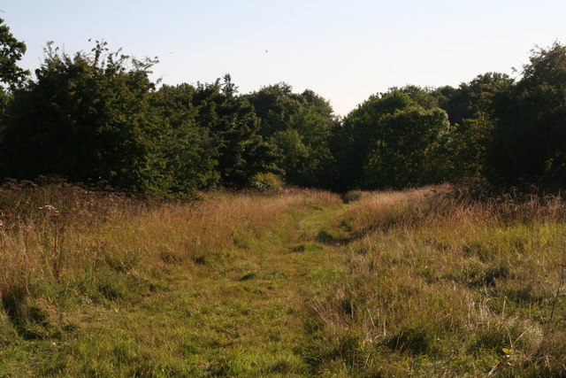
Avenue Holt is a charming woodland area located in Lincolnshire, known for its picturesque forest scenery and tranquil atmosphere. Nestled within the county, Avenue Holt offers visitors a unique opportunity to immerse themselves in the beauty of nature, away from the bustling city life.

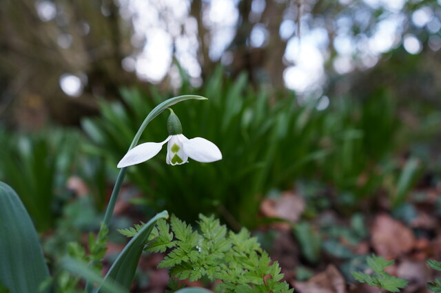
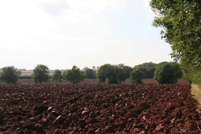
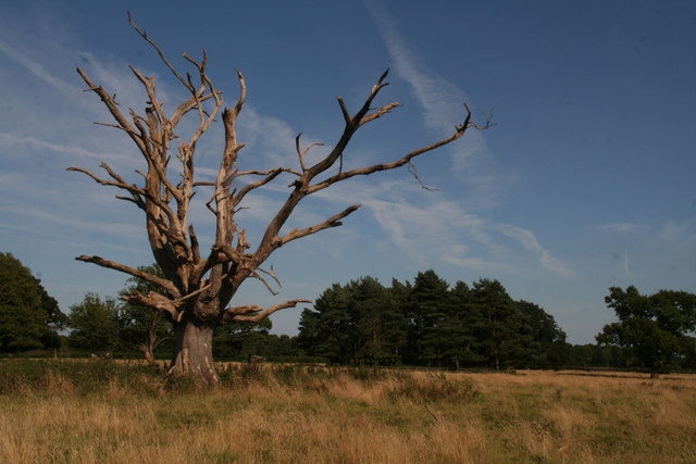
The forest boasts a diverse range of trees, including oak, beech, and birch, which create a lush green canopy overhead. The forest floor is adorned with a carpet of wildflowers, adding vibrant pops of color to the landscape. The area is also home to various wildlife, including deer, squirrels, and a variety of bird species, making it a haven for nature enthusiasts and birdwatchers.

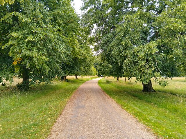
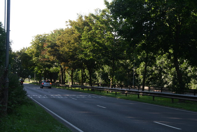
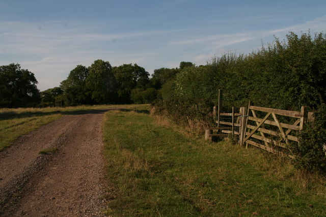
Avenue Holt is a popular destination for outdoor activities, such as hiking, cycling, and picnicking. There are well-maintained trails that wind through the forest, offering visitors the chance to explore the area and discover hidden gems along the way. The peaceful ambiance of the woodland also makes it an ideal spot for meditation and relaxation.

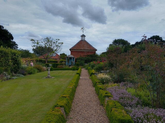
In addition to its natural beauty, Avenue Holt is also steeped in history. The forest has been preserved for centuries, serving as a reminder of the area's rich cultural heritage. Visitors can explore the remnants of ancient settlements and learn about the historical significance of the land.

Overall, Avenue Holt in Lincolnshire is a captivating destination that offers a peaceful retreat from the demands of everyday life. Whether you are seeking solace in nature, embarking on an outdoor adventure, or delving into history, this woodland sanctuary has something to offer for everyone.

If you have any feedback on the listing, please let us know in the comments section below.

Avenue Holt Images

Images are sourced within 2km of 53.174895/0.20866376 or Grid Reference TF4766. Thanks to Geograph Open Source API. All images are credited.

Direction Sign – Signpost on Gravel Pits Lane, Burgh le Marsh Located on the southwest side of the junction of North Road, Gravel Pits Lane and Bratoft Lane in Burgh le Marsh parish. 3 arms and no finial.

Milestone Society National ID: LI_TF4865
Direction Sign – Signpost on Gravel Pits Lane, Burgh le Marsh
Located on the southwest side of the junction of North Road, Gravel Pits Lane and Bratoft Lane in Burgh le Marsh parish. 3 arms and no finial. Milestone Society National ID: LI_TF4865
Orby: aerial 2022 (1)
Orby: aerial 2022 (2)
Exquisite beauty This solitary snowdrop displays its finery to its full extent.
Exquisite beauty
This solitary snowdrop displays its finery to its full extent.
Here kitty, kitty, kitty. ....  Kitty?! Amongst the myriad of scattered drinks cans, bottles, takeaway wrappers, cigarette papers and other items ejected from thoughtless vehicle windows, someone has discarded this poor unfortunate creature at the end of the pleasant footpath.
 
Lucky black cat anyone?
Here kitty, kitty, kitty. .... Kitty?!
Amongst the myriad of scattered drinks cans, bottles, takeaway wrappers, cigarette papers and other items ejected from thoughtless vehicle windows, someone has discarded this poor unfortunate creature at the end of the pleasant footpath. Lucky black cat anyone?
Gunby: aerial 2023
Gunby: aerial 2023
Gunby Hall path The path to Gunby Hall, a National Trust property.
Gunby Hall path
The path to Gunby Hall, a National Trust property.
Gunby Hall garden
Gunby Hall garden
Onions ripening Gunby Hall
East aspect Gunby Hall
Orchard Gunby Hall
Orchard Gunby Hall
Ploughed fields by B1196 north of Gunby End of August, much of the harvest is in and the first fields have been ploughed.
Ploughed fields by B1196 north of Gunby
End of August, much of the harvest is in and the first fields have been ploughed.
One of many dead trees in Gunby Park No criticism intended, quite nice to let them decay naturally. Apart from those killed by disease, I suppose given that many were planted at the same time over a century ago they have simply reached the end of their lives.
Elsewhere in the park a tree had been "saved" by breaking the ivy's stranglehold - see <a href="https://www.geograph.org.uk/photo/4626554">TF4666 : Breaking the ivy's stranglehold: tree by Little Wood, Gunby</a>.
One of many dead trees in Gunby Park
No criticism intended, quite nice to let them decay naturally. Apart from those killed by disease, I suppose given that many were planted at the same time over a century ago they have simply reached the end of their lives. Elsewhere in the park a tree had been "saved" by breaking the ivy's stranglehold - see TF4666 : Breaking the ivy's stranglehold: tree by Little Wood, Gunby.
House, pub (and Wifi Hotspot) by the A158 at Gunby
Shady avenue, Gunby Actually one side of a strange short length of dual carriageway in the middle of nowhere.
Shady avenue, Gunby
Actually one side of a strange short length of dual carriageway in the middle of nowhere.
Footpath through Gunby Park to the A158
Run, chicken, run: footpath to the former railway, Gunby
Path down the former railway's trackbed Now owned by the National Trust.
Path down the former railway's trackbed
Now owned by the National Trust.
Show me another place!

Avenue Holt is located at Grid Ref: TF4766 (Lat: 53.174895, Lng: 0.20866376)

Administrative County: Lincolnshire

District: East Lindsey

Police Authority: Lincolnshire

What 3 Words

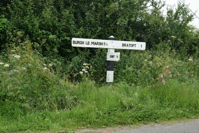
///mealtime.loser.marked. Near Burgh le Marsh, Lincolnshire

Related Wikis

Burgh-le-Marsh railway station

Burgh-le-Marsh was a railway station on the East Lincolnshire Railway which served the town of Burgh le Marsh in Lincolnshire between 1848 and 1970. It...
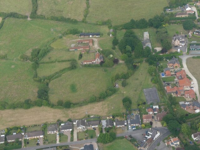
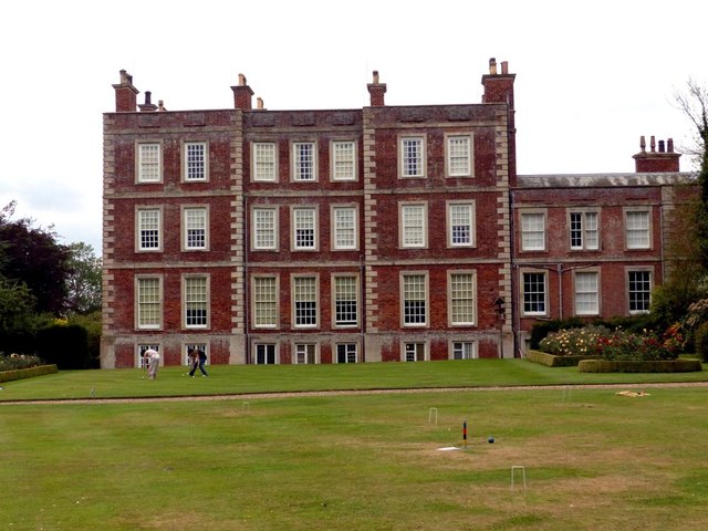
Gunby Hall

Gunby Hall is a country house in Gunby, near Spilsby, in Lincolnshire, England, reached by a half mile long private drive. The Estate comprises the 42...

Bratoft

Bratoft is a small hamlet in the East Lindsey district of Lincolnshire, England. It is situated approximately 5 miles (8 km) east from Spilsby, 2 miles...

Orby

Orby is a village and civil parish in the East Lindsey district of Lincolnshire, England. It is situated approximately 9 miles (14 km) east from the town...

Welton le Marsh

Welton le Marsh (or Welton in the Marsh) is a village and civil parish in the East Lindsey district of Lincolnshire, England. It is situated approximately...

Candlesby with Gunby

Candlesby with Gunby is a civil parish in the East Lindsey district of Lincolnshire, England, about 5 miles (8.0 km) east of the town of Spilsby, and includes...

Candlesby

Candlesby is a village and former civil parish, now in the parish of Candlesby with Gunby, in the East Lindsey district of Lincolnshire, England. It is...
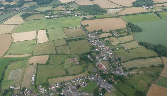
Burgh le Marsh

Burgh le Marsh is a town and civil parish in the East Lindsey district of Lincolnshire, England. == Geography == The town is built on a low hill surrounded...

Nearby Amenities

Located within 500m of 53.174895,0.20866376
Bus Stop
Old Signal Box
Naptan AtcoCode: 270000010494
Naptan Bearing: SE
Naptan CommonName: Old Signal Box
Naptan Indicator: opp
Naptan Landmark: Old Signal Box
Naptan NaptanCode: linjmtwd
Naptan Street: Station Road
Naptan Verified: no
Source: naptan_import
Lat/Long: 53.1766233/0.2089845
Bus Stop
Old Signal Box
Naptan AtcoCode: 270000010495
Naptan Bearing: NW
Naptan CommonName: Old Signal Box
Naptan Indicator: adj
Naptan Landmark: Old Signal Box
Naptan NaptanCode: linjmtwg
Naptan Street: Station Road
Naptan Verified: no
Source: naptan_import
Lat/Long: 53.1764613/0.2089911
Lodge Farm
Place: farm
Source: Bing
Lat/Long: 53.1737245/0.2123191
Red House Farm
Alt Name: Red Farm
Place: farm
Source: Bing
Lat/Long: 53.1756251/0.2094953
Crossing
Button Operated: no
Crossing: uncontrolled
Supervised: no
Traffic Signals Sound: no
Lat/Long: 53.1773263/0.2081546
Tastee Farm Shop
Addr City: Skegness
Addr Country: GB
Addr Housename: Massingberd Arms Farm
Addr Postcode: PE24 5EX
Addr Street: Station Road
Addr Town: Burgh Le Marsh
Fhrs Authority: East Lindsey
Fhrs Id: 157081
Fhrs Local Authority Id: EHFDI/07903/08
Shop: farm
Lat/Long: 53.1767792/0.2079937
Burgh-le-Marsh
Historic Railway: station
Old Name: Burgh
Railway: site
Wikidata: Q4998616
Wikipedia: en:Burgh-le-Marsh railway station
Lat/Long: 53.176362/0.2085383
The data included in this document is from www.openstreetmap.org. The data is made available under ODbL.

Have you been to Avenue Holt?

Leave your review of Avenue Holt below (or comments, questions and feedback).