Cook's Holt

Wood, Forest in Lincolnshire East Lindsey

England

Cook's Holt

Orby: aerial 2022 (1)
Orby: aerial 2022 (1) Credit: Simon Tomson

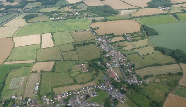
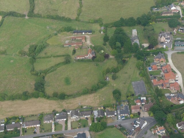
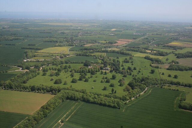
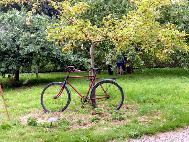
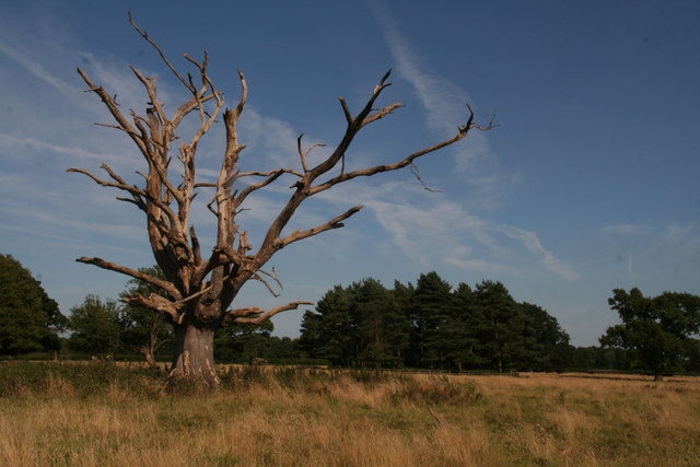
Cook's Holt is a picturesque woodland area located in Lincolnshire, England. The forest is spread across a vast expanse of approximately 250 acres and is known for its diverse range of tree species, including oak, ash, birch, and beech. Situated near the village of Wood, Cook's Holt provides a tranquil and serene environment for nature enthusiasts and those seeking a peaceful escape from the bustling city life.

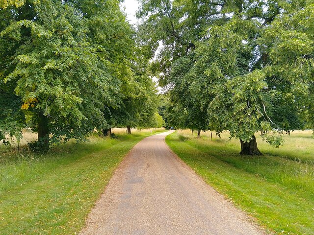
The forest is managed by the Forestry Commission, ensuring the preservation and conservation of its natural beauty. It offers various walking trails that allow visitors to explore the enchanting woodlands at their own pace. These trails cater to different levels of fitness and range from short leisurely walks to longer, more challenging hikes.

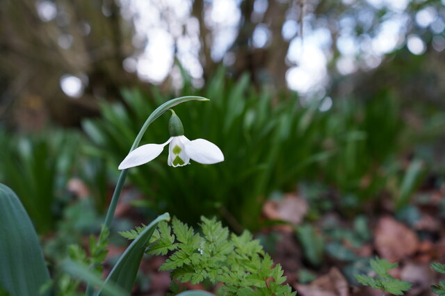
The woodland is also home to a rich variety of wildlife, including deer, foxes, badgers, and an array of bird species. Bird watchers can enjoy spotting birds such as woodpeckers, owls, and various songbirds in their natural habitat.

Moreover, Cook's Holt offers recreational activities such as picnicking and camping, making it an ideal destination for families and outdoor enthusiasts. The forest is equipped with picnic areas and facilities, allowing visitors to enjoy a delightful meal amidst the natural beauty of the surroundings.

Overall, Cook's Holt in Lincolnshire is a captivating woodland that offers a peaceful retreat and opportunities for outdoor exploration, making it a popular destination for nature lovers and those seeking a connection with the natural world.

If you have any feedback on the listing, please let us know in the comments section below.
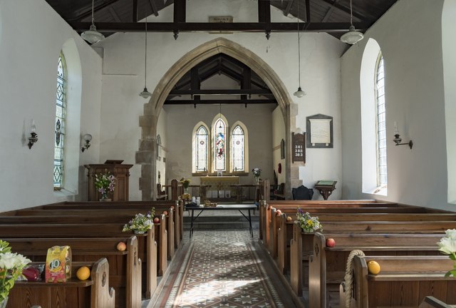
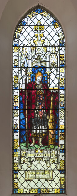
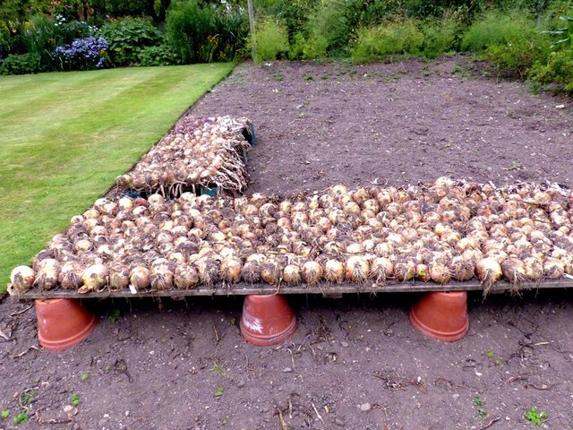
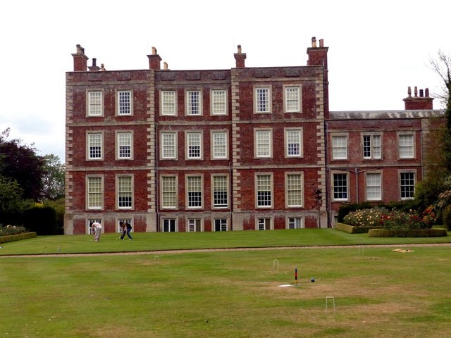
Cook's Holt Images

Images are sourced within 2km of 53.179317/0.20437138 or Grid Reference TF4766. Thanks to Geograph Open Source API. All images are credited.

Orby: aerial 2022 (1)
Orby: aerial 2022 (2)
Exquisite beauty This solitary snowdrop displays its finery to its full extent.
Exquisite beauty
This solitary snowdrop displays its finery to its full extent.
Here kitty, kitty, kitty. ....  Kitty?! Amongst the myriad of scattered drinks cans, bottles, takeaway wrappers, cigarette papers and other items ejected from thoughtless vehicle windows, someone has discarded this poor unfortunate creature at the end of the pleasant footpath.
 
Lucky black cat anyone?
Here kitty, kitty, kitty. .... Kitty?!
Amongst the myriad of scattered drinks cans, bottles, takeaway wrappers, cigarette papers and other items ejected from thoughtless vehicle windows, someone has discarded this poor unfortunate creature at the end of the pleasant footpath. Lucky black cat anyone?
Gunby: aerial 2023
Gunby: aerial 2023
Gunby Hall path The path to Gunby Hall, a National Trust property.
Gunby Hall path
The path to Gunby Hall, a National Trust property.
Gunby Hall garden
Gunby Hall garden
St Benedict's church, Candlesby A view from the south east.
St Benedict's church, Candlesby
A view from the south east.
Interior, St Benedict's church, Candlesby Grade II listed

The church was built in 1838 by E. Rainey of Spilsbury, with alterations in 1897. It was built on the site of an older church which was demolished.

The church is built in brick with a slate roof. There is a western tower, nave, chancel, and vestry.

The tower is of two stages with a plain parapet and angle pinnacles. There is a belfry with louvred lights.
The nave has a plain interior with three windows north and south.
The chancel has a moulded arch, a blocked priest's door and a triple lancet east window.
Most of the fittings are from the nineteenth century.

There are several stained-glass windows.
Interior, St Benedict's church, Candlesby
Grade II listed The church was built in 1838 by E. Rainey of Spilsbury, with alterations in 1897. It was built on the site of an older church which was demolished. The church is built in brick with a slate roof. There is a western tower, nave, chancel, and vestry. The tower is of two stages with a plain parapet and angle pinnacles. There is a belfry with louvred lights. The nave has a plain interior with three windows north and south. The chancel has a moulded arch, a blocked priest's door and a triple lancet east window. Most of the fittings are from the nineteenth century. There are several stained-glass windows.
East Window, St Benedict's church, Candlesby Triple lancet window with Jesus (as sower?) central, and Alpha and Omega either side. Sadly the paint on Jesus' face is extremely faded. It commemorates Margaret Massingberd of nearby Gunby Hall who died in 1906.
Artist unknown.
East Window, St Benedict's church, Candlesby
Triple lancet window with Jesus (as sower?) central, and Alpha and Omega either side. Sadly the paint on Jesus' face is extremely faded. It commemorates Margaret Massingberd of nearby Gunby Hall who died in 1906. Artist unknown.
Stained glass window, St Benedict's church, Candlesby Depicting David with spear and shield, glass by Powells.
In memory of John Franklin Rawnsley d.1924 aged 62.
Stained glass window, St Benedict's church, Candlesby
Depicting David with spear and shield, glass by Powells. In memory of John Franklin Rawnsley d.1924 aged 62.
Onions ripening Gunby Hall
East aspect Gunby Hall
Orchard Gunby Hall
Orchard Gunby Hall
Converted chapel in Welton le Marsh
Pleasant churchyard at Welton le Marsh
Ploughed fields by B1196 north of Gunby End of August, much of the harvest is in and the first fields have been ploughed.
Ploughed fields by B1196 north of Gunby
End of August, much of the harvest is in and the first fields have been ploughed.
One of many dead trees in Gunby Park No criticism intended, quite nice to let them decay naturally. Apart from those killed by disease, I suppose given that many were planted at the same time over a century ago they have simply reached the end of their lives.
Elsewhere in the park a tree had been "saved" by breaking the ivy's stranglehold - see <a href="https://www.geograph.org.uk/photo/4626554">TF4666 : Breaking the ivy's stranglehold: tree by Little Wood, Gunby</a>.
One of many dead trees in Gunby Park
No criticism intended, quite nice to let them decay naturally. Apart from those killed by disease, I suppose given that many were planted at the same time over a century ago they have simply reached the end of their lives. Elsewhere in the park a tree had been "saved" by breaking the ivy's stranglehold - see TF4666 : Breaking the ivy's stranglehold: tree by Little Wood, Gunby.
Show me another place!

Cook's Holt is located at Grid Ref: TF4766 (Lat: 53.179317, Lng: 0.20437138)

Administrative County: Lincolnshire

District: East Lindsey

Police Authority: Lincolnshire

What 3 Words

///trim.grinders.perfumes. Near Burgh le Marsh, Lincolnshire

Related Wikis

Burgh-le-Marsh railway station

Burgh-le-Marsh was a railway station on the East Lincolnshire Railway which served the town of Burgh le Marsh in Lincolnshire between 1848 and 1970. It...

Gunby Hall

Gunby Hall is a country house in Gunby, near Spilsby, in Lincolnshire, England, reached by a half mile long private drive. The Estate comprises the 42...

Welton le Marsh

Welton le Marsh (or Welton in the Marsh) is a village and civil parish in the East Lindsey district of Lincolnshire, England. It is situated approximately...

Orby

Orby is a village and civil parish in the East Lindsey district of Lincolnshire, England. It is situated approximately 9 miles (14 km) east from the town...

Candlesby with Gunby

Candlesby with Gunby is a civil parish in the East Lindsey district of Lincolnshire, England, about 5 miles (8.0 km) east of the town of Spilsby, and includes...

Candlesby

Candlesby is a village and former civil parish, now in the parish of Candlesby with Gunby, in the East Lindsey district of Lincolnshire, England. It is...

Bratoft

Bratoft is a small hamlet in the East Lindsey district of Lincolnshire, England. It is situated approximately 5 miles (8 km) east from Spilsby, 2 miles...

Burgh le Marsh

Burgh le Marsh is a town and civil parish in the East Lindsey district of Lincolnshire, England. == Geography == The town is built on a low hill surrounded...

Nearby Amenities

Located within 500m of 53.179317,0.20437138
Bus Stop
Old Signal Box
Naptan AtcoCode: 270000010494
Naptan Bearing: SE
Naptan CommonName: Old Signal Box
Naptan Indicator: opp
Naptan Landmark: Old Signal Box
Naptan NaptanCode: linjmtwd
Naptan Street: Station Road
Naptan Verified: no
Source: naptan_import
Lat/Long: 53.1766233/0.2089845
Bus Stop
Old Signal Box
Naptan AtcoCode: 270000010495
Naptan Bearing: NW
Naptan CommonName: Old Signal Box
Naptan Indicator: adj
Naptan Landmark: Old Signal Box
Naptan NaptanCode: linjmtwg
Naptan Street: Station Road
Naptan Verified: no
Source: naptan_import
Lat/Long: 53.1764613/0.2089911
Crossing
Button Operated: no
Crossing: uncontrolled
Supervised: no
Traffic Signals Sound: no
Lat/Long: 53.179618/0.2042585
Traffic Signals
Traffic Signals Direction: forward
Lat/Long: 53.1812753/0.1998742
Traffic Signals
Traffic Signals Direction: forward
Lat/Long: 53.181617/0.1998142
Give Way
Lat/Long: 53.1818979/0.1983765
Traffic Signals
Traffic Signals Direction: forward
Lat/Long: 53.1814285/0.1997737
Traffic Signals
Traffic Signals Direction: forward
Lat/Long: 53.1815876/0.200184
Ranson's Corner
Place: locality
Source: Bing
Lat/Long: 53.1772042/0.2001567
Crossing
Button Operated: no
Crossing: uncontrolled
Supervised: no
Traffic Signals Sound: no
Lat/Long: 53.1773263/0.2081546
Crossing
Button Operated: no
Crossing: uncontrolled
Supervised: no
Traffic Signals Sound: no
Lat/Long: 53.179703/0.2043526
Tastee Farm Shop
Addr City: Skegness
Addr Country: GB
Addr Housename: Massingberd Arms Farm
Addr Postcode: PE24 5EX
Addr Street: Station Road
Addr Town: Burgh Le Marsh
Fhrs Authority: East Lindsey
Fhrs Id: 157081
Fhrs Local Authority Id: EHFDI/07903/08
Shop: farm
Lat/Long: 53.1767792/0.2079937
Burgh-le-Marsh
Historic Railway: station
Old Name: Burgh
Railway: site
Wikidata: Q4998616
Wikipedia: en:Burgh-le-Marsh railway station
Lat/Long: 53.176362/0.2085383
The data included in this document is from www.openstreetmap.org. The data is made available under ODbL.

Have you been to Cook's Holt?

Leave your review of Cook's Holt below (or comments, questions and feedback).