Aston

Settlement in Hertfordshire East Hertfordshire

England

Aston

Parishes Mead. Parishes mead is a newer development on the east side of Stevenage.  There is a mixture of private and social housing here.
Parishes Mead. Credit: Robin Hall

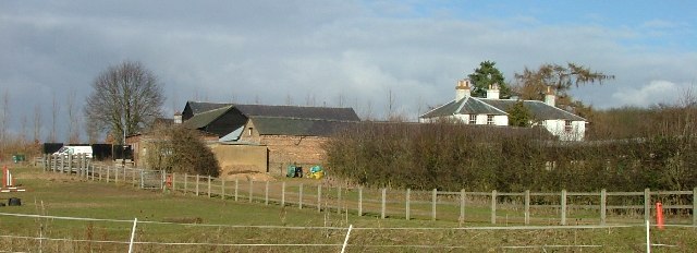
Aston is a small village located in the county of Hertfordshire, England. It is situated approximately 35 miles north of London and is part of the East Hertfordshire district. With a population of around 800 residents, Aston offers a peaceful and rural atmosphere.

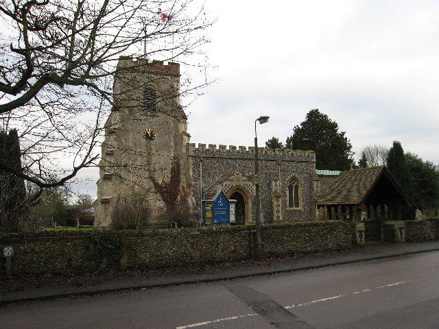
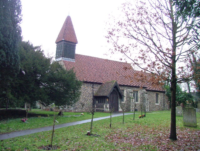
The village of Aston boasts a rich history dating back to the medieval period. Evidence of this can be seen in the charming architecture of some of its buildings, such as the St. Mary the Virgin Church, which dates back to the 14th century. The village is also home to several well-preserved thatched cottages, adding to its picturesque charm.

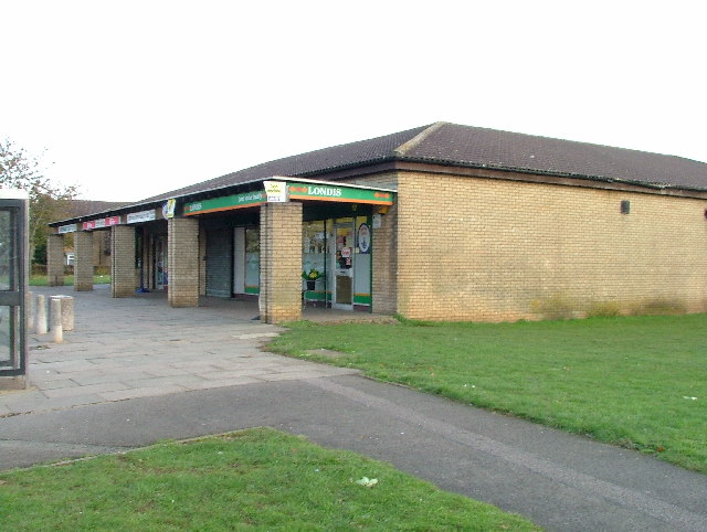
Although small in size, Aston offers a range of amenities for its residents. These include a primary school, a village hall, and a local pub. The village enjoys a close-knit community spirit, with various social events and gatherings taking place throughout the year.

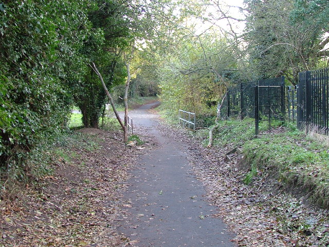
Surrounded by beautiful countryside, Aston is an ideal location for those who enjoy outdoor activities. The village is surrounded by fields and woodlands, offering numerous walking and cycling routes. Additionally, the nearby River Rib provides opportunities for fishing and leisurely walks along its banks.

Aston benefits from its proximity to larger towns and cities. The nearby town of Stevenage offers a wider range of amenities, including shopping centers, leisure facilities, and transportation links. The village is also conveniently located for commuters, with easy access to major road networks and train services to London and other nearby cities.

In conclusion, Aston is a charming and historic village in Hertfordshire, offering a tranquil rural lifestyle while still being well-connected to larger towns and cities.

If you have any feedback on the listing, please let us know in the comments section below.
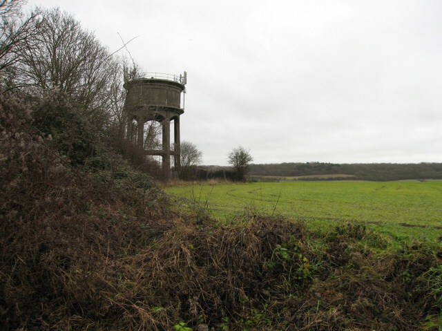
Aston Images

Images are sourced within 2km of 51.887553/-0.150947 or Grid Reference TL2722. Thanks to Geograph Open Source API. All images are credited.

Parishes Mead. Parishes mead is a newer development on the east side of Stevenage.  There is a mixture of private and social housing here.
Parishes Mead.
Parishes mead is a newer development on the east side of Stevenage. There is a mixture of private and social housing here.
Ridlins Athletics Track This photo of the Ridlins Athletics track shows the west corner and the Bert Hill stand.  The back of the stand has space for community groups such as playgroups.
Ridlins Athletics Track
This photo of the Ridlins Athletics track shows the west corner and the Bert Hill stand. The back of the stand has space for community groups such as playgroups.
Football pitches These are to the north west of the running track.
Football pitches
These are to the north west of the running track.
Footbridge over Stevenage Brook. This footpath runs parallel to and within 30 yards of the main Stevenage - Hertford Road.
Footbridge over Stevenage Brook.
This footpath runs parallel to and within 30 yards of the main Stevenage - Hertford Road.
Shops in Kenilworth Close. Supermarket, newsagent, Chinese takeaway and alternative therapist.
Shops in Kenilworth Close.
Supermarket, newsagent, Chinese takeaway and alternative therapist.
Longmeadow Evangelical Church Many of Stevenage's churche seem to thrive and this is one of them.
Longmeadow Evangelical Church
Many of Stevenage's churche seem to thrive and this is one of them.
St Mary's Church, Aston The church is built of flint with stone dressings on the nave and chancel and the roofs are covered with copper.
St Mary's Church, Aston
The church is built of flint with stone dressings on the nave and chancel and the roofs are covered with copper.
Aston Water Tower The Water Tower and surrounding countryside from the lane to Aston End
Aston Water Tower
The Water Tower and surrounding countryside from the lane to Aston End
The Crown, Aston End
St Marys, Shephall St Mary's Shephall is a lovely little old church in the middle of a sprawl of 20th century buildings.
St Marys, Shephall
St Mary's Shephall is a lovely little old church in the middle of a sprawl of 20th century buildings.
Shephalbury Park Primary School. This small area of Stevenage is stuffed with schools of all sizes and ages.
Shephalbury Park Primary School.
This small area of Stevenage is stuffed with schools of all sizes and ages.
Heathcote School It is clear to me that the problem with photographing schools is that if done during the daytime you run the risk of attracting attention that you don't want.  By night it is too dark.  And you can't get close enough really most of the time.
Heathcote School
It is clear to me that the problem with photographing schools is that if done during the daytime you run the risk of attracting attention that you don't want. By night it is too dark. And you can't get close enough really most of the time.
Greenside School. This small area of Stevenage has so many schools that the average age in this area during the day must be about 11.
Greenside School.
This small area of Stevenage has so many schools that the average age in this area during the day must be about 11.
Telephone Box - may I borrow your mobile. Not particularly significant but as I was passing I noticed it and couldn't resist.
Telephone Box - may I borrow your mobile.
Not particularly significant but as I was passing I noticed it and couldn't resist.
Footbridge and Ford over River Beane. "River" is a bit of a grand description for what is little more than a trickle at this point (although other images for this square and the one to the north suggest that it can get pretty wet down here).
Footbridge and Ford over River Beane.
"River" is a bit of a grand description for what is little more than a trickle at this point (although other images for this square and the one to the north suggest that it can get pretty wet down here).
Pumping house and cattle crush at Ford across River Beane. One of a pair of similar pumping houses on the River Beane.
Pumping house and cattle crush at Ford across River Beane.
One of a pair of similar pumping houses on the River Beane.
Pumping station on River Beane. For some reason this trickle known as the River (river?) Beane has a cluster of pumping stations near this spot.  The neighbour is Whitehall Pumping Station Number 1.  So this must be number 2 then.
Pumping station on River Beane.
For some reason this trickle known as the River (river?) Beane has a cluster of pumping stations near this spot. The neighbour is Whitehall Pumping Station Number 1. So this must be number 2 then.
White Hall Farm Taken on a lovely sunny day.  Other days are also available.
White Hall Farm
Taken on a lovely sunny day. Other days are also available.
Show me another place!

Aston is located at Grid Ref: TL2722 (Lat: 51.887553, Lng: -0.150947)

Administrative County: Hertfordshire

District: East Hertfordshire

Police Authority: Hertfordshire

What 3 Words

///captions.ballots.slurs. Near Knebworth, Hertfordshire

Related Wikis

Aston, Hertfordshire

Aston is a village and civil parish in the East Hertfordshire district of Hertfordshire, England. According to the 2001 census it had a population of...

Aston Bury

Aston Bury is a manor house near Aston, Hertfordshire, England. It is Grade I listed building.It was built in the mid 17th century, possibly by the Boteler...

Ridlins Mire

Ridlins Mire is a 1.6-hectare (4.0-acre) nature reserve managed by the Herts and Middlesex Wildlife Trust in Stevenage, Hertfordshire, England.This wetland...

Stevenage (UK Parliament constituency)

Stevenage is a constituency in Hertfordshire represented in the House of Commons of the UK Parliament since 2010 by Stephen McPartland, a member of the...

Aston End

Aston End is a hamlet in Hertfordshire, England. It is in the civil parish of Aston. It features a pub and a butchers, as well as a few houses. == References... ==

Benington High Wood

Benington High Wood is a 20.7-hectare (51-acre) biological Site of Special Scientific Interest in Benington, Hertfordshire. The planning authority is East...

Barnwell School

Barnwell School is a coeducational secondary school and sixth form that was established in 1959 and is situated in the south of Stevenage, Hertfordshire...

A602 road

The A602 is a road linking Hitchin in Hertfordshire, England, with A10 at Ware in Hertfordshire, via Stevenage. The course of the road has changed significantly...

Nearby Amenities

Located within 500m of 51.887553,-0.150947
Aston
Place: village
Lat/Long: 51.888048/-0.1504495
Pub
Pig and Whistle
Wikidata: Q26583220
Lat/Long: 51.8888208/-0.1483954
Note: Marker post for "Circular Walk Town to Country No 2"
Lat/Long: 51.8896461/-0.1572625
Village Hall
Description: Village Hall
Lat/Long: 51.8898423/-0.147359
Cricket Ground
Local Ref: NR
Naptan AtcoCode: 210021300015
Naptan Bearing: NE
Naptan BusStopType: CUS
Naptan CommonName: Cricket Ground
Naptan Crossing: Cricket Ground
Naptan Indicator: nr
Naptan Landmark: Cricket Ground
Naptan NaptanCode: hrtdwdtp
Naptan PlusbusZoneRef: STEVNGE
Naptan ShortCommonName: NA
Naptan Street: Stringers Lane
Naptan Verified: no
Source: naptan_import
Lat/Long: 51.8858116/-0.151167
Bus Stop
Cricket Ground
Bench: no
Bin: no
Bus: yes
Lit: no
Naptan AtcoCode: 210021313090
Naptan Bearing: SW
Naptan CommonName: Cricket Ground
Naptan Crossing: Cricket Ground
Naptan Indicator: opp
Naptan Landmark: Cricket Ground
Naptan NaptanCode: hrtdmtjp
Naptan PlusbusZoneRef: STEVNGE
Naptan ShortCommonName: NA
Naptan Street: Stingers Lane
Naptan Verified: no
Public Transport: platform
Shelter: no
Source: naptan_import
Tactile Paving: no
Lat/Long: 51.8862767/-0.1504359
Post Box
Collection Times: Mo-Fr 16:45; Sa 08:00
Post Box Type: lamp
Ref: SG2 56
Lat/Long: 51.888565/-0.148109
Post Box
Collection Times: Mo-Fr 09:00; Sa 07:00
Description: NOPLATE/School Lane / Aston End Road//NOPLATE
Post Box Type: lamp
Ref: SG2 86
Royal Cypher: EIIR
Royal Cypher Wikidata: Q33102113
Lat/Long: 51.89016/-0.151236
Aston Tennis Club
Sport: tennis
Lat/Long: 51.8890231/-0.1557191
Power: pole
Lat/Long: 51.8878621/-0.1458223
Material: wood
Power: pole
Lat/Long: 51.8871961/-0.1483689
Material: wood
Pole: transition
Power: pole
Lat/Long: 51.8883135/-0.1439566
Location Transition: yes
Power: pole
Lat/Long: 51.8880856/-0.1449438
Material: wood
Power: pole
Lat/Long: 51.8844115/-0.1517511
Power: pole
Lat/Long: 51.887387/-0.1476596
Material: wood
Power: pole
Lat/Long: 51.8835853/-0.1526912
Material: wood
Power: pole
Lat/Long: 51.8855745/-0.1503302
Note: Footpath sign is here pointing south, therefore the northern half is presumed not to be a ROW.
Lat/Long: 51.8890215/-0.1505421
Bus Stop
Rose and Crown PH
Bus: yes
Naptan AtcoCode: 210021300010
Naptan Bearing: NE
Naptan BusStopType: CUS
Naptan CommonName: Rose and Crown PH
Naptan Crossing: Rose and Crown PH
Naptan Indicator: o/s
Naptan Landmark: Rose and Crown PH
Naptan NaptanCode: hrtdwdtm
Naptan PlusbusZoneRef: STEVNGE
Naptan ShortCommonName: NA
Naptan Street: Broadwater Lane
Naptan Verified: no
Public Transport: platform
Source: naptan;bing;naptan_compare_tool
Lat/Long: 51.8885082/-0.1497001
The data included in this document is from www.openstreetmap.org. The data is made available under ODbL.

Have you been to Aston?

Leave your review of Aston below (or comments, questions and feedback).