Townend Plantation

Wood, Forest in Essex Uttlesford

England

Townend Plantation

On Icknield Way Trail looking west from Cane's Walk near Chrishall
On Icknield Way Trail looking west from Cane's Walk near Chrishall Credit: Colin Park

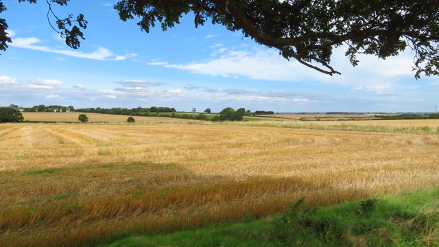
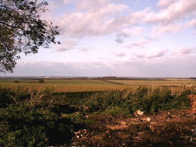
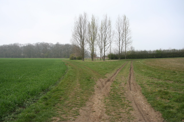
Townend Plantation is a woodland area located in Essex, England. Situated in the heart of the county, this forested area covers approximately 100 acres of land. The plantation is known for its diverse range of trees and wildlife, making it a popular destination for nature enthusiasts and outdoor adventurers.

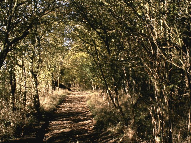
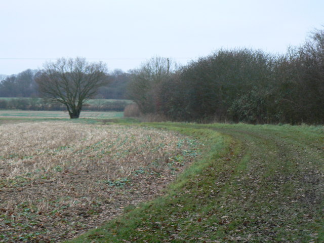
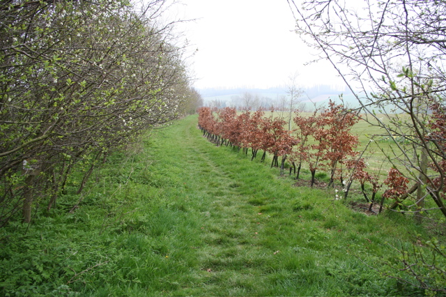
The woodland consists primarily of deciduous trees, including oak, beech, and birch, which create a picturesque and enchanting atmosphere. The dense canopy provides ample shade during the summer months and a vibrant display of autumn colors in the fall. The forest floor is covered with a rich carpet of mosses, ferns, and wildflowers, adding to the natural beauty of the area.

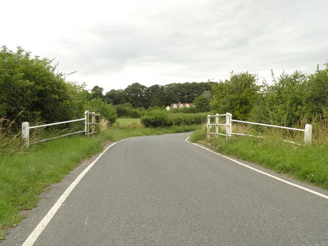
Visitors to Townend Plantation can enjoy a network of well-maintained trails that wind their way through the woodland. These paths offer opportunities for leisurely strolls, jogging, or even cycling, allowing visitors to explore and experience the serene surroundings at their own pace. The trails are also suitable for families with young children, making it an ideal spot for a family day out.

The plantation is home to a variety of wildlife, including squirrels, rabbits, and an array of bird species. Birdwatchers will particularly enjoy the opportunity to spot woodpeckers, owls, and various songbirds that call the woodland home. The tranquil setting also attracts a range of butterfly species, creating a haven for nature lovers and photographers alike.

Overall, Townend Plantation in Essex offers a peaceful and natural escape from the hustle and bustle of daily life. With its diverse flora and fauna, well-maintained trails, and enchanting atmosphere, it is a must-visit destination for anyone seeking to connect with nature in this part of England.

If you have any feedback on the listing, please let us know in the comments section below.

Townend Plantation Images

Images are sourced within 2km of 52.038267/0.13759758 or Grid Reference TL4639. Thanks to Geograph Open Source API. All images are credited.

On Icknield Way Trail looking west from Cane's Walk near Chrishall
Elmdon - St Nicholas' Church
Elmdon - village centre
View northwest across field from Freewood Farm, Elmdon
Track leading north from Strethall
Strethall - Church of St Mary the Virgin
Ruined church in grounds of Lofts Hall
Elmdon, St Nicholas
Elmdon, St Nicholas
St. Mary's church, Strethall, Essex Almost entirely obscured by trees, Strethall church stands by a farm in a remote part of north Essex. The church dates back to the 11th century and has a Saxon nave with a fine Saxon chancel arch. The chancel and tower are 15th century.
St. Mary's church, Strethall, Essex
Almost entirely obscured by trees, Strethall church stands by a farm in a remote part of north Essex. The church dates back to the 11th century and has a Saxon nave with a fine Saxon chancel arch. The chancel and tower are 15th century.
Dark Lane path Dark Lane path near to its junction with Parkhouse Lane by-road.
Dark Lane path
Dark Lane path near to its junction with Parkhouse Lane by-road.
North Essex countryside near Elmdon An autumn view from the Icknield Way long-distance path.
North Essex countryside near Elmdon
An autumn view from the Icknield Way long-distance path.
Some path near Strethall Picture of a path and tree in top NE corner of the grid square. Best picture of the ones I took, as this square is just fields, and landscape shots were pretty hazy due to the clouds and it being quite a dark day.
Some path near Strethall
Picture of a path and tree in top NE corner of the grid square. Best picture of the ones I took, as this square is just fields, and landscape shots were pretty hazy due to the clouds and it being quite a dark day.
Young beech hedge Dividing a track from the grounds of a house near Pond Street
Young beech hedge
Dividing a track from the grounds of a house near Pond Street
The track divides Left to Chrishall, right to Lofts Hall. But which is the path less travelled?
The track divides
Left to Chrishall, right to Lofts Hall. But which is the path less travelled?
The southern end of Essex Hill This is the road that links the B1039 with Elmdon village.
The southern end of Essex Hill
This is the road that links the B1039 with Elmdon village.
Part of Elmdon village on Essex Hill This is the first view of the village when approached from the south.
Part of Elmdon village on Essex Hill
This is the first view of the village when approached from the south.
The centre of Elmdon village This is the end of Essex Hill where it starts to join Ickleton Road off to the right and Heydon Lane off to the left.
The centre of Elmdon village
This is the end of Essex Hill where it starts to join Ickleton Road off to the right and Heydon Lane off to the left.
St. Nicholas church and War Memorial at Elmdon The picture shows the 15th century tower of Elmdon's parish church, but the rest of the church dates from 1852 and 1879. Apart from the tower, the Victorians must have decided that the original church was beyond repair and so they replaced it with what is seen today.
St. Nicholas church and War Memorial at Elmdon
The picture shows the 15th century tower of Elmdon's parish church, but the rest of the church dates from 1852 and 1879. Apart from the tower, the Victorians must have decided that the original church was beyond repair and so they replaced it with what is seen today.
Show me another place!

Townend Plantation is located at Grid Ref: TL4639 (Lat: 52.038267, Lng: 0.13759758)

Administrative County: Essex

District: Uttlesford

Police Authority: Essex

What 3 Words

///forehand.propose.nerves. Near Great Chesterford, Essex

Related Wikis

Elmdon

See also, Elmdon, West Midlands.Elmdon is a village in the civil parish of Elmdon, Duddenhoe End & Wenden Lofts situated in the Uttlesford district of...

Strethall

Strethall is a village and a civil parish in the Uttlesford District, in the English county of Essex, near the town of Saffron Walden. Having suffered...

Chrishall

Chrishall (pronounced Chris hall) is a small village in the English county of Essex. It is located 12 miles (20 km) south of Cambridge and lies equidistant...

Littlebury Green

Littlebury Green is a village in the civil parish of Littlebury and the district of Uttlesford in Essex, England. Littlebury Green is one of three settlements...

Wenden Lofts

Wenden Lofts is a small community in the civil parish of Elmdon, Duddenhoe End & Wenden Lofts in the Uttlesford district, in the county of Essex, England...

Duddenhoe End

Duddenhoe End is a small village in the civil parish of Elmdon & Wenden Lofts, in northwest Essex, England, and situated approximately halfway between...

Heydon, Cambridgeshire

Heydon is a village and civil parish in Cambridgeshire, England. The parish of Heydon was transferred from Essex to Cambridgeshire in 1894. The area of...

Ickleton Priory

Ickleton Priory was a Benedictine priory of nuns at Ickleton, Cambridgeshire, England. It was established in the middle of the 12th century and suppressed...

Nearby Amenities

Located within 500m of 52.038267,0.13759758
Ele: 95
Lat/Long: 52.0390206/0.1394918
Post Box
Brand: Royal Mail
Brand Wikidata: Q638098
Brand Wikipedia: en:Royal Mail
Collection Times: Mo-Fr 16:00; Sa 11:00
Operator: Royal Mail
Operator Wikidata: Q638098
Post Box Design: type_m
Post Box Type: pillar
Ref: CB11 62
Royal Cypher: EIIR
Royal Cypher Wikidata: Q33102113
Source: survey
Lat/Long: 52.0365769/0.1325629
Note Splitway: The 445 bus 'ends' here and turns around
Lat/Long: 52.0378791/0.1373253
Public Bookcase
Booth: K6
Check Date: 2024-03-11
Colour: red
Disused Amenity: telephone
Listed Status: Grade II
Man Made: telephone_box
Public Bookcase Type: phone_box
Lat/Long: 52.0377475/0.137101
The data included in this document is from www.openstreetmap.org. The data is made available under ODbL.

Have you been to Townend Plantation?

Leave your review of Townend Plantation below (or comments, questions and feedback).