Elmdon

Settlement in Essex Uttlesford

England

Elmdon

On Icknield Way Trail looking west from Cane's Walk near Chrishall
On Icknield Way Trail looking west from Cane's Walk near Chrishall Credit: Colin Park

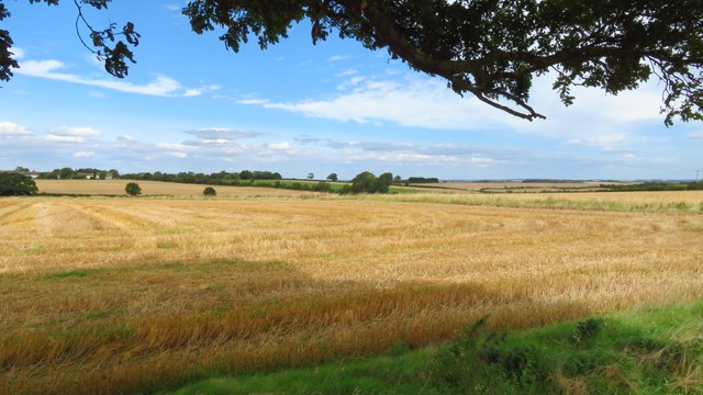
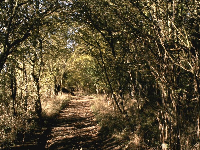
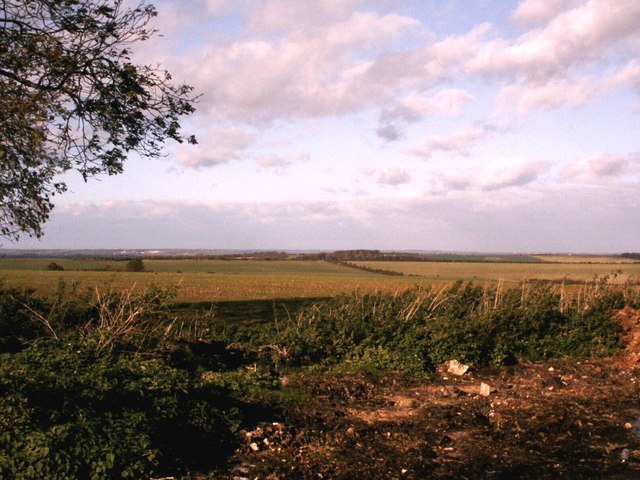
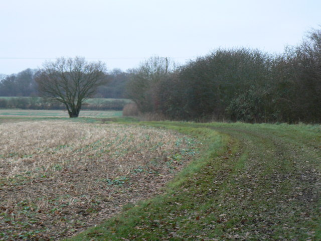
Elmdon is a small village located in the county of Essex, England. Situated approximately 25 miles northeast of London, it falls within the administrative area of Uttlesford District Council. The village is set amidst the picturesque countryside, offering a tranquil and idyllic setting for its residents.

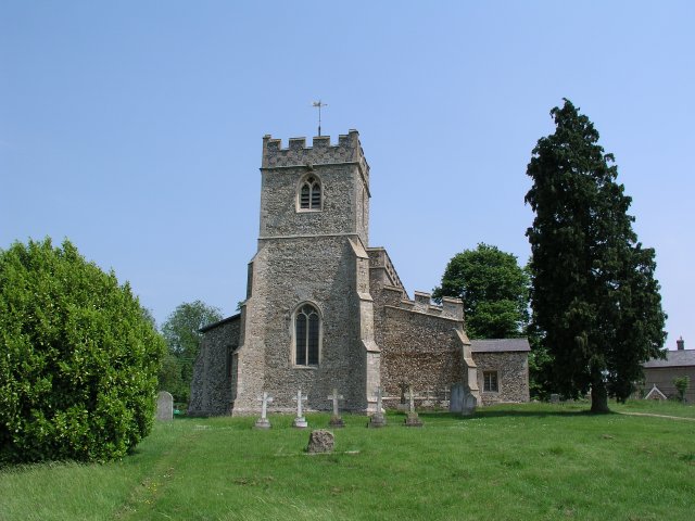
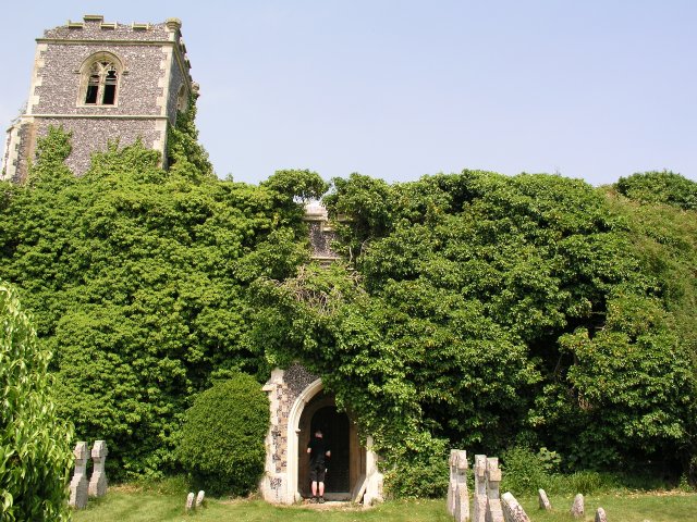
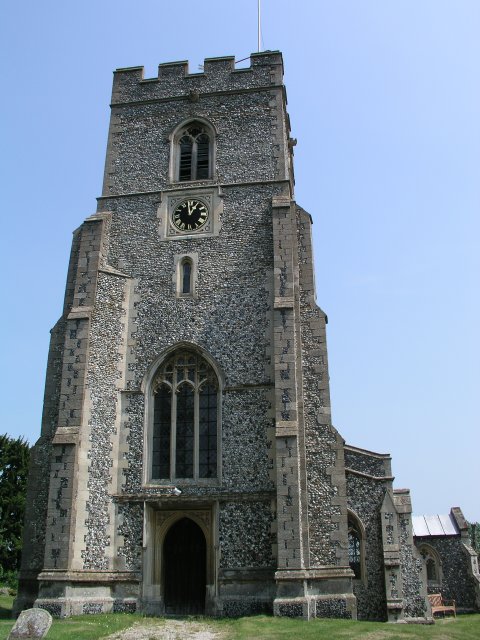
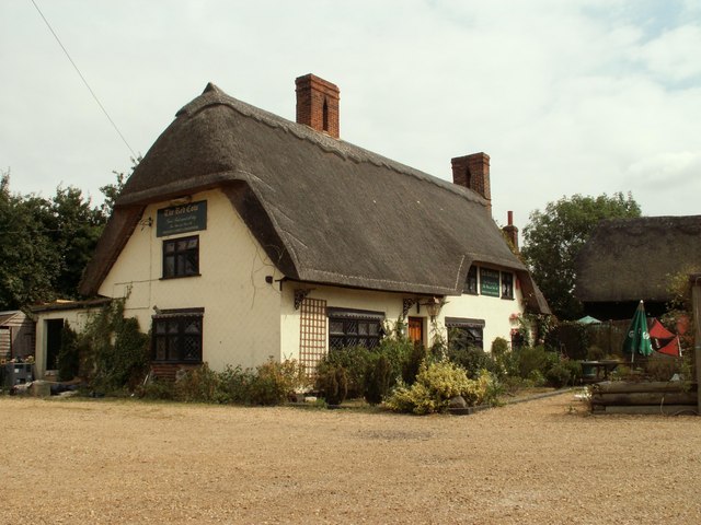
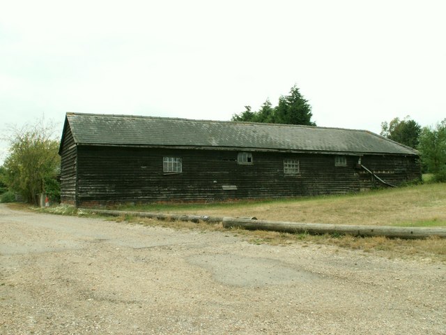
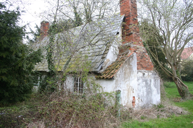
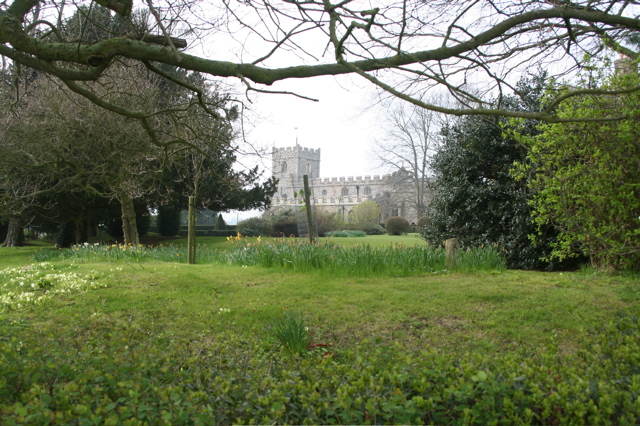
Elmdon has a rich history, with evidence of human settlement dating back to the Roman period. The village is known for its charming traditional architecture, with many buildings dating back several centuries. The local St. Nicholas Church, built in the 12th century, stands as a testament to the village's historical significance.

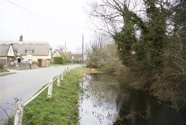
Despite its small size, Elmdon boasts a tight-knit community, with friendly and welcoming residents. The village has a vibrant social scene, with various community events and gatherings taking place throughout the year. The Elmdon Cricket Club is a popular local institution, providing a focal point for sports enthusiasts and fostering a sense of camaraderie among villagers.

Elmdon benefits from its proximity to the nearby towns of Saffron Walden and Bishop's Stortford, which offer a range of amenities including shopping centers, schools, and healthcare facilities. The village is also well-connected by road, with easy access to major transport routes such as the M11 motorway and Stansted Airport, making it an attractive location for commuters.

In summary, Elmdon is a charming village in Essex, England, known for its rich history, picturesque surroundings, and sense of community. With its idyllic countryside setting and convenient location, Elmdon offers a peaceful and desirable place to live.

If you have any feedback on the listing, please let us know in the comments section below.

Elmdon Images

Images are sourced within 2km of 52.035815/0.12949066 or Grid Reference TL4639. Thanks to Geograph Open Source API. All images are credited.

On Icknield Way Trail looking west from Cane's Walk near Chrishall
Elmdon - St Nicholas' Church
Elmdon - village centre
View northwest across field from Freewood Farm, Elmdon
Chrishall church
Chrishall church
Ruined church in grounds of Lofts Hall
Elmdon, St Nicholas
Elmdon, St Nicholas
'The Red Cow' inn, Chrishall, Essex
Barn at Parsonage Farm, Chrishall, Essex
Dark Lane path Dark Lane path near to its junction with Parkhouse Lane by-road.
Dark Lane path
Dark Lane path near to its junction with Parkhouse Lane by-road.
North Essex countryside near Elmdon An autumn view from the Icknield Way long-distance path.
North Essex countryside near Elmdon
An autumn view from the Icknield Way long-distance path.
Some path near Strethall Picture of a path and tree in top NE corner of the grid square. Best picture of the ones I took, as this square is just fields, and landscape shots were pretty hazy due to the clouds and it being quite a dark day.
Some path near Strethall
Picture of a path and tree in top NE corner of the grid square. Best picture of the ones I took, as this square is just fields, and landscape shots were pretty hazy due to the clouds and it being quite a dark day.
Autumn colours frame the climb up to Chrishall village View north on Hollow Rd, Chrishall at the entrance to New Farm. (The highest point in Essex is within the parish boundary).
Autumn colours frame the climb up to Chrishall village
View north on Hollow Rd, Chrishall at the entrance to New Farm. (The highest point in Essex is within the parish boundary).
Wire Farm, Crawley End, Chrishall There are five ponds in Chrishall Village but it is difficult to capture the reflections of buildings in any of them. This was taken on a bright, still February morning from the edge of an open field. See <span class="nowrap"><a title="http://www.chrishallessex.com" rel="nofollow ugc noopener" href="http://www.chrishallessex.com">Link</a><img style="margin-left:2px;" alt="External link" title="External link - shift click to open in new window" src="https://s1.geograph.org.uk/img/external.png" width="10" height="10"/></span> for more photos of this village.
Wire Farm, Crawley End, Chrishall
There are five ponds in Chrishall Village but it is difficult to capture the reflections of buildings in any of them. This was taken on a bright, still February morning from the edge of an open field. See LinkExternal link for more photos of this village.
Crawley End Pond, Chrishall The frozen pond supports a light snow covering. The thatched roof of Faerie Cottage is just visible through the trees.
Crawley End Pond, Chrishall
The frozen pond supports a light snow covering. The thatched roof of Faerie Cottage is just visible through the trees.
Crawley End Pond, Chrishall, looking North This pond gets overgrown quite quickly but it had recently been cleared when this photo was taken in May 2002
Crawley End Pond, Chrishall, looking North
This pond gets overgrown quite quickly but it had recently been cleared when this photo was taken in May 2002
A Hovel in Chrishall Dilapidated unoccupied cottage
A Hovel in Chrishall
Dilapidated unoccupied cottage
Chrishall Church and grounds Daffodils and primroses in the grounds. An excellent brass dated 1375 within the church.
Chrishall Church and grounds
Daffodils and primroses in the grounds. An excellent brass dated 1375 within the church.
Show me another place!

Elmdon is located at Grid Ref: TL4639 (Lat: 52.035815, Lng: 0.12949066)

Administrative County: Essex

District: Uttlesford

Police Authority: Essex

What 3 Words

///pushed.hopping.plausible. Near Great Chesterford, Essex

Related Wikis

Elmdon

See also, Elmdon, West Midlands.Elmdon is a village in the civil parish of Elmdon, Duddenhoe End & Wenden Lofts situated in the Uttlesford district of...

Chrishall

Chrishall (pronounced Chris hall) is a small village in the English county of Essex. It is located 12 miles (20 km) south of Cambridge and lies equidistant...

Wenden Lofts

Wenden Lofts is a small community in the civil parish of Elmdon, Duddenhoe End & Wenden Lofts in the Uttlesford district, in the county of Essex, England...

Strethall

Strethall is a village and a civil parish in the Uttlesford District, in the English county of Essex, near the town of Saffron Walden. Having suffered...

Duddenhoe End

Duddenhoe End is a small village in the civil parish of Elmdon & Wenden Lofts, in northwest Essex, England, and situated approximately halfway between...

Littlebury Green

Littlebury Green is a village in the civil parish of Littlebury and the district of Uttlesford in Essex, England. Littlebury Green is one of three settlements...

Heydon, Cambridgeshire

Heydon is a village and civil parish in Cambridgeshire, England. The parish of Heydon was transferred from Essex to Cambridgeshire in 1894. The area of...

Great Chishill

Great Chishill is a village and former civil parish, now in the parish of Great and Little Chishill, in the South Cambridgeshire district, in the county...

Nearby Amenities

Located within 500m of 52.035815,0.12949066
Ele: 130
Lat/Long: 52.0365106/0.1256085
Elmdonbury Farm
Landuse: farm
Note Retag: CS #48756035
Lat/Long: 52.0390677/0.1287295
Post Box
Brand: Royal Mail
Brand Wikidata: Q638098
Brand Wikipedia: en:Royal Mail
Collection Times: Mo-Fr 16:00; Sa 11:00
Operator: Royal Mail
Operator Wikidata: Q638098
Post Box Design: type_m
Post Box Type: pillar
Ref: CB11 62
Royal Cypher: EIIR
Royal Cypher Wikidata: Q33102113
Source: survey
Lat/Long: 52.0365769/0.1325629
Church Farm
Landuse: farm
Note Retag: CS #48756035
Lat/Long: 52.0356484/0.1307282
Post Box
Brand: Royal Mail
Brand Wikidata: Q638098
Brand Wikipedia: en:Royal Mail
Collection Times: Mo-Fr 09:00; Sa 07:00
Operator: Royal Mail
Operator Wikidata: Q638098
Post Box Type: lamp
Ref: CB11 63
Royal Cypher: EIIR
Royal Cypher Wikidata: Q33102113
Source: survey
Lat/Long: 52.0345727/0.1290866
Bus Stop
Kings Lane
Bench: no
Bin: no
Bus: yes
Fixme: These bus stops may need distancing
Lit: no
Naptan AtcoCode: 1500IM1000
Naptan Bearing: S
Naptan BusStopType: CUS
Naptan CommonName: Kings Lane
Naptan Crossing: Kings Lane
Naptan Indicator: Adj
Naptan Landmark: Kings Lane
Naptan NaptanCode: esxadgwj
Naptan Street: Essex Hill
Naptan Verified: no
Public Transport: platform
Shelter: no
Source: naptan_import
Tactile Paving: no
Lat/Long: 52.0342924/0.1291372
Bus Stop
Kings Lane
Bench: no
Bin: no
Bus: yes
Fixme: These bus stops may need distancing
Lit: no
Naptan AtcoCode: 1500IM1000AA
Naptan Bearing: N
Naptan BusStopType: CUS
Naptan CommonName: Kings Lane
Naptan Crossing: Kings Lane
Naptan Indicator: Opp
Naptan Landmark: Kings Lane
Naptan NaptanCode: esxgtgwt
Naptan Street: Essex Hill
Naptan Verified: no
Public Transport: platform
Shelter: no
Source: naptan_import
Tactile Paving: no
Lat/Long: 52.034298/0.1289946
Bus Stop
Ickleton Road
Bench: yes
Bin: yes
Bus: yes
Lit: no
Local Ref: adj
Naptan AtcoCode: 1500IM2560
Naptan Bearing: SE
Naptan CommonName: Elmdon Cross
Naptan Crossing: Essex Hill
Naptan Indicator: adj
Naptan Landmark: Elmdon Cross
Naptan NaptanCode: esxdatmj
Naptan Street: Heydon Lane
Naptan Verified: no
Public Transport: platform
Shelter: yes
Source: naptan_import
Tactile Paving: no
Lat/Long: 52.0358609/0.1290841
Bus Stop
Ickleton Road
Bench: yes
Bin: no
Bus: yes
Lit: no
Local Ref: opp
Naptan AtcoCode: 1500IM2560AA
Naptan Bearing: NW
Naptan BusStopType: CUS
Naptan CommonName: Elmdon Cross
Naptan Crossing: Essex Hill
Naptan Indicator: opp
Naptan Landmark: Elmdon Cross
Naptan NaptanCode: esxgpjdg
Naptan Street: Heydon Lane
Naptan Verified: no
Public Transport: platform
Shelter: no
Source: naptan_import
Tactile Paving: no
Lat/Long: 52.0358187/0.1289485
Note Splitway: Split the way here, owing to turning 31 (Village Link) buses.
Lat/Long: 52.0358418/0.1289901
Telephone
Booth: K6
Covered: booth
Listed Status: Grade II
Phone: +44 1763 838260
Wikidata: Q26532791
Lat/Long: 52.034375/0.1290245
Advertising: board
Direction: 55
Lat/Long: 52.0358143/0.1288884
Bench
Backrest: yes
Material: wood
Lat/Long: 52.0357987/0.1288992
Advertising: board
Direction: 210
Lat/Long: 52.0359232/0.129382
Historic: memorial
Memorial: war_memorial
Lat/Long: 52.0359232/0.1290722
The data included in this document is from www.openstreetmap.org. The data is made available under ODbL.

Have you been to Elmdon?

Leave your review of Elmdon below (or comments, questions and feedback).