Grove Wood

Wood, Forest in Sussex Wealden

England

Grove Wood

Jack's Farm
Jack's Farm Credit: N Chadwick

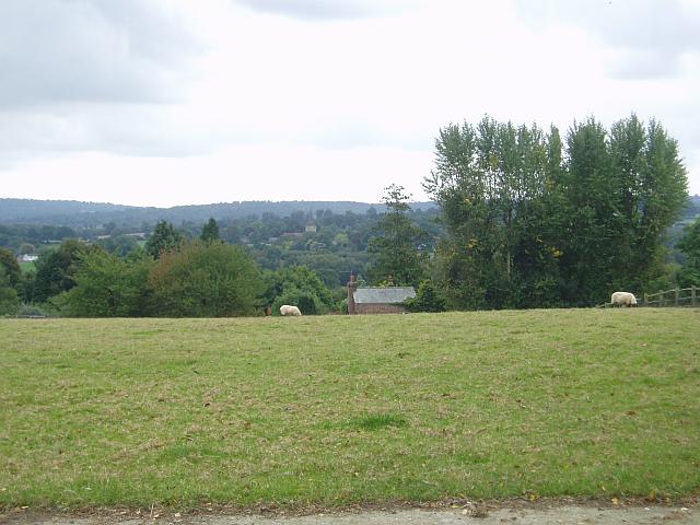
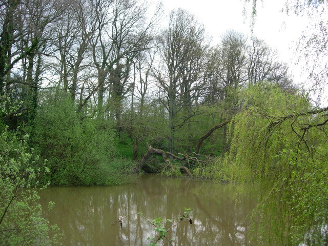
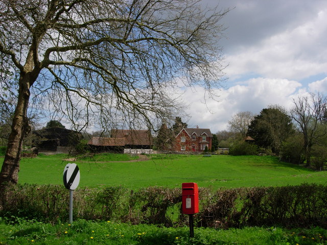
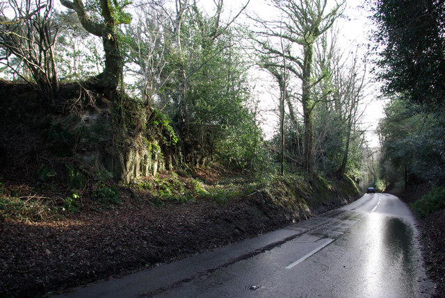
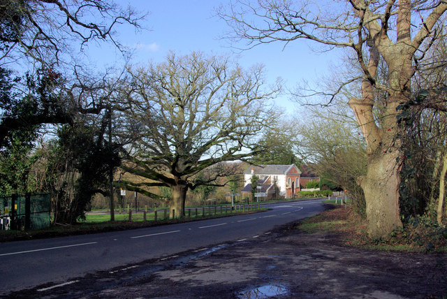
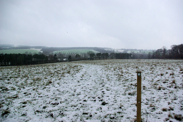
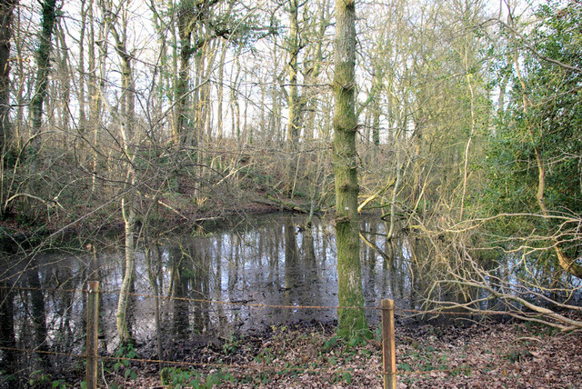
Grove Wood is a picturesque forest located in the county of Sussex, England. Spread across a vast area, it is renowned for its natural beauty and diverse flora and fauna. The wood is situated near the village of Grove, nestled within rolling hills and stunning scenery.

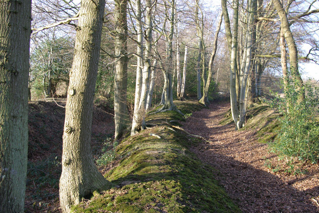
The forest is predominantly made up of deciduous trees such as oak, beech, and ash, which create a dense canopy, providing shade and shelter for a variety of wildlife. These woodlands offer a peaceful and tranquil environment for visitors and nature enthusiasts alike.

Grove Wood is home to a wide range of animals, including deer, foxes, badgers, and numerous bird species. Birdwatchers can delight in spotting woodpeckers, owls, and various migrating birds throughout the year. The forest also boasts a rich diversity of plant life, with carpets of bluebells and wildflowers covering the forest floor during the spring and summer months.

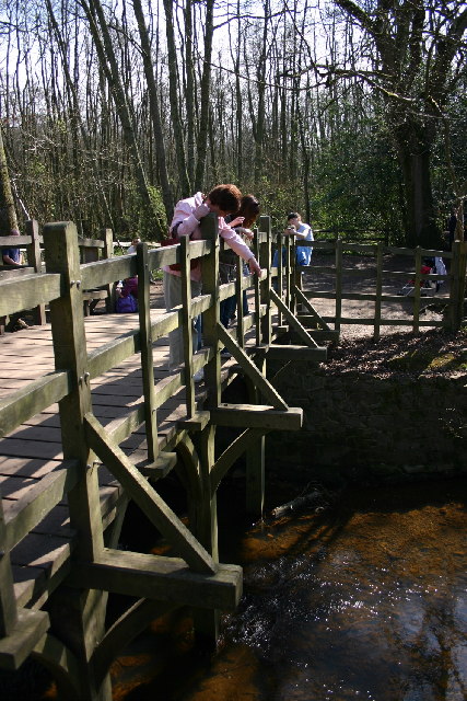
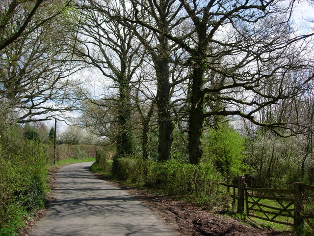
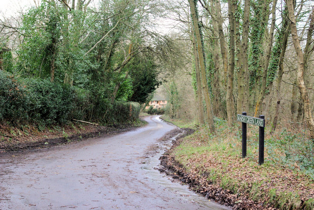
The wood offers a network of walking trails, allowing visitors to explore its natural wonders at their own pace. These paths wind through the forest, leading to hidden glades, babbling brooks, and breathtaking viewpoints. It is a popular destination for hikers, joggers, and families seeking a day out in nature.

Grove Wood is a cherished local treasure and an important conservation area. Efforts are made to protect and preserve its natural habitats and biodiversity. The wood serves as a vital ecosystem, providing a refuge for wildlife and a sanctuary for people seeking solace in nature's embrace. Whether it is a leisurely stroll, birdwatching, or simply enjoying the serenity of the forest, Grove Wood offers an idyllic escape from the hustle and bustle of everyday life.

If you have any feedback on the listing, please let us know in the comments section below.

Grove Wood Images

Images are sourced within 2km of 51.09193/0.087309451 or Grid Reference TQ4634. Thanks to Geograph Open Source API. All images are credited.

Jack's Farm
Jack's Farm
Pooh Sticks Bridge, Ashdown Forest AA Milne's famous bridge.
Pooh Sticks Bridge, Ashdown Forest
AA Milne's famous bridge.
Hatch Inn at Colemans Hatch Serving Harveys bitter and good food. A popular haunt but parking can be tricky on busy days.
Hatch Inn at Colemans Hatch
Serving Harveys bitter and good food. A popular haunt but parking can be tricky on busy days.
Colemans Hatch church The church is on a sharp bend on the road from Forest Row to Upper Hartfield
Colemans Hatch church
The church is on a sharp bend on the road from Forest Row to Upper Hartfield
Sawpit Wood From Forest Way
Sawpit Wood
From Forest Way
Towards Hartfield From Butcherfield Lane looking south towards Hartfield. You can just make out the spire at St Mary the Virgin Parish Church
Towards Hartfield
From Butcherfield Lane looking south towards Hartfield. You can just make out the spire at St Mary the Virgin Parish Church
A Pond in Parrock Lane, Upper Hartfield A pretty pond by the roadside.
A Pond in Parrock Lane, Upper Hartfield
A pretty pond by the roadside.
Parrock Lane near Upper Hartdield A narrow country lane with farms and large houses.
Parrock Lane near Upper Hartdield
A narrow country lane with farms and large houses.
Little Parrock Farm The farm is situated at the junction of Parrock Lane and the B2110 near to Forest Row.
Little Parrock Farm
The farm is situated at the junction of Parrock Lane and the B2110 near to Forest Row.
Marsh Green Lane Viewed from its eastern end.
Marsh Green Lane
Viewed from its eastern end.
B2026 South of Hartfield Looking north. Rock of the Ashdown Beds exposed on left.
B2026 South of Hartfield
Looking north. Rock of the Ashdown Beds exposed on left.
Cotchford Lane Looking towards Upper Hartfield.
Cotchford Lane
Looking towards Upper Hartfield.
Kilnwood Farm Entrance On Cotchford Lane, Hartfield.
Kilnwood Farm Entrance
On Cotchford Lane, Hartfield.
B2110/B2026 Junction, Hartfield. This is the junction south of Hartfield, the B2026 is in the foreground, the B2110 behind the tree.
B2110/B2026 Junction, Hartfield.
This is the junction south of Hartfield, the B2026 is in the foreground, the B2110 behind the tree.
Permissive Path towards Lower Parrock The path actually heads for the local sewage works first, hidden in the trees at the bottom of the field.
Permissive Path towards Lower Parrock
The path actually heads for the local sewage works first, hidden in the trees at the bottom of the field.
Parrock Lane in the Snow A rather slippery lane that morning.
Parrock Lane in the Snow
A rather slippery lane that morning.
Old Trackways above Lower Parrock These were probably formed when iron ore from the Wadhurst Clay along the higher ground north of the Medway was brought down to the iron works at Lower Parrock. The public footpath now forms a parallel third way at the field edge to the right.
Old Trackways above Lower Parrock
These were probably formed when iron ore from the Wadhurst Clay along the higher ground north of the Medway was brought down to the iron works at Lower Parrock. The public footpath now forms a parallel third way at the field edge to the right.
Pond in Wick Wood Formed in an old excavation for iron ore in the Wadhurst Clay.
Pond in Wick Wood
Formed in an old excavation for iron ore in the Wadhurst Clay.
Show me another place!

Grove Wood is located at Grid Ref: TQ4634 (Lat: 51.09193, Lng: 0.087309451)

Administrative County: East Sussex

District: Wealden

Police Authority: Sussex

What 3 Words

///lamplight.upward.shrimps. Near Forest Row, East Sussex

Related Wikis

Upper Hartfield

Upper Hartfield is a small village slightly west of Hartfield in East Sussex, England. The Tudor house "Apedroc" in Upper Hartfield is the former home...

Cotchford Farm

Cotchford Farm is a farmhouse building to the southwest of the village of Hartfield, East Sussex, in the High Weald Area of Outstanding Natural Beauty...

Hartfield

Hartfield is a village and civil parish in the Wealden district of East Sussex, England. The parish also includes the settlements of Colemans Hatch, Hammerwood...

Ashdown House, East Sussex

Ashdown House is a country house and former school near Forest Row, East Sussex, England, a Grade II* listed building. One of the first houses in England...

Hartfield railway station

Hartfield was a railway station serving Hartfield, England, on the Three Bridges to Tunbridge Wells Central Line which closed in 1967, a casualty of the...

Emerson College (UK)

Emerson College, UK was founded in 1962 by Francis Edmunds. It is now situated on Pixton Hill, Forest Row in East Sussex, UK. It was named after Ralph...

Withyham Priory

Withyham Priory was a Benedictine monastic house in East Sussex, extant in 1086 and dissolved in 1413. == History == Robert, Count of Mortain, some time...
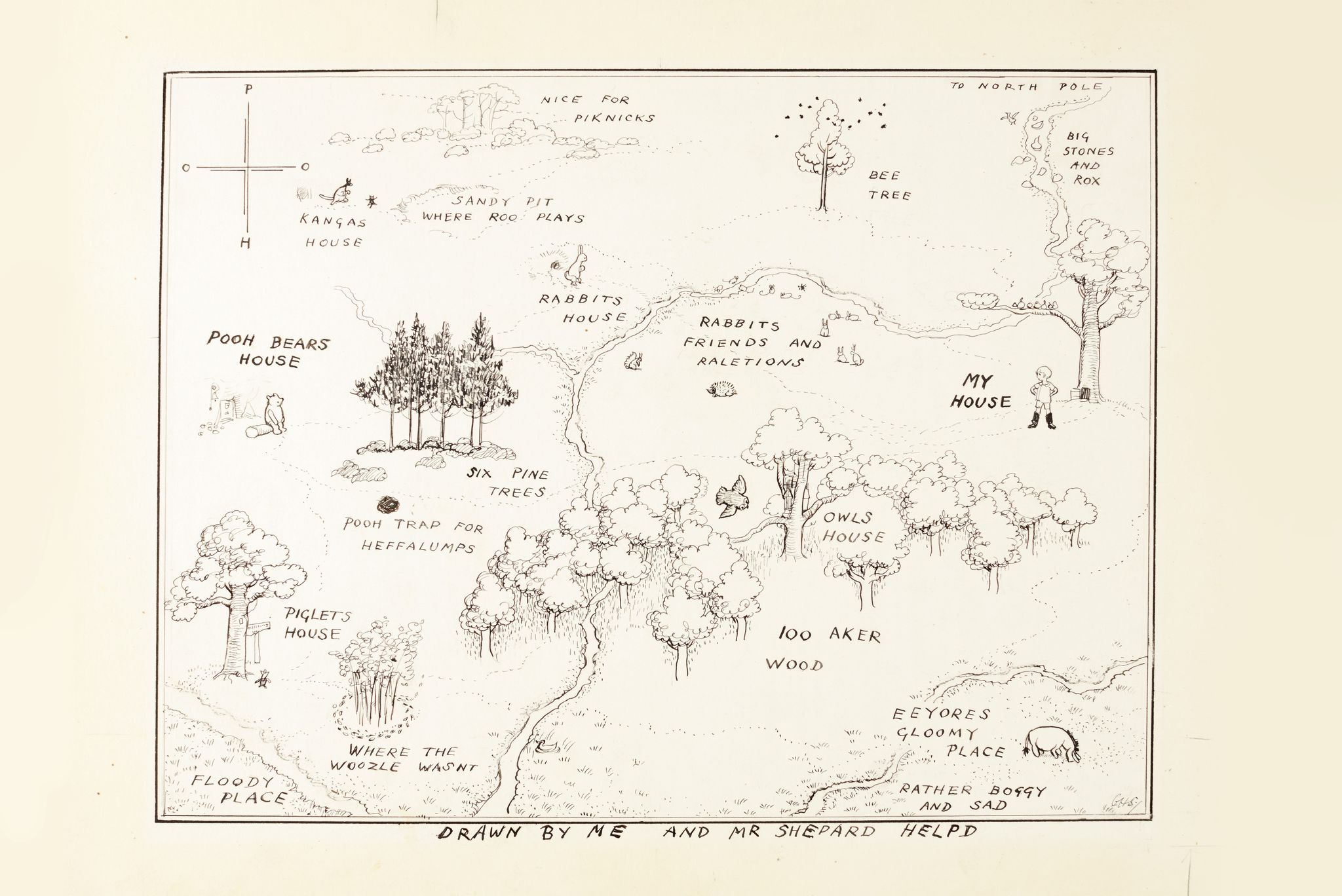
Hundred Acre Wood

The Hundred Acre Wood (also spelled as 100 Aker Wood, Hundred-Acre Wood, and 100 Acre Wood; also known as simply "The Wood") is a part of the fictional...

Related Videos

Walking to Winnie The Pooh's Bridge

Walking tour to see Winnie the Pooh's sticks bridge on a beautiful spring day in Ashdown Forest, England.

Tea at Pooh Corner, Hartfield 🫖

Join me to have tea at Pooh Corner in Hartfield, UK They also have a Pooh'seum & a gift ship! #winniethepooh #poohcorner ...

Nearby Amenities

Located within 500m of 51.09193,0.087309451
Barrier: stile
Material: wood
Stile: stepover
Lat/Long: 51.0898291/0.0907499
Upper Hartfield
Place: village
Source: npe
Wikidata: Q7898682
Lat/Long: 51.0897512/0.0887903
Bus Stop
Garage
Public Transport: platform
Lat/Long: 51.0925816/0.0910482
Post Box
Operator: Royal Mail
Post Box Type: wall
Ref: TN7 154
Royal Cypher: GR
Royal Cypher Wikidata: Q33102273
Lat/Long: 51.0929553/0.0916919
Post Box
Operator: Royal Mail
Post Box Type: lamp
Ref: TN7 167D
Royal Cypher: EIIR
Royal Cypher Wikidata: Q33102113
Lat/Long: 51.0888051/0.0857232
Bus Stop
Garage
Bus: yes
Public Transport: platform
Shelter: yes
Lat/Long: 51.093138/0.0918642
Barrier: stile
Lat/Long: 51.0907555/0.0918151
Barrier: stile
Material: wood
Stile: stepover
Lat/Long: 51.0918129/0.0934547
The data included in this document is from www.openstreetmap.org. The data is made available under ODbL.

Have you been to Grove Wood?

Leave your review of Grove Wood below (or comments, questions and feedback).