Engagement Plantation

Wood, Forest in Cambridgeshire South Cambridgeshire

England

Engagement Plantation

Harvesting near Chrishall Grange
Harvesting near Chrishall Grange Credit: Richard Vince

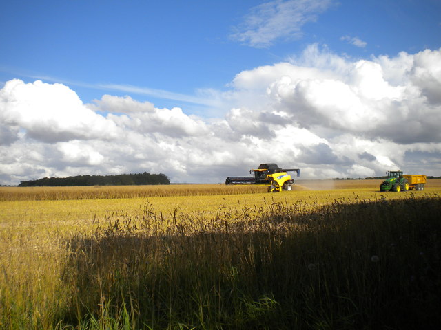
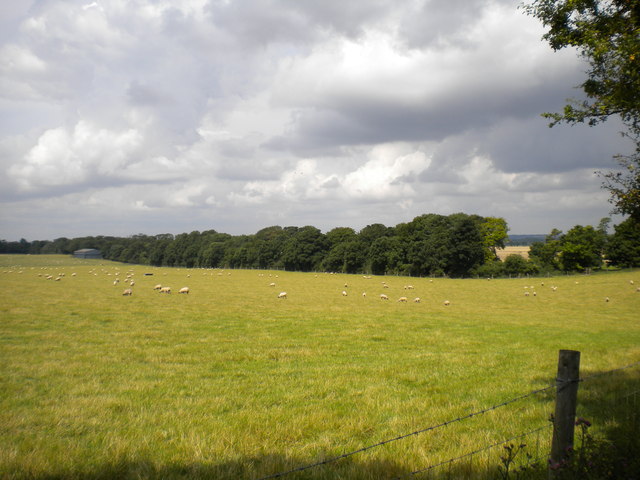
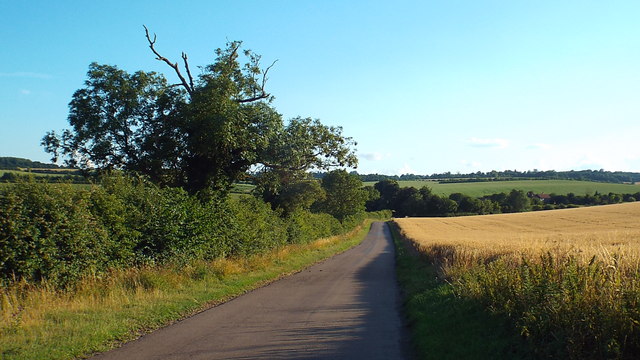
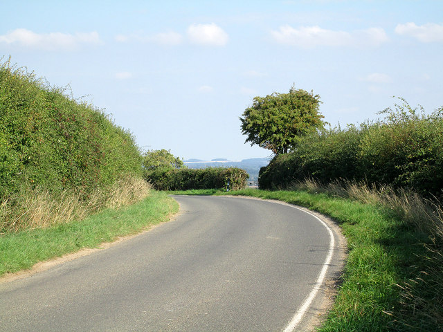
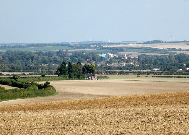
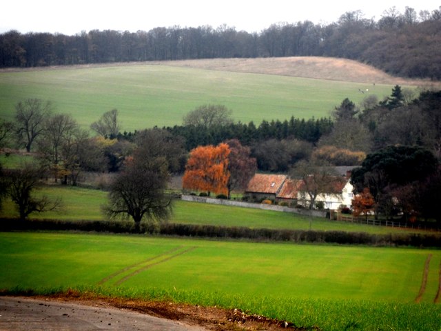
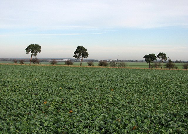
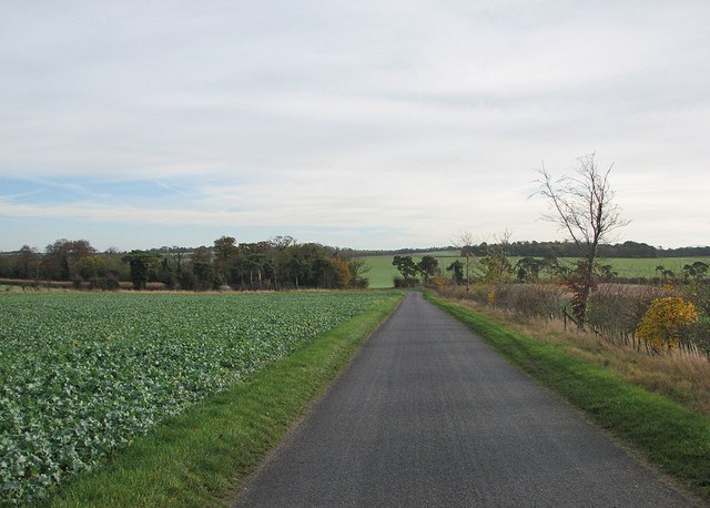
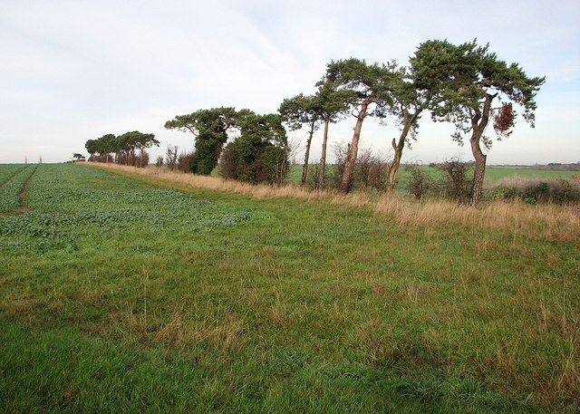
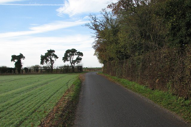
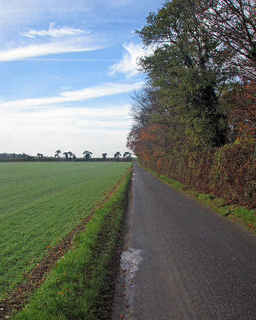
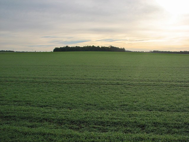
Engagement Plantation is a picturesque woodland located in the county of Cambridgeshire, England. This enchanting forest covers an area of approximately 300 acres, providing a tranquil escape for nature enthusiasts and outdoor adventurers alike.

The woodland is characterized by its dense canopy of towering trees, predominantly consisting of oak, birch, and beech varieties. The lush undergrowth is adorned with an array of wildflowers, creating a vibrant and colorful landscape during the spring and summer months. The forest floor is carpeted with a thick layer of moss and fallen leaves, offering a soft and inviting path for visitors to explore.

Engagement Plantation is home to a diverse range of wildlife, making it a popular destination for birdwatchers and animal lovers. Common sightings include various woodland birds such as robins, blackbirds, and woodpeckers, as well as small mammals like squirrels and hedgehogs. Lucky visitors may even catch a glimpse of elusive creatures such as deer and foxes, which roam the forest in search of food and shelter.

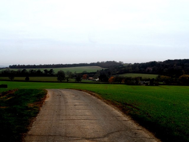
The plantation features a network of well-maintained walking trails, allowing visitors to fully immerse themselves in the natural beauty of the surroundings. These paths cater to different levels of fitness and provide opportunities for leisurely strolls, brisk hikes, and even trail running. Along the way, visitors will encounter charming wooden benches strategically placed for moments of rest and contemplation.

Engagement Plantation offers a peaceful retreat for those seeking solace in nature. Its serene atmosphere, abundant wildlife, and breathtaking scenery make it a true gem within the Cambridgeshire countryside.

If you have any feedback on the listing, please let us know in the comments section below.

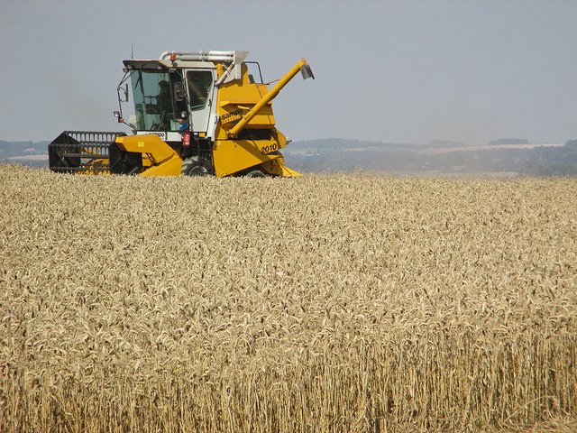
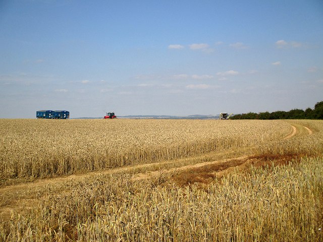
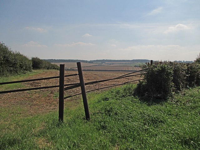
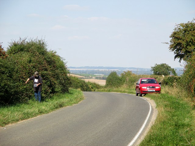
Engagement Plantation Images

Images are sourced within 2km of 52.061365/0.13031199 or Grid Reference TL4642. Thanks to Geograph Open Source API. All images are credited.

Harvesting near Chrishall Grange
Field near Chrishall Grange Sheep safely grazing in a field between Chrishall Grange and the plantation which bears its name. The trees in the distance line the track that gives access to the plantation.
Field near Chrishall Grange
Sheep safely grazing in a field between Chrishall Grange and the plantation which bears its name. The trees in the distance line the track that gives access to the plantation.
Country lane near Elmdon, Essex A country lane in north Essex.  In the opposite direction, the road crosses the county boundary into Cambridgeshire within a few hundred metres.

Long shadows show that this image was taken during the evening.
Country lane near Elmdon, Essex
A country lane in north Essex. In the opposite direction, the road crosses the county boundary into Cambridgeshire within a few hundred metres. Long shadows show that this image was taken during the evening.
A bend at the crest of the hill At the top of the hill half-way between Elmdon and Ickleton, just on the Cambridgeshire side of the county boundary.
A bend at the crest of the hill
At the top of the hill half-way between Elmdon and Ickleton, just on the Cambridgeshire side of the county boundary.
A view towards Ickleton This is another Cambridgeshire view which changed when Wadlow Wind Farm (on the skyline to the right of centre) was built in 2012. The road from Elmdon to Ickleton snakes between high hedges in the middle distance on the left, passing Valance Farm Cottages. By way of comparison, see two pictures taken in September 2010: <a href="https://www.geograph.org.uk/photo/2067226">TL4741 : Looking into Cambridgeshire</a> and <a href="https://www.geograph.org.uk/photo/2077081">TL4943 : Ickleton and the M11 from afar</a>.
A view towards Ickleton
This is another Cambridgeshire view which changed when Wadlow Wind Farm (on the skyline to the right of centre) was built in 2012. The road from Elmdon to Ickleton snakes between high hedges in the middle distance on the left, passing Valance Farm Cottages. By way of comparison, see two pictures taken in September 2010: TL4741 : Looking into Cambridgeshire and TL4943 : Ickleton and the M11 from afar.
Minor road and farmland near Ickleton Granges
Ickleton Old Granges
Cottages, Chrishall Grange
Combining on the edge of Cambridgeshire I stood in a gateway on the boundary of Cambridgeshire and Essex (behind the camera) for this foreshortened zoom view of a Finnish Sampo Rosenlew 2010 harvester at work. The Gog Magog Hills south-east of Cambridge are on the skyline, about eight miles away.
Combining on the edge of Cambridgeshire
I stood in a gateway on the boundary of Cambridgeshire and Essex (behind the camera) for this foreshortened zoom view of a Finnish Sampo Rosenlew 2010 harvester at work. The Gog Magog Hills south-east of Cambridge are on the skyline, about eight miles away.
Harvest time on the edge of Cambridgeshire I stood in a gateway on the boundary of Cambridgeshire and Essex (behind the camera) for this shot of a hilltop wheatfield mid-way between Ickleton (Cambridgeshire) and Elmdon (Essex). For a close-up of the harvester, see <a href="https://www.geograph.org.uk/photo/4156342">TL4741 : Combining on the edge of Cambridgeshire</a>.
Harvest time on the edge of Cambridgeshire
I stood in a gateway on the boundary of Cambridgeshire and Essex (behind the camera) for this shot of a hilltop wheatfield mid-way between Ickleton (Cambridgeshire) and Elmdon (Essex). For a close-up of the harvester, see TL4741 : Combining on the edge of Cambridgeshire.
South into Essex On a sunny September afternoon I stood by a field gate on the Cambridgeshire-Essex border (and on the 100m/328ft contour line) for this view across the valley towards the hills between Strethall and Elmdon.
South into Essex
On a sunny September afternoon I stood by a field gate on the Cambridgeshire-Essex border (and on the 100m/328ft contour line) for this view across the valley towards the hills between Strethall and Elmdon.
Blackberrying with a view over South Cambridgeshire Near the summit of the road from Elmdon to Ickleton (ahead). The county boundary between Cambridgeshire and Essex is not far behind the camera. Ahead is a view across the valley of the eastern branch of the River Cam, with the Gog Magog Hills near Cambridge on the skyline.
Blackberrying with a view over South Cambridgeshire
Near the summit of the road from Elmdon to Ickleton (ahead). The county boundary between Cambridgeshire and Essex is not far behind the camera. Ahead is a view across the valley of the eastern branch of the River Cam, with the Gog Magog Hills near Cambridge on the skyline.
Over the fields towards Duxford Airfield A view from Grange Road on a November morning. The large white buildings in the distance are at the Imperial War Museum at Duxford Airfield.
Over the fields towards Duxford Airfield
A view from Grange Road on a November morning. The large white buildings in the distance are at the Imperial War Museum at Duxford Airfield.
On Grange Road Grange Road serves several isolated farms on the edge of the chalk hills on the border of Cambridgeshire and Essex.
On Grange Road
Grange Road serves several isolated farms on the edge of the chalk hills on the border of Cambridgeshire and Essex.
Wind-bent pines at a field boundary Corsican pines (I think), shaped by prevailing south-westerly winds in an exposed spot on the edge of the chalk hills on the Cambridgeshire-Essex border.
Wind-bent pines at a field boundary
Corsican pines (I think), shaped by prevailing south-westerly winds in an exposed spot on the edge of the chalk hills on the Cambridgeshire-Essex border.
The only bend in Grange Road Grange Road is a long straight road serving farms south-west of Duxford. The sun would shortly break through high cloud on a November morning.
The only bend in Grange Road
Grange Road is a long straight road serving farms south-west of Duxford. The sun would shortly break through high cloud on a November morning.
Along Grange Road Parts of the sky were clear on a November morning, but the sun had yet to break through completely - see <a href="https://www.geograph.org.uk/photo/4256569">TL4543 : Towards Round Plantation</a>, taken with the camera pointing south-east.
Along Grange Road
Parts of the sky were clear on a November morning, but the sun had yet to break through completely - see TL4543 : Towards Round Plantation, taken with the camera pointing south-east.
Towards Round Plantation The chalk hills on the Cambridgeshire-Essex border. The sun had not completely broken through high cloud on a November morning. Richard Thomas took a similar picture in brighter September 2006 - see <a href="https://www.geograph.org.uk/photo/248771">TL4543 : Round Plantation</a>.
Towards Round Plantation
The chalk hills on the Cambridgeshire-Essex border. The sun had not completely broken through high cloud on a November morning. Richard Thomas took a similar picture in brighter September 2006 - see TL4543 : Round Plantation.
Show me another place!

Engagement Plantation is located at Grid Ref: TL4642 (Lat: 52.061365, Lng: 0.13031199)

Administrative County: Cambridgeshire

District: South Cambridgeshire

Police Authority: Cambridgeshire

What 3 Words

///scared.basically.hires. Near Duxford, Cambridgeshire

Related Wikis

Ickleton Priory

Ickleton Priory was a Benedictine priory of nuns at Ickleton, Cambridgeshire, England. It was established in the middle of the 12th century and suppressed...

Elmdon

See also, Elmdon, West Midlands.Elmdon is a village in the civil parish of Elmdon, Duddenhoe End & Wenden Lofts situated in the Uttlesford district of...

Duxford Aerodrome

Duxford Aerodrome (ICAO: EGSU) is located 8 nautical miles (15 km; 9.2 mi) south of Cambridge, within the civil parish of Duxford, Cambridgeshire, England...

Ickleton

Ickleton is a village and civil parish about 9 miles (14 km) south of Cambridge in Cambridgeshire, England. The village is beside the River Cam, close...

Imperial War Museum Duxford

Imperial War Museum Duxford is a branch of the Imperial War Museum near Duxford in Cambridgeshire, England. Britain's largest aviation museum, Duxford...

Chrishall

Chrishall (pronounced Chris hall) is a small village in the English county of Essex. It is located 12 miles (20 km) south of Cambridge and lies equidistant...

St Mary Magdalene Church, Ickleton

St Mary Magdalene Church is the Church of England parish church in the village of Ickleton in Cambridgeshire. The church is a Grade I listed building....

Heydon, Cambridgeshire

Heydon is a village and civil parish in Cambridgeshire, England. The parish of Heydon was transferred from Essex to Cambridgeshire in 1894. The area of...

Nearby Amenities

Located within 500m of 52.061365,0.13031199
Power: pole
Lat/Long: 52.0588502/0.1259483
Power: pole
Lat/Long: 52.0574797/0.131306
Power: pole
Lat/Long: 52.0585056/0.1271715
Power: pole
Lat/Long: 52.0591932/0.1247145
Power: pole
Lat/Long: 52.0581311/0.1283651
Power: pole
Lat/Long: 52.0577131/0.1301407
Pepperton Hill
Ele: 101
Natural: peak
Lat/Long: 52.0635634/0.1289956
The data included in this document is from www.openstreetmap.org. The data is made available under ODbL.

Have you been to Engagement Plantation?

Leave your review of Engagement Plantation below (or comments, questions and feedback).