The Grove

Wood, Forest in Kent Sevenoaks

England

The Grove

Scene south of Obriss Farm
Scene south of Obriss Farm Credit: Trevor Harris

The Grove, located in Kent, England, is a picturesque woodland area known for its natural beauty and tranquil atmosphere. Situated in the heart of the county, the Grove is a popular destination for nature enthusiasts and those looking to escape the hustle and bustle of city life.

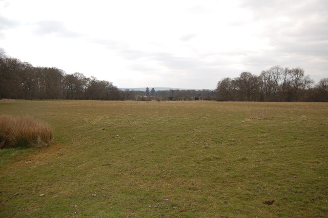
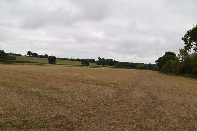
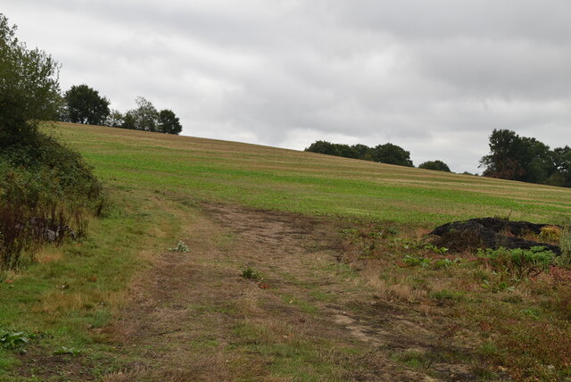
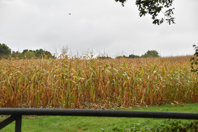
Covering a vast expanse of land, the Grove is characterized by its dense forestation and an abundance of diverse flora and fauna. The woodland is home to a wide variety of tree species, including oak, beech, and birch, creating a rich and vibrant ecosystem. The forest floor is adorned with carpets of wildflowers during the spring and summer months, adding splashes of color to the verdant landscape.

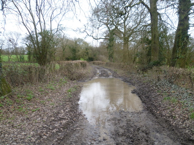
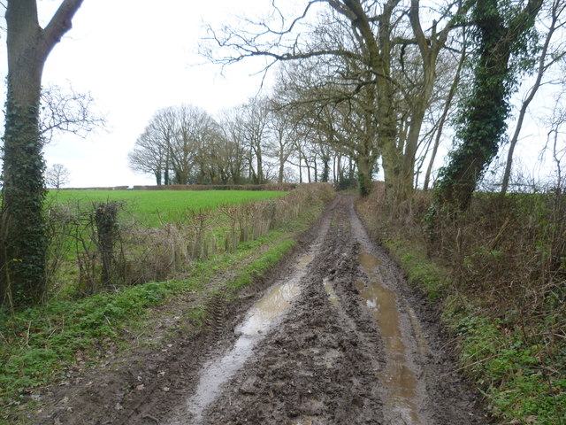
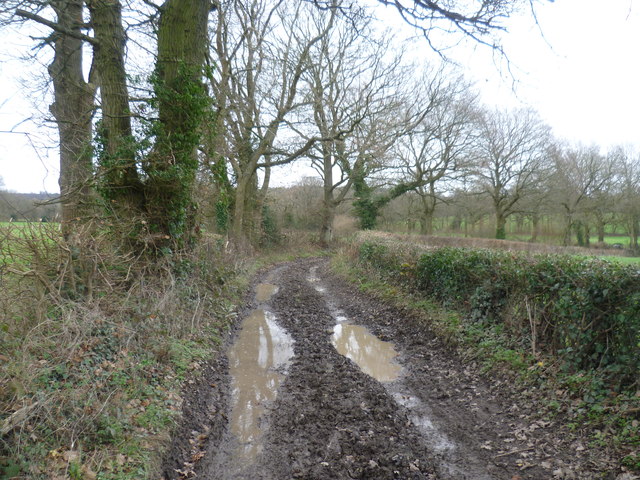
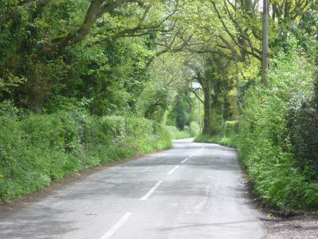
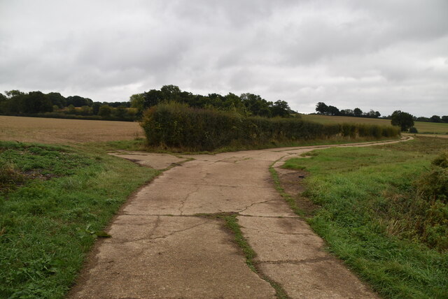
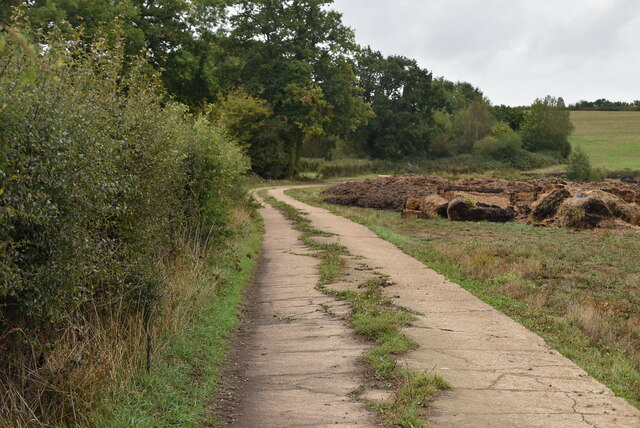
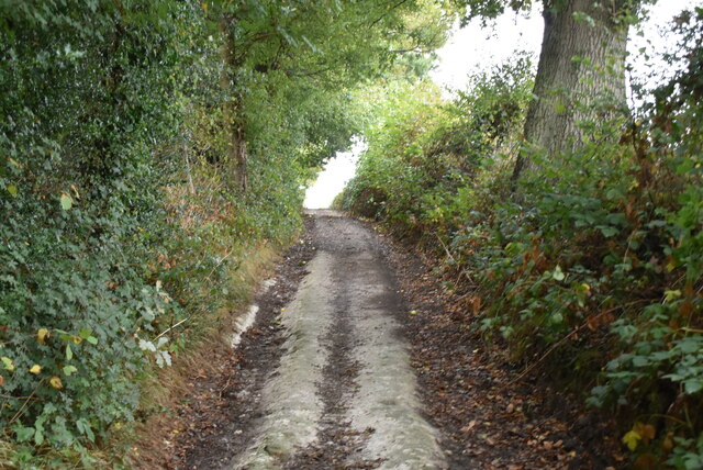
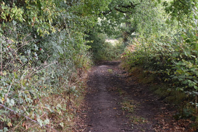
Visitors to the Grove can explore its numerous walking trails, which wind their way through the woods and offer breathtaking views of the surrounding countryside. These paths cater to all levels of fitness, ranging from gentle strolls to more challenging hikes, ensuring there is something for everyone.

The Grove is not only a haven for nature lovers but also a sanctuary for wildlife. It provides a habitat for many species, including deer, squirrels, and a variety of birdlife. Birdwatchers will delight in the opportunity to spot rare and migratory birds, such as woodpeckers and kingfishers, among the treetops.

In addition to its natural beauty, the Grove offers a range of amenities to enhance visitors' experiences. These include picnic areas, a visitor center, and on-site facilities for camping and caravanning. The Grove also hosts educational programs and guided tours, providing an opportunity for visitors to learn about the area's history and ecology.

Overall, the Grove in Kent is a captivating destination that offers a peaceful retreat and an opportunity to immerse oneself in the wonders of nature.

If you have any feedback on the listing, please let us know in the comments section below.

The Grove Images

Images are sourced within 2km of 51.243992/0.08756723 or Grid Reference TQ4551. Thanks to Geograph Open Source API. All images are credited.

Scene south of Obriss Farm
Track near Pollards This track between Mapleton Road and Grange Farm is described in walking books as being prone to mud. The weekend before Christmas it was living up to its reputation. Nothing less than wellington boots were any use.
Track near Pollards
This track between Mapleton Road and Grange Farm is described in walking books as being prone to mud. The weekend before Christmas it was living up to its reputation. Nothing less than wellington boots were any use.
Muddy track near Pollards This track between Mapleton Road and Grange Farm is described in walking books as being prone to mud. The weekend before Christmas it was living up to its reputation. Nothing less than wellington boots were any use.
Muddy track near Pollards
This track between Mapleton Road and Grange Farm is described in walking books as being prone to mud. The weekend before Christmas it was living up to its reputation. Nothing less than wellington boots were any use.
Muddy track to Mapleton Road This track between Grange Farm and Mapleton Road is described in walking books as being prone to mud. The weekend before Christmas it was living up to its reputation. Nothing less than wellington boots were any use.
Muddy track to Mapleton Road
This track between Grange Farm and Mapleton Road is described in walking books as being prone to mud. The weekend before Christmas it was living up to its reputation. Nothing less than wellington boots were any use.
Mapleton Road This looks in the direction of Four Elms. A path to the right leads to Crockham Grange and Pootings Road.
Mapleton Road
This looks in the direction of Four Elms. A path to the right leads to Crockham Grange and Pootings Road.
Track by Crockham Grange
Grange Farm
Grange Farm
Hay bales, Grange Farm
Barn, Grange Farm
Barn, Grange Farm
Bare field
Bare field
Bare field
Bare field
Field by byway
Field by byway
Maize field
Maize field
Rutted byway
Rutted byway
Show me another place!

The Grove is located at Grid Ref: TQ4551 (Lat: 51.243992, Lng: 0.08756723)

Administrative County: Kent

District: Sevenoaks

Police Authority: Kent

What 3 Words

///aims.milk.humans. Near Westerham, Kent

Related Wikis

Chartwell

Chartwell is a country house near Westerham, Kent, in South East England. For over forty years it was the home of Sir Winston Churchill. He bought the...

Toys Hill

Toys Hill is a hamlet which lies within Brasted civil parish in the Sevenoaks district of Kent, England. It lies to the south of Brasted Chart, also in...

Westerham Mines

Westerham Mines is a 25.4-hectare (63-acre) biological Site of Special Scientific Interest south of Westerham in Kent.The main interest of this site lies...

Holy Trinity Church, Crockham Hill

Holy Trinity Church is a Church of England parish church based in Crockham Hill, Kent, England. It was constructed in 1842 and is a Grade II listed building...

Scord's Wood and Brockhoult Mount

Scord's Wood and Brockhoult Mount is a 252.3-hectare (623-acre) biological Site of Special Scientific Interest west of Sevenoaks in Kent. Scord's Wood...

Crockham Hill

Crockham Hill is a village in the Sevenoaks district of Kent, England. It is about 3 miles (5 km) south of Westerham, and Chartwell is nearby. The village...

Emmetts Garden

Emmetts Garden is an Edwardian estate located at Ide Hill, near Sevenoaks in Kent, UK. It is now owned by the National Trust for Places of Historic Interest...

Squerryes Estate

Squerryes Estate is a vineyard, estate, and location of Squerryes Court, a grade I listed building in Kent, England. It is a producer of English sparkling...

Nearby Amenities

Located within 500m of 51.243992,0.08756723
Bus Stop
Chartwell Main Entrance
Flag: no
Naptan AtcoCode: 2400A070700A
Naptan Bearing: N
Naptan BusStopType: CUS
Naptan CommonName: Chartwell Main Entrance
Naptan Indicator: o/s
Naptan Landmark: Chartwell Stately Home
Naptan NaptanCode: kntgdjgt
Naptan Street: Mapleton
Naptan Verified: no
Public Transport: platform
Source: naptan_import
Lat/Long: 51.2462885/0.0833609
Cafe
Landemare café
Toilets Wheelchair: yes
Wheelchair: yes
Wheelchair Description: Step-free from Blue Badge spaces in car park. Accessible toilets at Visitor Centre & pay point, both 50m via ramps
Lat/Long: 51.2462586/0.0827449
Bench
Material: stone
Lat/Long: 51.2448342/0.083184
Barrier: kissing_gate
Lat/Long: 51.2431013/0.0854149
Bicycle Parking
Capacity: 6
Covered: no
Lat/Long: 51.2463402/0.0832784
Parking
Access: yes
Capacity: 4
Parking: surface
Lat/Long: 51.2435267/0.0819421
Access: permissive
Entrance: main
Lat/Long: 51.2443365/0.0831666
Barrier: stile
Lat/Long: 51.2428818/0.0862521
Bench
Backrest: no
Seats: 3
Lat/Long: 51.2448781/0.0819589
Bench
Backrest: no
Seats: 3
Lat/Long: 51.2442257/0.0817212
Historic: memorial
Inscription: Sir Winston often sat besides this pool to meditate and to watch the golden orfes
Material: concrete
Memorial: pavement plaque
Lat/Long: 51.2451744/0.0835477
The armchair of Sir Winston
Historic: yes
Lat/Long: 51.2452242/0.0834702
Barrier: entrance
Lat/Long: 51.2449081/0.0834045
Bench
Lat/Long: 51.2444421/0.0834783
Barrier: entrance
Lat/Long: 51.2447788/0.0835881
Bench
Inscription: Winston Spencer churchill
Lat/Long: 51.2444063/0.083357
Entrance: exit
Lat/Long: 51.244413/0.0833109
Artwork Type: column
Inscription: Here lies the Bali dove — I think of it again — It does not do wander too far from sober men but there’s an island yonder
Tourism: artwork
Lat/Long: 51.243022/0.0830949
Golden Wedding Memorial
Historic: memorial
Inscription: This Rose Walk commemorates the golden wedding ofWinston & ClementineChurchill and was the gift of their children Diana Randolph Sarah and Mary — 12 september 1958
Memorial: plaque
Start Date: 1958-09-12
Lat/Long: 51.2429364/0.0835474
Bench
Lat/Long: 51.2431891/0.0822363
Bench
Lat/Long: 51.2432303/0.0823208
Bench
Lat/Long: 51.2432764/0.0824032
Bench
Lat/Long: 51.2433188/0.0824824
Bench
Lat/Long: 51.2430293/0.0831436
Bench
Lat/Long: 51.2430511/0.0830753
Bench
Lat/Long: 51.2429941/0.0831168
Entrance: home
Lat/Long: 51.2436402/0.083994
Winston Churchill’s Studio
Historic: building
Lat/Long: 51.2436181/0.0840301
Entrance: main
Lat/Long: 51.246243/0.0833476
Historic: memorial
Inscription: Chartwell home of Sir Winston Churchill was bought and presented to the nation in 1947 by a group of his friends & admirers whose names are recorded here in gratitude by the National Trust (+ the names)
Material: stone
Memorial: plaque
Lat/Long: 51.2444271/0.0833113
Bus Stop
Chartwell
Physically Present: no
Public Transport: platform
Wheelchair: limited
Lat/Long: 51.2442812/0.0831104
Tourism: viewpoint
Lat/Long: 51.2447555/0.0819661
The data included in this document is from www.openstreetmap.org. The data is made available under ODbL.

Have you been to The Grove?

Leave your review of The Grove below (or comments, questions and feedback).