Longroad Plantation

Wood, Forest in Cambridgeshire Cambridge

England

Longroad Plantation

Trumpington church
Trumpington church Credit: mym

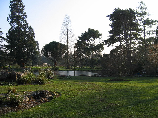
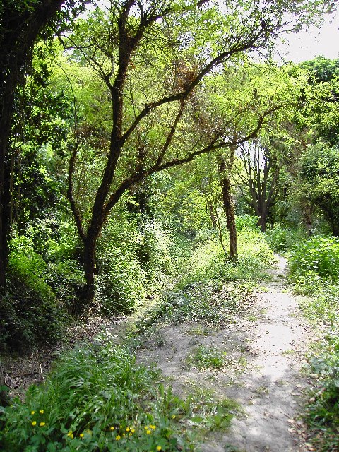
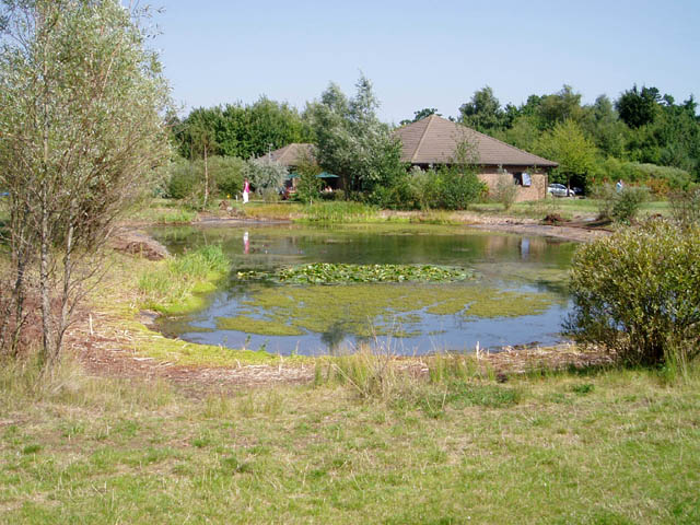
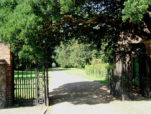
Longroad Plantation, located in Cambridgeshire, is a picturesque woodland area known for its natural beauty and serene atmosphere. It covers an expansive area and is characterized by its dense forest vegetation, making it an ideal destination for nature enthusiasts and outdoor lovers.

The plantation is home to a diverse range of tree species, including oak, beech, and pine, which contribute to the lush greenery and provide a haven for various wildlife. The forest floor is adorned with a vibrant carpet of ferns, wildflowers, and moss, adding to its enchanting appeal.

Visitors to Longroad Plantation can explore its many walking trails and enjoy leisurely strolls amidst the tranquil surroundings. The pathways meander through the woodland, offering glimpses of the occasional wildlife that call this area home, such as deer, rabbits, and a variety of bird species.

The plantation also offers opportunities for more active pursuits, with designated areas for cycling and horse riding. Cyclists can navigate the well-maintained trails, while equestrians can take advantage of the bridleways that wind through the forest.

Longroad Plantation is a popular destination for families, as it provides ample space for picnics and outdoor activities. Children can engage in nature-based play and explore the natural wonders of the woodland.

With its stunning scenery and diverse ecosystem, Longroad Plantation in Cambridgeshire is a true gem for those seeking solace in nature and a chance to immerse themselves in the beauty of the countryside.

If you have any feedback on the listing, please let us know in the comments section below.

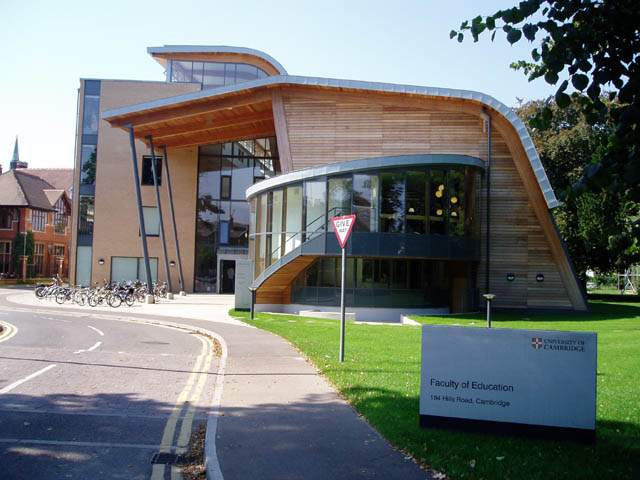
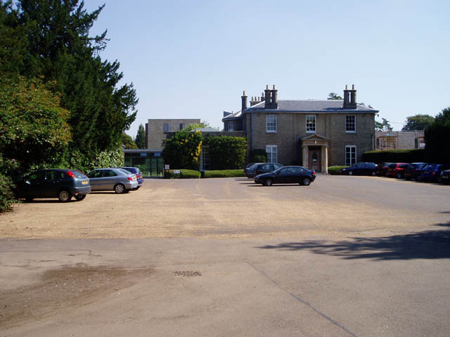
Longroad Plantation Images

Images are sourced within 2km of 52.177852/0.13107691 or Grid Reference TL4555. Thanks to Geograph Open Source API. All images are credited.

Trumpington church
Trumpington church
Addenbrooke's Hospital, Cambridge A small amount of Cambridge's large NHS hospital.
Addenbrooke's Hospital, Cambridge
A small amount of Cambridge's large NHS hospital.
Cambridge University Botanic Garden A 40-acre garden to the south of the city centre. Enjoyed by many for pleasure, it is also the site of research by academics in the University.
Cambridge University Botanic Garden
A 40-acre garden to the south of the city centre. Enjoyed by many for pleasure, it is also the site of research by academics in the University.
Disused railway bridge Long since abandoned by the railway companies, it's now claimed by teenagers and painted with graffiti. The road that runs over it is A1134, (Long Road) the Cambridge ring road.
Disused railway bridge
Long since abandoned by the railway companies, it's now claimed by teenagers and painted with graffiti. The road that runs over it is A1134, (Long Road) the Cambridge ring road.
Nine Wells In 1614, Cambridge needed a new water supply. Thomas Hobson built a causeway bringing water from springs at Nine Wells near Shelford outside Cambridge into the city centre. The channels still run along Trumpington Street in Cambridge. Thomas Hobson made his money hiring out horses, but hirers had to take the horse closest to the door. This led to the expression "Hobson's Choice" meaning "No choice"!
Nine Wells
In 1614, Cambridge needed a new water supply. Thomas Hobson built a causeway bringing water from springs at Nine Wells near Shelford outside Cambridge into the city centre. The channels still run along Trumpington Street in Cambridge. Thomas Hobson made his money hiring out horses, but hirers had to take the horse closest to the door. This led to the expression "Hobson's Choice" meaning "No choice"!
Mainline from Cambridge to London Railway heading south from Cambridge, just before it divides into the Liverpool Street or Kings Cross branches.
Mainline from Cambridge to London
Railway heading south from Cambridge, just before it divides into the Liverpool Street or Kings Cross branches.
Terraced houses, Cherry Hinton Road Most of the housing in this area is inter-war or later, but there are some older houses along the main roads including this terrace, which I'd guess was built before the First World War.
Terraced houses, Cherry Hinton Road
Most of the housing in this area is inter-war or later, but there are some older houses along the main roads including this terrace, which I'd guess was built before the First World War.
Homerton College and the Education Faculty Homerton was founded as a teacher training college, but is now a constituent college of Cambridge University and offers most subjects. Most of its students still study Education, though, hence the presence of the Education Faculty alongside.
Homerton College and the Education Faculty
Homerton was founded as a teacher training college, but is now a constituent college of Cambridge University and offers most subjects. Most of its students still study Education, though, hence the presence of the Education Faculty alongside.
Cambridge University Faculty of Education A striking new building, completed only in 2005.
Cambridge University Faculty of Education
A striking new building, completed only in 2005.
English Heritage office One of several Government offices off Brooklands Avenue.
English Heritage office
One of several Government offices off Brooklands Avenue.
Cambridge Lakes Golf Course A public golf course with the motto 'Golf for All'. This is the club house.
Cambridge Lakes Golf Course
A public golf course with the motto 'Golf for All'. This is the club house.
“And Worse Than Oaths at Trumpington” This is a picture of the Driveway to Trumpington hall, Contrary to Rupert Brooke’s experience the locals seemed very friendly these days! For an explanation of the title see <span class="nowrap"><a title="http://www.poetsgraves.co.uk/Classic%20Poems/Brooke/grantchester.htm" rel="nofollow ugc noopener" href="http://www.poetsgraves.co.uk/Classic%20Poems/Brooke/grantchester.htm">Link</a><img style="margin-left:2px;" alt="External link" title="External link - shift click to open in new window" src="https://s1.geograph.org.uk/img/external.png" width="10" height="10"/></span>
“And Worse Than Oaths at Trumpington”
This is a picture of the Driveway to Trumpington hall, Contrary to Rupert Brooke’s experience the locals seemed very friendly these days! For an explanation of the title see LinkExternal link
Cambridge People Rarely Smile Hardly a fair comment by Rupert Brooke. This terrace of houses in Rathmore Road to the south of Cambridge City Centre would have been built while Brooke was a Child. For an explanation of the title see  <span class="nowrap"><a title="http://www.poetsgraves.co.uk/Classic%20Poems/Brooke/grantchester.htm" rel="nofollow ugc noopener" href="http://www.poetsgraves.co.uk/Classic%20Poems/Brooke/grantchester.htm">Link</a><img style="margin-left:2px;" alt="External link" title="External link - shift click to open in new window" src="https://s1.geograph.org.uk/img/external.png" width="10" height="10"/></span>
Cambridge People Rarely Smile
Hardly a fair comment by Rupert Brooke. This terrace of houses in Rathmore Road to the south of Cambridge City Centre would have been built while Brooke was a Child. For an explanation of the title see LinkExternal link
Shops on the Queen Edith's estate A sizeable post-war housing development.
Shops on the Queen Edith's estate
A sizeable post-war housing development.
Hobson's (well hidden) monument
Hobson's Conduit (near Nine Wells)
Cambridge Station This is taken looking north, towards Ely. The platforms in the picture are numbered 6,5 and 4, from left to right.  Platforms 6 and 5 are bay platforms, serving mainly Norwich and Ipswich.  Platform 4 is eventually re-numbered Platform 1 to the south to create the longest platform in the UK.  Platforms 2 and 3 at the south end of the station are also bay platforms.
Cambridge Station
This is taken looking north, towards Ely. The platforms in the picture are numbered 6,5 and 4, from left to right. Platforms 6 and 5 are bay platforms, serving mainly Norwich and Ipswich. Platform 4 is eventually re-numbered Platform 1 to the south to create the longest platform in the UK. Platforms 2 and 3 at the south end of the station are also bay platforms.
Carriages at Cambridge Celebrating one year of 'first class' geograph.
Carriages at Cambridge
Celebrating one year of 'first class' geograph.
Show me another place!

Longroad Plantation is located at Grid Ref: TL4555 (Lat: 52.177852, Lng: 0.13107691)

Administrative County: Cambridgeshire

District: Cambridge

Police Authority: Cambridgeshire

What 3 Words

///elaborate.rental.bleat. Near Cambridge, Cambridgeshire

Nearby Locations

Longroad Plantation

Related Wikis

Long Road Sixth Form College

Long Road Sixth Form College (LRSFC) is a public sector co-educational sixth form college in Cambridge, England. It is situated on Long Road, from which...

Cambridge South railway station

Cambridge South railway station is a railway station that is under construction.Located in southern Cambridge, it is planned to serve the Cambridge Biomedical...

Sedley Taylor Road

Sedley Taylor Road is a road in west Cambridge, England. It is reputedly one of the most expensive in the UK and the most expensive in East Anglia. The...

Trumpington Community College

Trumpington Community College is a co-educational secondary school located in the Trumpington area of Cambridge in the English county of Cambridgeshire...

Royal Papworth Hospital

Royal Papworth Hospital is a specialist heart and lung hospital, located on the Cambridge Biomedical Campus in Cambridgeshire, England. The Hospital is...

The Perse School

The Perse School is a public school (English fee-charging day and, in the case of the Perse, a former boarding school) in Cambridge, England. Founded in...

Addenbrooke's Hospital

Addenbrooke's Hospital is a large teaching hospital and research centre in Cambridge, England, with strong affiliations to the University of Cambridge...

Cambridge Biomedical Campus

The Cambridge Biomedical Campus is the largest centre of medical research and health science in Europe. The site is located at the southern end of Hills...

Related Videos

A Day Walking In Historical Market Square Cambridge 4K 60fps

A Day Walking In Historical Market Square Cambridge 4K 60fps Open-air market displaying exquisite cuisine slows down, ...

Unseen Cambridge / England (UK) 🇬🇧 | A Walking Tour of Hidden Spots | Travel Vlog | Europe Travel

offbeatdestination #cambridge #uk #england Unseen Cambridge / England (UK) | A Walking Tour of Hidden Spots | Travel ...

Street Food in Cambridge #shorts #england #streetfood #foodie #foodlover #travel #cambridge #food

Street Food in Cambridge #shorts #england #streetfood #foodie #foodlover #travel #cambridge #food.

Nearby Amenities

Located within 500m of 52.177852,0.13107691
Bus Stop
Robinson Way
Naptan AtcoCode: 0500CCITY204
Naptan Bearing: W
Naptan CommonName: Robinson Way
Naptan Indicator: near
Naptan Landmark: Robinson Way
Naptan NaptanCode: cmbdapap
Naptan PlusbusZoneRef: CAMBDGE
Naptan ShortCommonName: Long Road
Naptan Street: Long Road
Naptan Verified: no
Public Transport: platform
Source: naptan_import
Lat/Long: 52.1791019/0.1369002
Bus Stop
Robinson Way
Naptan AtcoCode: 0500CCITY205
Naptan Bearing: E
Naptan CommonName: Robinson Way
Naptan Indicator: opp
Naptan Landmark: Robinson Way
Naptan NaptanCode: cmbdapat
Naptan PlusbusZoneRef: CAMBDGE
Naptan ShortCommonName: Long Road
Naptan Street: Long Road
Naptan Verified: no
Public Transport: platform
Source: naptan_import
Lat/Long: 52.1792419/0.1366143
Bus Stop
Rutherford Road
Naptan AtcoCode: 0500CCITY206
Naptan Bearing: E
Naptan CommonName: Rutherford Road
Naptan Indicator: near
Naptan Landmark: Rutherford Road
Naptan NaptanCode: cmbdapaw
Naptan PlusbusZoneRef: CAMBDGE
Naptan ShortCommonName: Rutherford Road
Naptan Street: Long Road
Naptan Verified: no
Public Transport: platform
Shelter: no
Source: naptan_import
Lat/Long: 52.1800493/0.1261794
Bus Stop
Rutherford Road
Naptan AtcoCode: 0500CCITY207
Naptan Bearing: W
Naptan CommonName: Rutherford Road
Naptan Indicator: opp
Naptan Landmark: Rutherford Road
Naptan NaptanCode: cmbdapda
Naptan PlusbusZoneRef: CAMBDGE
Naptan ShortCommonName: Rutherford Road
Naptan Street: Long Road
Naptan Verified: no
Public Transport: platform
Shelter: no
Source: naptan_import
Lat/Long: 52.1799581/0.1257853
Bus Stop
Long Road Sixth Form College
Naptan AtcoCode: 0500CCITY442
Naptan Bearing: S
Naptan BusStopType: CUS
Naptan CommonName: Long Rd 6th Form Coll
Naptan Indicator: opp
Naptan Landmark: Robinson Way
Naptan NaptanCode: cmbdgdwa
Naptan PlusbusZoneRef: CAMBDGE
Naptan ShortCommonName: Long Road College
Naptan Street: Robinson Way
Naptan Verified: no
Shelter: no
Source: naptan_import
Lat/Long: 52.1778335/0.1353724
Bus Stop
Long Road Sixth Form College
Naptan AtcoCode: 0500CCITY443
Naptan Bearing: N
Naptan CommonName: Long Rd 6th Form Coll
Naptan Indicator: o/s
Naptan Landmark: Robinson Way
Naptan NaptanCode: cmbdgdwd
Naptan PlusbusZoneRef: CAMBDGE
Naptan ShortCommonName: Long Road College
Naptan Street: Robinson Way
Naptan Verified: no
Shelter: no
Source: naptan_import
Lat/Long: 52.1779804/0.135241
Source: survey (Oct 2010)
Lat/Long: 52.1739343/0.1334503
Crossing
Crossing: traffic_signals
Crossing Ref: toucan
Source: survey (October 2010)
Lat/Long: 52.1742092/0.1334553
Traffic Signals
Lat/Long: 52.1742817/0.1334622
Barrier: height_restrictor
Maxheight: 3.6
Lat/Long: 52.1744508/0.1326129
Barrier: bollard
Bicycle: yes
Foot: yes
Lat/Long: 52.1743161/0.1331101
Bicycle: no
Entrance: yes
Foot: yes
Operator: University of Cambridge
Ref: H025-C
Vehicle: no
Lat/Long: 52.1765034/0.1380386
Entrance: main
Operator: University of Cambridge
Ref: H034-A
Lat/Long: 52.1756748/0.1338741
Access: staff
Barrier: lift_gate
Bicycle: no
Foot: no
Operator: University of Cambridge
Ref: H025-A
Vehicle: yes
Lat/Long: 52.1771456/0.1382851
Access: staff
Barrier: lift_gate
Bicycle: no
Foot: no
Operator: University of Cambridge
Ref: H025-B
Vehicle: yes
Lat/Long: 52.1771554/0.1381785
Entrance: main
Operator: University of Cambridge
Ref: H023.1-A
Lat/Long: 52.1771863/0.1358472
Access: staff
Barrier: lift_gate
Bicycle: no
Foot: no
Operator: University of Cambridge
Ref: H025-D
Vehicle: yes
Lat/Long: 52.1771926/0.1377724
Access: staff
Barrier: lift_gate
Bicycle: no
Foot: no
Operator: University of Cambridge
Ref: H025-E
Vehicle: yes
Lat/Long: 52.1772009/0.1376817
Entrance: secondary
Lat/Long: 52.1757147/0.1374962
Bench
Lat/Long: 52.17622/0.137153
Bench
Lat/Long: 52.1763059/0.1370926
Bench
Lat/Long: 52.1764165/0.1379453
Bench
Lat/Long: 52.1764397/0.1377844
Bench
Lat/Long: 52.1764502/0.1376165
Barrier: bollard
Lat/Long: 52.177429/0.1373255
Barrier: bollard
Lat/Long: 52.1774309/0.1373
Barrier: bollard
Lat/Long: 52.1774333/0.137269
Barrier: bollard
Lat/Long: 52.1774361/0.1372381
Barrier: bollard
Lat/Long: 52.1774376/0.1372172
Barrier: bollard
Lat/Long: 52.1774395/0.1371932
Barrier: bollard
Lat/Long: 52.1774423/0.1371592
Barrier: bollard
Lat/Long: 52.1774447/0.1371344
Barrier: bollard
Lat/Long: 52.1774466/0.1371151
Barrier: lift_gate
Lat/Long: 52.1787706/0.1356714
Bicycle Parking
Access: private
Bicycle Parking: stands
Capacity: 20
Operator: University of Cambridge
Lat/Long: 52.1772211/0.1359526
Barrier: entrance
Entrance: main
Operator: Cambridge University Hospitals NHS Foundation Trust
Ref University Of Cambridge: H-C
Lat/Long: 52.1791413/0.1354366
Barrier: entrance
Bicycle: yes
Entrance: secondary
Foot: yes
Operator: Cambridge University Hospitals NHS Foundation Trust
Ref University Of Cambridge: H-D
Vehicle: no
Lat/Long: 52.1791041/0.1376228
Railway: switch
Lat/Long: 52.180068/0.1306801
Defibrillator
Access: private
Defibrillator Location: At reception on shelf behind front desk
Emergency: defibrillator
Indoor: yes
Operator: University of Cambridge
Ref: H023.1
Lat/Long: 52.1771573/0.1356508
Crossing
Crossing: traffic_signals
Crossing Ref: puffin
Source: survey
Lat/Long: 52.1793329/0.134773
Bus Stop
Puddicombe Way
Bench: yes
Bin: yes
Bus: yes
Naptan AtcoCode: 0500CCITY534
Naptan Bearing: W
Naptan BusStopType: CUS
Naptan CommonName: Puddicombe Way
Naptan Indicator: near
Naptan Landmark: Robinson Way
Naptan NaptanCode: CMBGMPAW
Naptan Street: Puddicombe Way
Public Transport: platform
Shelter: yes
Lat/Long: 52.1774896/0.1359175
Bicycle Parking
Lat/Long: 52.1785338/0.1339528
Bicycle Parking
Lat/Long: 52.1787838/0.1335612
Department: Molecular Immunity Unit
Occupier: Addenbrooke's Centre for Clinical Investigation
Operator: University of Cambridge
Ref: H034
Lat/Long: 52.1753497/0.131957
Bus Stop
Francis Crick Avenue
Naptan AtcoCode: 0500CCITY543
Naptan Bearing: NE
Naptan BusStopType: CUS
Naptan CommonName: Francis Crick Avenue
Naptan Indicator: opp
Naptan Landmark: AstraZeneca
Naptan NaptanCode: CMBGMTAJ
Naptan Street: Francis Crick Avenue
Note: Notice asserts that this stop is served by R|the busway
Public Transport: platform
Source: manual addition from naptan
Lat/Long: 52.1750682/0.1337837
Barrier: bollard
Bollard: rising
Bus: yes
Lat/Long: 52.174233/0.1336206
Bicycle Parking
Bicycle Parking: stands
Capacity: 20
Covered: no
Note: Estimated capacity
Lat/Long: 52.1807174/0.13232
Bicycle Repair Station
Operator: University of Cambridge
Ref: H146
Service Bicycle Pump: yes
Lat/Long: 52.1764804/0.1369241
Entrance: service
Lat/Long: 52.1765371/0.1368995
Entrance: main
Operator: University of Cambridge
Ref: H146-A
Lat/Long: 52.1770016/0.1369468
Bench
Lat/Long: 52.1766868/0.1369925
Bench
Lat/Long: 52.1767362/0.1370099
Bench
Lat/Long: 52.1767979/0.1370193
Bench
Lat/Long: 52.1769146/0.1370743
Barrier: bollard
Lat/Long: 52.1773315/0.1373346
Barrier: bollard
Lat/Long: 52.177326/0.1374005
Barrier: bollard
Lat/Long: 52.1773374/0.137265
Barrier: bollard
Lat/Long: 52.1773421/0.1372085
Barrier: bollard
Lat/Long: 52.1773477/0.1371426
Barrier: bollard
Lat/Long: 52.1773535/0.1370731
Bench
Lat/Long: 52.1769845/0.13633
Bench
Lat/Long: 52.1769467/0.1363635
Bench
Lat/Long: 52.1770339/0.1363876
Bench
Backrest: no
Lat/Long: 52.1739445/0.1342084
Bench
Backrest: yes
Lat/Long: 52.1739933/0.1336683
Crossing
Crossing: traffic_signals
Crossing Ref: puffin
Source: survey
Lat/Long: 52.179127/0.1377758
Bench
Backrest: yes
Colour: Light Wood
Material: wood
Seats: 3
Lat/Long: 52.178405/0.1242257
Barrier: block
Bicycle: yes
Foot: yes
Lat/Long: 52.1801191/0.1262164
Bench
Backrest: yes
Lat/Long: 52.1798927/0.1260644
Barrier: bollard
Lat/Long: 52.1793172/0.1255364
Crossing
Crossing Island: no
Kerb: flush
Tactile Paving: no
Lat/Long: 52.1746071/0.1278663
Defibrillator
Defibrillator Location: On exterior wall of sports pavilion, facing towards the railway line.
Emergency: defibrillator
Lat/Long: 52.1791617/0.1300979
Bicycle Parking
Bicycle Parking: stands
Capacity: 10
Covered: no
Lat/Long: 52.1750823/0.1253866
Bicycle Parking
Bicycle Parking: stands
Capacity: 10
Covered: no
Lat/Long: 52.1754674/0.1254401
Bicycle Parking
Bicycle Parking: stands
Capacity: 10
Covered: no
Lat/Long: 52.1755761/0.1261732
Bench
Backrest: no
Material: wood
Lat/Long: 52.1755953/0.1260734
Bench: yes
Leisure: picnic_table
Material: wood
Lat/Long: 52.1750534/0.1255261
Bench: yes
Leisure: picnic_table
Material: wood
Lat/Long: 52.1750166/0.1255004
Bench: yes
Leisure: picnic_table
Material: wood
Lat/Long: 52.1750306/0.1256087
Bench
Backrest: yes
Material: wood
Lat/Long: 52.1751355/0.1254348
Bench
Backrest: yes
Material: wood
Lat/Long: 52.1752002/0.1254149
Bench
Backrest: no
Material: wood
Lat/Long: 52.1755324/0.1255717
Bench
Backrest: no
Material: wood
Lat/Long: 52.175417/0.125623
Bench
Backrest: no
Material: wood
Lat/Long: 52.175466/0.125757
Cambridge South
Description: New railway station under construction
Lat/Long: 52.173464/0.1313323
Parking
Access: private
Capacity: 5
Capacity Disabled: 3
Charging Station: yes
Parking: surface
Smoothness: good
Surface: paving_stones
Lat/Long: 52.175366/0.1357108
Parking
Access: private
Capacity: 5
Capacity Disabled: 5
Charging Station: yes
Parking: surface
Smoothness: good
Surface: paving_stones
Lat/Long: 52.1750436/0.1360054
Bicycle Parking
Access: yes
Bicycle Parking: stands
Capacity: 50
Capacity Cargo Bike: 2
Covered: yes
Lit: yes
Operator: astra zeneca
Smoothness: good
Surface: paving_stones
Lat/Long: 52.1744543/0.1341169
Cafe
Opening Hours: Mo-Fr 9:00-15:00
Lat/Long: 52.1749244/0.1354931
Traffic Calming: choker
Lat/Long: 52.1798605/0.1340535
Artwork Type: tent
Tourism: artwork
Lat/Long: 52.173861/0.1342152
The data included in this document is from www.openstreetmap.org. The data is made available under ODbL.

Have you been to Longroad Plantation?

Leave your review of Longroad Plantation below (or comments, questions and feedback).