Chrishall Grange Plantation

Wood, Forest in Cambridgeshire South Cambridgeshire

England

Chrishall Grange Plantation

Harvesting near Chrishall Grange
Harvesting near Chrishall Grange Credit: Richard Vince

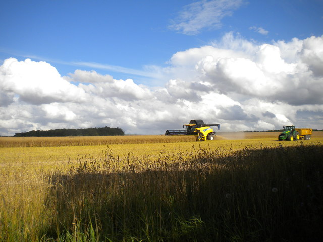
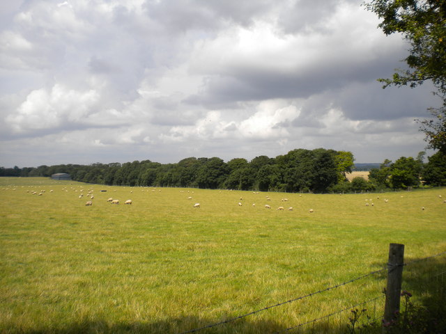
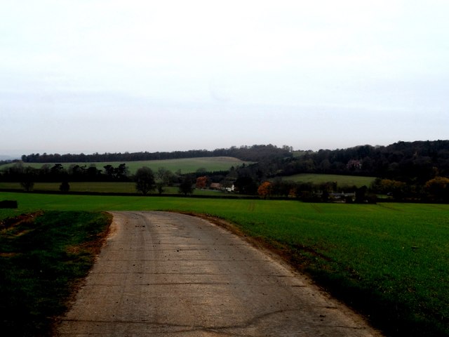
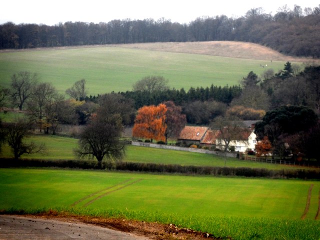
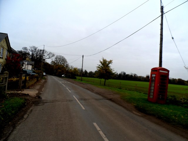
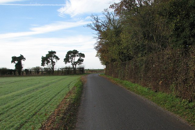
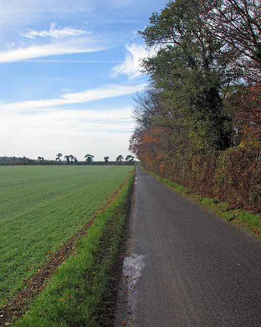
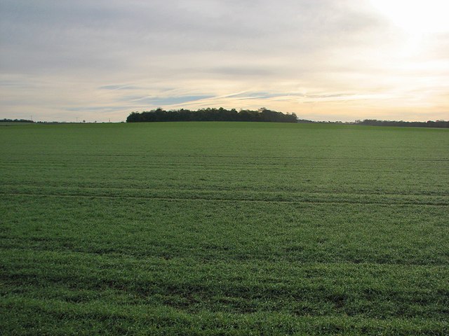
Chrishall Grange Plantation is a picturesque woodland located in Cambridgeshire, England. Covering an expansive area, this plantation is a haven for nature enthusiasts and provides a peaceful retreat from the hustle and bustle of everyday life.

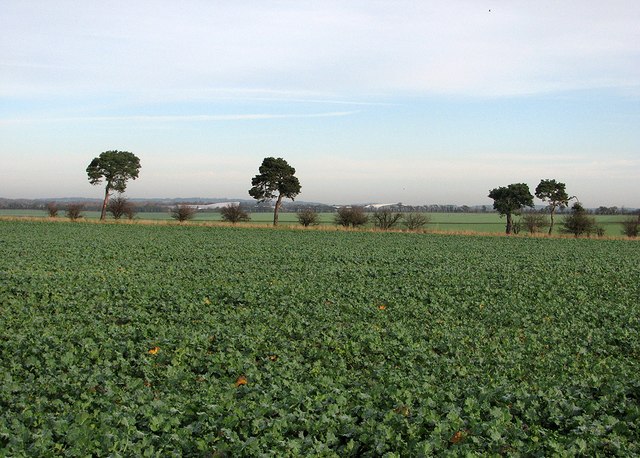
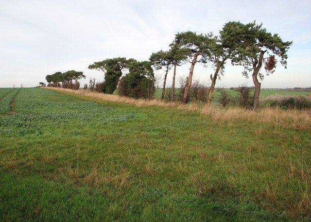
The woodland is predominantly composed of native tree species such as oak, ash, and birch, creating a diverse and thriving ecosystem. The tall, majestic trees tower over the forest floor, providing ample shade and creating a tranquil atmosphere. The forest floor is adorned with a variety of flora, including bluebells, ferns, and mosses, adding bursts of color to the green landscape during springtime.

The plantation is home to a wide range of wildlife, making it an ideal spot for birdwatching and animal spotting. Bird species such as woodpeckers, jays, and owls can often be seen and heard among the treetops, while mammals like deer, foxes, and rabbits roam the forest floor. The plantation is also home to a thriving population of insects and invertebrates, further enhancing its ecological value.

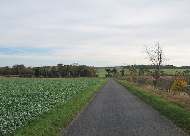
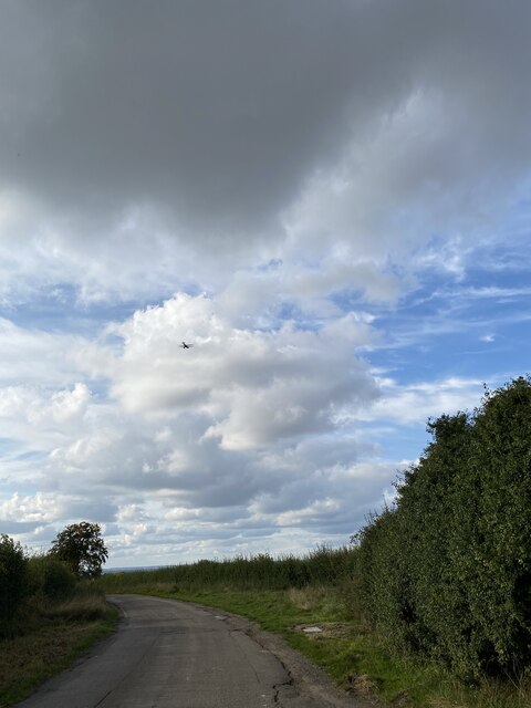
This woodland offers several walking trails, allowing visitors to explore the plantation at their own pace. The well-maintained paths wind through the trees, offering glimpses of breathtaking views and serene landscapes. The plantation is popular among hikers, joggers, and dog walkers, who enjoy the peaceful ambiance and the opportunity to connect with nature.

In summary, Chrishall Grange Plantation is a beautiful woodland in Cambridgeshire, providing a haven for wildlife and a tranquil escape for visitors. Its diverse flora and fauna, along with its well-maintained trails, make it a must-visit destination for nature lovers and outdoor enthusiasts.

If you have any feedback on the listing, please let us know in the comments section below.

Chrishall Grange Plantation Images

Images are sourced within 2km of 52.064213/0.12043922 or Grid Reference TL4542. Thanks to Geograph Open Source API. All images are credited.

Harvesting near Chrishall Grange
Field near Chrishall Grange Sheep safely grazing in a field between Chrishall Grange and the plantation which bears its name. The trees in the distance line the track that gives access to the plantation.
Field near Chrishall Grange
Sheep safely grazing in a field between Chrishall Grange and the plantation which bears its name. The trees in the distance line the track that gives access to the plantation.
Minor road and farmland near Ickleton Granges
Ickleton Old Granges
Cottages, Chrishall Grange
A straight lane A November morning on the lane from Chrishall to the A505. Keith Edkins' <a href="https://www.geograph.org.uk/photo/802170">TL4444 : Cow-parsley-lined road</a> is a comparable view from May 2008.
A straight lane
A November morning on the lane from Chrishall to the A505. Keith Edkins' TL4444 : Cow-parsley-lined road is a comparable view from May 2008.
Field-edge farm track and twisted larch Seen from the lane from Chrishall to the A505 on a November morning.
Field-edge farm track and twisted larch
Seen from the lane from Chrishall to the A505 on a November morning.
From Grange Road to the A505 A view across a beet field and along the lane from Chrishall. Grange Road is at the foot of the chalk hills on the Essex and Hertfordshire border, but most of the land to the north, towards Cambridge, is below the 30m/98ft contour line.
From Grange Road to the A505
A view across a beet field and along the lane from Chrishall. Grange Road is at the foot of the chalk hills on the Essex and Hertfordshire border, but most of the land to the north, towards Cambridge, is below the 30m/98ft contour line.
Over the fields towards Duxford Airfield A view from Grange Road on a November morning. The large white buildings in the distance are at the Imperial War Museum at Duxford Airfield.
Over the fields towards Duxford Airfield
A view from Grange Road on a November morning. The large white buildings in the distance are at the Imperial War Museum at Duxford Airfield.
On Grange Road Grange Road serves several isolated farms on the edge of the chalk hills on the border of Cambridgeshire and Essex.
On Grange Road
Grange Road serves several isolated farms on the edge of the chalk hills on the border of Cambridgeshire and Essex.
Wind-bent pines at a field boundary Corsican pines (I think), shaped by prevailing south-westerly winds in an exposed spot on the edge of the chalk hills on the Cambridgeshire-Essex border.
Wind-bent pines at a field boundary
Corsican pines (I think), shaped by prevailing south-westerly winds in an exposed spot on the edge of the chalk hills on the Cambridgeshire-Essex border.
The only bend in Grange Road Grange Road is a long straight road serving farms south-west of Duxford. The sun would shortly break through high cloud on a November morning.
The only bend in Grange Road
Grange Road is a long straight road serving farms south-west of Duxford. The sun would shortly break through high cloud on a November morning.
Along Grange Road Parts of the sky were clear on a November morning, but the sun had yet to break through completely - see <a href="https://www.geograph.org.uk/photo/4256569">TL4543 : Towards Round Plantation</a>, taken with the camera pointing south-east.
Along Grange Road
Parts of the sky were clear on a November morning, but the sun had yet to break through completely - see TL4543 : Towards Round Plantation, taken with the camera pointing south-east.
Towards Round Plantation The chalk hills on the Cambridgeshire-Essex border. The sun had not completely broken through high cloud on a November morning. Richard Thomas took a similar picture in brighter September 2006 - see <a href="https://www.geograph.org.uk/photo/248771">TL4543 : Round Plantation</a>.
Towards Round Plantation
The chalk hills on the Cambridgeshire-Essex border. The sun had not completely broken through high cloud on a November morning. Richard Thomas took a similar picture in brighter September 2006 - see TL4543 : Round Plantation.
Grange Farm, Duxford One of the farms reached along Grange Road. Keith Edkins' <a href="https://www.geograph.org.uk/photo/802181">TL4544 : Grange Farm</a> dates from May 2008.
Grange Farm, Duxford
One of the farms reached along Grange Road. Keith Edkins' TL4544 : Grange Farm dates from May 2008.
Delivery van on Grange Road The van had just delivered something to Grange Farm and was driving back to Duxford.
Delivery van on Grange Road
The van had just delivered something to Grange Farm and was driving back to Duxford.
College Farm Cottages The cottages are dated 1868.
College Farm Cottages
The cottages are dated 1868.
Road near Chrishall Grange
Show me another place!

Chrishall Grange Plantation is located at Grid Ref: TL4542 (Lat: 52.064213, Lng: 0.12043922)

Administrative County: Cambridgeshire

District: South Cambridgeshire

Police Authority: Cambridgeshire

What 3 Words

///option.concluded.seaweed. Near Duxford, Cambridgeshire

Related Wikis

Duxford Aerodrome

Duxford Aerodrome (ICAO: EGSU) is located 8 nautical miles (15 km; 9.2 mi) south of Cambridge, within the civil parish of Duxford, Cambridgeshire, England...

Imperial War Museum Duxford

Imperial War Museum Duxford is a branch of the Imperial War Museum near Duxford in Cambridgeshire, England. Britain's largest aviation museum, Duxford...

Fowlmere

Fowlmere is one of the southernmost villages in Cambridgeshire, England. The population of the civil parish at the 2011 Census was 1,206. It is very close...

Elmdon

See also, Elmdon, West Midlands.Elmdon is a village in the civil parish of Elmdon, Duddenhoe End & Wenden Lofts situated in the Uttlesford district of...

Ickleton Priory

Ickleton Priory was a Benedictine priory of nuns at Ickleton, Cambridgeshire, England. It was established in the middle of the 12th century and suppressed...

Heydon, Cambridgeshire

Heydon is a village and civil parish in Cambridgeshire, England. The parish of Heydon was transferred from Essex to Cambridgeshire in 1894. The area of...

Chrishall

Chrishall (pronounced Chris hall) is a small village in the English county of Essex. It is located 12 miles (20 km) south of Cambridge and lies equidistant...

Ickleton

Ickleton is a village and civil parish about 9 miles (14 km) south of Cambridge in Cambridgeshire, England. The village is beside the River Cam, close...

Nearby Amenities

Located within 500m of 52.064213,0.12043922
Power: pole
Lat/Long: 52.0628377/0.1146939
Power: pole
Lat/Long: 52.0623776/0.1192805
Power: pole
Lat/Long: 52.0627503/0.119157
Power: pole
Lat/Long: 52.0626966/0.1159545
Power: pole
Lat/Long: 52.062493/0.1181726
Power: pole
Lat/Long: 52.0634198/0.119023
Power: pole
Lat/Long: 52.059899/0.1222577
Power: pole
Lat/Long: 52.0640414/0.1189144
Power: pole
Lat/Long: 52.0615415/0.1194332
Power: pole
Lat/Long: 52.0625911/0.1170515
Power: pole
Lat/Long: 52.0606278/0.119566
Power: pole
Lat/Long: 52.0602527/0.1209488
The data included in this document is from www.openstreetmap.org. The data is made available under ODbL.

Have you been to Chrishall Grange Plantation?

Leave your review of Chrishall Grange Plantation below (or comments, questions and feedback).