Clay Hill Wood

Wood, Forest in Sussex Lewes

England

Clay Hill Wood

Oast House Single round kiln oast house.

Grade II listed.
Oast House Credit: Oast House Archive

Clay Hill Wood is a picturesque woodland located in Sussex, England. Spread across an area of approximately 40 hectares, it is known for its diverse flora and fauna, making it a popular destination for nature lovers and wildlife enthusiasts.

The woodland is primarily composed of broadleaf trees, including oak, birch, and beech, which create a dense canopy, providing shade and shelter to the woodland floor below. The undergrowth is rich with various plant species, such as bluebells, primroses, and wild garlic, which add vibrant colors to the woodland during springtime.

Clay Hill Wood is home to a wide range of wildlife. Birdwatchers can spot a variety of species, including woodpeckers, owls, and warblers. Additionally, the woodland provides a habitat for mammals like deer, foxes, and rabbits. It is also home to a diverse population of insects, including butterflies, bees, and beetles.

The wood offers several well-maintained walking trails, allowing visitors to explore its natural beauty. These pathways wind through the woodland, providing stunning views of the surrounding countryside. There are also designated picnic areas, making it an ideal spot for a day out with family or friends.

Clay Hill Wood is managed by a local conservation organization, which works to protect and preserve its natural beauty. They organize regular educational events and guided walks to raise awareness about the importance of woodland conservation and the species that inhabit the area.

Overall, Clay Hill Wood is a tranquil and enchanting destination, offering visitors a chance to immerse themselves in the wonders of nature and experience the beauty of a Sussex woodland.

If you have any feedback on the listing, please let us know in the comments section below.

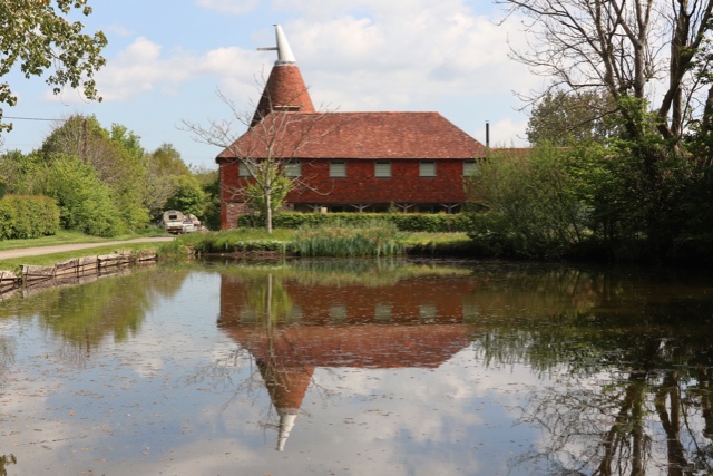
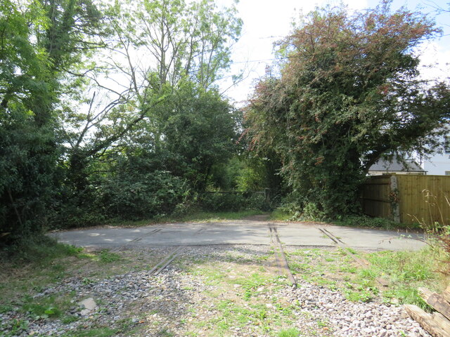
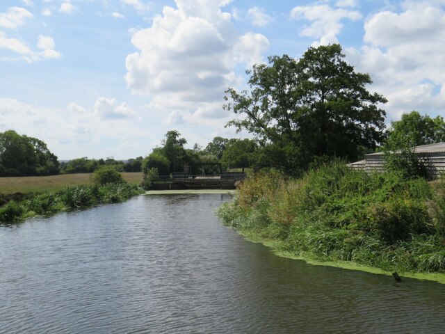
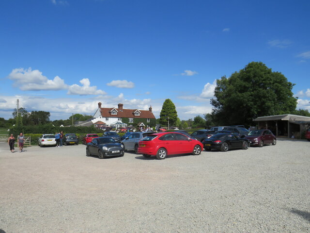
Clay Hill Wood Images

Images are sourced within 2km of 50.923578/0.061195804 or Grid Reference TQ4415. Thanks to Geograph Open Source API. All images are credited.

Oast House Single round kiln oast house.

Grade II listed.
Oast House
Single round kiln oast house. Grade II listed.
The Oast House Single square kiln oast house.
The Oast House
Single square kiln oast house.
Isfield Village Hall Isfield lies just off the main A26 Uckfield to Lewes main road, and is well hidden in the Ouse valley. The Romans established a staging post in the village, near a ford across the Ouse, this was on a section of Ermine Street which ran from Newhaven to London, passing through Lewes and Isfield and Maresfield. The village was recorded as Sifelle in the Domesday book.
More info at <span class="nowrap"><a title="http://www.villagenet.co.uk/ashdownforest/villages/isfield.php" rel="nofollow ugc noopener" href="http://www.villagenet.co.uk/ashdownforest/villages/isfield.php">Link</a><img style="margin-left:2px;" alt="External link" title="External link - shift click to open in new window" src="https://s1.geograph.org.uk/img/external.png" width="10" height="10"/></span>
Isfield Village Hall
Isfield lies just off the main A26 Uckfield to Lewes main road, and is well hidden in the Ouse valley. The Romans established a staging post in the village, near a ford across the Ouse, this was on a section of Ermine Street which ran from Newhaven to London, passing through Lewes and Isfield and Maresfield. The village was recorded as Sifelle in the Domesday book. More info at LinkExternal link
Station Rd Isfield lies just off the main A26 Uckfield to Lewes main road, and is well hidden in the Ouse valley. The Romans established a staging post in the village, near a ford across the Ouse, this was on a section of Ermine Street which ran from Newhaven to London, passing through Lewes and Isfield and Maresfield. The village was recorded as Sifelle in the Domesday book.
More info at <span class="nowrap"><a title="http://www.villagenet.co.uk/ashdownforest/villages/isfield.php" rel="nofollow ugc noopener" href="http://www.villagenet.co.uk/ashdownforest/villages/isfield.php">Link</a><img style="margin-left:2px;" alt="External link" title="External link - shift click to open in new window" src="https://s1.geograph.org.uk/img/external.png" width="10" height="10"/></span>
Station Rd
Isfield lies just off the main A26 Uckfield to Lewes main road, and is well hidden in the Ouse valley. The Romans established a staging post in the village, near a ford across the Ouse, this was on a section of Ermine Street which ran from Newhaven to London, passing through Lewes and Isfield and Maresfield. The village was recorded as Sifelle in the Domesday book. More info at LinkExternal link
Track in Isfield
Track in Isfield
Faulkners
Faulkners
Anchor Lane, near Barcombe Cross Anchor Lane is a minor lane through East Sussex countryside.  Here it passes Delves Farm.
Anchor Lane, near Barcombe Cross
Anchor Lane is a minor lane through East Sussex countryside. Here it passes Delves Farm.
Former railway level crossing near Barcombe Cross A former railway route between Uckfield and Lewes in East Sussex.  Here, the former railway crosses Anchor Lane, a minor road.  The railway closed in 1969 but more than half a century later, rails were still in place where the line crossed the road.
Former railway level crossing near Barcombe Cross
A former railway route between Uckfield and Lewes in East Sussex. Here, the former railway crosses Anchor Lane, a minor road. The railway closed in 1969 but more than half a century later, rails were still in place where the line crossed the road.
Former railway level crossing near Barcombe Cross A view of Anchor Lane, near Barcombe Cross in East Sussex, at a former railway level crossing.  The line from Lewes to Uckfield crossed Anchor Lane here.  Although the line closed in 1969, rails are still in place more than half a century later at the site of the level crossing.
Former railway level crossing near Barcombe Cross
A view of Anchor Lane, near Barcombe Cross in East Sussex, at a former railway level crossing. The line from Lewes to Uckfield crossed Anchor Lane here. Although the line closed in 1969, rails are still in place more than half a century later at the site of the level crossing.
River Ouse near Barcombe Cross A view of the River Ouse in East Sussex, as it flows past the Anchor Inn.  The blue boats belong to a boat hire business which operates here.
River Ouse near Barcombe Cross
A view of the River Ouse in East Sussex, as it flows past the Anchor Inn. The blue boats belong to a boat hire business which operates here.
River Ouse near Barcombe Cross A view of the River Ouse as it flows through East Sussex countryside.
River Ouse near Barcombe Cross
A view of the River Ouse as it flows through East Sussex countryside.
Algae on the River Ouse, near Barcombe Cross Algae on the surface of the River Ouse in East Sussex.  The algae had built up over a very hot and dry spell during the summer of 2022.
Algae on the River Ouse, near Barcombe Cross
Algae on the surface of the River Ouse in East Sussex. The algae had built up over a very hot and dry spell during the summer of 2022.
Pub car park, near Barcombe Cross The car park of the Anchor Inn, alongside the River Ouse in East Sussex.
Pub car park, near Barcombe Cross
The car park of the Anchor Inn, alongside the River Ouse in East Sussex.
Anchor Inn, near Barcombe Cross The Anchor Inn, alongside the River Ouse in East Sussex.  This photograph was taken on a sunny Bank Holiday Monday in August 2022, when the pub was busy.
Anchor Inn, near Barcombe Cross
The Anchor Inn, alongside the River Ouse in East Sussex. This photograph was taken on a sunny Bank Holiday Monday in August 2022, when the pub was busy.
Former railway route near Barcombe Cross A former railway route, now used as a permissive bridleway, in East Sussex countryside near Barcombe Cross.  The railway, which closed in 1969, ran from Uckfield to Lewes.  Here there is a bridge where the former railway crosses a stream.
Former railway route near Barcombe Cross
A former railway route, now used as a permissive bridleway, in East Sussex countryside near Barcombe Cross. The railway, which closed in 1969, ran from Uckfield to Lewes. Here there is a bridge where the former railway crosses a stream.
Former railway route near Barcombe Cross A former railway route, now in use as a permissive bridleway, near Barcombe Cross in East Sussex.  The railway, which linked Uckfield with Lewes, closed in 1969.

Here, a footpath branches off to the right.
Former railway route near Barcombe Cross
A former railway route, now in use as a permissive bridleway, near Barcombe Cross in East Sussex. The railway, which linked Uckfield with Lewes, closed in 1969. Here, a footpath branches off to the right.
Former railway route near Barcombe Cross A permissive bridleway uses a section of former railway near Barcombe Cross in East Sussex.  The railway, which closed in 1969, linked the towns of Uckfield and Lewes.
Former railway route near Barcombe Cross
A permissive bridleway uses a section of former railway near Barcombe Cross in East Sussex. The railway, which closed in 1969, linked the towns of Uckfield and Lewes.
Former railway route near Barcombe Cross A former railway route, now used as a permissive bridleway, in East Sussex.  The railway linked the towns of Uckfield and Lewes.  It closed in 1969.

Here, the route crosses a stream.
Former railway route near Barcombe Cross
A former railway route, now used as a permissive bridleway, in East Sussex. The railway linked the towns of Uckfield and Lewes. It closed in 1969. Here, the route crosses a stream.
Show me another place!

Clay Hill Wood is located at Grid Ref: TQ4415 (Lat: 50.923578, Lng: 0.061195804)

Administrative County: East Sussex

District: Lewes

Police Authority: Sussex

What 3 Words

///audit.sprains.crossing. Near Ringmer, East Sussex

Related Wikis

Isfield

Isfield is a small village and civil parish in the Wealden District of East Sussex in England, located north-east of Lewes. == History == The village of...

Plashett Park Wood

Plashett Park Wood is a 157.6-hectare (389-acre) biological Site of Special Scientific Interest between Lewes and Uckfield in East Sussex.This ancient...

Lavender Line

The Lavender Line is a heritage railway based at Isfield Station, near Uckfield in East Sussex, England. == History == The Lavender Line was originally...

Isfield railway station

Isfield is a preserved railway station on the closed section of the Wealden Line which served the East Sussex village of Isfield near Uckfield. Originally...

River Uck

The River Uck is a river in East Sussex, United Kingdom, which drains a catchment starting near Crowborough in the North, Hadlow Down to the East and Laughton...

Barcombe Mills

Barcombe Mills is a small settlement and an area of countryside including a local nature reserve near the village of Barcombe Cross in East Sussex, England...

Barcombe Mills railway station

Barcombe Mills is a disused railway station in the hamlet of Barcombe Mills, on the closed section of the Wealden Line. The station was opened in 1858...

Barcombe

Barcombe is an East Sussex village and civil parish in the Lewes District of East Sussex. The parish has four settlements: old Barcombe (TQ 418 143), the...

Nearby Amenities

Located within 500m of 50.923578,0.061195804
Material: wood
Power: pole
Source: bing
Lat/Long: 50.9191379/0.0605615
Material: wood
Power: pole
Source: bing
Lat/Long: 50.9202473/0.0611592
Material: wood
Power: pole
Source: bing
Lat/Long: 50.9208762/0.0612252
Material: wood
Power: pole
Source: bing
Lat/Long: 50.9213667/0.0620743
Material: wood
Power: pole
Source: bing
Lat/Long: 50.9223359/0.0635926
Material: wood
Power: pole
Source: bing
Lat/Long: 50.922714/0.0556985
Material: wood
Power: pole
Source: bing
Lat/Long: 50.9233407/0.0565531
Material: wood
Power: pole
Source: bing
Lat/Long: 50.9239686/0.0574174
Material: wood
Power: pole
Source: bing
Lat/Long: 50.9247089/0.0584194
Material: wood
Power: pole
Source: bing
Lat/Long: 50.9260237/0.0602133
Material: wood
Power: pole
Source: bing
Lat/Long: 50.9267969/0.0612521
Material: wood
Power: pole
Source: bing
Lat/Long: 50.9275603/0.0623005
Bus Stop
Old Ship
Bus: yes
Public Transport: platform
Lat/Long: 50.9204401/0.0611077
Oaklands Park
Addr City: Isfield
Addr Postcode: TN22 5UB
Is In: Isfield; Uckfield; East Sussex
Place: isolated_dwelling
Lat/Long: 50.9248345/0.0654513
Bus Stop
Old Ship
Bus: yes
Public Transport: platform
Lat/Long: 50.920563/0.0610141
The data included in this document is from www.openstreetmap.org. The data is made available under ODbL.

Have you been to Clay Hill Wood?

Leave your review of Clay Hill Wood below (or comments, questions and feedback).