Road Wood

Wood, Forest in Sussex Lewes

England

Road Wood

Carriages, Lavender Line The Lavender line is a 1.4km section of preserved railway running from Isfield station. The original line ran between Uckfield and Lewes and closed in the 1960's . The section of railway was restored in 1983 and informally named the Lavender Line, after a local coal merchants who operated from Isfield station yard.
Carriages, Lavender Line Credit: N Chadwick

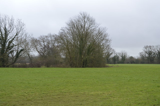
Road Wood is a picturesque woodland located in Sussex, England. It is known for its natural beauty, diverse flora and fauna, and its accessibility for visitors. Covering an area of approximately 100 acres, Road Wood is a popular destination for nature enthusiasts, hikers, and families looking for a peaceful retreat.

The woodland is characterized by a mix of deciduous and coniferous trees, including oak, beech, birch, and pine. These trees provide a stunning backdrop throughout the year, with vibrant colors in autumn and lush greenery in spring and summer. The forest floor is carpeted with ferns, bluebells, and other wildflowers, creating a vibrant and diverse ecosystem.

Road Wood is home to a variety of wildlife, including birds, mammals, and insects. Visitors can spot species such as deer, foxes, badgers, squirrels, and a wide array of bird species. The woodland is also known for its rich insect life, with butterflies, beetles, and dragonflies adding to its biodiversity.

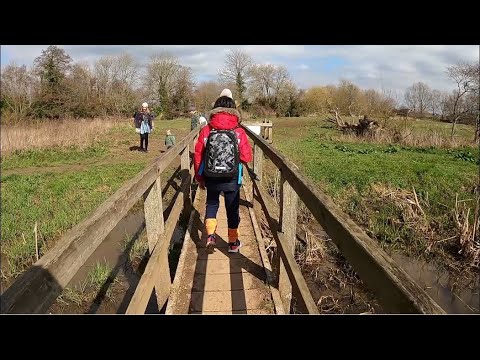
The wood is crisscrossed by a network of well-maintained trails, offering visitors the opportunity to explore the area on foot. These trails cater to different levels of difficulty, ensuring that visitors of all ages and fitness levels can enjoy the beauty of Road Wood. The woodland is also equipped with picnic areas and benches, providing visitors with the option to relax and enjoy a meal surrounded by nature.

In summary, Road Wood in Sussex is a stunning woodland with diverse flora and fauna, offering visitors a peaceful and picturesque setting to explore and enjoy nature.

If you have any feedback on the listing, please let us know in the comments section below.

Road Wood Images

Images are sourced within 2km of 50.918501/0.057869808 or Grid Reference TQ4415. Thanks to Geograph Open Source API. All images are credited.

Carriages, Lavender Line The Lavender line is a 1.4km section of preserved railway running from Isfield station. The original line ran between Uckfield and Lewes and closed in the 1960's . The section of railway was restored in 1983 and informally named the Lavender Line, after a local coal merchants who operated from Isfield station yard.
Carriages, Lavender Line
The Lavender line is a 1.4km section of preserved railway running from Isfield station. The original line ran between Uckfield and Lewes and closed in the 1960's . The section of railway was restored in 1983 and informally named the Lavender Line, after a local coal merchants who operated from Isfield station yard.
Isfield Signalbox Isfield lies just off the main A26 Uckfield to Lewes main road, and is well hidden in the Ouse valley. The Romans established a staging post in the village, near a ford across the Ouse, this was on a section of Ermine Street which ran from Newhaven to London, passing through Lewes and Isfield and Maresfield. The village was recorded as Sifelle in the Domesday book.
More info at <span class="nowrap"><a title="http://www.villagenet.co.uk/ashdownforest/villages/isfield.php" rel="nofollow ugc noopener" href="http://www.villagenet.co.uk/ashdownforest/villages/isfield.php">Link</a><img style="margin-left:2px;" alt="External link" title="External link - shift click to open in new window" src="https://s1.geograph.org.uk/img/external.png" width="10" height="10"/></span>
Isfield Signalbox
Isfield lies just off the main A26 Uckfield to Lewes main road, and is well hidden in the Ouse valley. The Romans established a staging post in the village, near a ford across the Ouse, this was on a section of Ermine Street which ran from Newhaven to London, passing through Lewes and Isfield and Maresfield. The village was recorded as Sifelle in the Domesday book. More info at LinkExternal link
Horsted Lane, Station Rd junction
The Lavender Line Isfield lies just off the main A26 Uckfield to Lewes main road, and is well hidden in the Ouse valley. The Romans established a staging post in the village, near a ford across the Ouse, this was on a section of Ermine Street which ran from Newhaven to London, passing through Lewes and Isfield and Maresfield. The village was recorded as Sifelle in the Domesday book.
More info at <span class="nowrap"><a title="http://www.villagenet.co.uk/ashdownforest/villages/isfield.php" rel="nofollow ugc noopener" href="http://www.villagenet.co.uk/ashdownforest/villages/isfield.php">Link</a><img style="margin-left:2px;" alt="External link" title="External link - shift click to open in new window" src="https://s1.geograph.org.uk/img/external.png" width="10" height="10"/></span>
The Lavender Line
Isfield lies just off the main A26 Uckfield to Lewes main road, and is well hidden in the Ouse valley. The Romans established a staging post in the village, near a ford across the Ouse, this was on a section of Ermine Street which ran from Newhaven to London, passing through Lewes and Isfield and Maresfield. The village was recorded as Sifelle in the Domesday book. More info at LinkExternal link
House on Station Rd Isfield lies just off the main A26 Uckfield to Lewes main road, and is well hidden in the Ouse valley. The Romans established a staging post in the village, near a ford across the Ouse, this was on a section of Ermine Street which ran from Newhaven to London, passing through Lewes and Isfield and Maresfield. The village was recorded as Sifelle in the Domesday book.
More info at <span class="nowrap"><a title="http://www.villagenet.co.uk/ashdownforest/villages/isfield.php" rel="nofollow ugc noopener" href="http://www.villagenet.co.uk/ashdownforest/villages/isfield.php">Link</a><img style="margin-left:2px;" alt="External link" title="External link - shift click to open in new window" src="https://s1.geograph.org.uk/img/external.png" width="10" height="10"/></span>
House on Station Rd
Isfield lies just off the main A26 Uckfield to Lewes main road, and is well hidden in the Ouse valley. The Romans established a staging post in the village, near a ford across the Ouse, this was on a section of Ermine Street which ran from Newhaven to London, passing through Lewes and Isfield and Maresfield. The village was recorded as Sifelle in the Domesday book. More info at LinkExternal link
The Laughing Fish Isfield lies just off the main A26 Uckfield to Lewes main road, and is well hidden in the Ouse valley. The Romans established a staging post in the village, near a ford across the Ouse, this was on a section of Ermine Street which ran from Newhaven to London, passing through Lewes and Isfield and Maresfield. The village was recorded as Sifelle in the Domesday book.
More info at <span class="nowrap"><a title="http://www.villagenet.co.uk/ashdownforest/villages/isfield.php" rel="nofollow ugc noopener" href="http://www.villagenet.co.uk/ashdownforest/villages/isfield.php">Link</a><img style="margin-left:2px;" alt="External link" title="External link - shift click to open in new window" src="https://s1.geograph.org.uk/img/external.png" width="10" height="10"/></span>
The Laughing Fish
Isfield lies just off the main A26 Uckfield to Lewes main road, and is well hidden in the Ouse valley. The Romans established a staging post in the village, near a ford across the Ouse, this was on a section of Ermine Street which ran from Newhaven to London, passing through Lewes and Isfield and Maresfield. The village was recorded as Sifelle in the Domesday book. More info at LinkExternal link
Station Rd Isfield lies just off the main A26 Uckfield to Lewes main road, and is well hidden in the Ouse valley. The Romans established a staging post in the village, near a ford across the Ouse, this was on a section of Ermine Street which ran from Newhaven to London, passing through Lewes and Isfield and Maresfield. The village was recorded as Sifelle in the Domesday book.
More info at <span class="nowrap"><a title="http://www.villagenet.co.uk/ashdownforest/villages/isfield.php" rel="nofollow ugc noopener" href="http://www.villagenet.co.uk/ashdownforest/villages/isfield.php">Link</a><img style="margin-left:2px;" alt="External link" title="External link - shift click to open in new window" src="https://s1.geograph.org.uk/img/external.png" width="10" height="10"/></span>
Station Rd
Isfield lies just off the main A26 Uckfield to Lewes main road, and is well hidden in the Ouse valley. The Romans established a staging post in the village, near a ford across the Ouse, this was on a section of Ermine Street which ran from Newhaven to London, passing through Lewes and Isfield and Maresfield. The village was recorded as Sifelle in the Domesday book. More info at LinkExternal link
River Ouse The Ouse rises at Lower Beeding and flows generally southwards to reach the English Channel at Newhaven, a distance of approximately 33 miles. The Sussex Ouse Valley Way follows its route from source to mouth. The River is one of four rivers to cut through the South Downs, an example of Superimposed drainage.
Wikipedia: <span class="nowrap"><a title="http://en.wikipedia.org/wiki/River_Ouse,_Sussex" rel="nofollow ugc noopener" href="http://en.wikipedia.org/wiki/River_Ouse,_Sussex">Link</a><img style="margin-left:2px;" alt="External link" title="External link - shift click to open in new window" src="https://s1.geograph.org.uk/img/external.png" width="10" height="10"/></span>
River Ouse
The Ouse rises at Lower Beeding and flows generally southwards to reach the English Channel at Newhaven, a distance of approximately 33 miles. The Sussex Ouse Valley Way follows its route from source to mouth. The River is one of four rivers to cut through the South Downs, an example of Superimposed drainage. Wikipedia: LinkExternal link
Floodplain of the River Ouse
Sussex Ouse Valley Way Opened in 2005, the Sussex Ouse Valley Way is a beautiful 42 mile journey that broadly follows the River Ouse from its source close to Lower Beeding in the High Weald to the sea at Seaford Bay. It is signed using a picture of the Ouse Valley Viaduct. Website: <span class="nowrap"><a title="http://www.sussexousevalleyway.co.uk/index.htm" rel="nofollow ugc noopener" href="http://www.sussexousevalleyway.co.uk/index.htm">Link</a><img style="margin-left:2px;" alt="External link" title="External link - shift click to open in new window" src="https://s1.geograph.org.uk/img/external.png" width="10" height="10"/></span>
Sussex Ouse Valley Way
Opened in 2005, the Sussex Ouse Valley Way is a beautiful 42 mile journey that broadly follows the River Ouse from its source close to Lower Beeding in the High Weald to the sea at Seaford Bay. It is signed using a picture of the Ouse Valley Viaduct. Website: LinkExternal link
Crabtree Shaw
Crabtree Shaw
Floodplain of the River Ouse
Pillbox, Ouse Valley In 1940 a network of defences was hastily built all over Britain to prevent an expected German invasion. The most common of these defences were called “pillboxes”, squat concrete forts that were sited at road junctions, canals and other strategic points.

With the passage of time it is estimated that fewer than 6,000 of a total of 28,000 pillboxes built still survive. They remain as permanent monuments and a silent tribute to the courage and tenacity of the British people during the dark days of 1940 when Britain stood alone against Nazi Germany.

More detail see <span class="nowrap"><a title="www.pillboxesuk.co.uk" rel="nofollow ugc noopener" href="http://www.pillboxesuk.co.uk">Link</a><img style="margin-left:2px;" alt="External link" title="External link - shift click to open in new window" src="https://s1.geograph.org.uk/img/external.png" width="10" height="10"/></span>
Pillbox, Ouse Valley
In 1940 a network of defences was hastily built all over Britain to prevent an expected German invasion. The most common of these defences were called “pillboxes”, squat concrete forts that were sited at road junctions, canals and other strategic points. With the passage of time it is estimated that fewer than 6,000 of a total of 28,000 pillboxes built still survive. They remain as permanent monuments and a silent tribute to the courage and tenacity of the British people during the dark days of 1940 when Britain stood alone against Nazi Germany. More detail see LinkExternal link
Show me another place!

Road Wood is located at Grid Ref: TQ4415 (Lat: 50.918501, Lng: 0.057869808)

Administrative County: East Sussex

District: Lewes

Police Authority: Sussex

What 3 Words

///setting.turkeys.waking. Near Ringmer, East Sussex

Related Wikis

Isfield

Isfield is a small village and civil parish in the Wealden District of East Sussex in England, located north-east of Lewes. == History == The village of...

Plashett Park Wood

Plashett Park Wood is a 157.6-hectare (389-acre) biological Site of Special Scientific Interest between Lewes and Uckfield in East Sussex.This ancient...

Barcombe Mills railway station

Barcombe Mills is a disused railway station in the hamlet of Barcombe Mills, on the closed section of the Wealden Line. The station was opened in 1858...

Lavender Line

The Lavender Line is a heritage railway based at Isfield Station, near Uckfield in East Sussex, England. == History == The Lavender Line was originally...

Barcombe Mills

Barcombe Mills is a small settlement and an area of countryside including a local nature reserve near the village of Barcombe Cross in East Sussex, England...

Isfield railway station

Isfield is a preserved railway station on the closed section of the Wealden Line which served the East Sussex village of Isfield near Uckfield. Originally...

River Uck

The River Uck is a river in East Sussex, United Kingdom, which drains a catchment starting near Crowborough in the North, Hadlow Down to the East and Laughton...

King's Academy Ringmer

King's Academy Ringmer is an academy school and a specialist technology college. It is located in the village of Ringmer, East Sussex, England. The school...

Related Videos

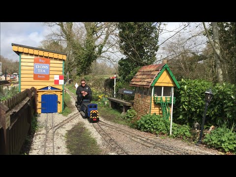
Riley’s Miniature Railway - Easter Bank Holiday Monday 10-04-23

A short video taken on 10-04-23 showing Riley's Miniature Railway at the Lavender Line, a preserved heritage railway line at ...

Nearby Amenities

Located within 500m of 50.918501,0.057869808
Material: wood
Power: pole
Source: bing
Lat/Long: 50.9148401/0.0583938
Material: wood
Power: pole
Source: bing
Lat/Long: 50.9153377/0.057325
Material: wood
Power: pole
Source: bing
Lat/Long: 50.9156978/0.0575933
Material: wood
Power: pole
Source: bing
Lat/Long: 50.916078/0.0578372
Material: wood
Power: pole
Source: bing
Lat/Long: 50.9162381/0.059069
Material: wood
Power: pole
Source: bing
Lat/Long: 50.9166679/0.0524854
Material: wood
Power: pole
Source: bing
Lat/Long: 50.9174742/0.0529021
Material: wood
Power: pole
Source: bing
Lat/Long: 50.9176446/0.0598035
Material: wood
Power: pole
Source: bing
Lat/Long: 50.9182647/0.0533381
Material: wood
Power: pole
Source: bing
Lat/Long: 50.9191379/0.0605615
Material: wood
Power: pole
Source: bing
Lat/Long: 50.9191529/0.0538051
Material: wood
Power: pole
Source: bing
Lat/Long: 50.920052/0.0542722
Material: wood
Power: pole
Source: bing
Lat/Long: 50.9202473/0.0611592
Material: wood
Power: pole
Source: bing
Lat/Long: 50.9208762/0.0612252
Material: wood
Power: pole
Source: bing
Lat/Long: 50.9209768/0.0547683
Material: wood
Power: pole
Source: bing
Lat/Long: 50.9213667/0.0620743
Material: wood
Power: pole
Source: bing
Lat/Long: 50.922714/0.0556985
Bus Stop
Old Ship
Bus: yes
Public Transport: platform
Lat/Long: 50.9204401/0.0611077
Banff Farm
Addr City: Ringmer
Addr Postcode: BN8 5RR
Addr Street: Uckfield Road
Place: farm
Lat/Long: 50.9151675/0.0559528
Upper Clayhill Farm
Addr City: Ringmer
Addr Postcode: BN8 5RR
Addr Street: Uckfield Road
Place: farm
Lat/Long: 50.9163238/0.0547256
Bus Stop
Top of Clay Hill
Public Transport: platform
Lat/Long: 50.9147117/0.0561379
Bus Stop
Old Ship
Bus: yes
Public Transport: platform
Lat/Long: 50.920563/0.0610141
The data included in this document is from www.openstreetmap.org. The data is made available under ODbL.

Have you been to Road Wood?

Leave your review of Road Wood below (or comments, questions and feedback).