Speaker's Holt
Wood, Forest in Sussex Lewes
England
Speaker's Holt
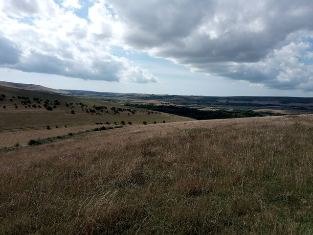
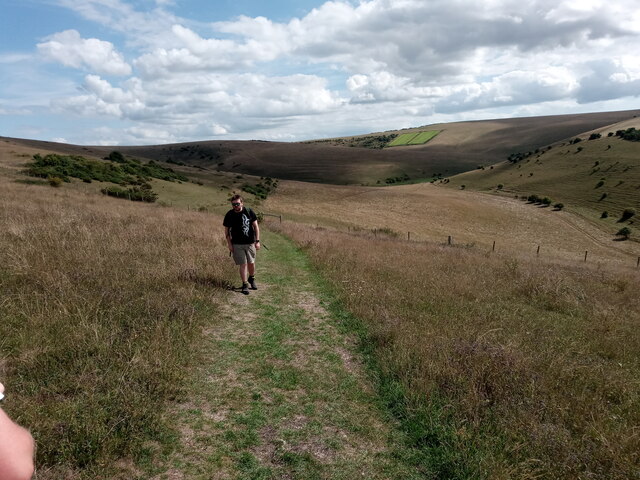
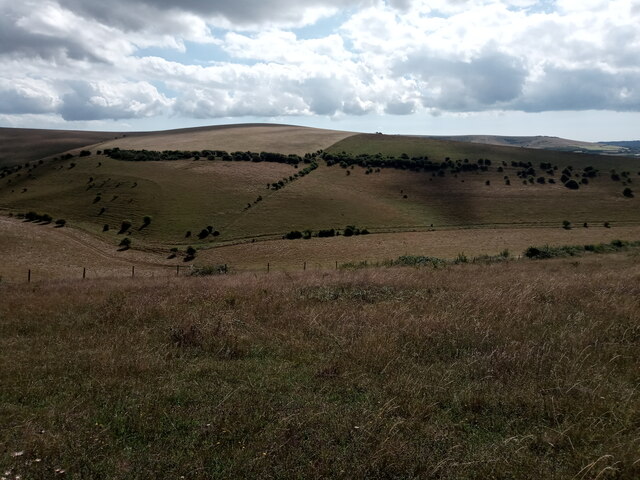
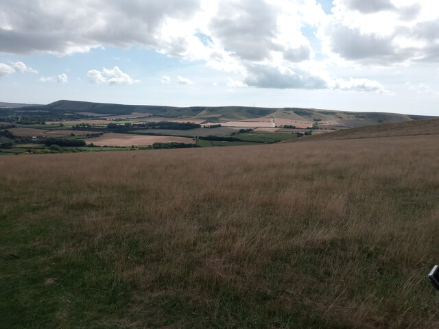
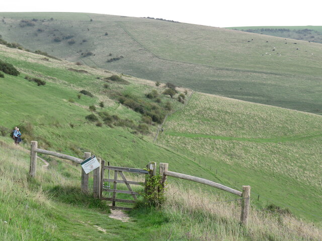
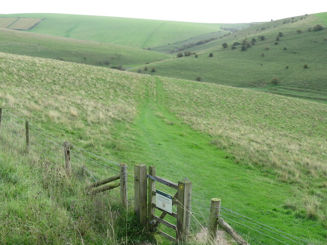
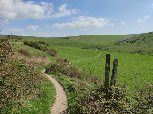
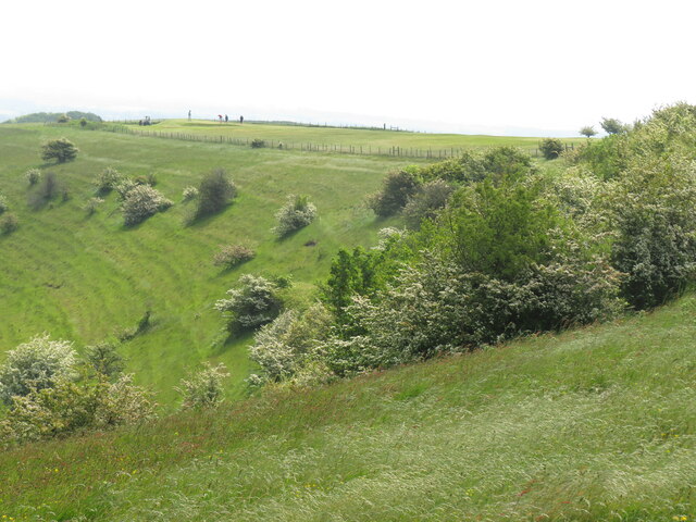
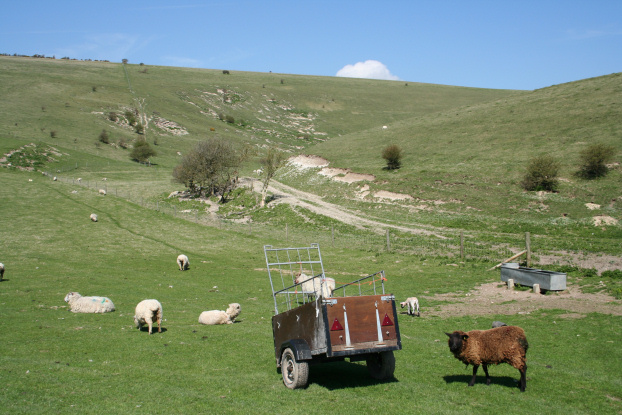
Speaker's Holt is a picturesque woodland located in Sussex, England. Situated in the heart of the South Downs National Park, this forested area spans approximately 200 acres and is renowned for its natural beauty and tranquility. The name "Holt" is derived from the Old English word for a wooded hill, aptly describing the landscape of this captivating destination.
The woodland is predominantly populated by a mix of ancient oak, beech, and birch trees, creating a diverse and vibrant ecosystem. The forest floor is adorned with an array of wildflowers, adding color and charm to the surroundings. These woodlands are particularly enchanting during the spring and summer months when the fragrant bluebells come into bloom, transforming the landscape into a sea of vibrant hues.
Speaker's Holt is a haven for wildlife, providing a sanctuary for various species. Visitors may have the opportunity to spot deer, foxes, badgers, and a wide variety of birds, including woodpeckers and owls. The forest is also home to a multitude of insects, offering an important habitat for biodiversity.
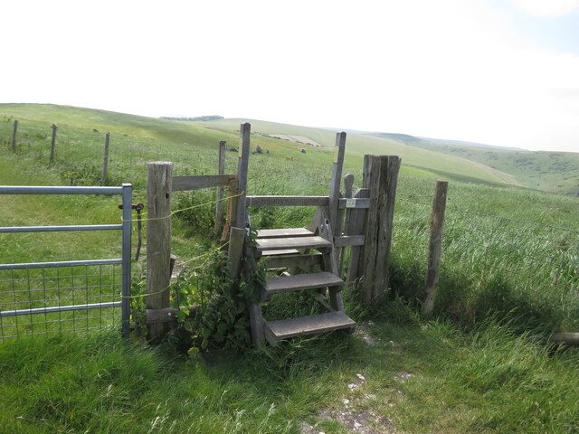
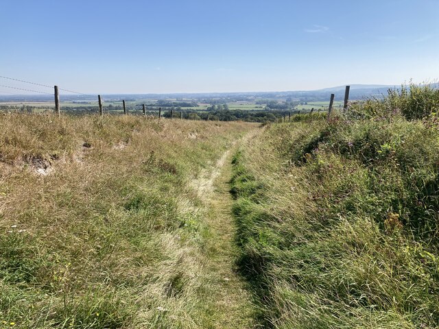
The woodland is a popular destination for nature enthusiasts, hikers, and photographers due to its stunning vistas and peaceful ambiance. Several well-marked trails meander through the forest, allowing visitors to explore its hidden gems. These paths range in difficulty, catering to both casual walkers and avid hikers.
Overall, Speaker's Holt in Sussex offers a captivating experience for those seeking solace in the midst of nature's splendor. With its ancient trees, vibrant flora, and diverse wildlife, this woodland is a treasure trove for nature lovers and a true gem within the South Downs National Park.
If you have any feedback on the listing, please let us know in the comments section below.
Speaker's Holt Images
Images are sourced within 2km of 50.864591/0.058010399 or Grid Reference TQ4409. Thanks to Geograph Open Source API. All images are credited.


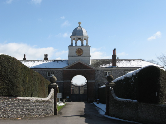
![Glynde Place [1] From the car parking area, this grassy path leads through the gardens to the house.
The Glynde Place estate is situated at the top of the village of Glynde, some 2½ miles east of Lewes. The house was built in 1569 from local flint, chalk and Caen stone. The estate has 10 acres of garden and 74 acres of parkland. The house is listed, grade I, with details at: <span class="nowrap"><a title="https://historicengland.org.uk/listing/the-list/list-entry/1221546" rel="nofollow ugc noopener" href="https://historicengland.org.uk/listing/the-list/list-entry/1221546">Link</a><img style="margin-left:2px;" alt="External link" title="External link - shift click to open in new window" src="https://s1.geograph.org.uk/img/external.png" width="10" height="10"/></span> The grounds are on the Register of Historic Parks and Gardens. Grade II*, with much history and detail at:
<span class="nowrap"><a title="https://historicengland.org.uk/listing/the-list/list-entry/1000307" rel="nofollow ugc noopener" href="https://historicengland.org.uk/listing/the-list/list-entry/1000307">Link</a><img style="margin-left:2px;" alt="External link" title="External link - shift click to open in new window" src="https://s1.geograph.org.uk/img/external.png" width="10" height="10"/></span>](https://s1.geograph.org.uk/geophotos/07/22/39/7223997_32bfd076.jpg)
![Glynde Place [2] The house is seen from the approach path from the car park.
The Glynde Place estate is situated at the top of the village of Glynde, some 2½ miles east of Lewes. The house was built in 1569 from local flint, chalk and Caen stone. The estate has 10 acres of garden and 74 acres of parkland. The house is listed, grade I, with details at: <span class="nowrap"><a title="https://historicengland.org.uk/listing/the-list/list-entry/1221546" rel="nofollow ugc noopener" href="https://historicengland.org.uk/listing/the-list/list-entry/1221546">Link</a><img style="margin-left:2px;" alt="External link" title="External link - shift click to open in new window" src="https://s1.geograph.org.uk/img/external.png" width="10" height="10"/></span> The grounds are on the Register of Historic Parks and Gardens. Grade II*, with much history and detail at:
<span class="nowrap"><a title="https://historicengland.org.uk/listing/the-list/list-entry/1000307" rel="nofollow ugc noopener" href="https://historicengland.org.uk/listing/the-list/list-entry/1000307">Link</a><img style="margin-left:2px;" alt="External link" title="External link - shift click to open in new window" src="https://s1.geograph.org.uk/img/external.png" width="10" height="10"/></span>](https://s0.geograph.org.uk/geophotos/07/22/40/7224000_f05209ec.jpg)
![Glynde Place [3] The east front of the house.
The Glynde Place estate is situated at the top of the village of Glynde, some 2½ miles east of Lewes. The house was built in 1569 from local flint, chalk and Caen stone. The estate has 10 acres of garden and 74 acres of parkland. The house is listed, grade I, with details at: <span class="nowrap"><a title="https://historicengland.org.uk/listing/the-list/list-entry/1221546" rel="nofollow ugc noopener" href="https://historicengland.org.uk/listing/the-list/list-entry/1221546">Link</a><img style="margin-left:2px;" alt="External link" title="External link - shift click to open in new window" src="https://s1.geograph.org.uk/img/external.png" width="10" height="10"/></span> The grounds are on the Register of Historic Parks and Gardens. Grade II*, with much history and detail at:
<span class="nowrap"><a title="https://historicengland.org.uk/listing/the-list/list-entry/1000307" rel="nofollow ugc noopener" href="https://historicengland.org.uk/listing/the-list/list-entry/1000307">Link</a><img style="margin-left:2px;" alt="External link" title="External link - shift click to open in new window" src="https://s1.geograph.org.uk/img/external.png" width="10" height="10"/></span>](https://s3.geograph.org.uk/geophotos/07/22/40/7224003_5478c9f8.jpg)
![Glynde Place [4] The garden wall and gate piers were built in 1760. On one side the wall is faced with squared knapped flints with blind arches of red brick and gate piers of squared knapped flints edged with red brick. The other side of the wall is faced with cobbles and the gate piers are wholly of red brick. The piers are crowned with a lead figure of a wyvern. Listed, grade II*, with details at: <span class="nowrap"><a title="https://historicengland.org.uk/listing/the-list/list-entry/1043919" rel="nofollow ugc noopener" href="https://historicengland.org.uk/listing/the-list/list-entry/1043919">Link</a><img style="margin-left:2px;" alt="External link" title="External link - shift click to open in new window" src="https://s1.geograph.org.uk/img/external.png" width="10" height="10"/></span>
The Glynde Place estate is situated at the top of the village of Glynde, some 2½ miles east of Lewes. The house was built in 1569 from local flint, chalk and Caen stone. The estate has 10 acres of garden and 74 acres of parkland. The house is listed, grade I, with details at: <span class="nowrap"><a title="https://historicengland.org.uk/listing/the-list/list-entry/1221546" rel="nofollow ugc noopener" href="https://historicengland.org.uk/listing/the-list/list-entry/1221546">Link</a><img style="margin-left:2px;" alt="External link" title="External link - shift click to open in new window" src="https://s1.geograph.org.uk/img/external.png" width="10" height="10"/></span> The grounds are on the Register of Historic Parks and Gardens. Grade II*, with much history and detail at:
<span class="nowrap"><a title="https://historicengland.org.uk/listing/the-list/list-entry/1000307" rel="nofollow ugc noopener" href="https://historicengland.org.uk/listing/the-list/list-entry/1000307">Link</a><img style="margin-left:2px;" alt="External link" title="External link - shift click to open in new window" src="https://s1.geograph.org.uk/img/external.png" width="10" height="10"/></span>](https://s1.geograph.org.uk/geophotos/07/22/40/7224005_d61e403d.jpg)
Speaker's Holt is located at Grid Ref: TQ4409 (Lat: 50.864591, Lng: 0.058010399)
Administrative County: East Sussex
District: Lewes
Police Authority: Sussex
What 3 Words
///angry.giggles.responses. Near Ringmer, East Sussex
Nearby Locations
Related Wikis

Mount Caburn
Mount Caburn is a 150-metre (492 ft) prominent landmark in East Sussex, England, about one mile (1.6 km) east of Lewes overlooking the village of Glynde...

Glynde Place
Glynde Place is an Elizabethan Manor House at Glynde in East Sussex, England. Situated in the South Downs National Park, it is the family home of the Viscounts...

St Mary's Church, Glynde
The Church of St Mary the Virgin is a Grade II* listed Anglican church in the village of Glynde in East Sussex. It was built in the 1760s by Richard Trevor...
Southerham Farm
Southerham Farm is a 131-hectare (320-acre) nature reserve on the eastern outskirts of Lewes in East Sussex. It is managed by the Sussex Wildlife Trust...
Glynde
Glynde is a village and shares a civil parish with Beddingham in the Lewes District of East Sussex, United Kingdom. It is located two miles (5 km) east...

Glynde and Beddingham
Glynde and Beddingham Parish Council is a combined council of two civil parishes in the Lewes district of East Sussex. == Glynde == == Beddingham... ==
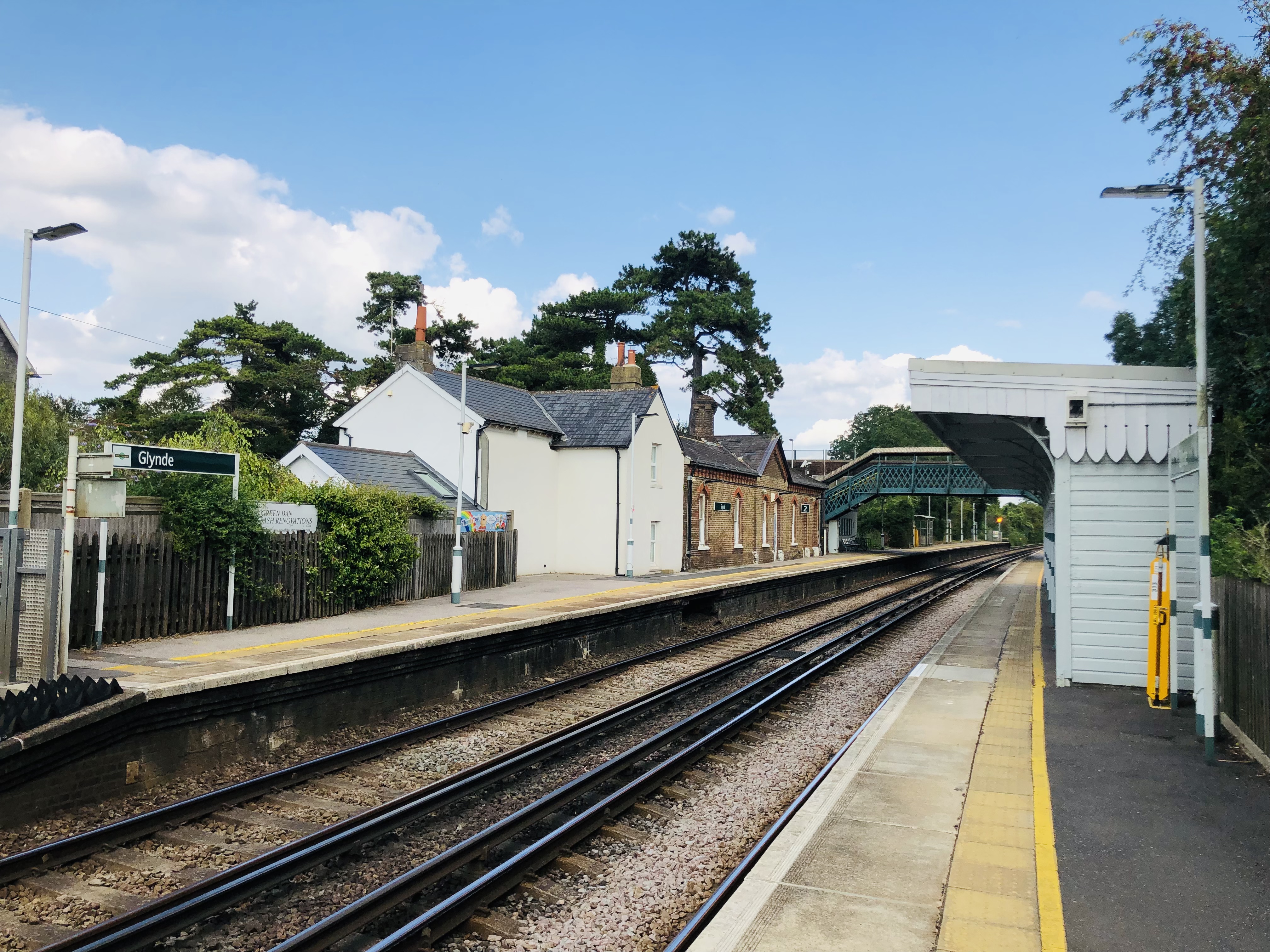
Glynde railway station
Glynde railway station serves Glynde in East Sussex. It is 53 miles 11 chains (85.5 km) from London Bridge, on the East Coastway Line and train services...

Lewes Downs
Lewes Downs is a 165-hectare (410-acre) biological Site of Special Scientific Interest east of Lewes in East Sussex. It is a Nature Conservation Review...
Nearby Amenities
Located within 500m of 50.864591,0.058010399Have you been to Speaker's Holt?
Leave your review of Speaker's Holt below (or comments, questions and feedback).