Aston

Settlement in Herefordshire

England

Aston

Farm track near Richard's Castle In valleys of springs of rivers,
           By Onny and Teme and Clun,
          The country for easy livers,
           The quietest under the sun.

Excerpt from 'A Shropshire Lad' by AE Housman
Farm track near Richard's Castle Credit: Jeremy Bolwell

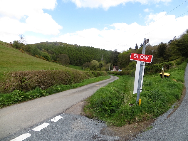
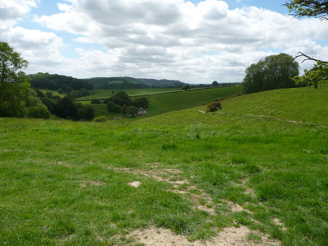
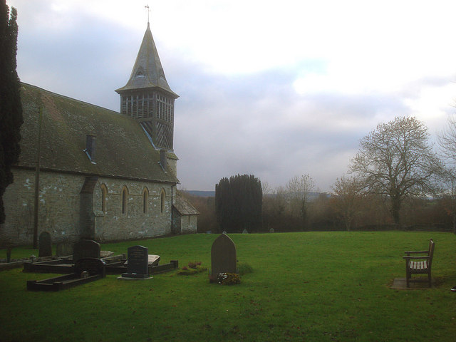
Aston is a small village located in the county of Herefordshire, England. Situated in the West Midlands region, Aston is nestled in the picturesque countryside, surrounded by rolling hills and lush green fields. The village itself is characterized by its charming and quaint atmosphere, with traditional cottages and buildings lining its narrow streets.

Aston is home to a tight-knit community, with a population of around 500 residents. The village boasts a peaceful and tranquil environment, making it an ideal place for those seeking a quiet and rural lifestyle. The local residents take pride in their village, which is reflected in the well-maintained gardens and pristine streets.

Despite its small size, Aston offers a range of amenities and facilities for its residents. These include a village hall, a primary school, and a local pub, which serves as a hub for social gatherings and community events. The village also benefits from being in close proximity to larger towns and cities, such as Hereford and Leominster, providing residents with easy access to a wider range of services and amenities.

The surrounding area of Aston is renowned for its natural beauty, with plenty of opportunities for outdoor activities and exploration. The nearby countryside offers scenic walking trails, cycling routes, and fishing spots, allowing residents and visitors to immerse themselves in the stunning landscapes of Herefordshire.

In conclusion, Aston, Herefordshire, offers a peaceful and idyllic village lifestyle, surrounded by breathtaking natural beauty. Its strong sense of community and range of amenities make it an attractive place to live for those seeking a rural retreat.

If you have any feedback on the listing, please let us know in the comments section below.

Aston Images

Images are sourced within 2km of 52.334414/-2.7939176 or Grid Reference SO4671. Thanks to Geograph Open Source API. All images are credited.

Farm track near Richard's Castle In valleys of springs of rivers,
           By Onny and Teme and Clun,
          The country for easy livers,
           The quietest under the sun.

Excerpt from 'A Shropshire Lad' by AE Housman
Farm track near Richard's Castle
In valleys of springs of rivers, By Onny and Teme and Clun, The country for easy livers, The quietest under the sun. Excerpt from 'A Shropshire Lad' by AE Housman
The Goggin A road follows a scenic valley up the dip side of the big limestone ridge. The scarp side, Killhorse Lane is not so forgiving.
The Goggin
A road follows a scenic valley up the dip side of the big limestone ridge. The scarp side, Killhorse Lane is not so forgiving.
The Goggin View uphill.  There is a string of small cottages along the road as it ascends the pass.
The Goggin
View uphill. There is a string of small cottages along the road as it ascends the pass.
The Goggin Goggin Copse - off the beaten track
The Goggin
Goggin Copse - off the beaten track
Valley to the east of High Cullis This was taken looking west towards Oldfield Farm from about SO469696
Valley to the east of High Cullis
This was taken looking west towards Oldfield Farm from about SO469696
Oxleasow Coppice Gatley Park Estate on the great limestone ridge southwest of Ludlow. Note animal track heading from the wood...
Oxleasow Coppice
Gatley Park Estate on the great limestone ridge southwest of Ludlow. Note animal track heading from the wood...
Lane near Leinthall Starkes church Looking east to Petchfield Copse.
Lane near Leinthall Starkes church
Looking east to Petchfield Copse.
Oldfield Coppice Thinned woodland near Leinthall Earls.
Oldfield Coppice
Thinned woodland near Leinthall Earls.
Logs, Dionscourt Evidence of recent thinning.
Logs, Dionscourt
Evidence of recent thinning.
Small woodland near New House
Small valley near New House
The Old School, Burrington
Woodlands A farm off Killhorse Lane.
Woodlands
A farm off Killhorse Lane.
Woodlands A farm off Killhorse Lane.
Woodlands
A farm off Killhorse Lane.
Rhuddshole A small and isolated cottage on the Salwey estate, one of several dotting the surrounding common. A splendid isolation on a day in May.
Rhuddshole
A small and isolated cottage on the Salwey estate, one of several dotting the surrounding common. A splendid isolation on a day in May.
Fields near Richard's Castle in May This patchwork of fields is very quiet and remote, proven by the herd of deer resting in the field under the cloud shadow. The Shropshire - Herefordshire county border at about its best.
Fields near Richard's Castle in May
This patchwork of fields is very quiet and remote, proven by the herd of deer resting in the field under the cloud shadow. The Shropshire - Herefordshire county border at about its best.
Fallow Deer near Richard's Castle This herd of a dozen or so Fallow does are resting in the middle of a field, two graze and keep watch, but they seem as unconcerned by our presence as the neighbouring sheep.
Fallow Deer near Richard's Castle
This herd of a dozen or so Fallow does are resting in the middle of a field, two graze and keep watch, but they seem as unconcerned by our presence as the neighbouring sheep.
St Giles, Pipe Aston Delightful Norman church on the back road to Ludlow
St Giles, Pipe Aston
Delightful Norman church on the back road to Ludlow
Show me another place!

Aston is located at Grid Ref: SO4671 (Lat: 52.334414, Lng: -2.7939176)

Unitary Authority: County of Herefordshire

Police Authority: West Mercia

What 3 Words

///suddenly.annotated.wasps. Near Elton, Herefordshire

Related Wikis

Elton, Herefordshire

Elton is a hamlet and civil parish in the far north of Herefordshire. It is situated on the Wigmore to Ludlow road. The village is northeast of Leinthall...

Pipe Aston

Pipe Aston is a small village and civil parish in the far north of Herefordshire, close to the border with Shropshire. It has a population of about 24...

Burrington, Herefordshire

Burrington is a small village and civil parish in the far north of Herefordshire, England. It is part of the Leintwardine group of parishes and shares...

High Vinnalls

High Vinnalls is a hill in the English county of Herefordshire, though commonly considered a member of the Shropshire Hills. It is located in the parish...

Nearby Amenities

Located within 500m of 52.334414,-2.7939176
Bus Stop
Church
Bus: yes
Naptan AtcoCode: 2090A141200
Naptan Bearing: SW
Naptan BusStopType: CUS
Naptan CommonName: Church
Naptan Indicator: opp
Naptan Landmark: Church
Naptan NaptanCode: heragdmj
Naptan Street: N/K
Naptan Verified: no
Public Transport: platform
Source: naptan_import
Lat/Long: 52.3335795/-2.7989301
Bus Stop
Church
Bus: yes
Naptan AtcoCode: 2090A18919
Naptan Bearing: NE
Naptan BusStopType: CUS
Naptan CommonName: Church
Naptan Indicator: adj
Naptan Landmark: Church
Naptan NaptanCode: herajgtw
Naptan Street: N/K
Naptan Verified: no
Public Transport: platform
Source: naptan_import
Lat/Long: 52.3336143/-2.7990921
Elton
Place: hamlet
Wikidata: Q5367828
Lat/Long: 52.3341883/-2.7981813
Post Box
Letters Only: yes
Post Box Design: hovis
Post Box Mounting: wall
Post Box Type: lamp
Ref: SY8 26
Royal Cypher: VR
Royal Cypher Wikidata: Q33102356
Lat/Long: 52.3331858/-2.7992657
Bench
Source: survey
Lat/Long: 52.3342443/-2.7918658
The data included in this document is from www.openstreetmap.org. The data is made available under ODbL.

Have you been to Aston?

Leave your review of Aston below (or comments, questions and feedback).