Smoky Wood

Wood, Forest in Kent Sevenoaks

England

Smoky Wood

Oak and bluebells near Hoopers Farm It is unusual in these parts for bluebells to grow thickly in an open field. Perhaps it was once a wood? Indeed it was. Kiln Wood is roughly square in late Victorian maps, extending over this area. Now it is a much smaller triangle behind and right of the viewpoint.
Oak and bluebells near Hoopers Farm Credit: Robin Webster

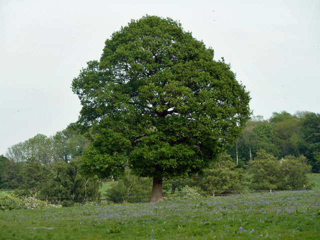
Smoky Wood, located in Kent, is a picturesque forest known for its dense foliage and serene atmosphere. Spanning over a vast area, this woodland is a haven for nature enthusiasts and outdoor adventurers alike. The name "Smoky Wood" is derived from the ethereal mist that often hangs in the air, creating an enchanting and mysterious ambiance.

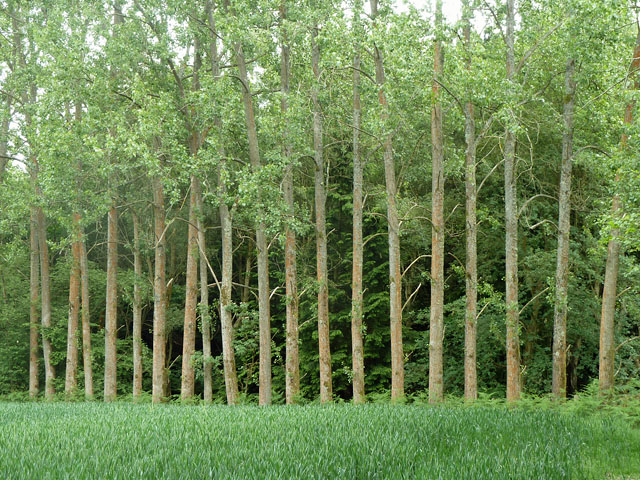
The forest is characterized by its diverse range of tree species, including towering oak, beech, and pine trees. The canopy of leaves provides ample shade, making it an ideal destination for leisurely walks or picnics on warm summer days. Birdsong fills the air, as numerous avian species call Smoky Wood their home, creating a melodious symphony that resonates throughout the forest.

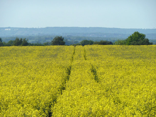
Tranquil streams meander through the forest, adding to the overall tranquility of the area. These streams are inhabited by various aquatic species, including small fish and amphibians, providing a thriving ecosystem within the woodland.

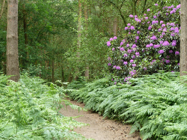
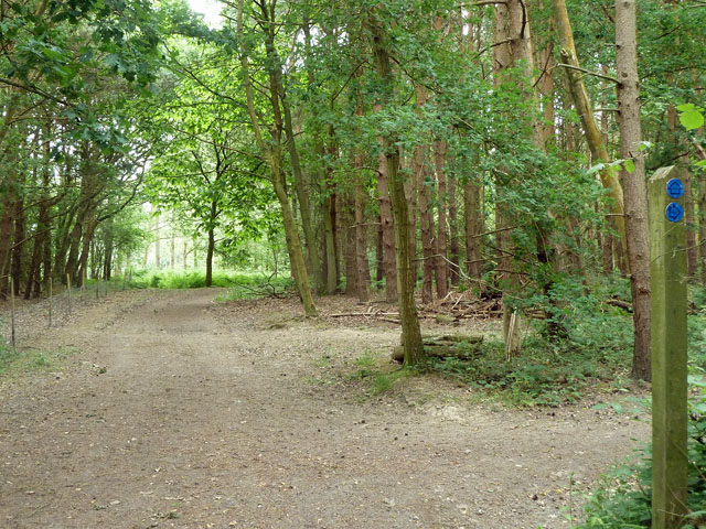
Smoky Wood offers a network of well-maintained trails, allowing visitors to explore the forest and discover its hidden gems. These paths cater to all levels of hiking ability, from leisurely strolls to more challenging treks. Along the trails, visitors may stumble upon ancient ruins and remnants of a forgotten era, adding a touch of history to the natural beauty of the woodland.

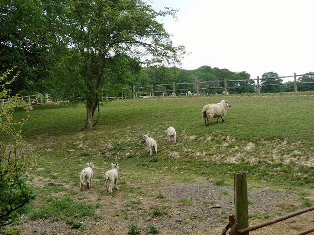
Nature enthusiasts can also observe a plethora of wildlife within the confines of Smoky Wood. Deer, foxes, and squirrels roam freely, while rabbits and hedgehogs scurry amongst the undergrowth. The forest is a sanctuary for these animals, providing a safe habitat away from human interference.

Overall, Smoky Wood in Kent is a tranquil and enchanting forest, offering a serene retreat for those seeking solace in nature.

If you have any feedback on the listing, please let us know in the comments section below.

Smoky Wood Images

Images are sourced within 2km of 51.158762/0.05977641 or Grid Reference TQ4441. Thanks to Geograph Open Source API. All images are credited.

Oak and bluebells near Hoopers Farm It is unusual in these parts for bluebells to grow thickly in an open field. Perhaps it was once a wood? Indeed it was. Kiln Wood is roughly square in late Victorian maps, extending over this area. Now it is a much smaller triangle behind and right of the viewpoint.
Oak and bluebells near Hoopers Farm
It is unusual in these parts for bluebells to grow thickly in an open field. Perhaps it was once a wood? Indeed it was. Kiln Wood is roughly square in late Victorian maps, extending over this area. Now it is a much smaller triangle behind and right of the viewpoint.
Yellow auto-suggestion As I gazed at this photograph of oil-seed rape, for a moment I thought I could smell it. How about you?
Yellow auto-suggestion
As I gazed at this photograph of oil-seed rape, for a moment I thought I could smell it. How about you?
Trees in a regular row These appear to be Limes. They have been planted all along the wood edge.
Trees in a regular row
These appear to be Limes. They have been planted all along the wood edge.
Colour in Jules Wood Unless the path has wandered a little from where it should be, the rhododendron is in Kent and the other side of the path is Surrey.
Colour in Jules Wood
Unless the path has wandered a little from where it should be, the rhododendron is in Kent and the other side of the path is Surrey.
Small pond near Crippenden Manor This has been made along a stream, seemingly for decorative purposes. It is about the same length again behind the viewpoint, but that part is mainly in TQ4441!
Small pond near Crippenden Manor
This has been made along a stream, seemingly for decorative purposes. It is about the same length again behind the viewpoint, but that part is mainly in TQ4441!
Ewe and lambs The post and rail fences dividing this field up into paddocks are presumably for horses - the sheep can duck straight through them.
Ewe and lambs
The post and rail fences dividing this field up into paddocks are presumably for horses - the sheep can duck straight through them.
Formal pond, Leighton Manor Through the bridge, water cascades down to a much larger informal lake.
Formal pond, Leighton Manor
Through the bridge, water cascades down to a much larger informal lake.
Scarletts, Furnace Lane A grade II listed building (listed as Scarlets), much the worse for wear. The centre part is late mediaeval. The grounds have recently been tidied up before the boarded-up house is tackled - usually it is the other way around. I was surprised to find that this had not been geographed before, until I realized it was previously hidden from the lane by trees and vegetation.
Scarletts, Furnace Lane
A grade II listed building (listed as Scarlets), much the worse for wear. The centre part is late mediaeval. The grounds have recently been tidied up before the boarded-up house is tackled - usually it is the other way around. I was surprised to find that this had not been geographed before, until I realized it was previously hidden from the lane by trees and vegetation.
Range of buildings, Lower Stonehurst Farm The far white building is a 20th century cottage. There are two long narrow brick buildings closer, which, if the maps are correct, are more recent and date from about 1960 - 1970. The near building has two stable doors, but these cannot account for the full length of the buildings. What were they used for?
Range of buildings, Lower Stonehurst Farm
The far white building is a 20th century cottage. There are two long narrow brick buildings closer, which, if the maps are correct, are more recent and date from about 1960 - 1970. The near building has two stable doors, but these cannot account for the full length of the buildings. What were they used for?
Horses on the footpath The public footpath between Upper and Lower Stonehurst Farms follows a deliberately engineered track, which here crosses the field on a low, straight causeway.
Horses on the footpath
The public footpath between Upper and Lower Stonehurst Farms follows a deliberately engineered track, which here crosses the field on a low, straight causeway.
Repositioned bridleway junction Just inside the Kent/Surrey boundary, the junction of bridleways SR650 and SR650A has been moved north from the legal line. SR650 comes from behind the viewpoint and turns to the right. The legal line of SR650A is as a left turn off SR650 about 50 m south, which would pass through a conifer plantation. The actual line of SR650A is straight on at the edge of the wood. Kent County Council have condoned this on their direction post, although their interactive map shows only the legal route.
Repositioned bridleway junction
Just inside the Kent/Surrey boundary, the junction of bridleways SR650 and SR650A has been moved north from the legal line. SR650 comes from behind the viewpoint and turns to the right. The legal line of SR650A is as a left turn off SR650 about 50 m south, which would pass through a conifer plantation. The actual line of SR650A is straight on at the edge of the wood. Kent County Council have condoned this on their direction post, although their interactive map shows only the legal route.
Cottages 1 and 2, Greybury Lane There is a group of seven cottages at the top of this rise in the lane, which publicly is only a bridleway.
Cottages 1 and 2, Greybury Lane
There is a group of seven cottages at the top of this rise in the lane, which publicly is only a bridleway.
Fields behind Round House Farm Viewed from the bridleway.
Fields behind Round House Farm
Viewed from the bridleway.
Near Howlets Farm
Near Howlets Farm
Howlets Farm
Howlets Farm
Howlets Farmhouse
Howlets Farmhouse
Track to Cobhambury Farm
Howlets Farm
Howlets Farm
Show me another place!

Smoky Wood is located at Grid Ref: TQ4441 (Lat: 51.158762, Lng: 0.05977641)

Administrative County: Kent

District: Sevenoaks

Police Authority: Kent

What 3 Words

///proud.baked.shades. Near Dormansland, Surrey

Related Wikis

Sundridge with Ide Hill

Sundridge and Ide Hill is a civil parish in the Sevenoaks District of Kent, England. It is located in the Darenth valley and lies between Sevenoaks and...

London to Lewes Way

The London to Lewes Way is a 71 kilometres (44 mi) long Roman road between Watling Street at Peckham and Lewes in Sussex. The road passes through Beckenham...

Cowden Pound Pastures

Cowden Pound Pastures is a 5.9-hectare (15-acre) biological Site of Special Scientific Interest north of Cowden in Kent. It is managed by the Kent Wildlife...

Marsh Green, Kent

Marsh Green is a small hamlet in Eden Vale, part of the parish of Edenbridge, England. The hamlet was founded in 1554 under its current name. Marsh Green...

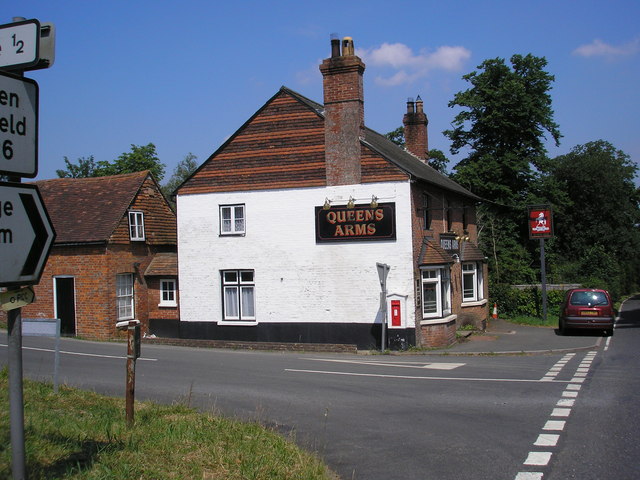
Queen's Arms, Cowden Pound

The Queens Arms is a Grade II listed public house at Hartfield Road, Cowden in Kent. It is on the Campaign for Real Ale's National Inventory of Historic...

Starborough Castle

Starborough Castle, known historically as Sterborough Castle, is a Neo-Gothic garden house of dressed sandstone near the eastern boundary of Surrey, built...

Hammerwood

Hammerwood is a hamlet in the civil parish of Forest Row in East Sussex, England. Its nearest town is East Grinstead, which lies approximately 3.5 miles...

Cowden

Cowden () is a small village and civil parish in the Sevenoaks District of Kent, England. The parish is located on the northern slopes of the Weald, south...

Nearby Amenities

Located within 500m of 51.158762,0.05977641
The data included in this document is from www.openstreetmap.org. The data is made available under ODbL.

Have you been to Smoky Wood?

Leave your review of Smoky Wood below (or comments, questions and feedback).