Long Shaw

Wood, Forest in Kent Sevenoaks

England

Long Shaw

Lane near Cowden, Kent
Lane near Cowden, Kent Credit: Oast House Archive

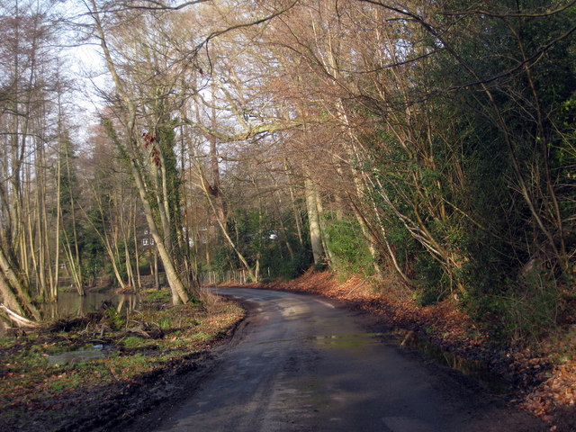
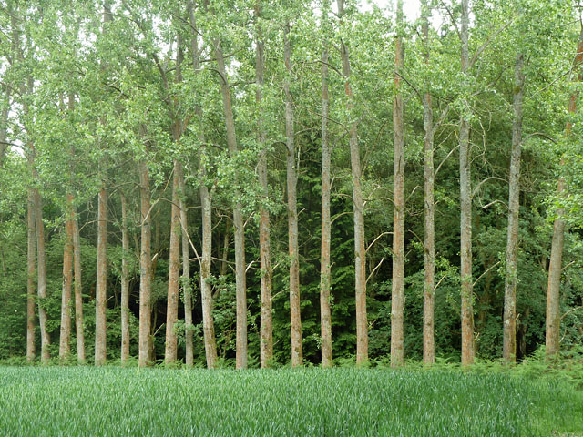
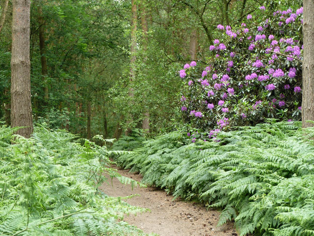
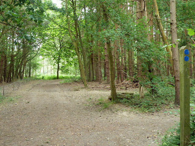
Long Shaw is a small wooded area situated in Kent, England. Located within the larger district of Wood, Forest, Long Shaw is known for its dense and picturesque forest landscape. The area is characterized by a variety of trees, including oak, beech, and birch, which provide a vibrant display of colors throughout the year.

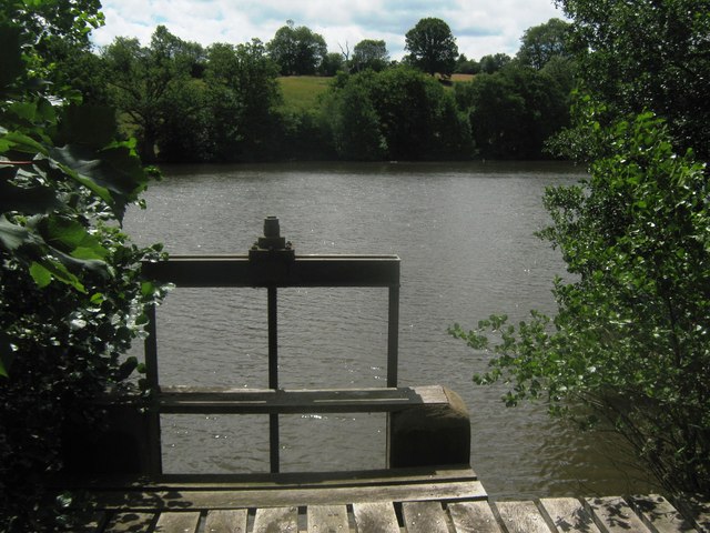
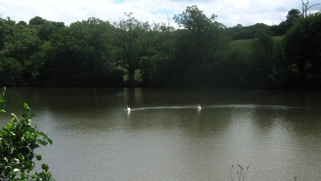
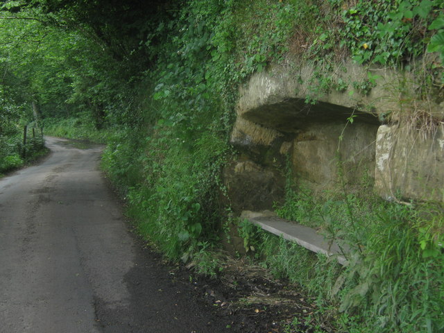
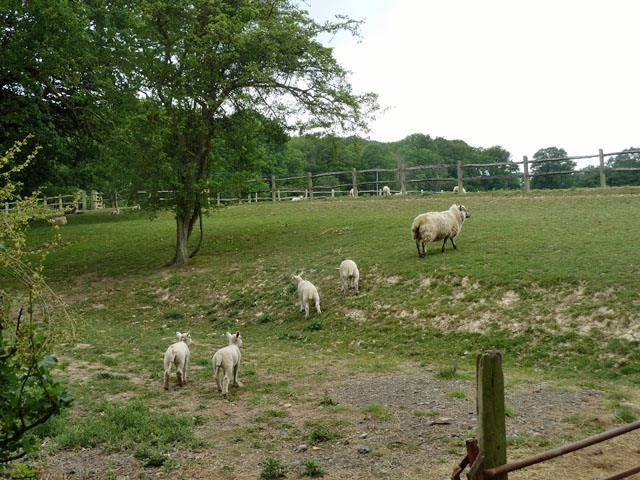
Long Shaw is a popular destination for nature enthusiasts and hikers due to its tranquil atmosphere and well-maintained trails. These trails offer visitors the opportunity to explore the area's natural beauty, while also providing a chance to spot local wildlife, such as deer, rabbits, and a diverse array of bird species.

In addition to its natural attractions, Long Shaw is also home to a small community of residents who appreciate the tranquility and serenity of the area. The community actively works to preserve the natural environment and ensure the sustainability of the forest.

The area surrounding Long Shaw is rich in history, with evidence of human habitation dating back thousands of years. Archaeological finds, including ancient tools and pottery, have been discovered in the vicinity, indicating that the area has been inhabited since prehistoric times.

Overall, Long Shaw in Kent offers visitors a chance to escape the hustle and bustle of everyday life and immerse themselves in the beauty of nature. Whether it's a leisurely walk through the forest or a picnic in a peaceful clearing, Long Shaw provides a serene and idyllic setting for all who visit.

If you have any feedback on the listing, please let us know in the comments section below.

Long Shaw Images

Images are sourced within 2km of 51.156954/0.072009083 or Grid Reference TQ4441. Thanks to Geograph Open Source API. All images are credited.

Lane near Cowden, Kent
Furnace Pond As seen from Furnace lane over the weir on the Kent Water. (Stream on the Kent / Sussex boundary).
This large lake belongs to <a href="https://www.geograph.org.uk/photo/42065">TQ4539 : Cottage near Holtye, Kent/Sussex border</a>. It was a large pond dammed by the lane, to create power.
Furnace Pond
As seen from Furnace lane over the weir on the Kent Water. (Stream on the Kent / Sussex boundary). This large lake belongs to TQ4539 : Cottage near Holtye, Kent/Sussex border. It was a large pond dammed by the lane, to create power.
Swans on Furnace Pond Pair of gliding swans on the large pond on Kent Water (stream on the Kent / Sussex Boundary). As seen from Furnace Lane.
Swans on Furnace Pond
Pair of gliding swans on the large pond on Kent Water (stream on the Kent / Sussex Boundary). As seen from Furnace Lane.
Bench in the rocks on Furnace Lane This lane leads from Holtye Hill heading towards Dormansland. 

Why ??
Bench in the rocks on Furnace Lane
This lane leads from Holtye Hill heading towards Dormansland. Why ??
Furnace Lane and Kent Water Furnace Lane leads from Holtye Hill towards Shepherdsgrove Lane. Kent Water is a stream that flows along the Kent / Sussex Border. The lane is in Kent.
Furnace Lane and Kent Water
Furnace Lane leads from Holtye Hill towards Shepherdsgrove Lane. Kent Water is a stream that flows along the Kent / Sussex Border. The lane is in Kent.
Post Box on Furnace Lane This lane leads from Holtye Hill towards Shepherdsgrove Lane.
The postbox is beside Furnace Farm.
Post Box on Furnace Lane
This lane leads from Holtye Hill towards Shepherdsgrove Lane. The postbox is beside Furnace Farm.
Trees in a regular row These appear to be Limes. They have been planted all along the wood edge.
Trees in a regular row
These appear to be Limes. They have been planted all along the wood edge.
Colour in Jules Wood Unless the path has wandered a little from where it should be, the rhododendron is in Kent and the other side of the path is Surrey.
Colour in Jules Wood
Unless the path has wandered a little from where it should be, the rhododendron is in Kent and the other side of the path is Surrey.
Small pond near Crippenden Manor This has been made along a stream, seemingly for decorative purposes. It is about the same length again behind the viewpoint, but that part is mainly in TQ4441!
Small pond near Crippenden Manor
This has been made along a stream, seemingly for decorative purposes. It is about the same length again behind the viewpoint, but that part is mainly in TQ4441!
Ewe and lambs The post and rail fences dividing this field up into paddocks are presumably for horses - the sheep can duck straight through them.
Ewe and lambs
The post and rail fences dividing this field up into paddocks are presumably for horses - the sheep can duck straight through them.
Formal pond, Leighton Manor Through the bridge, water cascades down to a much larger informal lake.
Formal pond, Leighton Manor
Through the bridge, water cascades down to a much larger informal lake.
An elegant footbridge This looks good, is not overdesigned, and so should be cheap. I would have dispensed with one set of handrails to make it even cheaper. The beam is wood and the footway is wood. Whether they act together as a composite T-section was not checked, but ideally they should, and probably do - there was no noticeable deflection with one person crossing.
An elegant footbridge
This looks good, is not overdesigned, and so should be cheap. I would have dispensed with one set of handrails to make it even cheaper. The beam is wood and the footway is wood. Whether they act together as a composite T-section was not checked, but ideally they should, and probably do - there was no noticeable deflection with one person crossing.
Scarletts, Furnace Lane A grade II listed building (listed as Scarlets), much the worse for wear. The centre part is late mediaeval. The grounds have recently been tidied up before the boarded-up house is tackled - usually it is the other way around. I was surprised to find that this had not been geographed before, until I realized it was previously hidden from the lane by trees and vegetation.
Scarletts, Furnace Lane
A grade II listed building (listed as Scarlets), much the worse for wear. The centre part is late mediaeval. The grounds have recently been tidied up before the boarded-up house is tackled - usually it is the other way around. I was surprised to find that this had not been geographed before, until I realized it was previously hidden from the lane by trees and vegetation.
Repositioned bridleway junction Just inside the Kent/Surrey boundary, the junction of bridleways SR650 and SR650A has been moved north from the legal line. SR650 comes from behind the viewpoint and turns to the right. The legal line of SR650A is as a left turn off SR650 about 50 m south, which would pass through a conifer plantation. The actual line of SR650A is straight on at the edge of the wood. Kent County Council have condoned this on their direction post, although their interactive map shows only the legal route.
Repositioned bridleway junction
Just inside the Kent/Surrey boundary, the junction of bridleways SR650 and SR650A has been moved north from the legal line. SR650 comes from behind the viewpoint and turns to the right. The legal line of SR650A is as a left turn off SR650 about 50 m south, which would pass through a conifer plantation. The actual line of SR650A is straight on at the edge of the wood. Kent County Council have condoned this on their direction post, although their interactive map shows only the legal route.
The Queen's Arms A rear view from its car park of a small pub apparently refusing to make any special attempt to attract passing trade. The near building looks like old stables or similar.
The Queen's Arms
A rear view from its car park of a small pub apparently refusing to make any special attempt to attract passing trade. The near building looks like old stables or similar.
Fields behind Round House Farm Viewed from the bridleway.
Fields behind Round House Farm
Viewed from the bridleway.
Pit in the Wadhurst Clay As the northern end of Gilridge Wood drops down the hill, the geology changes from the Ashdown Formation, fairly acid, to Wadhurst Clay, fairly basic. This large excavation was either for agricultural purposes - marling nearby acid soils - or for ironstone. Nodules in this clay were the prime source of ironstone for the old Wealden iron industry.
Pit in the Wadhurst Clay
As the northern end of Gilridge Wood drops down the hill, the geology changes from the Ashdown Formation, fairly acid, to Wadhurst Clay, fairly basic. This large excavation was either for agricultural purposes - marling nearby acid soils - or for ironstone. Nodules in this clay were the prime source of ironstone for the old Wealden iron industry.
Entrance to public footpath off Hartfield Road
Show me another place!

Long Shaw is located at Grid Ref: TQ4441 (Lat: 51.156954, Lng: 0.072009083)

Administrative County: Kent

District: Sevenoaks

Police Authority: Kent

What 3 Words

///origin.found.digit. Near Edenbridge, Kent

Related Wikis

Sundridge with Ide Hill

Sundridge and Ide Hill is a civil parish in the Sevenoaks District of Kent, England. It is located in the Darenth valley and lies between Sevenoaks and...

London to Lewes Way

The London to Lewes Way is a 71 kilometres (44 mi) long Roman road between Watling Street at Peckham and Lewes in Sussex. The road passes through Beckenham...

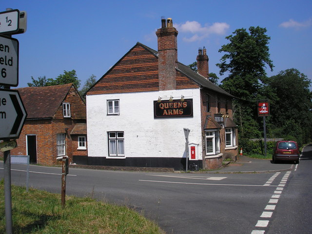
Queen's Arms, Cowden Pound

The Queens Arms is a Grade II listed public house at Hartfield Road, Cowden in Kent. It is on the Campaign for Real Ale's National Inventory of Historic...

Cowden Pound Pastures

Cowden Pound Pastures is a 5.9-hectare (15-acre) biological Site of Special Scientific Interest north of Cowden in Kent. It is managed by the Kent Wildlife...

Cowden

Cowden () is a small village and civil parish in the Sevenoaks District of Kent, England. The parish is located on the northern slopes of the Weald, south...

Marsh Green, Kent

Marsh Green is a small hamlet in Eden Vale, part of the parish of Edenbridge, England. The hamlet was founded in 1554 under its current name. Marsh Green...

Cowden railway station

Cowden railway station is on the Uckfield branch of the Oxted line in southern England and serves Cowden in Kent. It is 29 miles 26 chains (29.33 miles...

Markbeech

Markbeech (sometimes styled Mark Beech) is a village in the civil parish of Hever in the Sevenoaks district of Kent, England. The village is located on...

Have you been to Long Shaw?

Leave your review of Long Shaw below (or comments, questions and feedback).