Alington Plantation

Wood, Forest in Lincolnshire East Lindsey

England

Alington Plantation

Pool Decoy, NE of Eastville: aerial 2023 (1)
Pool Decoy, NE of Eastville: aerial 2023 (1) Credit: Chris

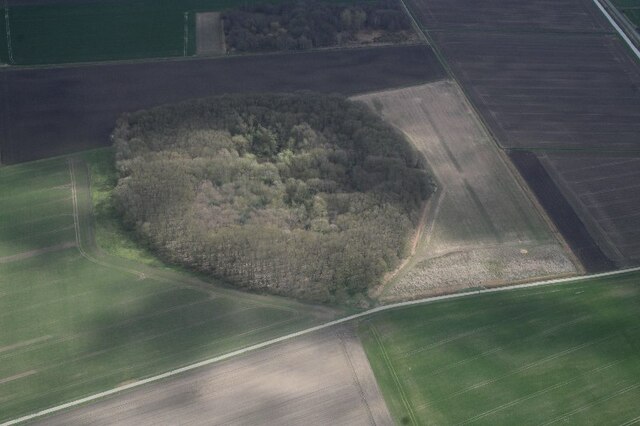
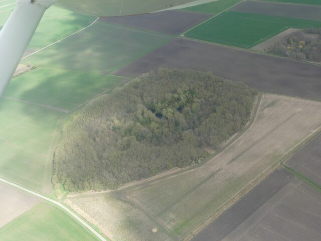
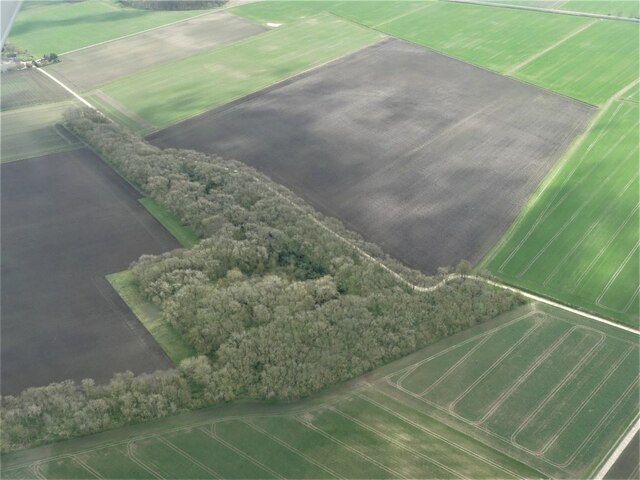
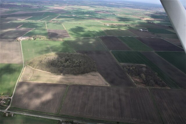
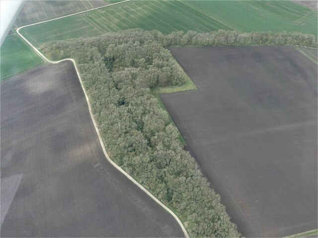
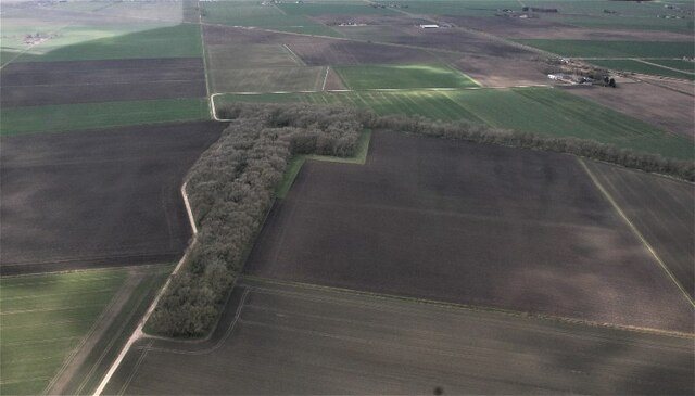
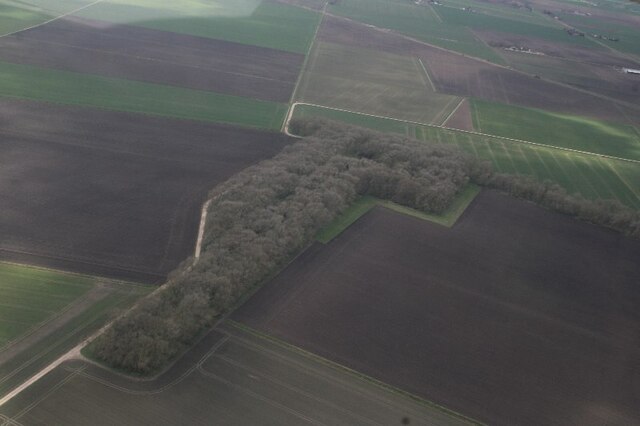
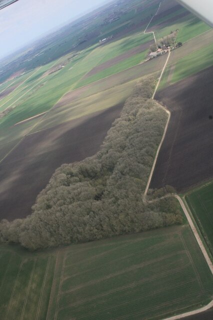
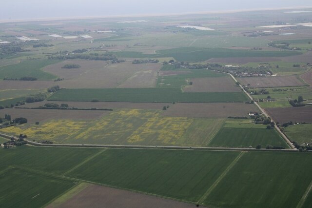
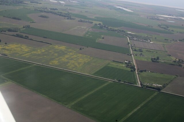
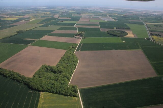
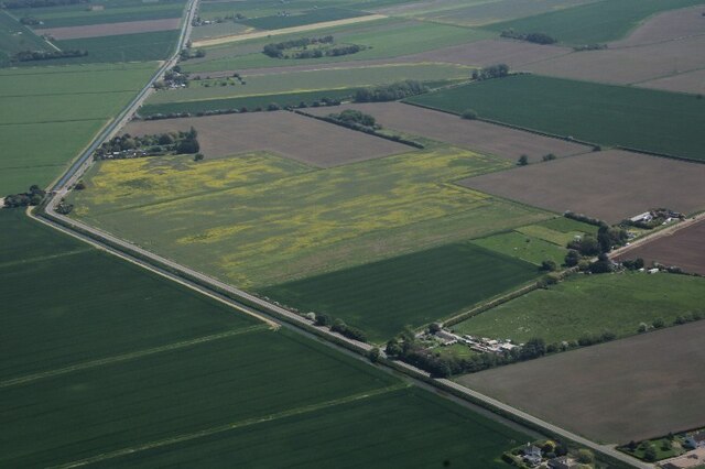
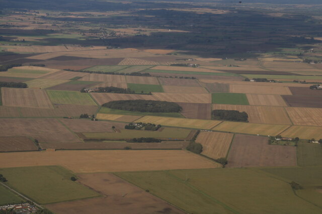
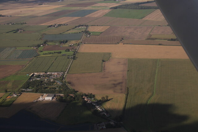
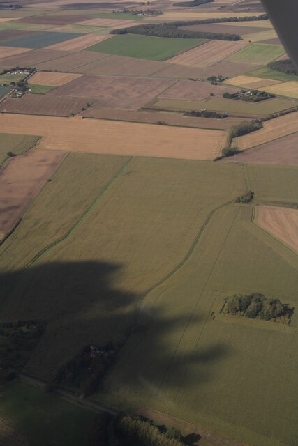
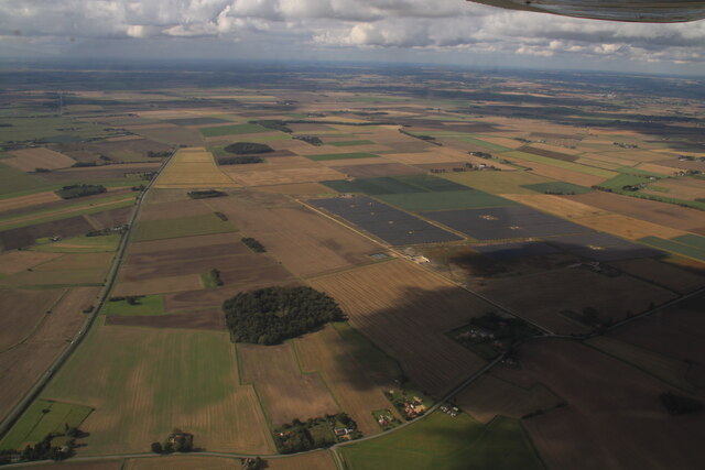
Alington Plantation is a historic woodland located in the county of Lincolnshire, England. It is situated in the district of Wood, Forest, and covers an area of approximately 200 acres. The plantation is renowned for its diverse flora and fauna, making it a popular destination for nature enthusiasts and wildlife photographers.

The woodland is predominantly composed of deciduous trees, including oak, ash, beech, and birch, which create a picturesque and serene environment. The plantation is well-maintained, with well-marked trails that allow visitors to explore the area while enjoying the beauty of the surrounding nature.

Alington Plantation is also home to a variety of wildlife species. Birdwatchers can spot a range of birds, such as woodpeckers, owls, and various small songbirds. The woodland provides a suitable habitat for mammals like foxes, rabbits, and badgers. Reptiles and amphibians, including snakes and frogs, can also be found within the plantation.

The plantation has a rich history, dating back several centuries. It was originally part of a larger estate owned by the Alington family, who were prominent landowners in the area. Over the years, the woodland has been preserved and protected by local conservation efforts, ensuring its longevity for future generations to enjoy.

Visitors to Alington Plantation can participate in various activities, such as hiking, picnicking, and nature walks. The tranquil atmosphere and stunning natural beauty make it an ideal destination for those seeking a peaceful retreat amidst Lincolnshire's countryside.

If you have any feedback on the listing, please let us know in the comments section below.

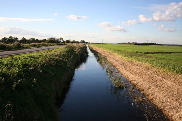
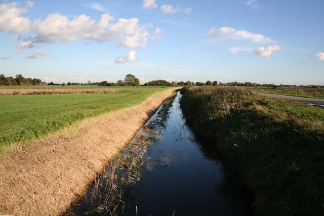
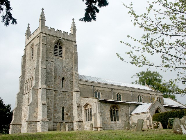
Alington Plantation Images

Images are sourced within 2km of 53.090946/0.14983468 or Grid Reference TF4457. Thanks to Geograph Open Source API. All images are credited.

Pool Decoy, NE of Eastville: aerial 2023 (1)
Pool Decoy, NE of Eastville: aerial 2023 (2)
The Deeps and Drain Bank Plantation: aerial 2023 (1) Alongside Bethlem Drain, with Bethlem Farm top left.

Seemingly all that is left of the patchwork of meres called "The Deeps" on the East Fen before it was drained.

See <span class="nowrap"><a title="https://rbt.org.uk/john-rennie/projects/east-fen-west-fen-and-wildmore-fen-drainage/" rel="nofollow ugc noopener" href="https://rbt.org.uk/john-rennie/projects/east-fen-west-fen-and-wildmore-fen-drainage/">Link</a><img style="margin-left:2px;" alt="External link" title="External link - shift click to open in new window" src="https://s1.geograph.org.uk/img/external.png" width="10" height="10"/></span>
The Deeps and Drain Bank Plantation: aerial 2023 (1)
Alongside Bethlem Drain, with Bethlem Farm top left. Seemingly all that is left of the patchwork of meres called "The Deeps" on the East Fen before it was drained. See LinkExternal link
Pool Decoy, NE of Eastville: aerial 2023 (3)
The Deeps and Drain Bank Plantation: aerial 2023 (2) Alongside Bethlem Drain.

Seemingly all that is left of the patchwork of meres called "The Deeps" on the East Fen before it was drained. 

See <span class="nowrap"><a title="https://rbt.org.uk/john-rennie/projects/east-fen-west-fen-and-wildmore-fen-drainage/" rel="nofollow ugc noopener" href="https://rbt.org.uk/john-rennie/projects/east-fen-west-fen-and-wildmore-fen-drainage/">Link</a><img style="margin-left:2px;" alt="External link" title="External link - shift click to open in new window" src="https://s1.geograph.org.uk/img/external.png" width="10" height="10"/></span>
The Deeps and Drain Bank Plantation: aerial 2023 (2)
Alongside Bethlem Drain. Seemingly all that is left of the patchwork of meres called "The Deeps" on the East Fen before it was drained. See LinkExternal link
The Deeps and Drain Bank Plantation: aerial 2023 (3) Alongside Bethlem Drain.

Seemingly all that is left of the patchwork of meres called "The Deeps" on the East Fen before it was drained.

See <span class="nowrap"><a title="https://rbt.org.uk/john-rennie/projects/east-fen-west-fen-and-wildmore-fen-drainage/" rel="nofollow ugc noopener" href="https://rbt.org.uk/john-rennie/projects/east-fen-west-fen-and-wildmore-fen-drainage/">Link</a><img style="margin-left:2px;" alt="External link" title="External link - shift click to open in new window" src="https://s1.geograph.org.uk/img/external.png" width="10" height="10"/></span>
The Deeps and Drain Bank Plantation: aerial 2023 (3)
Alongside Bethlem Drain. Seemingly all that is left of the patchwork of meres called "The Deeps" on the East Fen before it was drained. See LinkExternal link
The Deeps and Drain Bank Plantation: aerial 2023 (4) Alongside Bethlem Drain.

Seemingly all that is left of the patchwork of meres called "The Deeps" on the East Fen before it was drained.

See <span class="nowrap"><a title="https://rbt.org.uk/john-rennie/projects/east-fen-west-fen-and-wildmore-fen-drainage/" rel="nofollow ugc noopener" href="https://rbt.org.uk/john-rennie/projects/east-fen-west-fen-and-wildmore-fen-drainage/">Link</a><img style="margin-left:2px;" alt="External link" title="External link - shift click to open in new window" src="https://s1.geograph.org.uk/img/external.png" width="10" height="10"/></span>
The Deeps and Drain Bank Plantation: aerial 2023 (4)
Alongside Bethlem Drain. Seemingly all that is left of the patchwork of meres called "The Deeps" on the East Fen before it was drained. See LinkExternal link
The Deeps and Drain Bank Plantation: aerial 2023 (5) Alongside Bethlem Drain, with Bethlem Farm top right.

Seemingly all that is left of the patchwork of meres called "The Deeps" on the East Fen before it was drained.

See <span class="nowrap"><a title="https://rbt.org.uk/john-rennie/projects/east-fen-west-fen-and-wildmore-fen-drainage/" rel="nofollow ugc noopener" href="https://rbt.org.uk/john-rennie/projects/east-fen-west-fen-and-wildmore-fen-drainage/">Link</a><img style="margin-left:2px;" alt="External link" title="External link - shift click to open in new window" src="https://s1.geograph.org.uk/img/external.png" width="10" height="10"/></span>
The Deeps and Drain Bank Plantation: aerial 2023 (5)
Alongside Bethlem Drain, with Bethlem Farm top right. Seemingly all that is left of the patchwork of meres called "The Deeps" on the East Fen before it was drained. See LinkExternal link
Fodder Dike, and Dickon Hill Road, east of Eastville: aerial 2023 (1) On the drained East Fen. Fodder Dike runs horizontally across the bottom, Dickon Hill Road curves around to the left, with Dickon Hills marked to the right of the curve. Any rise in the ground is not perceptible from the contour lines on the map.

Re. Fodder dike: in the summer season, when the water had drained off or been evaporated, the surface of large districts was exposed, which speedily bore a strong crop of coarse grass, called "fodder." Every person having a right in this Fen, had the privilege of employing two labourers, and with them would go down into the Fen on the evening before Midsummerday, and lie down until they heard the report of a gun which was fired exactly at twelve o'clock (midnight) ; then each party would arise and set to work. By common agreement, all the “fodder” they could mow a path around became the frontager's own property.
After completing one circle, each party hastened to find fresh - ground to encircle in like manner, as long as any remained unclaimed, after which they completed at leisure the mowing of those parts they had surrounded. When the reaping was over, the "fodder" was gathered up, and boated away by the different rows to the fenside, from whence it was carted to their homes.

See: <span class="nowrap"><a title="https://theascoughsofeastfen.weebly.com/life-on-the-east-fen.html" rel="nofollow ugc noopener" href="https://theascoughsofeastfen.weebly.com/life-on-the-east-fen.html">Link</a><img style="margin-left:2px;" alt="External link" title="External link - shift click to open in new window" src="https://s1.geograph.org.uk/img/external.png" width="10" height="10"/></span>

The present-day road along the dike-side is notorious for its undulating surface, as it seemingly tries to sink back into the fen on which it was built.
Fodder Dike, and Dickon Hill Road, east of Eastville: aerial 2023 (1)
On the drained East Fen. Fodder Dike runs horizontally across the bottom, Dickon Hill Road curves around to the left, with Dickon Hills marked to the right of the curve. Any rise in the ground is not perceptible from the contour lines on the map. Re. Fodder dike: in the summer season, when the water had drained off or been evaporated, the surface of large districts was exposed, which speedily bore a strong crop of coarse grass, called "fodder." Every person having a right in this Fen, had the privilege of employing two labourers, and with them would go down into the Fen on the evening before Midsummerday, and lie down until they heard the report of a gun which was fired exactly at twelve o'clock (midnight) ; then each party would arise and set to work. By common agreement, all the “fodder” they could mow a path around became the frontager's own property. After completing one circle, each party hastened to find fresh - ground to encircle in like manner, as long as any remained unclaimed, after which they completed at leisure the mowing of those parts they had surrounded. When the reaping was over, the "fodder" was gathered up, and boated away by the different rows to the fenside, from whence it was carted to their homes. See: LinkExternal link The present-day road along the dike-side is notorious for its undulating surface, as it seemingly tries to sink back into the fen on which it was built.
Fodder Dike, and Dickon Hill Road, east of Eastville: aerial 2023 (2) On the drained East Fen. Fodder Dike runs horizontally across the bottom, Dickon Hill Road curves around to the left, with Dickon Hills marked to the right of the curve. Any rise in the ground is not perceptible from the contour lines on the map.

Re. Fodder dike: in the summer season, when the water had drained off or been evaporated, the surface of large districts was exposed, which speedily bore a strong crop of coarse grass, called "fodder." Every person having a right in this Fen, had the privilege of employing two labourers, and with them would go down into the Fen on the evening before Midsummerday, and lie down until they heard the report of a gun which was fired exactly at twelve o'clock (midnight) ; then each party would arise and set to work. By common agreement, all the “fodder” they could mow a path around became the frontager's own property.
After completing one circle, each party hastened to find fresh - ground to encircle in like manner, as long as any remained unclaimed, after which they completed at leisure the mowing of those parts they had surrounded. When the reaping was over, the "fodder" was gathered up, and boated away by the different rows to the fenside, from whence it was carted to their homes.

See: <span class="nowrap"><a title="https://theascoughsofeastfen.weebly.com/life-on-the-east-fen.html" rel="nofollow ugc noopener" href="https://theascoughsofeastfen.weebly.com/life-on-the-east-fen.html">Link</a><img style="margin-left:2px;" alt="External link" title="External link - shift click to open in new window" src="https://s1.geograph.org.uk/img/external.png" width="10" height="10"/></span>

The present-day road along the dike-side is notorious for its undulating surface, as it seemingly tries to sink back into the fen on which it was built.
Fodder Dike, and Dickon Hill Road, east of Eastville: aerial 2023 (2)
On the drained East Fen. Fodder Dike runs horizontally across the bottom, Dickon Hill Road curves around to the left, with Dickon Hills marked to the right of the curve. Any rise in the ground is not perceptible from the contour lines on the map. Re. Fodder dike: in the summer season, when the water had drained off or been evaporated, the surface of large districts was exposed, which speedily bore a strong crop of coarse grass, called "fodder." Every person having a right in this Fen, had the privilege of employing two labourers, and with them would go down into the Fen on the evening before Midsummerday, and lie down until they heard the report of a gun which was fired exactly at twelve o'clock (midnight) ; then each party would arise and set to work. By common agreement, all the “fodder” they could mow a path around became the frontager's own property. After completing one circle, each party hastened to find fresh - ground to encircle in like manner, as long as any remained unclaimed, after which they completed at leisure the mowing of those parts they had surrounded. When the reaping was over, the "fodder" was gathered up, and boated away by the different rows to the fenside, from whence it was carted to their homes. See: LinkExternal link The present-day road along the dike-side is notorious for its undulating surface, as it seemingly tries to sink back into the fen on which it was built.
The Deeps and Drain Bank Plantation: aerial 2023 (6) Alongside Bethlem Drain, with Bethlem Farm top right.

Seemingly all that is left of the patchwork of meres called "The Deeps" on the East Fen before it was drained.

See: <span class="nowrap"><a title="https://rbt.org.uk/john-rennie/projects/east-fen-west-fen-and-wildmore-fen-drainage/" rel="nofollow ugc noopener" href="https://rbt.org.uk/john-rennie/projects/east-fen-west-fen-and-wildmore-fen-drainage/">Link</a><img style="margin-left:2px;" alt="External link" title="External link - shift click to open in new window" src="https://s1.geograph.org.uk/img/external.png" width="10" height="10"/></span>

Pool Decoy top right.
The Deeps and Drain Bank Plantation: aerial 2023 (6)
Alongside Bethlem Drain, with Bethlem Farm top right. Seemingly all that is left of the patchwork of meres called "The Deeps" on the East Fen before it was drained. See: LinkExternal link Pool Decoy top right.
Fodder Dike and Blue Bridge: aerial 2023 On the drained East Fen. Blue Bridge left, on the bend.

Re. Fodder Dike: in the summer season, when the water had drained off or been evaporated, the surface of large districts was exposed, which speedily bore a strong crop of coarse grass, called "fodder." Every person having a right in this Fen, had the privilege of employing two labourers, and with them would go down into the Fen on the evening before Midsummerday, and lie down until they heard the report of a gun which was fired exactly at twelve o'clock (midnight) ; then each party would arise and set to work. By common agreement, all the “fodder” they could mow a path around became the frontager's own property.
After completing one circle, each party hastened to find fresh - ground to encircle in like manner, as long as any remained unclaimed, after which they completed at leisure the mowing of those parts they had surrounded. When the reaping was over, the "fodder" was gathered up, and boated away by the different rows to the fenside, from whence it was carted to their homes.

See: <span class="nowrap"><a title="https://theascoughsofeastfen.weebly.com/life-on-the-east-fen.html" rel="nofollow ugc noopener" href="https://theascoughsofeastfen.weebly.com/life-on-the-east-fen.html">Link</a><img style="margin-left:2px;" alt="External link" title="External link - shift click to open in new window" src="https://s1.geograph.org.uk/img/external.png" width="10" height="10"/></span>

The present-day road along the dike-side is notorious for its undulating surface, as it seemingly tries to sink back into the fen on which it was built.
Fodder Dike and Blue Bridge: aerial 2023
On the drained East Fen. Blue Bridge left, on the bend. Re. Fodder Dike: in the summer season, when the water had drained off or been evaporated, the surface of large districts was exposed, which speedily bore a strong crop of coarse grass, called "fodder." Every person having a right in this Fen, had the privilege of employing two labourers, and with them would go down into the Fen on the evening before Midsummerday, and lie down until they heard the report of a gun which was fired exactly at twelve o'clock (midnight) ; then each party would arise and set to work. By common agreement, all the “fodder” they could mow a path around became the frontager's own property. After completing one circle, each party hastened to find fresh - ground to encircle in like manner, as long as any remained unclaimed, after which they completed at leisure the mowing of those parts they had surrounded. When the reaping was over, the "fodder" was gathered up, and boated away by the different rows to the fenside, from whence it was carted to their homes. See: LinkExternal link The present-day road along the dike-side is notorious for its undulating surface, as it seemingly tries to sink back into the fen on which it was built.
Pool Decoy and Fodder Dike, east of Eastville: aerial 2023 See also <a href="https://www.geograph.org.uk/photo/7611686">TF4657 : Friskney Decoy Wood, Pool Decoy and the Deeps: aerial 2023 (1)</a>.

For history of duck decoys see <a href="https://www.geograph.org.uk/photo/3598845">TF4657 : Friskney Decoy Wood from Decoy Bridge</a>.
Pool Decoy and Fodder Dike, east of Eastville: aerial 2023
Small End and Dickon Hill Road, Friskney: aerial 2023 Lincolnshire Wildlife Park bottom left. See <span class="nowrap"><a title="https://www.lincswildlife.com/" rel="nofollow ugc noopener" href="https://www.lincswildlife.com/">Link</a><img style="margin-left:2px;" alt="External link" title="External link - shift click to open in new window" src="https://s1.geograph.org.uk/img/external.png" width="10" height="10"/></span>
Small End and Dickon Hill Road, Friskney: aerial 2023
Lincolnshire Wildlife Park bottom left. See LinkExternal link
Fields west of Dickon Hill Road, Friskney: aerial 2023 Booth's Plantation bottom right.
Fields west of Dickon Hill Road, Friskney: aerial 2023
Booth's Plantation bottom right.
Friskney Decoy Wood, Pool Decoy and the Deeps: aerial 2023 (2) East of Eastville. Centred on Pool Decoy. See also <a href="https://www.geograph.org.uk/photo/7611686">TF4657 : Friskney Decoy Wood, Pool Decoy and the Deeps: aerial 2023 (1)</a>.

Woodland, bottom to top: Friskney Decoy Wood, Pool Decoy and the Deeps.

For history of duck decoys see <a href="https://www.geograph.org.uk/photo/3598845">TF4657 : Friskney Decoy Wood from Decoy Bridge</a>.
Friskney Decoy Wood, Pool Decoy and the Deeps: aerial 2023 (2)
East of Eastville. Centred on Pool Decoy. See also TF4657 : Friskney Decoy Wood, Pool Decoy and the Deeps: aerial 2023 (1). Woodland, bottom to top: Friskney Decoy Wood, Pool Decoy and the Deeps. For history of duck decoys see TF4657 : Friskney Decoy Wood from Decoy Bridge.
Fodder Dike View west along Fodder Dike on Friskney Fen
Fodder Dike
View west along Fodder Dike on Friskney Fen
Fodder Dike View east along Fodder Dike on Friskney Fen
Fodder Dike
View east along Fodder Dike on Friskney Fen
Show me another place!

Alington Plantation is located at Grid Ref: TF4457 (Lat: 53.090946, Lng: 0.14983468)

Administrative County: Lincolnshire

District: East Lindsey

Police Authority: Lincolnshire

What 3 Words

///replaces.deals.florists. Near Wainfleet All Saints, Lincolnshire

Related Wikis

Friskney

Friskney is a village and civil parish within the East Lindsey district of Lincolnshire, England.The parish includes the settlement of Friskney Eaudyke...

East Ville railway station

East Ville was a railway station on the East Lincolnshire Railway which served the village of Eastville in Lincolnshire between 1848 and 1964. It originally...

Friskney Eaudyke

Friskney Eaudyke is a settlement in the civil parish of Friskney, and the East Lindsey district of Lincolnshire, England. It is 11 miles (20 km) north...

Wainfleet St Mary

Wainfleet St Mary is a village and civil parish in the East Lindsey district of Lincolnshire, England. It is situated directly south of Wainfleet All Saints...

Eastville, Lincolnshire

Eastville, a village in the East Lindsey district of Lincolnshire, England. It is situated approximately 9 miles (14 km) north-east from Boston and 6 miles...

Little Steeping railway station

Little Steeping was a railway station on the East Lincolnshire Railway which served the hamlet of Little Steeping in Lincolnshire between 1848 and 1964...

RAF Wainfleet

RAF Wainfleet was a Royal Air Force weapons range on The Wash on the east coast of England near Wainfleet, in the civil parish of Friskney, although the...

New Leake

New Leake is a village and civil parish in the East Lindsey district of Lincolnshire, England. The population of the civil parish at the 2011 census was...

Nearby Amenities

Located within 500m of 53.090946,0.14983468
Post Box
Ref: PE22 181
Lat/Long: 53.0948544/0.1471258
Friskney Fen
Place: farm
Source: Bing
Lat/Long: 53.0880793/0.1508396
Building: yes
Lat/Long: 53.0907003/0.1527375
Building: yes
Lat/Long: 53.0933226/0.1535851
The data included in this document is from www.openstreetmap.org. The data is made available under ODbL.

Have you been to Alington Plantation?

Leave your review of Alington Plantation below (or comments, questions and feedback).