Marlpit Shaw

Wood, Forest in Kent Sevenoaks

England

Marlpit Shaw

Cottage near Holtye, Kent/Sussex border This cottage stands on the site of an old ironworks. The road runs across the dam that supplied the water to power the bellows that worked the furnace.
Cottage near Holtye, Kent/Sussex border Credit: Ron Strutt

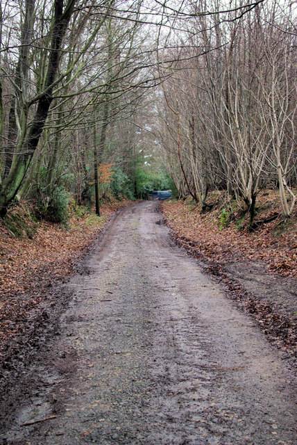
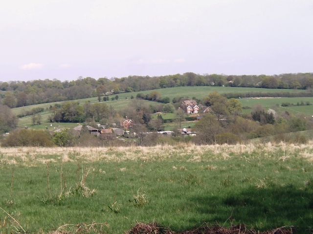
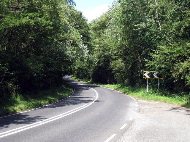
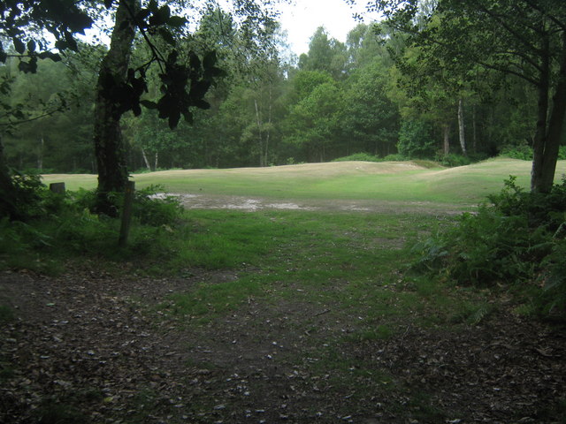
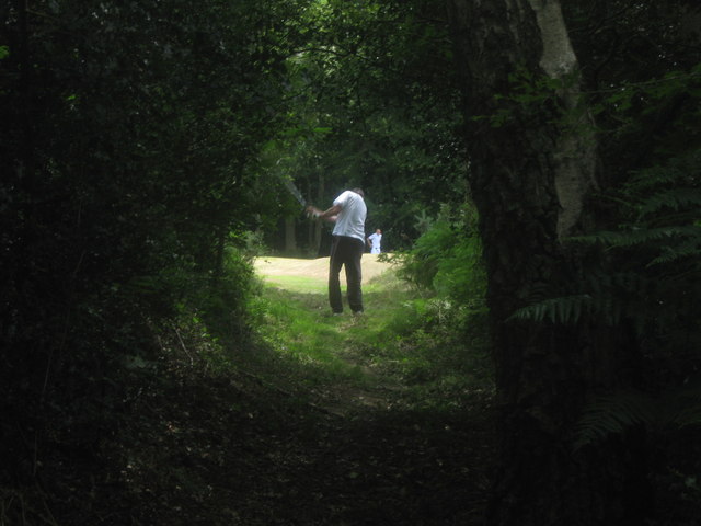
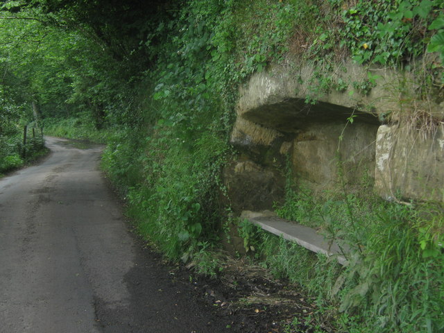
Marlpit Shaw is a woodland area located in Kent, England, specifically in the village of Wood. It is known for its dense forest and lush vegetation, making it a popular destination for nature enthusiasts and hikers alike. Covering an area of approximately 50 hectares, Marlpit Shaw is a designated Site of Special Scientific Interest (SSSI) due to its rich biodiversity.

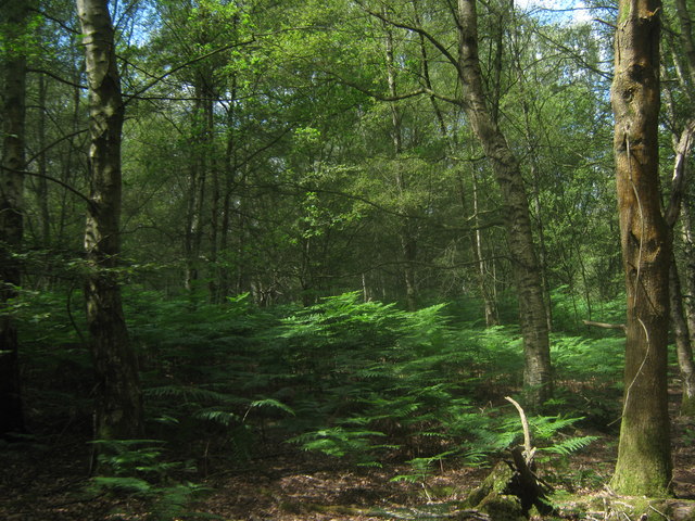
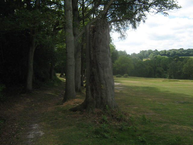
The woodland is predominantly composed of oak trees, which form a dense canopy that provides shade and shelter for various wildlife species. Other common tree species found in Marlpit Shaw include beech, birch, and holly. The forest floor is covered in a thick blanket of mosses, ferns, and wildflowers, adding to its natural beauty.

The diverse range of fauna found in Marlpit Shaw includes several bird species such as woodpeckers, tawny owls, and song thrushes. Mammals such as foxes, badgers, and deer can also be spotted within the woodland. Additionally, the area is home to a variety of insects, including butterflies and beetles.

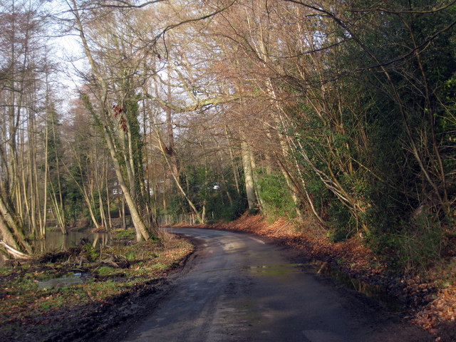
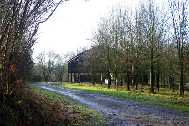
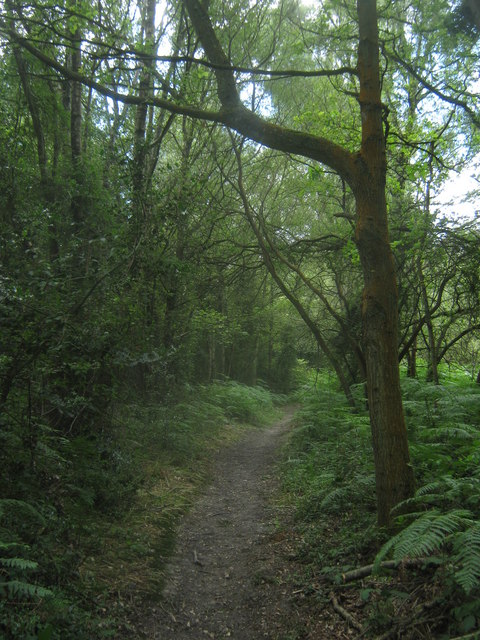
Marlpit Shaw offers numerous walking trails and paths, allowing visitors to explore its natural wonders. The woodland is well-maintained, with clear signposting and information boards providing insight into the flora and fauna that can be found in the area. It is a peaceful and tranquil place, providing a sanctuary for both wildlife and visitors seeking solace in nature.

Overall, Marlpit Shaw in Kent is a picturesque woodland with a diverse range of plant and animal life. It offers a serene environment for exploration and appreciation of the natural world.

If you have any feedback on the listing, please let us know in the comments section below.
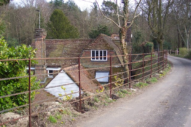
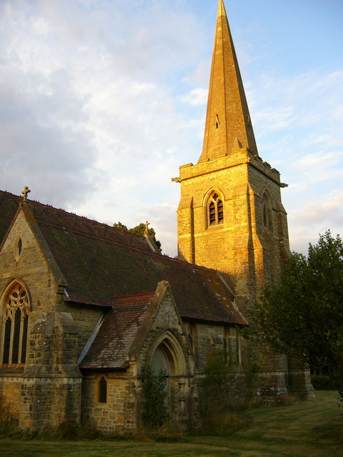
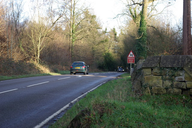
Marlpit Shaw Images

Images are sourced within 2km of 51.148032/0.058312037 or Grid Reference TQ4440. Thanks to Geograph Open Source API. All images are credited.

Cottage near Holtye, Kent/Sussex border This cottage stands on the site of an old ironworks. The road runs across the dam that supplied the water to power the bellows that worked the furnace.
Cottage near Holtye, Kent/Sussex border
This cottage stands on the site of an old ironworks. The road runs across the dam that supplied the water to power the bellows that worked the furnace.
St Stephen's Church Hammerwood
St Stephen's Church
Hammerwood
Bend on A264 east of Hammerwood Church A view east from the gateway into Hammerwood churchyard (its wall is on the right). The feature is the left-hand bend that the approaching car is rounding.
Bend on A264 east of Hammerwood Church
A view east from the gateway into Hammerwood churchyard (its wall is on the right). The feature is the left-hand bend that the approaching car is rounding.
Bridleway from Kent to Sussex A view towards the end of the bridleway (also a private track) where it meets the A264 at a tricky bend.
Bridleway from Kent to Sussex
A view towards the end of the bridleway (also a private track) where it meets the A264 at a tricky bend.
Hammerwood House Hammer Wood is to the right. The Hammer reference is derived from the Wealden iron industry.
Hammerwood House
Hammer Wood is to the right. The Hammer reference is derived from the Wealden iron industry.
Wealden farmland Taken just north of the main road from East Grinstead to Tunbridge Wells.
Wealden farmland
Taken just north of the main road from East Grinstead to Tunbridge Wells.
Lane near Cowden, Kent
Barn near Gotwick Manor Behind a gate off Shepherdsgrove Lane.
Barn near Gotwick Manor
Behind a gate off Shepherdsgrove Lane.
A264, Holtye Road Past Hammerwood.
A264, Holtye Road
Past Hammerwood.
A264, Holtye Road
A264, Holtye Road
Holtye Common Wood As seen from a bridleway from Furnace Lane towards the A264 Holtye Road.
Holtye Common Wood
As seen from a bridleway from Furnace Lane towards the A264 Holtye Road.
Bridleway in Holtye Common Wood This track leads from Furnace Lane towards the A264 Holtye Road.
Bridleway in Holtye Common Wood
This track leads from Furnace Lane towards the A264 Holtye Road.
Bridleway in Sweetwoods Park Golf Course A bridleway leads from Furnace Lane through Holtye Common wood and then the golf course towards the A264 Holtye Road.
Bridleway in Sweetwoods Park Golf Course
A bridleway leads from Furnace Lane through Holtye Common wood and then the golf course towards the A264 Holtye Road.
Bridleway junction in Sweetwoods Park Golf Course A bridleway from the A264 Holtye Road leads straight on towards Furnace Lane near Kitford Bridge. Another bridleway heads left towards Furnace Lane near Furnace Pond. Also a footpath heads right to Holtye Lane. In the background is Holtye Golf Club.
Bridleway junction in Sweetwoods Park Golf Course
A bridleway from the A264 Holtye Road leads straight on towards Furnace Lane near Kitford Bridge. Another bridleway heads left towards Furnace Lane near Furnace Pond. Also a footpath heads right to Holtye Lane. In the background is Holtye Golf Club.
Golfer on the bridleway This golfer is on Holtye Golf Course. Seen from a bridleway from Furnace Lane to Holtye Hill.

I was at <a href="https://www.geograph.org.uk/photo/1950151">TQ4539 : Bridleway junction in Sweetwoods Park Golf Course</a>, after coming along <a href="https://www.geograph.org.uk/photo/1950028">TQ4539 : Bridleway in Sweetwoods Park Golf Course</a>.
Saw that the golfers went ready so crosses the course. On my way I spotted a ball. The golfer taking the shot was looking in another area and was about to throw a new ball down. Claiming lost ball -1 shot. He was very pleased when I told him about the ball. His golfing partner (in the background) was on the cut grass and played already.
Golfer on the bridleway
This golfer is on Holtye Golf Course. Seen from a bridleway from Furnace Lane to Holtye Hill. I was at TQ4539 : Bridleway junction in Sweetwoods Park Golf Course, after coming along TQ4539 : Bridleway in Sweetwoods Park Golf Course. Saw that the golfers went ready so crosses the course. On my way I spotted a ball. The golfer taking the shot was looking in another area and was about to throw a new ball down. Claiming lost ball -1 shot. He was very pleased when I told him about the ball. His golfing partner (in the background) was on the cut grass and played already.
Furnace Pond As seen from Furnace lane over the weir on the Kent Water. (Stream on the Kent / Sussex boundary).
This large lake belongs to <a href="https://www.geograph.org.uk/photo/42065">TQ4539 : Cottage near Holtye, Kent/Sussex border</a>. It was a large pond dammed by the lane, to create power.
Furnace Pond
As seen from Furnace lane over the weir on the Kent Water. (Stream on the Kent / Sussex boundary). This large lake belongs to TQ4539 : Cottage near Holtye, Kent/Sussex border. It was a large pond dammed by the lane, to create power.
Swans on Furnace Pond Pair of gliding swans on the large pond on Kent Water (stream on the Kent / Sussex Boundary). As seen from Furnace Lane.
Swans on Furnace Pond
Pair of gliding swans on the large pond on Kent Water (stream on the Kent / Sussex Boundary). As seen from Furnace Lane.
Bench in the rocks on Furnace Lane This lane leads from Holtye Hill heading towards Dormansland. 

Why ??
Bench in the rocks on Furnace Lane
This lane leads from Holtye Hill heading towards Dormansland. Why ??
Show me another place!

Marlpit Shaw is located at Grid Ref: TQ4440 (Lat: 51.148032, Lng: 0.058312037)

Administrative County: Kent

District: Sevenoaks

Police Authority: Kent

What 3 Words

///spider.live.middle. Near Dormansland, Surrey

Related Wikis

Hammerwood

Hammerwood is a hamlet in the civil parish of Forest Row in East Sussex, England. Its nearest town is East Grinstead, which lies approximately 3.5 miles...

London to Lewes Way

The London to Lewes Way is a 71 kilometres (44 mi) long Roman road between Watling Street at Peckham and Lewes in Sussex. The road passes through Beckenham...

Hammerwood Park

Hammerwood Park is a country house in Hammerwood, near East Grinstead, in East Sussex, England. It is a Grade I listed building. One of the first houses...

Sundridge with Ide Hill

Sundridge and Ide Hill is a civil parish in the Sevenoaks District of Kent, England. It is located in the Darenth valley and lies between Sevenoaks and...

Cowden

Cowden () is a small village and civil parish in the Sevenoaks District of Kent, England. The parish is located on the northern slopes of the Weald, south...

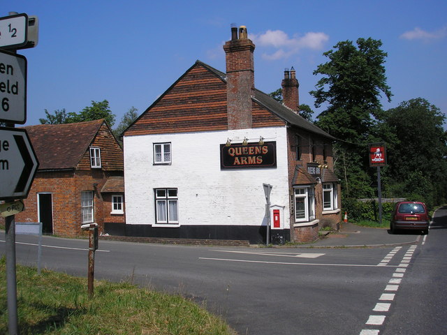
Queen's Arms, Cowden Pound

The Queens Arms is a Grade II listed public house at Hartfield Road, Cowden in Kent. It is on the Campaign for Real Ale's National Inventory of Historic...

Cowden Pound Pastures

Cowden Pound Pastures is a 5.9-hectare (15-acre) biological Site of Special Scientific Interest north of Cowden in Kent. It is managed by the Kent Wildlife...

Greathed Manor

Greathed Manor, Dormansland, Surrey, is a Victorian country house. Designed by the architect Robert Kerr in 1862–8, it is a Grade II listed building....

Nearby Amenities

Located within 500m of 51.148032,0.058312037
The data included in this document is from www.openstreetmap.org. The data is made available under ODbL.

Have you been to Marlpit Shaw?

Leave your review of Marlpit Shaw below (or comments, questions and feedback).